-
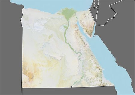
Relief map of Egypt (with border and mask). This image was compiled from data acquired by landsat 5 & 7 satellites combined with elevation data.
Con derechos protegidos
-
-

-

-

-

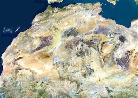
Satellite view of North Africa. This image was compiled from data acquired by Landsat 7 & 8 satellites.
Con derechos protegidos
-

Satellite view of Africa. This image was compiled from data acquired by Landsat 7 & 8 satellites.
Con derechos protegidos
-
-

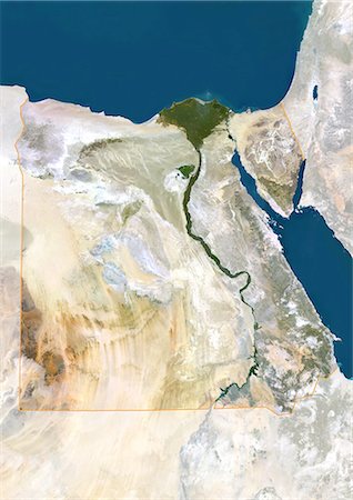
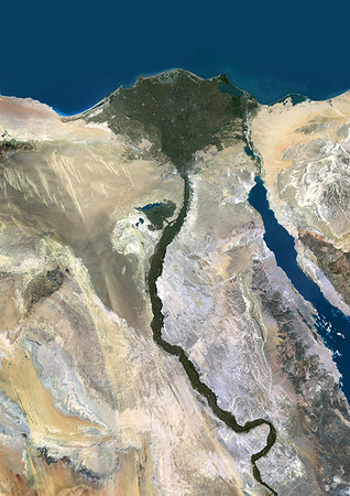
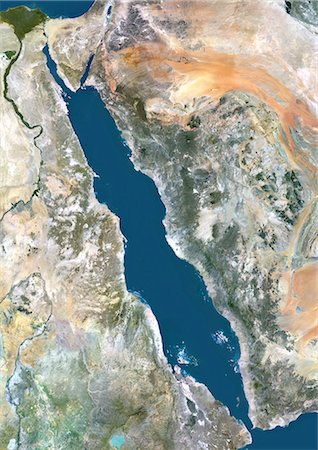
Egypt, True Colour Satellite Image With Border. Egypt, true colour satellite image with border. North is at top. In the center of the image is the Nile Delta, its lush vegetation following the path of the river. To the east of the Nile is the Gulf of Suez, which runs down the western side of the Sinai Peninsula. This image was compiled from data acquired by LANDSAT 5 & 7 satellites.
Con derechos protegidos
-
Sahara Desert, Africa, True Colour Satellite Image. Sahara desert, true colour satellite image. The Sahara is the world's largest hot desert, made of sand and volcanic mountains. Composite image using data from LANDSAT 5 & 7 satellites.
Con derechos protegidos
-

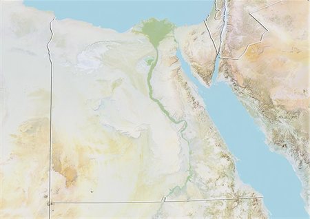
Egypt, True Colour Satellite Image With Mask. Egypt, true colour satellite image with mask. North is at top. In the center of the image is the Nile Delta, its lush vegetation following the path of the river. To the east of the Nile is the Gulf of Suez, which runs down the western side of the Sinai Peninsula. This image was compiled from data acquired by LANDSAT 5 & 7 satellites.
Con derechos protegidos
-
Color satellite image of the Nile River, Egypt. The Nile Delta is formed in Northern Egypt where the Nile River spreads out and drains into the Mediterranean Sea. Images collected on October 1, 2017 by Landsat 8 satellite.
Con derechos protegidos
-

Color satellite image of the Nile Delta. It is formed in Northern Egypt where the Nile River spreads out and drains into the Mediterranean Sea. Image collected on October 1, 2017 by Sentinel-2 satellites.
Con derechos protegidos
-

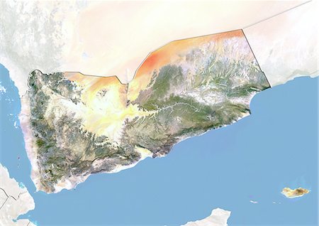
Relief map of Yemen (with border and mask). This image was compiled from data acquired by landsat 5 & 7 satellites combined with elevation data.
Con derechos protegidos
-
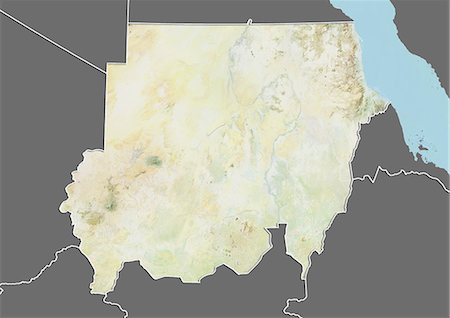
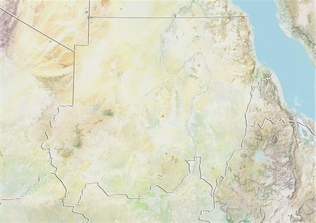
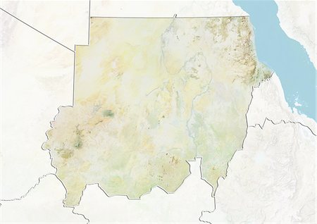
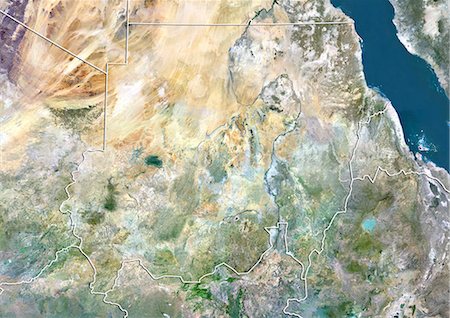
Relief map of Sudan (with border and mask). This image was compiled from data acquired by landsat 5 & 7 satellites combined with elevation data.
Con derechos protegidos
-
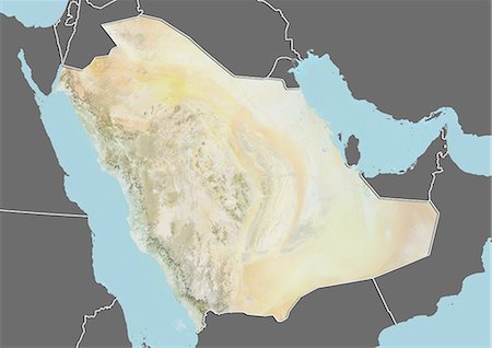
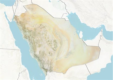
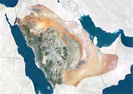
Relief map of Saudi Arabia (with border and mask). This image was compiled from data acquired by landsat 5 & 7 satellites combined with elevation data.
Con derechos protegidos
-
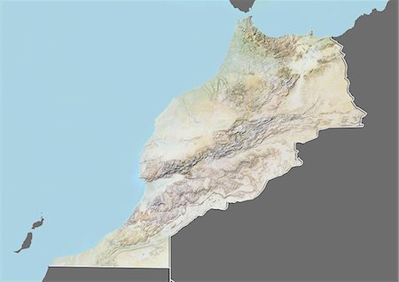
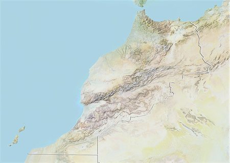
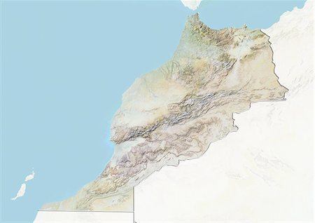
Relief map of Morocco (with border and mask). This image was compiled from data acquired by landsat 5 & 7 satellites combined with elevation data.
Con derechos protegidos
-
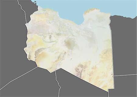
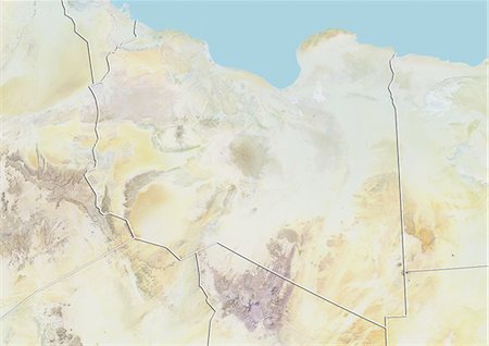
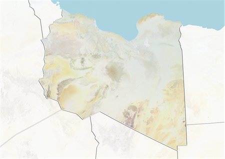
Relief map of Libya (with border and mask). This image was compiled from data acquired by landsat 5 & 7 satellites combined with elevation data.
Con derechos protegidos
-
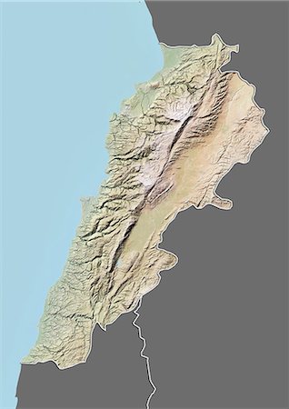
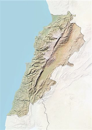
Relief map of Lebanon (with border and mask). This image was compiled from data acquired by landsat 5 & 7 satellites combined with elevation data.
Con derechos protegidos
-
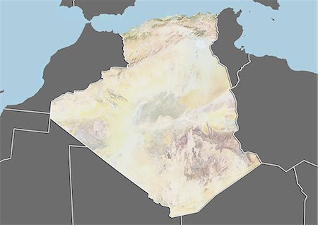
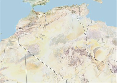
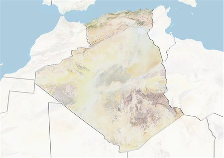
Relief map of Algeria (with border and mask). This image was compiled from data acquired by landsat 5 & 7 satellites combined with elevation data.
Con derechos protegidos
-
-

-
-
-

-
-
-
-
-
-

-
-
-
-
-

Nile Delta, Egypt, True Colour Satellite Image. True colour satellite image of the Nile Delta. It is formed in Northern Egypt where the Nile River spreads out and drains into the Mediterranean Sea. This swamp region has always been rich in fauna and flora, contrasting with the surrounding desert. Image taken on 23 August 2000 using LANDSAT data.
Con derechos protegidos
-

Assouan Dam And Lake Nasser, Egypt, True Colour Satellite Image. True colour satellite image of Assouan dam on the Nile river and the Lake Nasser in Egypt. Image taken on 15 November 1986 using LANDSAT data.
Con derechos protegidos
-
-

Colour satellite image of Cairo, Egypt. Image taken on December 16, 2013 with Landsat 8 data.
Con derechos protegidos
-

Color satellite image of Cairo, capital city of Egypt. Image collected on October 01, 2017 by Sentinel-2 satellites.
Con derechos protegidos
-

Satellite view of Southern Africa. It shows the African Great Lakes region. This image was compiled from data acquired by Landsat 7 & 8 satellites.
Con derechos protegidos
-

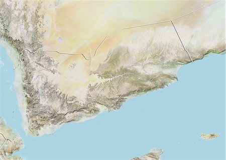
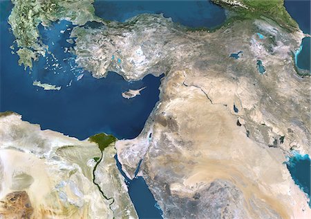
Satellite view of the Arabian Peninsula. This image was compiled from data acquired in 2014 by Landsat 8 satellite.
Con derechos protegidos
-
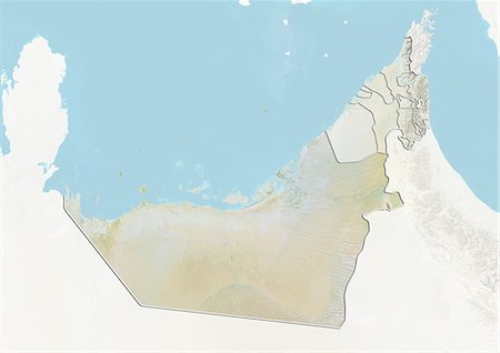
Relief map of the Emirate of Sharjah, United Arab Emirates. This image was compiled from data acquired by LANDSAT 5 & 7 satellites combined with elevation data.
Con derechos protegidos
-

Relief map of the Emirate of Abu Dhabi, United Arab Emirates. This image was compiled from data acquired by LANDSAT 5 & 7 satellites combined with elevation data.
Con derechos protegidos
-
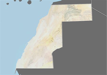
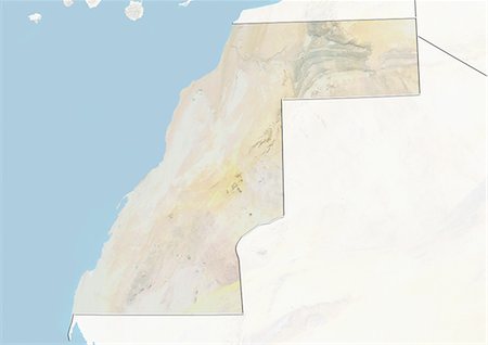
Relief map of Western Sahara (with border and mask). This image was compiled from data acquired by landsat 5 & 7 satellites combined with elevation data.
Con derechos protegidos
-

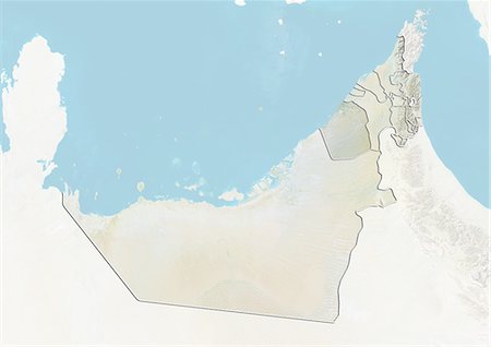
Relief map of the United Arab Emirates (with border and mask). This image was compiled from data acquired by landsat 5 & 7 satellites combined with elevation data.
Con derechos protegidos
-
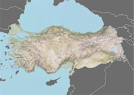
Relief map of Turkey (with border and mask). This image was compiled from data acquired by landsat 5 & 7 satellites combined with elevation data.
Con derechos protegidos
-
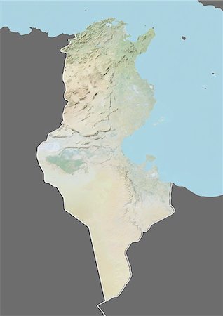
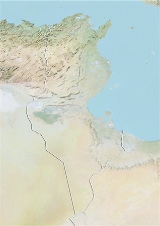
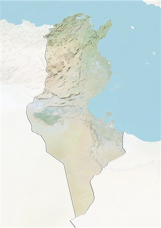
Relief map of Tunisia (with border and mask). This image was compiled from data acquired by landsat 5 & 7 satellites combined with elevation data.
Con derechos protegidos
-

Relief map of Syria (with border and mask). This image was compiled from data acquired by landsat 5 & 7 satellites combined with elevation data.
Con derechos protegidos
-

Relief map of Oman (with border and mask). This image was compiled from data acquired by landsat 5 & 7 satellites combined with elevation data.
Con derechos protegidos
-

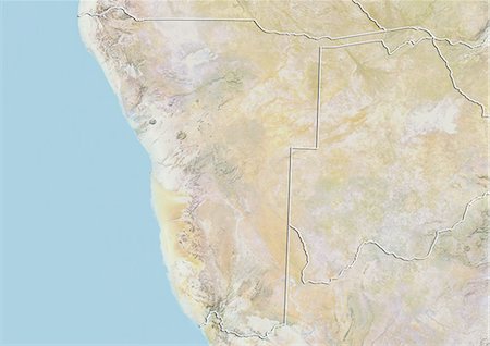
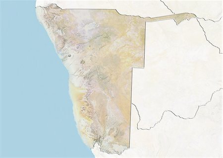
Relief map of Namibia (with border and mask). This image was compiled from data acquired by landsat 5 & 7 satellites combined with elevation data.
Con derechos protegidos
-
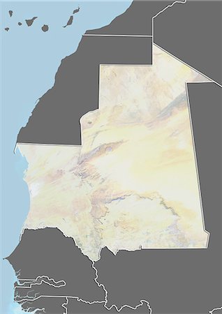
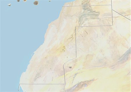
Relief map of Mauritania (with border and mask). This image was compiled from data acquired by landsat 5 & 7 satellites combined with elevation data.
Con derechos protegidos
-

Relief map of Kuwait (with border and mask). This image was compiled from data acquired by landsat 5 & 7 satellites combined with elevation data.
Con derechos protegidos
-

Relief map of Jordan (with border and mask). This image was compiled from data acquired by landsat 5 & 7 satellites combined with elevation data.
Con derechos protegidos
-
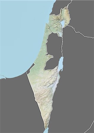
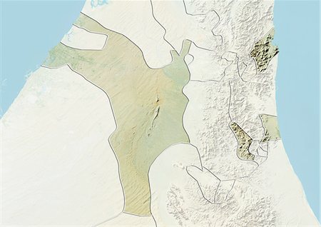
Relief map of Israel (with border and mask). This image was compiled from data acquired by landsat 5 & 7 satellites combined with elevation data.
Con derechos protegidos
-
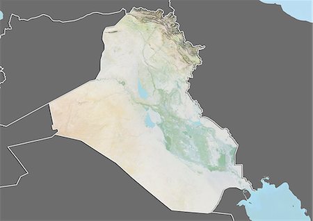
Relief map of Iraq (with border and mask). This image was compiled from data acquired by landsat 5 & 7 satellites combined with elevation data.
Con derechos protegidos
-

Relief map of Iran (with border and mask). This image was compiled from data acquired by landsat 5 & 7 satellites combined with elevation data.
Con derechos protegidos
-

Relief map of Ethiopia (with border and mask). This image was compiled from data acquired by landsat 5 & 7 satellites combined with elevation data.
Con derechos protegidos
-
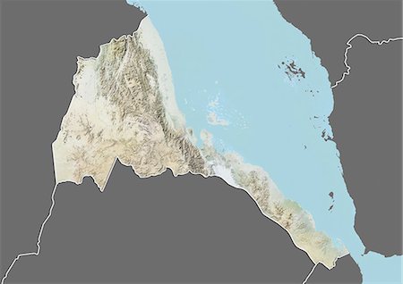
Relief map of Eritrea (with border and mask). This image was compiled from data acquired by landsat 5 & 7 satellites combined with elevation data.
Con derechos protegidos
-

Relief map of Angola (with border and mask). This image was compiled from data acquired by landsat 5 & 7 satellites combined with elevation data.
Con derechos protegidos
-

-

-

-

-

-
-
-

-

-

-
-
-
-

-

-

-

-
-
-

-

-
-

-

-
-

-

-
-
-


