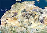
Satellite view of North Africa. This image was compiled from data acquired by Landsat 7 & 8 satellites.

Oferta introductoria
Obtener 50% de descuento cuando se une a nuestra lista de correo electrónico
-
Resolución de Internet
550×388px
19.4×13.7cm 28ppcm
-
Baja resolución
1007×712px
35.6×25.2cm 28ppcm
-
Mediana resolución
2230×1576px
18.9×13.3cm 118ppcm
-
Alta resolución
4961×3507px
42.0×29.7cm 118ppcm
* Precio final basado en el uso, no en el tamaño del archivo.
Palabras clave relacionadas
- 872-
- África
- África del Norte
- africano (lugares y cosas)
- africano (perteneciente a Africa)
- aire libre
- al aire libre
- Algeria
- cartográfico
- desierto (terreno árido)
- Desierto del Sahara
- Egipto
- étnico
- fotógrafia
- fotografía (arte)
- fotógrafias
- imagen a color
- Libia
- línea de la playa
- litoral
- Mali
- mapa
- Mar Mediterráneo
- Mar Rojo
- Marruecos
- medio-oriental (lugares y cosas)
- medio-oriental (relativo al Oriente Medio)
- Medio Oriente
- nadie
- Niger
- Nigeria
- océano
- río Nilo
- sacar fotos
- Sudan
- Universal Images Group
- vista de satélite
Imágenes relacionadas
- Satellite view of Africa. This image was compiled from data acquired by Landsat 7 & 8 satellites.
- Sahara Desert, Africa, True Colour Satellite Image. Sahara desert, true colour satellite image. The Sahara is the world's largest hot desert, made of sand and volcanic mountains. Composite image using data from LANDSAT 5 & 7 satellites.
- Satellite view of Southern Africa. It shows the African Great Lakes region. This image was compiled from data acquired by Landsat 7 & 8 satellites.
- Relief map of Egypt (with border and mask). This image was compiled from data acquired by landsat 5 & 7 satellites combined with elevation data.
- Egypt, True Colour Satellite Image With Border
- Egypt, True Colour Satellite Image With Border and Mask
- Egypt, Relief Map With Border
- Egypt, Relief Map With Border and Mask
Más imágenes relacionadas
- Satellite view of the Arabian Peninsula. This image was compiled from data acquired in 2014 by Landsat 8 satellite.
- Satellite View of Red Sea, Middle East
- Mediterranean Area, True Colour Satellite Image. Mediterranean Sea. True colour satellite images showing the Mediterranean Sea. Points of interest include the Alps (just above centre, white), the Blakek Sea (centre right), and the Nile Delta (green, lower right). This image was compiled from data acquired by LANDSAT 5 & 7 satellites.
- Color satellite image of the Nile River, Egypt. The Nile Delta is formed in Northern Egypt where the Nile River spreads out and drains into the Mediterranean Sea. Images collected on October 1, 2017 by Landsat 8 satellite.
- Color satellite image of the Nile Delta. It is formed in Northern Egypt where the Nile River spreads out and drains into the Mediterranean Sea. Image collected on October 1, 2017 by Sentinel-2 satellites.
- Satellite view of the Persian Gulf. This image was compiled from data acquired in 2014 by Landsat 8 satellite.
- Satellite view of the Middle East. This image was compiled from data acquired in 2014 by Landsat 8 satellite.
- Satellite view of Cyprus. This image was compiled from data acquired by Landsat 8 satellite in 2014.


