-

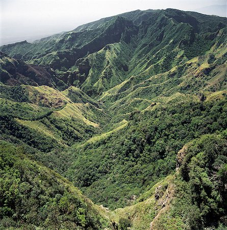
A section of the western wall of the Gregory Rift (a part of the eastern branch of the Africa's Great Rift Valley) above Lake Manyara,a shallow alkaline lake,which adjoins a national park of the same name. The escarpment drops several hundred feet in sheer cliffs and runs in a north-south straight line as far as the eye can see.
Rights-Managed
-
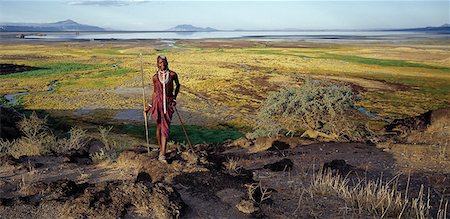
Maasai warrior in front of Lake Natron in northern Tanzania,one of the most alkaline lakes of the Rift system. As its waters evaporate in the intense heat,sodium sesquicarbonate,known as trona or natron,solidifies to resemble giant coral heads in brightly coloured water.The pastoral Maasai graze their cattle along its southern shores where the Enkare Sero River provides welcome pasture.
Rights-Managed
-

Lake Natron bathed in late afternoon sun with Shompole volcano (situated on the border of Kenya and Tanzania) in the distance at the northern end of the lake. Lake Natron is one of the most alkaline of the Rift system yet lesser flamingos breed there each year.
Rights-Managed
-

A false arm of the Great Rift Valley runs southeast from the Ngorongoro Highlands to Lake Eyasi,a shallow alkaline lake that can vary in size considerably from one year to the next. The Datoga people graze their livestock around the lakeshores.The Datoga (known to their Maasai neighbours as the Mang'ati and to the Iraqw as Babaraig) live in northern Tanzania and are primarily pastoralists.
Rights-Managed
-

A section of the western wall of the Gregory Rift (a part of the eastern branch of the Africa's Great Rift Valley) close to Lake Manyara. The escarpment drops several hundred feet in sheer cliffs and runs in a north-south straight line as far as the eye can see. .
Rights-Managed
-
Lake Natron in northern Tanzania is one of the most alkaline of the Rift system.As its waters evaporate in the intense heat, sodium sesquicarbonate, known as trona or natron, solidifies to resemble giant coral heads in brightly coloured water. Visible beyond the lake is Ol doinyo Lengai the only active volcano in the Gregory Rift.
Rights-Managed
-

The alkaline waters of Lake Bogoria are a favourite haunt of lesser flamingos. The barren shoreline is dotted with steam jets and geysers reflecting its volcanic origins.
Rights-Managed
-
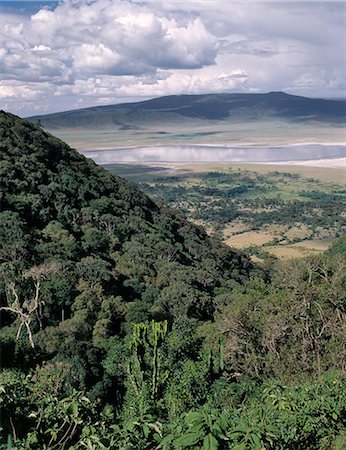
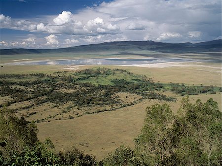
The world famous Ngorongoro Crater was declared a World Heritage Site in 1978. Its 102-square-mile crater floor is spectacular for wildlife. The crater is in fact a 'caldera' the largest unbroken,unflooded caldera in the world which was formed two and a half million years ago when a huge explosion destroyed the walls of a volcano standing about 15,000 feet high. .
Rights-Managed
-
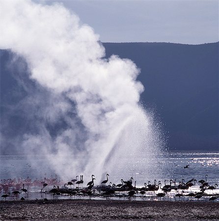
The alkaline waters of Lake Bogoria are a favourite haunt of lesser flamingos because the blue-green algae upon which they feed grows prolifically in the lake's shallow waters. The barren shoreline is dotted with steam jets and geysers reflecting its volcanic origins.
Rights-Managed
-
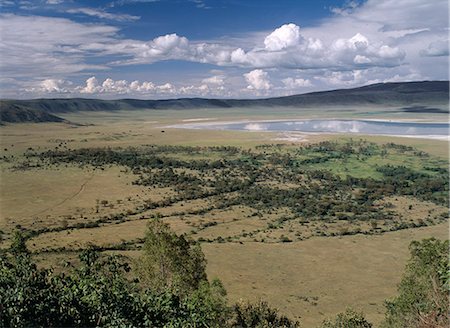
The world famous Ngorongoro Crater was declared a World Heritage Site in 1978. Its 102-square-mile crater floor is spectacular for wildlife. The crater is in fact a 'caldera' the largest unbroken,unflooded caldera in the world which was formed two and a half million years ago when a huge explosion destroyed the walls of a volcano standing about 15,000 feet high. .
Rights-Managed
-
The Silale swamp in the Tarangire National Park is a haven for wildlife in the dry season.
Rights-Managed
-
Sunset with a doum palm (Hyphaene coriacea) silhouetted in water at the northern end of the ephemeral alkaline lake,Eyasi,which lies in a false arm of the Great Rift Valley southeast of the Ngorongoro Highlands.
Rights-Managed
-

Maasai pastoralists water their livestock at the seasonal Sanjan River,which rises in the Gol Mountains of northern Tanzania.
Rights-Managed
-

Maasai men,spears in hand,drive their laden donkeys across pristine volcanic grassland at the southern end of Lake Natron. Donkeys carry loads in leather panniers strapped loosely to their flanks
Rights-Managed
-
Lake Natron in northern Tanzania is one of the most alkaline of the Rift system. As its waters evaporate in the intense heat,sodium sesquicarbonate,known as trona or natron,solidifies to resemble giant coral heads in brightly coloured water. Visible beyond the lake is Shompole volcano,a dormant volcano,situated on the border of Kenya and Tanzania.
Rights-Managed
-

Lake Bogoria is one of a series of alkaline lakes in Kenyas Rift Valley system and a favourite place to see thousands of lesser flamingos. Hot springs and geysers highlight the regions volcanic origins.
Rights-Managed
-
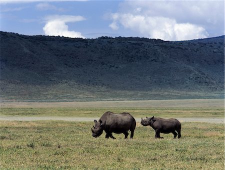
A black rhino mother and offspring are dwarfed by their surroundings in the world famous Ngorongoro Crater. The craters 102 square mile floor is spectacular for wildlife.
Rights-Managed
-

A black rhino mother and offspring are dwarfed by their surroundings in the world famous Ngorongoro Crater. The craters 102 square mile floor is spectacular for wildlife.
Rights-Managed
-

A lone black rhino is dwarfed by its surroundings in the world famous Ngorongoro Crater. The craters 102 square mile floor is spectacular for wildlife.
Rights-Managed
-

Hippos wallow in a small freshwater lake on the floor of the world famous Ngorongoro Crater.The craters 102 square mile floor is spectacular for wildlife.
Rights-Managed
-

Dawn over Ol doinyo Lengai, The Maasais Mountain of God, which is the only active volcano in the Gregory Rift, an important section of the eastern branch of Africas Great Rift Valley.
Rights-Managed
-
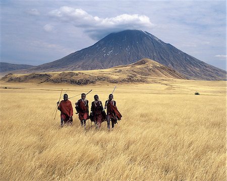
Maasai warriors stride across the golden grass plains at the foot of Ol doinyo Lengai, the Maasais Mountain of God. Ol doinyo Lengai is the only active volcano in the Gregory Rift, an important section of the eastern branch of Africas Great Rift Valley system that stretches from northern Kenya into Northern Tanzania.
Rights-Managed
-
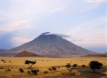
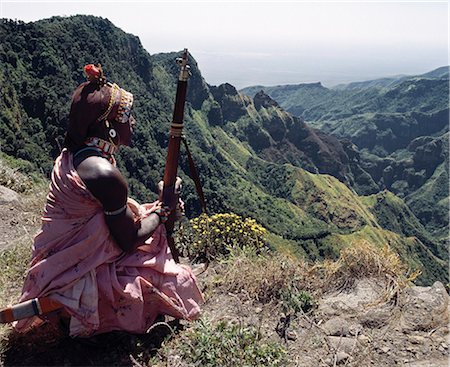
Ol doinyo Lengai, the Maasais Mountain of God, in early morning sunlight. It is the only active volcano in the Gregory Rift.An important section of the eastern branch of Africas Great Rift Valley.This 9,400 foot high volcano with deeply eroded sides stands 7,000 feet above the surrounding plains.
Rights-Managed
-
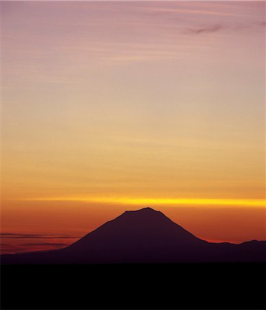
Sunrise over Ol Doinyo Lengai, The Maasais Mountain of God, which is the only active volcano in the Gregory Rift.An important section of the eastern branch of Africas Great Rift Valley.
Rights-Managed
-
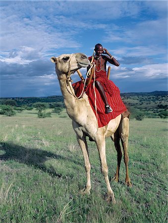
A Maasai warrior speaks on his mobile phone from the saddle of his camel near Lake Magadi in Kenyas Rift Valley Province.Mobile phones are a popular method of communicating with family and friends in remote areas of Kenya.
Rights-Managed
-
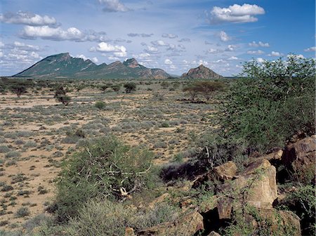
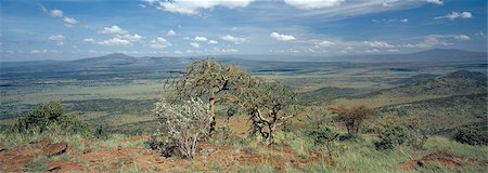
Semi arid thorn scrub best describes the vegetation of northern Samburuland where semi nomadic pastoralists make out a living from an unforgiving land. The region is characterised by grand vistas, poor soil and an unreliable rainfall.
Rights-Managed
-
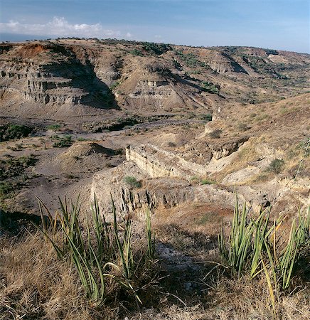
Mount Kulal is divided into two by an ancient volcano, which collapsed thousands of years ago, leaving an impressive gorge. This picture shows the remains of the steep sided volcanic crater. Mount Kulal rises to over 6,000 feet in Northern Kenya and is surrounded by a sea of lava and arid wastes.
Rights-Managed
-
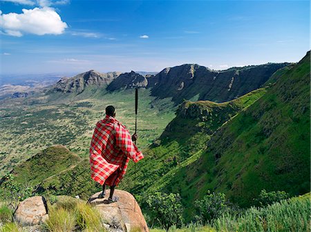
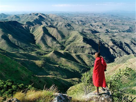
A Samburu warrior gazes at the eastern scarp of Africa's Great Rift Valley at Losiolo,north of Maralal. From 8,000 feet the land tumbles away 3,000 feet into rugged country,the domain of nomadic pastoralists,before rising again 75 miles away. The views at Losiolo are the most spectacular in Kenya of the largest,longest and most conspicuous physical feature of its kind on earth.
Rights-Managed
-

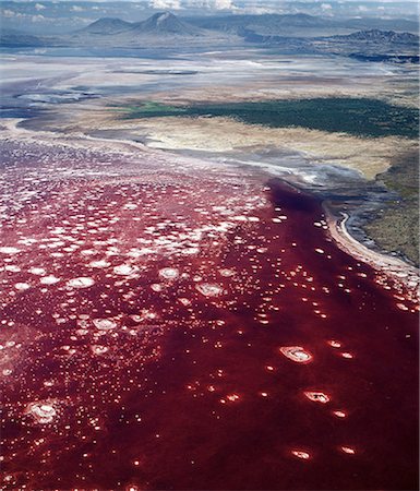
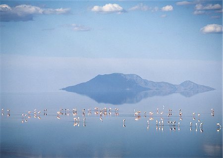
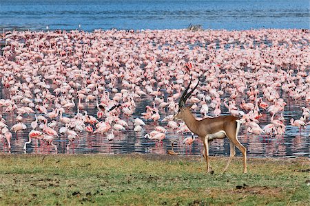
From the air,a pink band of Lesser flamingos hugs the barren shoreline of this intensely alkaline Rift Valley lake. The colour of the water is the result of green algae with high chlorophyll concentrations developing in it.
Rights-Managed
-

A fine view from the eastern wall of Africa's Great Rift Valley system at Losiolo near Maralal. There,the top of the escarpment rises to over 8,000 feet before dropping precipitously 3,000 feet into a stark valley inhabited only in wet weather.
Rights-Managed
-

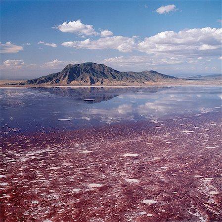
Mineral encrustations of trona or natron form by evaporation in the shallow alkaline waters of Lake Magadi. They are mined for a variety of commercial uses and are continually replenished by the action of underground springs.
Rights-Managed
-

Kenya,Rift Valley Province,Lake Magadi. The pink-tinged mineral encrustations of trona or natron form by evaporation in the shallow alkaline waters of Lake Magadi. They are mined for a variety of commercial uses and are continually replenished by the action of underground springs.
Rights-Managed
-

Lake Baringo is one of two freshwater lakes of the Eastern Rift Valley. Its waters are red with suspended solids due to bad soil erosion in its catchment area,which has been caused by inappropriate agricultural practices
Rights-Managed
-
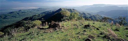
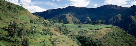
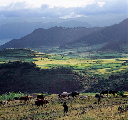
A fine view from the cultivated slopes of the Tugen Hills looking across the Kerio Valley to the Keiyo Escarpment rising in the distance. This escarpment forms the western wall of the Gregory Rift one of the most spectacular stretches of Africa's remarkable Great Rift Valley.
Rights-Managed
-
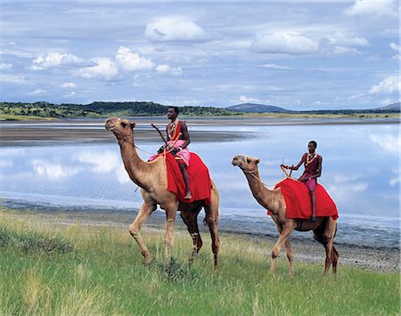
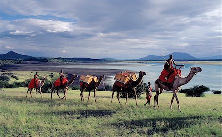
Two Maasai men ride camels near Lake Magadi in Kenya's Rift Valley Province. Although the Maasai do not customarily keep camels,much of the semi-arid land of southern Maasailand is more suited to camels than cattle.
Rights-Managed
-

In the early morning,Maasai men lead a camel caravan laden with equipment for a 'fly camp' (a small temporary camp) along the shores of Lake Magadi.
Rights-Managed
-

Maasai men lead a camel caravan laden with equipment for a 'fly camp' (a small temporary camp) past Lake Magadi. Clouds hang low over the Nguruman Escarpment (a western wall of the Great Rift Valley) in the distance.
Rights-Managed
-
Maasai men lead a camel caravan laden with equipment for a 'fly camp' (a small temporary camp) close to Lake Magadi in beautiful late afternoon sunlight.
Rights-Managed
-
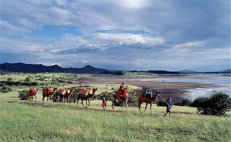
Maasai men lead a camel caravan laden with equipment for a 'fly camp' (a small temporary camp) close to Lake Magadi in beautiful late afternoon sunlight.
Rights-Managed
-
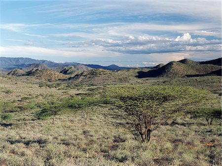
Semi-arid thorn scrub best describes the vegetation of northern Samburuland where semi-nomadic pastoralists eke out a living from an unforgiving land. The region is characterised by grand vistas,poor soil and an unreliable rainfall. The Ndoto Mountains can be seen in the far distance.
Rights-Managed
-
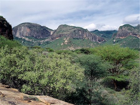
Poi,a prominent rock feature of the Ndoto Mountains in northern Samburuland. The small river rising at the top of the 8650-foot-high range provides permanent water at Ngurunit for people and their livestock.The Samburu of Northern Kenya are a semi-nomadic pastoral community related to their more famous cousins,the maa speaking Maasai.
Rights-Managed
-
Sheer rock faces of the impressive Ndoto Mountains near Ngurunit in Samburuland.The region is home to the Samburu people of Northern Kenya who are a semi-nomadic pastoral community related to their more famous cousins,the maa speaking Maasai.
Rights-Managed
-
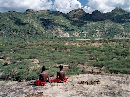
Two Samburu warriors relax on a rock outcrop near the foothills of the Ndoto Mountains in Samburuland. This northern region of semi-arid thorn scrub country barely supports sufficient livestock for the semi-nomadic pastoralists living there.The Samburu of Northern Kenya are related to their more famous cousins,the maa speaking Maasai.
Rights-Managed
-
A Samburu homeguard looks out over the steep-sided gorge of Mount Kulal,which divides the mountain into two. Volcanic in origin,Mount Kulal rises to over 6,000 feet in Northern Kenya and is surrounded by a sea of lava and arid wastes. The mountain is forested on top and is a vital water resource. It's open grasslands give pastoralists good grazing for their livestock.
Rights-Managed
-

The shoreline of Lake Naivasha is rimmed with beautiful yellow-barked 'fever' trees (Acacia xanthophloea). It is the highest lake of Africa's Great Rift Valley and has the reputation as an ornithologist's paradise; it hosts some 400 different species of birds. In this picture white-necked cormorants and Egyptian geese are very much in evidence while a hippo keeps a watchful eye offshore.
Rights-Managed
-
A spectacular view of the Laikipia Escarpment and Lake Baringo in the far distance.
Rights-Managed
-
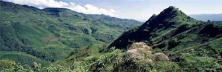
The fertile slopes of the Keiyo Escarpment a wall of Africa's Eastern Rift are farmed intensively. The flowering shrubs in the foreground are veronia,which grow in rich soil up to an altitude of 10,000 feet.
Rights-Managed
-

Traditional Marakwet houses built on the rocky eastern slopes of the Cherangani Hills in an area known as the Tot Escarpment.
Rights-Managed
-

Traditional Marakwet houses built on the rocky eastern slopes of the Cherangani Hills have a fine view across the Kerio Valley.
Rights-Managed
-

Traditional Marakwet homesteads built on the rocky eastern slopes of the Cherangani Hills have a fine view across the Kerio Valley.
Rights-Managed
-

Traditional thatched houses and smallholdings of the Pokot people dot the landscape on top of the fertile Cherangani Hills,which was once a forested area.
Rights-Managed
-
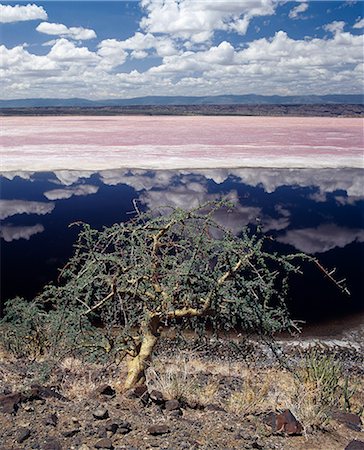
A hardy Commiphora tree thrives beside Lake Magadi,an alkaline lake of the Rift Valley system,situated in a vey hot region of southern Kenya. The pink-tinged mineral encrustation's are mined for a variety of commercial uses and are continually replenished from underground springs.
Rights-Managed
-

A Samburu warrior looks out across the eastern scarp of Africa's Great Rift Valley at Poro,Northern Kenya where the land drop precipitously 3,000 feet.
Rights-Managed
-
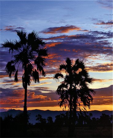
Sunset with silhouettes of Doum palms.The Manyara escarpment a western wall of Africa's Great Rift Valley is clearly visible in the background..
Rights-Managed
-

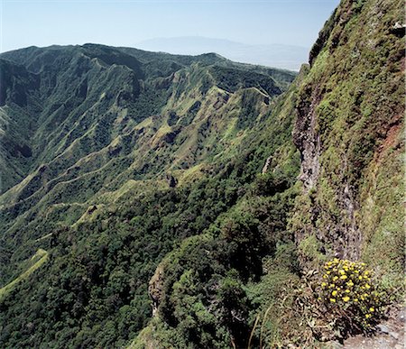
Forming a dramatic eastern boundary to Africa's Great Rift Valley,the Livingstone Mountains,a southern extension of the Kipengere Range,are situated in a remote part of Southern Tanzania. They drop almost perpendicularly more than 4,000 feet into the northeast corner of Lake Malawi. Trees grow sparsely on the rugged slopes but wild flowers are abundant.
Rights-Managed
-
Herds of cattle owned by Datoga pastoralists make deep ruts in the friable soil surrounding Lake Eyasi,a seasonal alkaline lake,which lies in a false arm of the Great Rift Valley southeast of the Ngorongoro Highlands
Rights-Managed
-
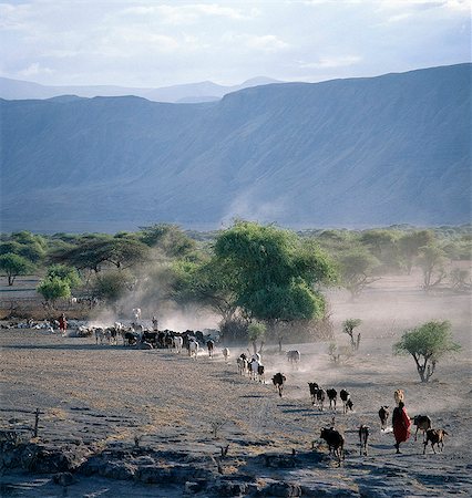
Maasai herdsmen drive their cattle home in the late afternoon over the dusty volcanic soil at the base of the western wall of the Gregory Rift,which dominates the landscape in this remote corner of northern Tanzania.
Rights-Managed
-
In the late afternoon,lesser flamingos feed on Lake Natron with Shompole volcano (situated on the border of Kenya and Tanzania) in the distance at the northern end of the lake. Lake Natron is one of the most alkaline of the Rift system yet lesser flamingos breed there each year.
Rights-Managed
-
A magnificent view from the eastern scarp of Africa's Great Rift Valley at Losiolo,north of Maralal. From 8,000 feet the land tumbles away 3,000 feet into rugged valleys and a broad plain,the domain of nomadic pastoralists,before rising again 75 miles away. The views at Losiolo are the finest in Kenya of the largest,longest and most conspicuous physical feature of its kind on earth.
Rights-Managed
-
Rwanda. Lake Burero reaches out underneath the volcanoes. The volcanic lakes provide protected habitat for numerous species of birds.
Rights-Managed
-
A grants gazelle walks past thousands of lesser flamingos feeding on algae along the shores of Lake Bogoria which is one of a series of alkaline lakes in Kenyas Rift Valley system.
Rights-Managed
-

An alkaline crater lake in the Queen Elizabeth National Park. An extraordinary violent outburst of volcanic activity occurred over a relatively short period about 7,000 years ago, causing the destruction of most of the fauna around Lakes Edward & George, and leaving the countryside pockmarked with craters.
Rights-Managed
-
A part of the Olduvai Gorge, famous for its fossil records of human origins.Named by the Maasai Oldupai after the wild sisal plant, Sansevieria, Olduvai displays a unique evolutionary trail spanning ten million years.
Rights-Managed
-

A magnificent view from the eastern scarp of Africas Great Rift Valley at Losiolo, north of Maralal. From 8,000 feet the land tumbles away 3,000 feet into rugged valleys and a broad plain, the domain of nomadic pastoralists, before rising again 75 miles away.
Rights-Managed
-
The vast expanse of inhospitable country from the eastern scarp of Africas Great Rift Valley at Losiolo, north of Maralal. From 8,000 feet the land tumbles away 3,000 feet into rugged valleys and a broad plain, the domain of nomadic pastoralists, before rising again 75 miles away.
Rights-Managed
-

A Samburu warrior looks out over a vast expanse of inhospitable country from the eastern scarp of Africas Great Rift Valley at Losiolo, north of Maralal. From 8,000 feet the land tumbles away 3,000 feet into rugged valleys and a broad plain, the domain of nomadic pastoralists, before rising again 75 miles away.
Rights-Managed
-

Semi arid thorn scrub best describes the vegetation of northern Samburuland where semi nomadic pastoralists eke out a living from an unforgiving land. The region is characterised by grand vistas, poor soil and an unreliable rainfall.
Rights-Managed
-
Semi arid thorn scrub best describes the vegetation of northern Samburuland where semi nomadic pastoralists eke out a living from an unforgiving land. The region is characterised by grand vistas, poor soil and an unreliable rainfall.
Rights-Managed
-
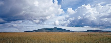
Mount Longonot, 9,110 feet high, lies on the floor of the Great Rift Valley, thirty five miles northwest of Nairobi.Aptly called by the Maasai Ol doinyo Longonot, the mountain of many valleys and gullies, it is of volcanic origin.
Rights-Managed
-
The Gregory Rift appears at its most majestic a short distance northwest of Nairobi where the valley trough narrows to just fifteen miles across.From its eastern wall above the rock strewn Kedong Valley, the ancient volcanos of Suswa, left, and Longonot, far right, can be seen as reminders of a turbulent volcanic past that shaped the Rift Valley landscape over 25 million years.
Rights-Managed
-
Fine farming country in the Tugen Hills, a massive fault block standing in the middle of the Gregory Rift.The Gregory Rift, an important section of the Eastern arm of Africas Great Rift Valley running through Kenya and Northern Tanzania, was named after Professor Gregory who identified the geological formation of the Rift, and coined the term Great Rift Valley.
Rights-Managed
-
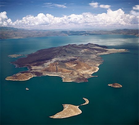
An aerial view of South Island, Lake Turkanas largest island. Situated in the southern sector of the lake where the water reaches a depth of 374 feet, the island is a spine of volcanic cones and hills covering 15 square miles. The lava flows are remarkably well preserved there.
Rights-Managed
-

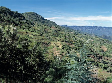
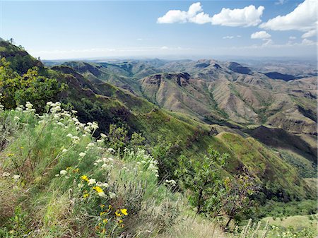
Terraced cultivation on a ledge of the western scarp of the Abysinnian Rift Valley at Ankober.Ethiopia is a land of vast horizons and dramatic scenery. The weathered mountains in the Ethiopian Highlands exhibit layer upon layer of volcanic material, which built the plateau into Africas most extensive upland region.
Rights-Managed
-
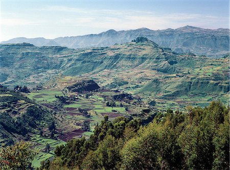
A spectacular view from the western scarp of the Abysinnian Rift Valley at Ankober.Ethiopia is a land of vast horizons and dramatic scenery. The weathered mountains in the Ethiopian Highlands exhibit layer upon layer of volcanic material, which built the plateau into Africas most extensive upland region.
Rights-Managed
-

A fine view from the western scarp of the Abyssinian Rift, just south of Debre Sina where the accumulated layers of basaltic lavas and tuffs lie 3,000 feet thick. The western scarp in this region rises to over 11,000 feet above sea level
Rights-Managed
-

A view of spectacular mountain scenery between Senbete and Kombolcha.Ethiopia is a land of vast horizons and dramatic scenery. The weathered mountains in the Ethiopian Highlands exhibit layer upon layer of volcanic material, which built the plateau into Africas most extensive upland region.
Rights-Managed
-
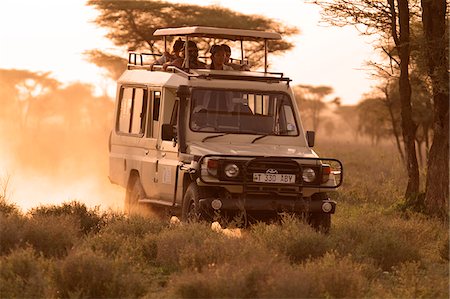
Safari vehicle on a game drive at dusk in the Ndutu region of the Serengeti National Park, Tanzania.
Rights-Managed
-
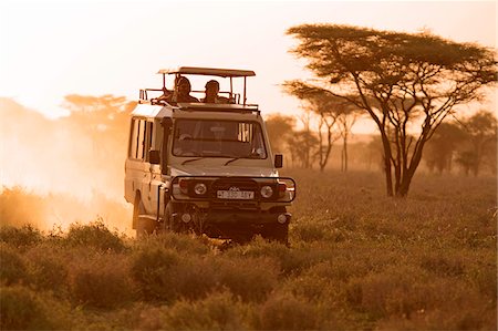
Safari vehicle on a game drive at dusk in the Ndutu region of the Serengeti National Park, Tanzania.
Rights-Managed
-

Safari vehicle with lion asleep in a tree, Ndutu region, Serengeti National Park, Tanzania.
Rights-Managed
-

A lone bull elephant browses amongst yellow fever trees in Ngorongoro Crater, Tanzania.
Rights-Managed
-

-

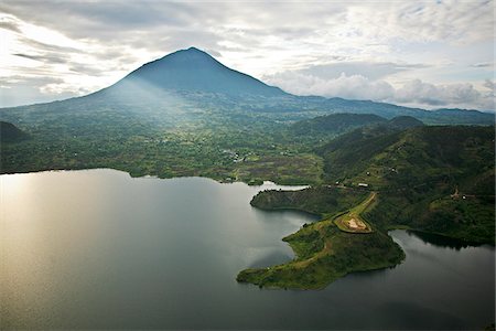
Volcano in the Virunga Mountain range viewed from Sabyinyo Silverback Lodge on the edge of Volcanoes National Park, Rwanda.
Rights-Managed
-

Volcano in the Virunga Mountain range viewed from Sabyinyo Silverback Lodge on the edge of Volcanoes National Park, Rwanda.
Rights-Managed
-

Volcano in the Virunga Mountain range viewed from Sabyinyo Silverback Lodge on the edge of Volcanoes National Park, Rwanda.
Rights-Managed


