-
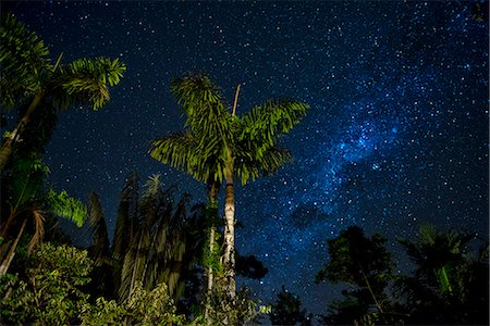
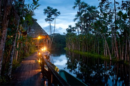
South America, Peru, Amazonia, South Manu National Park , night sky, UNESCO World Heritage
Rights-Managed
-
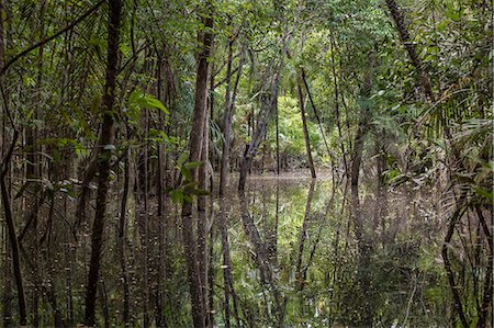
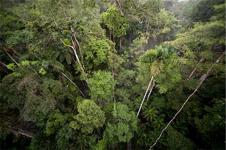
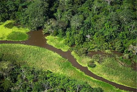
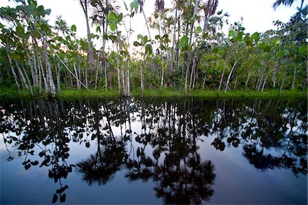
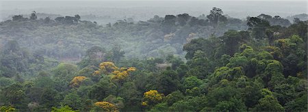
The flooded forest of the Rio negro Basin depicted in early August when the water level is still high and floods large area of the primary forest. Amazonas; Amazonia; Manaus; Brazil.
Premium Libres de Droits
-

-
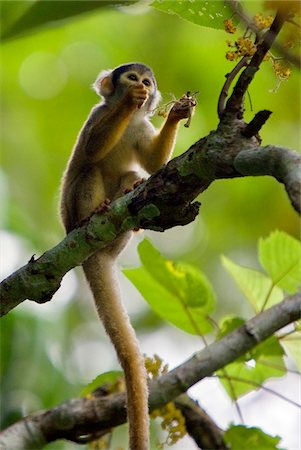
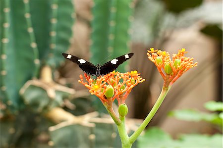
Pérou. Un singe de l'écureuil se nourrit de fleurs dans la forêt tropicale luxuriante au bord de la rivière Madre de Dios de.
Rights-Managed
-

-
-

-

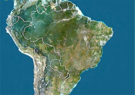
Vue satellite de l'état d'Amazonas, Brésil. Cette image a été compilée à partir de données acquises par les satellites LANDSAT 5 & 7.
Rights-Managed
-
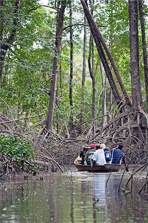
South America, Brazil, Para, Amazon, Marajo island, tourists in wooden canoes visiting red mangrove forest near Soure
Rights-Managed
-

-

-
-

Fleuve Amazone, au Brésil, couleur vraie Image-Satellite. Le fleuve Amazone, un du plus long fleuve du monde avec de nombreux virages et ses affluents. Image prise le 15 juillet 1986, à l'aide de données LANDSAT.
Rights-Managed
-

South America, Brazil, Amazonas, tourists spotting wildlife in the rainforest with a guide from the Tucano river boat
Rights-Managed
-

-
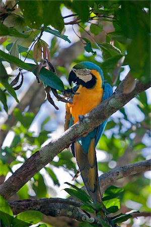
Pérou. Un Ara bleu et jaune coloré dans la forêt tropicale du bassin amazonien.
Rights-Managed
-

The flooded forest of the Rio negro Basin depicted in early August when the water level is still high and floods large area of the primary forest.
Rights-Managed
-
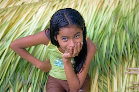
Village jeune fille assise sur lit de cultures récemment coupés dans le Village de Jamaraqua, regardant le monde passer. Communauté de Jamaraqua, région d'Amazonie, Brésil
Rights-Managed
-

Déforestation, East Rondonia, Brésil, en 2000, True Image Satellite de la couleur. Vrai couleur image satellite montrant la déforestation en Amazonie dans la partie orientale de l'état de Rondônia, Brésil. Image au format paysage pris en 2000, à l'aide de données LANDSAT.
Rights-Managed
-

Plan-relief de l'état d'Amazonas, Brésil. Cette image a été compilée à partir de données acquises par les satellites LANDSAT 5 & 7 combinées avec les données d'élévation.
Rights-Managed
-

Brazil, Amazon, Aerial view of an igapo, black water creek, in the Amazon forest near Manaus
Rights-Managed
-
-
Pérou, Amazon, Amazon River. Vue aérienne de la forêt tropicale près de Iquitos.
Rights-Managed
-

Satellite view of deforestation in East Rondonia, Brazil in 1986 and 2001. This before and after image shows deforestation impact over the years.
Rights-Managed
-

-

South America, Peru, Amazonia, Manu National Park, UNESCO World Heritage, dugout boat on old oxbow lake
Rights-Managed
-
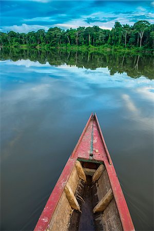
South America, Peru, Amazonia, Manu National Park, UNESCO World Heritage, dugout boat on old oxbow lake
Rights-Managed
-
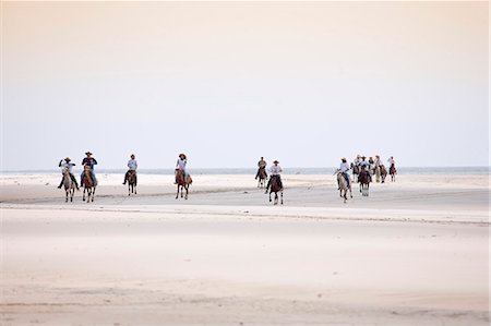
South America, Brazil, Para, Amazon, Marajo island, tourists on horseback riding on the beach near Soure
Rights-Managed
-

Pérou, Amazone, Amazone, Iquitos. Vue aérienne du port, port et des établissements d'Iquitos, la principale ville du bassin amazonien supérieur.
Rights-Managed
-
South America, Brazil, Para, Amazon, a wooden canoe moored on a lonely river beach backed by Amazon rainforest near Soure on Marajo island
Rights-Managed
-
Pérou. Un bromelia poussant dans la forêt tropicale du bassin amazonien. Le bromelia plus connu est l'ananas.
Rights-Managed
-
-
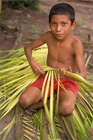
Young Boy tissage des branches de palmier ensemble pour la communauté eco shop pour la visite des touristes dans le village de Jamaraqua au bord de la Rio Tapajos
Rights-Managed
-
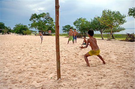
Match de football en action sur le village de Jamaraqua, sur les rives de la Rio Tapajos
Rights-Managed
-

-

South America, Brazil, Para, Amazon, an aerial shot of the city of Belem on Guajara Bay in the southern mouth of the Amazon confluence with a creek, mangrove and stilt houses in the foreground
Rights-Managed
-

-

-

South America, Brazil, Para, Amazon, an aerial shot of the city of Belem on Guajara Bay in the southern mouth of the Amazon confluence with mangrove and varzea forest in the foreground
Rights-Managed
-
-
Arbre à caoutchouc, Hevea brasiliensis, plantations sur les berges de l'Amazone, couper des marques indiquant où l'arbre a été traites au cours de plusieurs années.
Rights-Managed
-

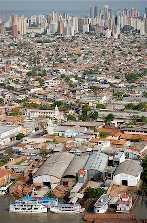
South America, Brazil, Para, Amazon, an aerial shot of the city of Belem in the southern mouth of the Amazon confluence, showing the Church and College of St. Alexander, the Cathedral and the Ver o Peso market on the waterfront of Guajara Bay
Rights-Managed
-
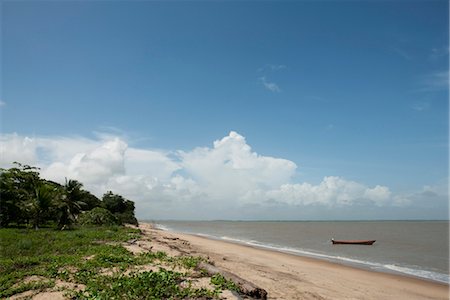
Scène de plage, Amazonie, Guyane française, en Amérique du Sud
Premium Libres de Droits
-
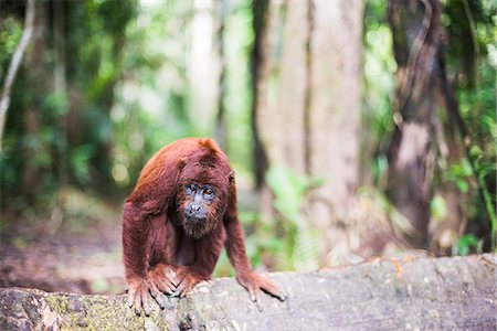
Red howler monkey (Alouatta Seniculus), Tambopata National Reserve, Puerto Maldonado Amazon Jungle area, Peru, South America
Rights-Managed
-
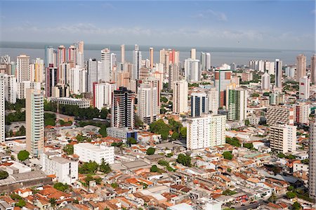
South America, Brazil, Para, Amazon, an aerial shot of the city of Belem in the southern mouth of the Amazon confluence, showing skyscraper apartment blocks and Guajara Bay
Rights-Managed
-
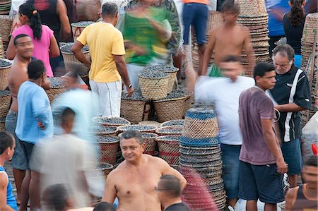
South America, Brazil, Para, Amazon, the morning acai market outside in Belem, which takes place outside the Ver o Peso market, on the waterfront of Guajara Bay
Rights-Managed
-

South America, Brazil, Para, Amazon, Marajo island, local man on horseback riding on the beach near Soure
Rights-Managed
-
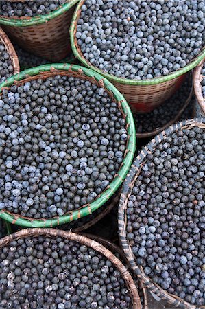
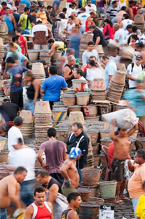
South America, Brazil, Para, Amazon, baskets of acai berry at the morning acai market in Belem, which takes place outside the Ver o Peso market, on the waterfront of Guajara Bay
Rights-Managed
-

South America, Colombia, Leticia, Amazon region, Kids lighting candles along a street
Rights-Managed
-

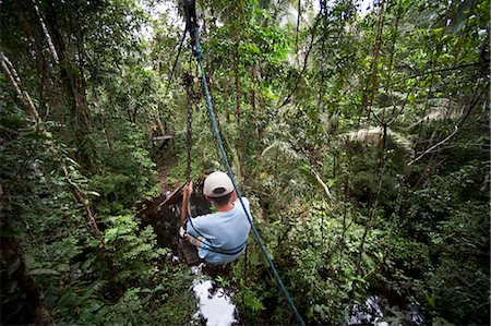
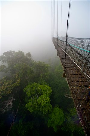
Amazon Jungle swinging rope bridge in Puerto Maldonado area, Peru, South America
Rights-Managed
-

-

Farineuse perroquet (Amazona farinosa) est l'un de la plus grande espèce de perroquet Amazone, en captivité au Royaume-Uni, Europe
Rights-Managed
-
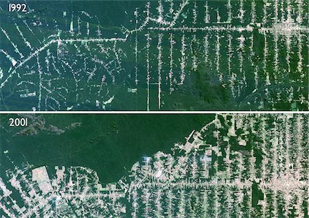
Déforestation, Mato Grosso, au Brésil, Satellite couleur vraie Image. Image satellite de véritable couleur montrant la déforestation en cours entre 1992 et 2001 en Amazonie dans l'état du Mato Grosso, à l'aide de données LANDSAT.
Rights-Managed
-
-

Pérou, Amazon, Amazon River. Coudes dans la rivière Nanay, un affluent du fleuve Amazone.
Rights-Managed
-
-

-

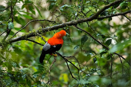
Pérou. Un ara rouge brillant dans la forêt tropicale du bassin amazonien.
Rights-Managed
-

-
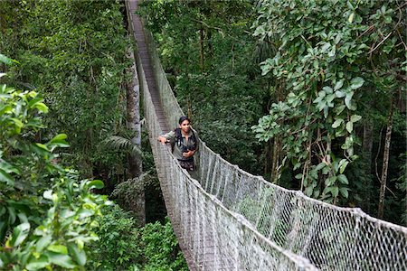
Pérou. Jésus, un guide local expérimenté au Inkaterra séjournez Amazonica, traversant un pont sur le parcours de la cime des arbres de la canopée.
Rights-Managed
-

Pérou, Amazon, Amazon River. Une liane (ou escalier de singe) descend à la litière de la forêt pluviale de canopée, Lago Preto Conservation Reserve, Amazon.
Rights-Managed
-
-
South America, Brazil, Para, Amazon, the morning acai market outside in Belem, which takes place outside the Ver o Peso market, on the waterfront of Guajara Bay
Rights-Managed
-
-

-
-
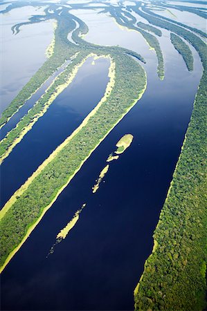
South America, Brazil, Amazon, Aerial view of the UNESCO listed Anavilhanas ecological station and the Anavilhanas archipelago and Amazon forest on the Rio Negro
Rights-Managed
-

Pérou, Amazon, Amazon River. Coudes dans la rivière Nanay, un affluent du fleuve Amazone.
Rights-Managed
-

Pérou, Amazon, Amazon River. Earthwatch bénévole et scientifique de décaissement d'un Transect de terres dans la réserve de Preto Lago. .
Rights-Managed
-

South America, Brazil, Para, Amazon, Marajo island, a guide from Fazenda Camburupy near Soure
Rights-Managed
-

-

-

Pérou. Les eaux rouges d'un affluent important du vent la rivière Madre de Dios à travers la jungle épaisse près de Puerto Maldonado.
Rights-Managed
-
-
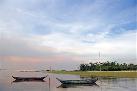
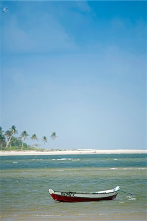
DUG out pirogues utilisées par les pêcheurs locaux tiré vers le haut sur les bords de la Rio Tapajos, un affluent du fleuve Amazone, au coucher du soleil dans la région d'Amazonas Brésil
Rights-Managed
-
-

South America, Brazil, Mato Grosso, Sao Jose do Rio Claro, the lake, main buildings at the Jardim da Amazonia jungle lodge and pousada in the Brazilian Amazon
Rights-Managed
-
South America, Brazil, Para, Amazon, an aerial shot of the city of Belem in the southern mouth of the Amazon confluence, showing skyscraper apartment blocks river boats docked on the waterfront, and Guajara Bay
Rights-Managed
-
-
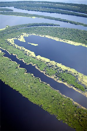
South America, Brazil, Amazon, Aerial view of the UNESCO listed Anavilhanas ecological station and the Anavilhanas archipelago and Amazon forest on the Rio Negro
Rights-Managed
-
-
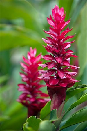
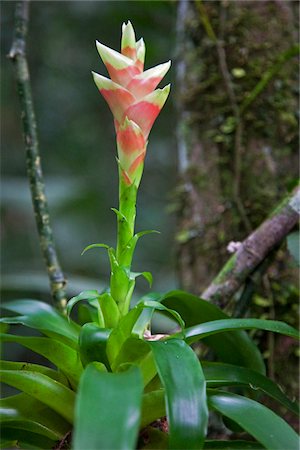
Pérou. Coloré rouge Ginger dans les jardins de Inkaterra Reserva Amazonica Lodge, sur les rives du fleuve Madre de Dios.
Rights-Managed
-

-
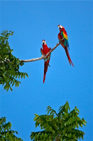
Pérou. Aras rouges colorés percher haut au-dessus de la canopée de la forêt près des rives du fleuve Madre de Dios
Rights-Managed
-

Amazon Delta (Brésil), véritable couleur Image Satellite. Image satellite de couleur vraie de l'embouchure du fleuve Amazone, un du plus long fleuve du monde avec de nombreux virages et ses affluents. Image composite à partir des données LANDSAT prises entre 1986 et 2001.
Rights-Managed
-

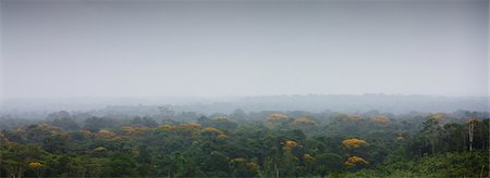
Brésil, Amazonie, Rio Tapajos. Un affluent de la Tapajos Rio qui est elle-même un affluent de l'Amazone. Nuage s'accumule au fil de ses riverains de la forêt tropicale humide à la fin de la saison sèche.
Rights-Managed
-
-
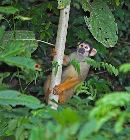
Pérou. Un singe de l'écureuil dans la forêt tropicale luxuriante du bassin amazonien.
Rights-Managed
-
-

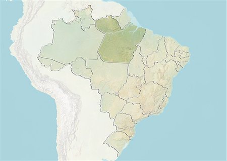
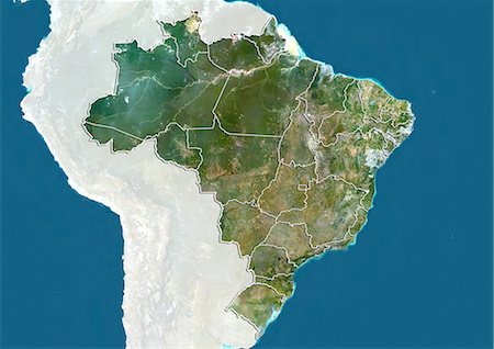
Carte du relief du Brésil (avec bordure et masque). Cette image a été compilée à partir de données acquises par les satellites landsat 5 & 7 combinées avec les données d'élévation.
Rights-Managed


