-

Relief map of the State of Washington, United States. This image was compiled from data acquired by LANDSAT 5 & 7 satellites combined with elevation data.
Rights-Managed
-
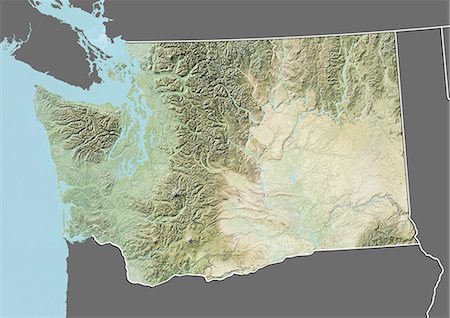
Relief map of the State of Washington, United States. This image was compiled from data acquired by LANDSAT 5 & 7 satellites combined with elevation data.
Rights-Managed
-

-

-
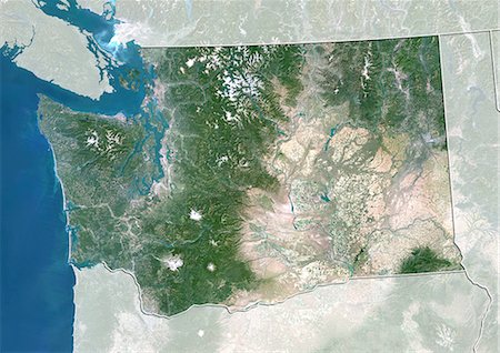
Satellite view of the State of Washington, United States. This image was compiled from data acquired by LANDSAT 5 & 7 satellites.
Rights-Managed
-

-

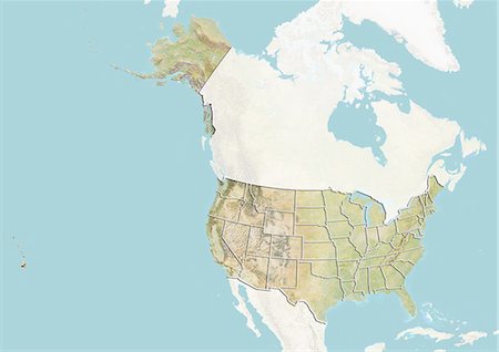
United States and the State of Washington, Satellite Image With Bump Effect
Rights-Managed
-

-

United States and the State of Washington, Satellite Image With Bump Effect
Rights-Managed
-
-
-

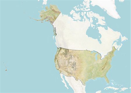
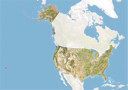
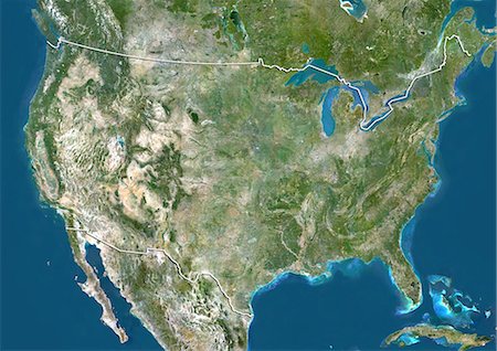
Relief map of the United States and Canada (with border). This image was compiled from data acquired by LANDSAT 5 & 7 satellites combined with elevation data.
Rights-Managed
-
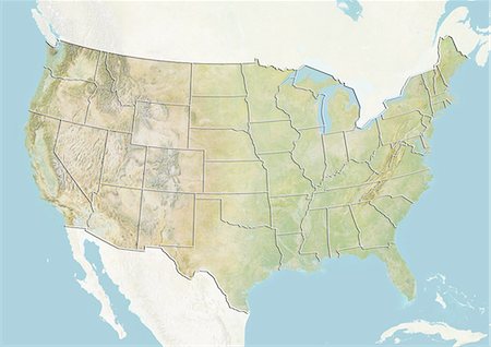
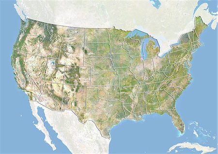
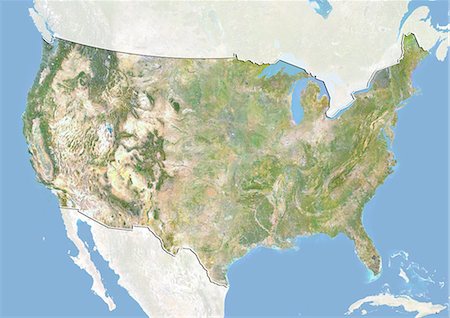
Relief map of the United States (with border and mask). This image was compiled from data acquired by landsat 5 & 7 satellites combined with elevation data.
Rights-Managed
-
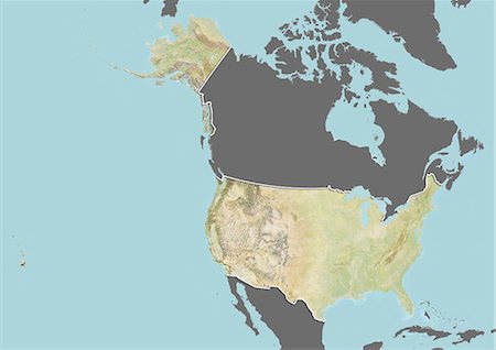
Relief map of the United States (with border and mask). This image was compiled from data acquired by landsat 5 & 7 satellites combined with elevation data.
Rights-Managed
-
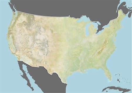
Relief map of the United States (with border and mask). This image was compiled from data acquired by landsat 5 & 7 satellites combined with elevation data.
Rights-Managed
-
-
-

-
-
-

-

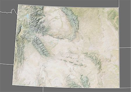
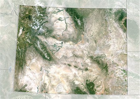
Relief map of the State of Wyoming, United States. This image was compiled from data acquired by LANDSAT 5 & 7 satellites combined with elevation data.
Rights-Managed
-
Relief map of the State of Wyoming, United States. This image was compiled from data acquired by LANDSAT 5 & 7 satellites combined with elevation data.
Rights-Managed
-
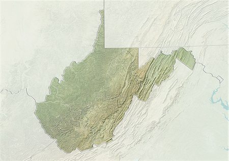
Relief map of the State of Western Virginia, United States. This image was compiled from data acquired by LANDSAT 5 & 7 satellites combined with elevation data.
Rights-Managed
-

Relief map of the State of Western Virginia, United States. This image was compiled from data acquired by LANDSAT 5 & 7 satellites combined with elevation data.
Rights-Managed
-

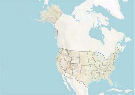
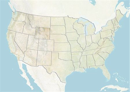
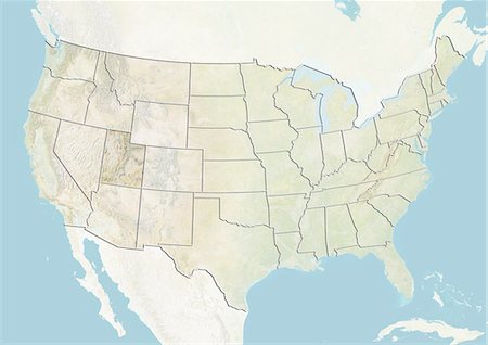
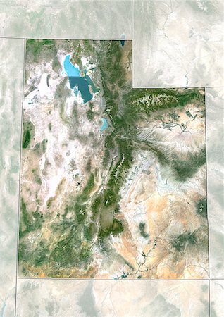
Relief map of the State of Utah, United States. This image was compiled from data acquired by LANDSAT 5 & 7 satellites combined with elevation data.
Rights-Managed
-

Relief map of the State of Utah, United States. This image was compiled from data acquired by LANDSAT 5 & 7 satellites combined with elevation data.
Rights-Managed
-

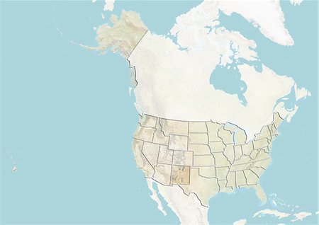
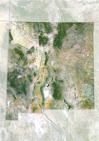
Relief map of the State of New Mexico, United States. This image was compiled from data acquired by LANDSAT 5 & 7 satellites combined with elevation data.
Rights-Managed
-

Relief map of the State of New Mexico, United States. This image was compiled from data acquired by LANDSAT 5 & 7 satellites combined with elevation data.
Rights-Managed
-
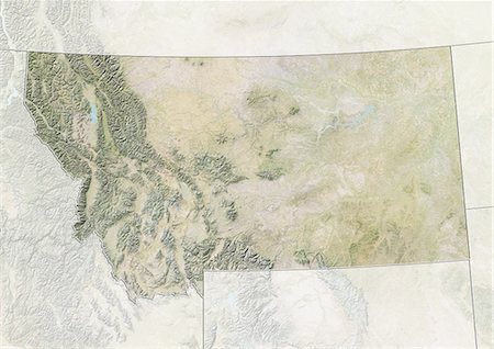
Relief map of the State of Montana, United States. This image was compiled from data acquired by LANDSAT 5 & 7 satellites combined with elevation data.
Rights-Managed
-
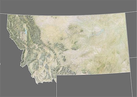
Relief map of the State of Montana, United States. This image was compiled from data acquired by LANDSAT 5 & 7 satellites combined with elevation data.
Rights-Managed
-
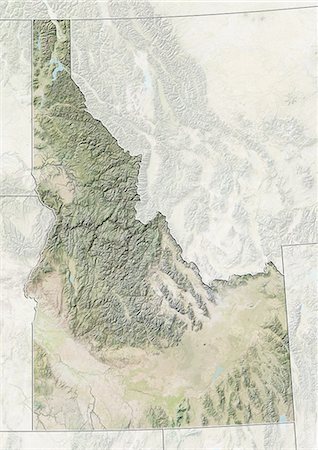
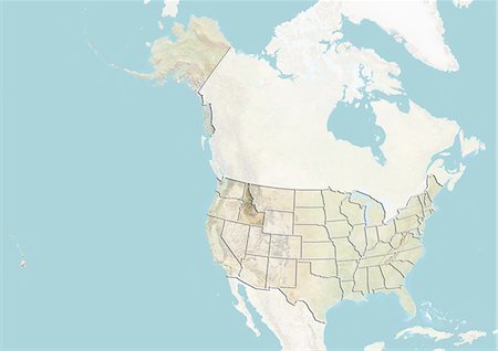
Relief map of the State of Idaho, United States. This image was compiled from data acquired by LANDSAT 5 & 7 satellites combined with elevation data.
Rights-Managed
-

Relief map of the State of Idaho, United States. This image was compiled from data acquired by LANDSAT 5 & 7 satellites combined with elevation data.
Rights-Managed
-
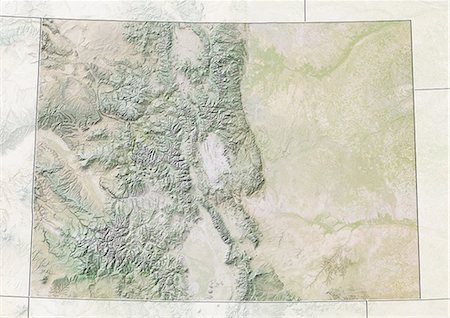
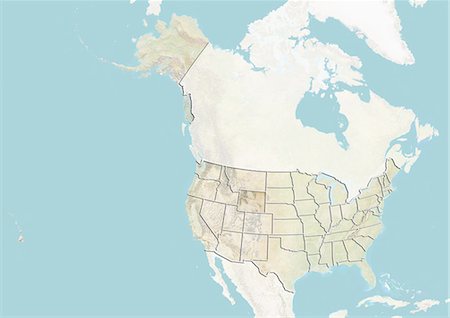
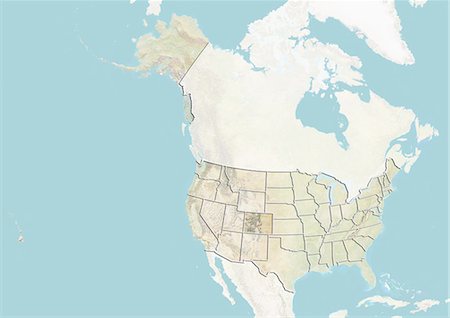
Relief map of the State of Colorado, United States. This image was compiled from data acquired by LANDSAT 5 & 7 satellites combined with elevation data.
Rights-Managed
-
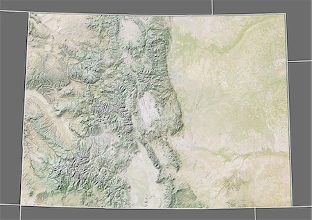
Relief map of the State of Colorado, United States. This image was compiled from data acquired by LANDSAT 5 & 7 satellites combined with elevation data.
Rights-Managed
-
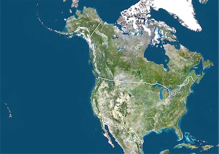
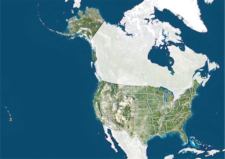
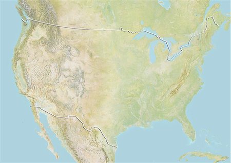
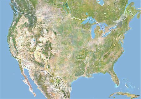
Satellite view of the United States and Canada (with border). This image was compiled from data acquired by LANDSAT 5 & 7 satellites.
Rights-Managed
-

Satellite view of the United States (with border and mask). This image was compiled from data acquired by LANDSAT 5 & 7 satellites.
Rights-Managed
-
-
-

-
-
-

-
-
-
-

-
-

-

-

-

-
-
-

-
-
-
Satellite view of the State of Wyoming, United States. This image was compiled from data acquired by LANDSAT 5 & 7 satellites.
Rights-Managed
-

Satellite view of the State of Western Virginia, United States. This image was compiled from data acquired by LANDSAT 5 & 7 satellites.
Rights-Managed
-
Satellite view of the State of Utah, United States. This image was compiled from data acquired by LANDSAT 5 & 7 satellites.
Rights-Managed
-
Satellite view of the State of New Mexico, United States. This image was compiled from data acquired by LANDSAT 5 & 7 satellites.
Rights-Managed
-

Satellite view of the State of Montana, United States. This image was compiled from data acquired by LANDSAT 5 & 7 satellites.
Rights-Managed
-

Satellite view of the State of Idaho, United States. This image was compiled from data acquired by LANDSAT 5 & 7 satellites.
Rights-Managed
-

Satellite view of the State of Colorado, United States. This image was compiled from data acquired by LANDSAT 5 & 7 satellites.
Rights-Managed
-

Relief map of the State of California, United States. This image was compiled from data acquired by LANDSAT 5 & 7 satellites combined with elevation data.
Rights-Managed
-

Relief map of the State of California, United States. This image was compiled from data acquired by LANDSAT 5 & 7 satellites combined with elevation data.
Rights-Managed
-
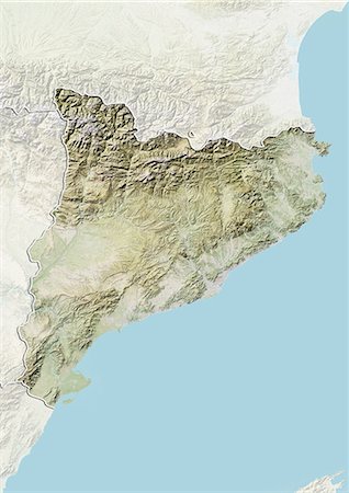
Relief map of Catalonia, Spain. This image was compiled from data acquired by LANDSAT 5 & 7 satellites combined with elevation data.
Rights-Managed
-

Relief map of Catalonia, Spain. This image was compiled from data acquired by LANDSAT 5 & 7 satellites combined with elevation data.
Rights-Managed
-

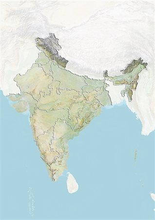
Relief map of the State of Uttarakhand, India. This image was compiled from data acquired by LANDSAT 5 & 7 satellites combined with elevation data.
Rights-Managed
-

Relief map of the State of Sikkim, India. This image was compiled from data acquired by LANDSAT 5 & 7 satellites combined with elevation data.
Rights-Managed
-

Relief map of the State of Jammu and Kashmir, India. This image was compiled from data acquired by LANDSAT 5 & 7 satellites combined with elevation data.
Rights-Managed
-
Relief map of the State of Himachal Pradesh, India. This image was compiled from data acquired by LANDSAT 5 & 7 satellites combined with elevation data.
Rights-Managed
-

Relief map of the State of Arunachal Pradesh, India. This image was compiled from data acquired by LANDSAT 5 & 7 satellites combined with elevation data.
Rights-Managed
-
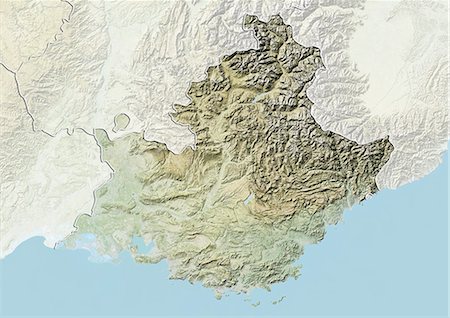
Relief map of Provence-Alpes-Cote d'Azur, France. This image was compiled from data acquired by LANDSAT 5 & 7 satellites combined with elevation data.
Rights-Managed
-
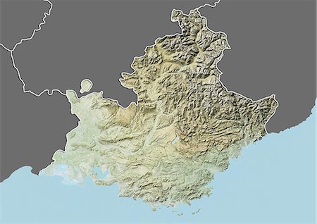
Relief map of Provence-Alpes-Cote d'Azur, France. This image was compiled from data acquired by LANDSAT 5 & 7 satellites combined with elevation data.
Rights-Managed
-

Relief map of Languedoc-Roussillon, France. This image was compiled from data acquired by LANDSAT 5 & 7 satellites combined with elevation data.
Rights-Managed
-

Relief map of Languedoc-Roussillon, France. This image was compiled from data acquired by LANDSAT 5 & 7 satellites combined with elevation data.
Rights-Managed
-

Relief map of British Columbia, Canada. This image was compiled from data acquired by LANDSAT 5 & 7 satellites combined with elevation data.
Rights-Managed
-
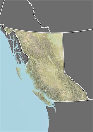
Relief map of British Columbia, Canada. This image was compiled from data acquired by LANDSAT 5 & 7 satellites combined with elevation data.
Rights-Managed
-

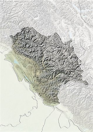
Relief map of the State of Vorarlberg, Austria. This image was compiled from data acquired by LANDSAT 5 & 7 satellites combined with elevation data.
Rights-Managed
-

Relief map of the State of Vienna, Austria. This image was compiled from data acquired by LANDSAT 5 & 7 satellites combined with elevation data.
Rights-Managed
-

Relief map of the State of Upper Austria, Austria. This image was compiled from data acquired by LANDSAT 5 & 7 satellites combined with elevation data.
Rights-Managed
-
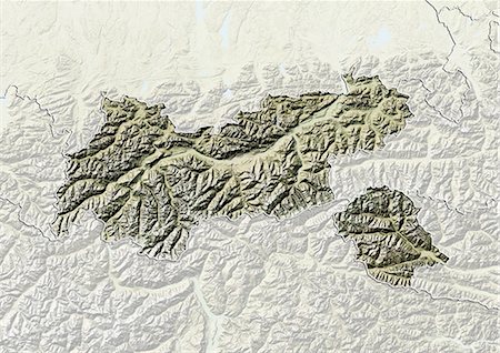
Relief map of the State of Tyrol, Austria. This image was compiled from data acquired by LANDSAT 5 & 7 satellites combined with elevation data.
Rights-Managed
-
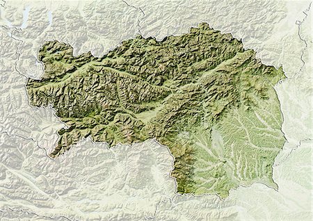
Relief map of the State of Styria, Austria. This image was compiled from data acquired by LANDSAT 5 & 7 satellites combined with elevation data.
Rights-Managed
-

Relief map of the State of Salzburg, Austria. This image was compiled from data acquired by LANDSAT 5 & 7 satellites combined with elevation data.
Rights-Managed
-

Relief map of the State of Lower Austria, Austria. This image was compiled from data acquired by LANDSAT 5 & 7 satellites combined with elevation data.
Rights-Managed
-
Relief map of the State of Carinthia, Austria. This image was compiled from data acquired by LANDSAT 5 & 7 satellites combined with elevation data.
Rights-Managed
-

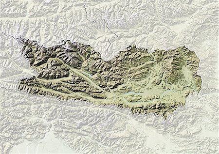
Relief map of the State of Burgenland, Austria. This image was compiled from data acquired by LANDSAT 5 & 7 satellites combined with elevation data.
Rights-Managed
-

Relief map of Uzbekistan (with border and mask). This image was compiled from data acquired by landsat 5 & 7 satellites combined with elevation data.
Rights-Managed
-

Relief map of Ukraine (with border and mask). This image was compiled from data acquired by landsat 5 & 7 satellites combined with elevation data.
Rights-Managed


