-

Satellite view of the district of Porto, Portugal. This image was compiled from data acquired by LANDSAT 5 & 7 satellites.
Rights-Managed
-

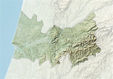
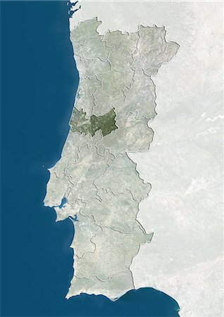
Relief map of the district of Porto, Portugal. This image was compiled from data acquired by LANDSAT 5 & 7 satellites combined with elevation data.
Rights-Managed
-

-

-
-
-

-
-

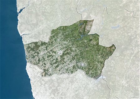
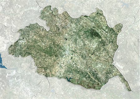
Satellite view of the district of Viana do Castelo, Portugal. This image was compiled from data acquired by LANDSAT 5 & 7 satellites.
Rights-Managed
-

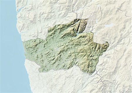
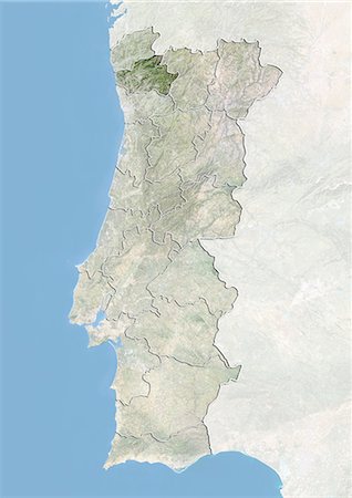
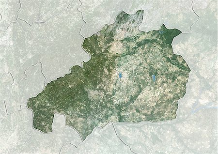
Relief map of the district of Viana do Castelo, Portugal. This image was compiled from data acquired by LANDSAT 5 & 7 satellites combined with elevation data.
Rights-Managed
-

Satellite view of the district of Setubal, Portugal. This image was compiled from data acquired by LANDSAT 5 & 7 satellites.
Rights-Managed
-

Relief map of the district of Setubal, Portugal. This image was compiled from data acquired by LANDSAT 5 & 7 satellites combined with elevation data.
Rights-Managed
-

Satellite view of the district of Lisbon, Portugal. This image was compiled from data acquired by LANDSAT 5 & 7 satellites.
Rights-Managed
-

Relief map of the district of Lisbon, Portugal. This image was compiled from data acquired by LANDSAT 5 & 7 satellites combined with elevation data.
Rights-Managed
-

Satellite view of the district of Leiria, Portugal. This image was compiled from data acquired by LANDSAT 5 & 7 satellites.
Rights-Managed
-

Relief map of the district of Leiria, Portugal. This image was compiled from data acquired by LANDSAT 5 & 7 satellites combined with elevation data.
Rights-Managed
-

Satellite view of the district of Faro, Portugal. This image was compiled from data acquired by LANDSAT 5 & 7 satellites.
Rights-Managed
-

Relief map of the district of Faro, Portugal. This image was compiled from data acquired by LANDSAT 5 & 7 satellites combined with elevation data.
Rights-Managed
-

Satellite view of the district of Coimbra, Portugal. This image was compiled from data acquired by LANDSAT 5 & 7 satellites.
Rights-Managed
-
Relief map of the district of Coimbra, Portugal. This image was compiled from data acquired by LANDSAT 5 & 7 satellites combined with elevation data.
Rights-Managed
-
Satellite view of the district of Braga, Portugal. This image was compiled from data acquired by LANDSAT 5 & 7 satellites.
Rights-Managed
-
Relief map of the district of Braga, Portugal. This image was compiled from data acquired by LANDSAT 5 & 7 satellites combined with elevation data.
Rights-Managed
-

Satellite view of the district of Beja, Portugal. This image was compiled from data acquired by LANDSAT 5 & 7 satellites.
Rights-Managed
-

Relief map of the district of Beja, Portugal. This image was compiled from data acquired by LANDSAT 5 & 7 satellites combined with elevation data.
Rights-Managed
-

Satellite view of the district of Aveiro, Portugal. This image was compiled from data acquired by LANDSAT 5 & 7 satellites.
Rights-Managed
-

Relief map of the district of Aveiro, Portugal. This image was compiled from data acquired by LANDSAT 5 & 7 satellites combined with elevation data.
Rights-Managed
-

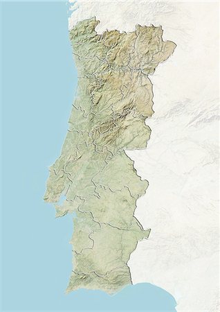
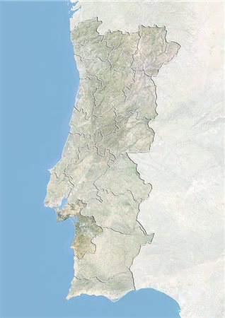
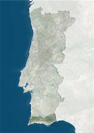
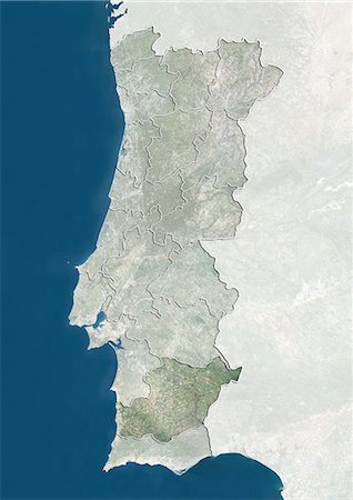
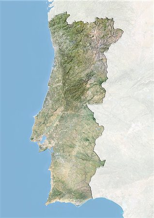
Relief map of Portugal (with border and mask). This image was compiled from data acquired by landsat 5 & 7 satellites combined with elevation data.
Rights-Managed
-
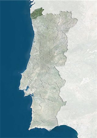
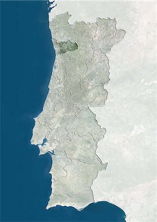
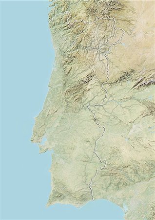
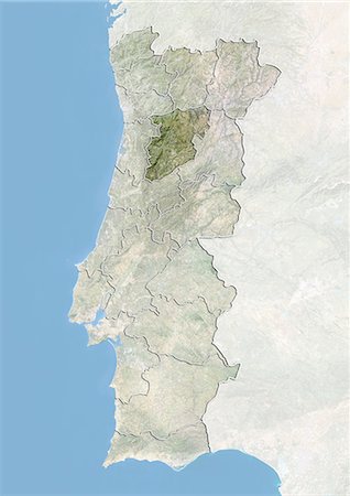
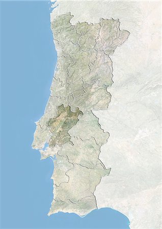
Portugal and the District of Viana do Castelo, True Colour Satellite Image
Rights-Managed
-

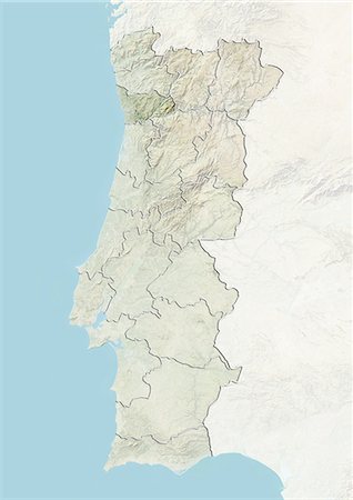
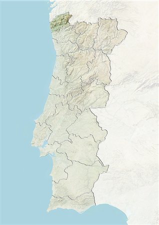
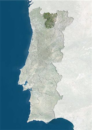
Portugal and the District of Viana do Castelo, Satellite Image With Bump Effect
Rights-Managed
-
-

-
-

-

-

-

-

-

-

-
-

-

-
-

-

-

-
-

-
-

-

-

-

-

-

-

-

-
-
-

-
Satellite view of the district of Viseu, Portugal. This image was compiled from data acquired by LANDSAT 5 & 7 satellites.
Rights-Managed
-

Relief map of the district of Viseu, Portugal. This image was compiled from data acquired by LANDSAT 5 & 7 satellites combined with elevation data.
Rights-Managed
-

Satellite view of the district of Vila Real, Portugal. This image was compiled from data acquired by LANDSAT 5 & 7 satellites.
Rights-Managed
-

Relief map of the district of Vila Real, Portugal. This image was compiled from data acquired by LANDSAT 5 & 7 satellites combined with elevation data.
Rights-Managed
-

Satellite view of the district of Santarem, Portugal. This image was compiled from data acquired by LANDSAT 5 & 7 satellites.
Rights-Managed
-

Relief map of the district of Santarem, Portugal. This image was compiled from data acquired by LANDSAT 5 & 7 satellites combined with elevation data.
Rights-Managed
-

Satellite view of the district of Portalegre, Portugal. This image was compiled from data acquired by LANDSAT 5 & 7 satellites.
Rights-Managed
-

Relief map of the district of Portalegre, Portugal. This image was compiled from data acquired by LANDSAT 5 & 7 satellites combined with elevation data.
Rights-Managed
-

Satellite view of the district of Guarda, Portugal. This image was compiled from data acquired by LANDSAT 5 & 7 satellites.
Rights-Managed
-

Relief map of the district of Guarda, Portugal. This image was compiled from data acquired by LANDSAT 5 & 7 satellites combined with elevation data.
Rights-Managed
-
Satellite view of the district of Evora, Portugal. This image was compiled from data acquired by LANDSAT 5 & 7 satellites.
Rights-Managed
-

Relief map of the district of Evora, Portugal. This image was compiled from data acquired by LANDSAT 5 & 7 satellites combined with elevation data.
Rights-Managed
-
Satellite view of the district of Castelo Branco, Portugal. This image was compiled from data acquired by LANDSAT 5 & 7 satellites.
Rights-Managed
-

Relief map of the district of Castelo Branco, Portugal. This image was compiled from data acquired by LANDSAT 5 & 7 satellites combined with elevation data.
Rights-Managed
-

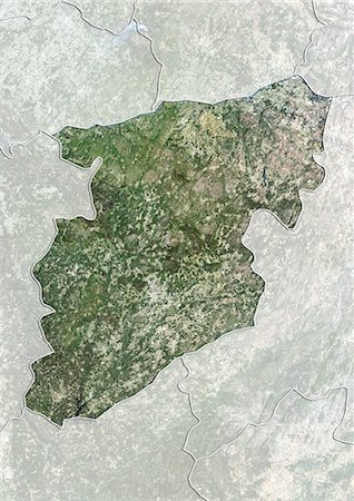
Satellite view of the district of Braganca, Portugal. This image was compiled from data acquired by LANDSAT 5 & 7 satellites.
Rights-Managed
-

Relief map of the district of Braganca, Portugal. This image was compiled from data acquired by LANDSAT 5 & 7 satellites combined with elevation data.
Rights-Managed
-

-
-

-
-

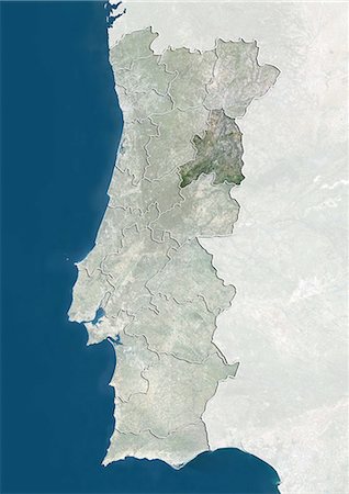
Portugal and the District of Vila Real, Satellite Image With Bump Effect
Rights-Managed
-

-

-
-

-

-

Portugal and the District of Portalegre, Satellite Image With Bump Effect
Rights-Managed
-

-
-


