-
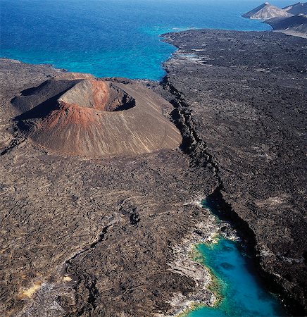
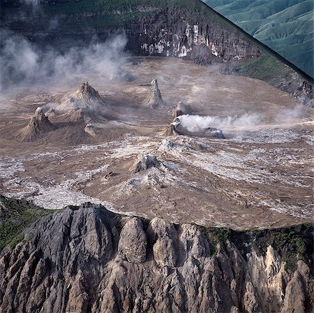
An aerial view of the volcanic cones at the inlet of Ghoubbet el Kharäb (the Devil's Throat),a region of high seismic activity where deep fractures in the lava continue to widen year by year.
Rights-Managed
-
An aerial view of the caldera Sisale Koma,which is 3,937 feet in diameter and 300,000 years old. It is situated at the inlet of Ghoubbet el Kharäb (the Devil's Throat),a region of high seismic activity where deep fractures in the lava continue to widen year by year.
Rights-Managed
-
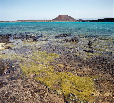
A perfect cone-shaped volcano juts into a beautiful turquoise sea at Ghoubbet el Kharäb (the Devil's Throat),a region of high seismic activity.
Rights-Managed
-
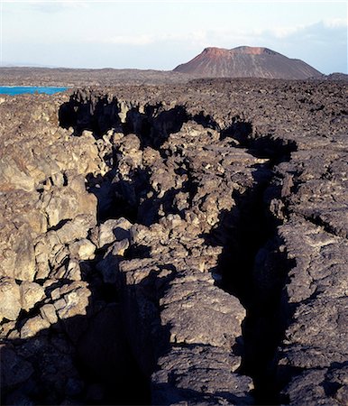
A little distance offshore from the coast of Djibouti, the northern extent of Africas Great Rift Valley abuts a triple junction where the oceanic rifts of the Red Sea and the Gulf of Aden converge.This photograph shows an obvious crack in a huge lava ridge.Other than Iceland, Djibouti is the only country where scientists can observe the sea floor spreading on dry land as two plates move apart.
Rights-Managed
-
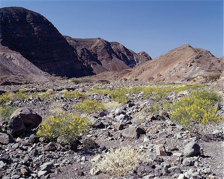
After a rain shower,shrubs of the Pea family (Papilionoideae) give a splash of colour to the forbidding landscape near Ghoubbet el Kharäb (the Devil's Throat),a region of high seismic activity where deep fractures in the lava continue to widen year by year.
Rights-Managed
-
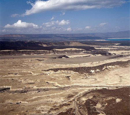
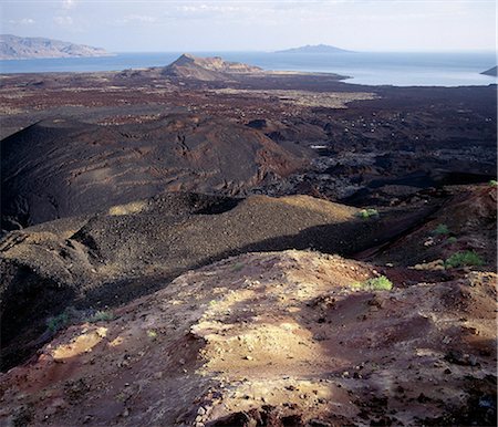
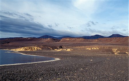
The inhospitable countryside between Garrayto and Lake Assal is strewn with lava and pale,friable material discharged from nearby volcanoes.
Rights-Managed
-
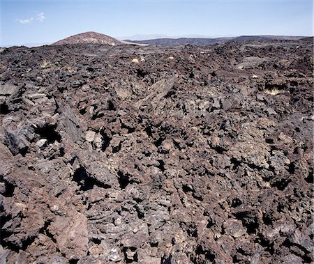
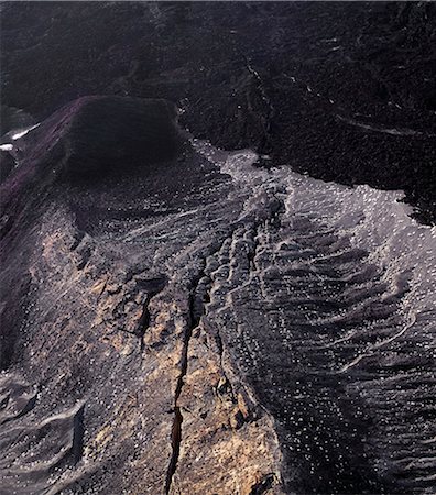
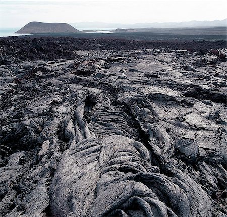
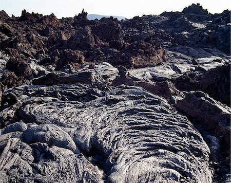
The region surrounding Ghoubbet el Kharäb (the Devil's Throat) is an inhospitable maze of lava rock,which makes walking virtually impossible.
Rights-Managed
-
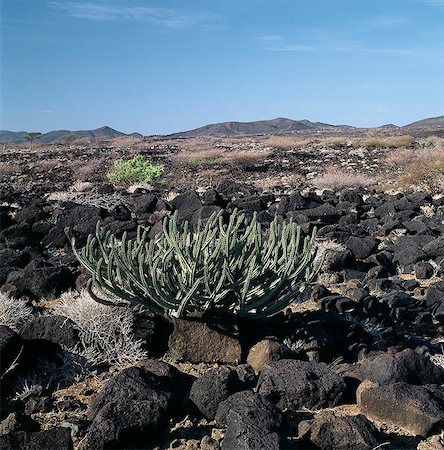
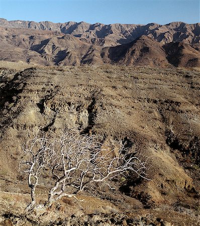
On the inhospitable lava-strewn hills surrounding the inlet of Ghoubbet el Kharäb (the Devil's Throat),a relative of the Dragon's Blood Tree (Dracaena orbet) struggles to survive in low rainfall and temperatures regularly exceeding 1000 F.
Rights-Managed
-
A little distance offshore from the coast of Djibouti, the northern extent of Africas Great Rift Valley abuts a triple junction where the oceanic rifts of the Red Sea and the Gulf of Aden converge.This photograph shows an obvious crack in a huge lava ridge.Other than Iceland, Djibouti is the only country where scientists can observe the sea floor spreading on dry land as two plates move apart.
Rights-Managed
-
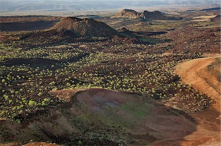
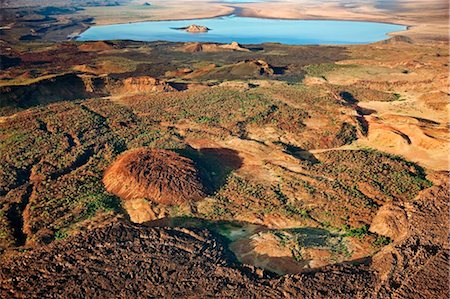
The Suguta Valley is a low-lying area of salt pans,mud flats and volcanic cones surrounded by awesome mountain ranges. Once,a part of Lake Turkana,the place is one of the hottest and most unpleasant corners of Kenya,a hell-on-earth where midday temperatures can reach 1400 F in the shade. Nomadic Turkana herdsmen bring their livestock here for salt but they never stay long.
Rights-Managed
-
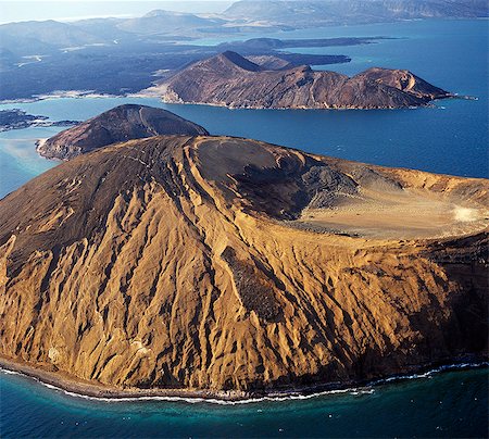
The volcanic island of Ounda Ginni Koma (the small Hill of Devils) situated near Ghoubbet el Kharäb (the Devil's Throat),a region of high seismic activity where deep fractures in the lava continue to widen year by year. The sand around the island is reddish due to the colour of some friable volcanic material.
Rights-Managed
-
The impressive Canyon d'Adail_,known to the Afar people as Dimbia,is an intersection of rifts and land faulting,south of Ghoubbet el Kharäb.
Rights-Managed
-

Sculptured volcanic cliffs on the volcanic island of Ounda Ginni Koma (the small Hill of Devils),which is situated near Ghoubbet el Kharäb (the Devil's Throat),a region of high seismic activity where deep fractures in the lava continue to widen year by year. The sand around the island is reddish due to the colour of some friable volcanic material.
Rights-Managed
-
Some of the lava flows from Telekis Volcano looking north to the southern end of Lake Turkana where the Nabuyatom cone is prominent. Named after Count Teleki, an Austrian nobleman, who led the first European expedition to the region in 1888.
Rights-Managed
-
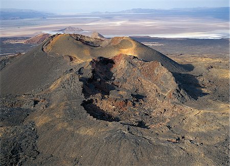
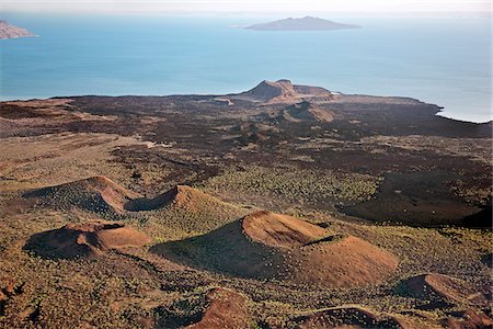
Andrew's Volcano is situated on 'The Barrier' - a large volcanic uplift that separates Lake Turkana from the Suguta Valley (visible in the distance of this picture) to its south. This volcano is one of many dormant volcanos in the region. It last erupted in about 1895 but steam can still be seen issuing from nearby vents.
Rights-Managed
-
Lava flows from Teleki's Volcano. Named after Count Teleki,an Austrian nobleman,who led the first European expedition to the region in 1888,the volcano last erupted in about 1895 - the only active volcano in the region at that time. Over centuries,each eruption ejected basaltic lava of a different colour. The flows in the foreground still look remarkably fresh.
Rights-Managed
-
Euphorbia shrubs and small 'wait-a-bit' thorn trees (Acacia brevispica) thrive among a confusion of basalt lava boulders at the southern end of Lake Turkana,near Sirima. Extensive lava fields in this region are an aftermath of Pleistocene volcanic activity and make walking a perfect misery.
Rights-Managed
-
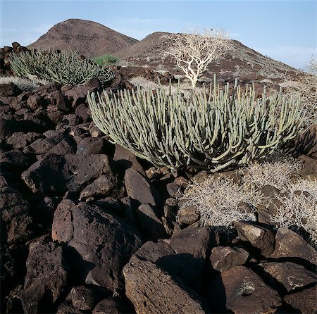
Euphorbia shrubs thrive among a confusion of basalt lava boulders at the southern end of Lake Turkana,near Sirima. Extensive lava fields in this region are an aftermath of Pleistocene volcanic activity and make walking a perfect misery.
Rights-Managed
-
South of Lake Turkana lies the Suguta Valley,the lowest and one of the most inhospitable place in Kenya. Vegetation is sparse and the area mainly uninhabited except for Turkana herdsmen and their goats. Most of the water there is too saline even for livestock to drink.
Rights-Managed
-
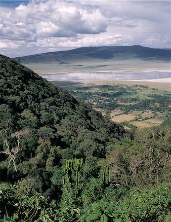
The world famous Ngorongoro Crater was declared a World Heritage Site in 1978. Its 102-square-mile crater floor is spectacular for wildlife. The crater is in fact a 'caldera' the largest unbroken,unflooded caldera in the world which was formed two and a half million years ago when a huge explosion destroyed the walls of a volcano standing about 15,000 feet high. .
Rights-Managed
-
Lake Natron in northern Tanzania is one of the most alkaline of the Rift system.As its waters evaporate in the intense heat, sodium sesquicarbonate, known as trona or natron, solidifies to resemble giant coral heads in brightly coloured water. Visible beyond the lake is Ol doinyo Lengai the only active volcano in the Gregory Rift.
Rights-Managed
-
A view from the top of Telekis Volcano looking north to the southern end of Lake Turkana and South Island beyond. Named after Count Teleki, an Austrian nobleman, who led the first European expedition to the region in 1888.
Rights-Managed
-
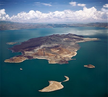
An aerial view of South Island, Lake Turkanas largest island. Situated in the southern sector of the lake where the water reaches a depth of 374 feet, the island is a spine of volcanic cones and hills covering 15 square miles. The lava flows are remarkably well preserved there.
Rights-Managed
-

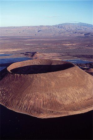
An aerial view of the southern end of Lake Turkana, which is named Von H hnel Bay after the Austrian naval officer who was part of an epic journey of exploration to reach the lake in 1888.The perfectly formed cone that juts into the lake is called Naboi eetom by the Turkana people.
Rights-Managed
-

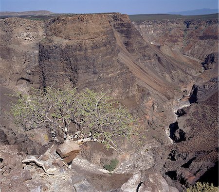
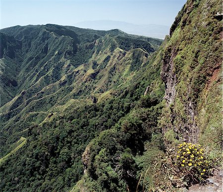
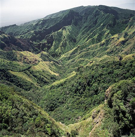
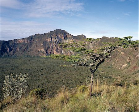
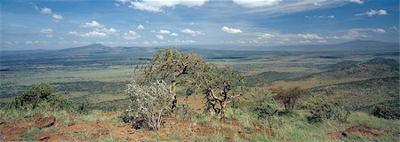
A fine view from the eastern wall of Africa's Great Rift Valley system at Losiolo near Maralal. There,the top of the escarpment rises to over 8,000 feet before dropping precipitously 3,000 feet into a stark valley inhabited only in wet weather.
Rights-Managed
-

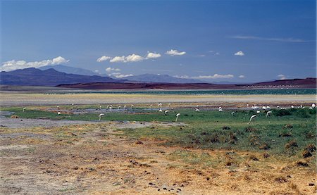
The alkaline waters of Lake Bogoria are a favourite haunt of lesser flamingos. The barren shoreline is dotted with steam jets and geysers reflecting its volcanic origins.
Rights-Managed
-
Lava boulders cover vast tracts of infertile land on the eastern side of Lake Turkana. Often referred to as the Jade Sea due to its distinctive colour,Lake Turkana is a true desert lake,receiving 95% of its inflow from the Omo River,which rises in the highlands of Ethiopia.
Rights-Managed
-
Inhospitable,semi-arid,thorn scrub country northwest of Lodwar,the administrative centre of the Turkana people. All the hills and mountains are of volcanic origin. The tall flues of termite mounds dot the landscape; their colour shows the soil structure deep underground.
Rights-Managed
-

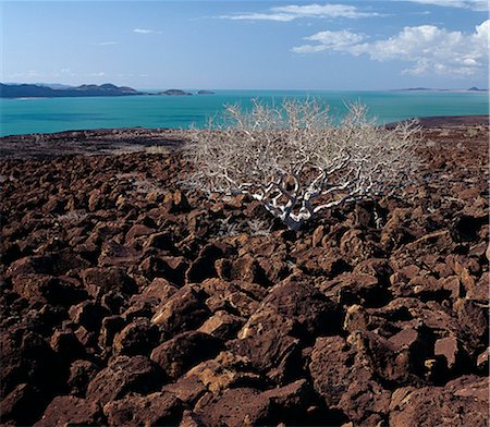
A Commiphora tree struggles for survival in a confused jumble of basalt lava boulders,reddened by the setting sun. Extensive lava fields are an unpleasant feature of southern Turkanaland.
Rights-Managed
-
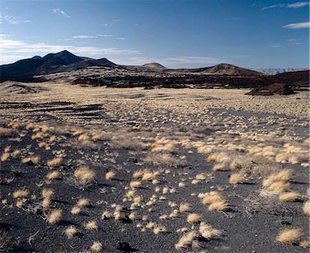
Awesome mountain ranges of volcanic origin surround the low-lying Suguta Valley,south of Lake Turkana. It is one of the hottest and most unpleasant corners of Kenya where midday temperatures rise to 1400 F in the shade - if you can find any
Rights-Managed
-
A commiphora tree struggles to survive among basalt boulders - an aftermath of Pleistocene volcanic activity - that litter the countryside at the inhospitable southeast corner of Lake Turkana. The remarkable colour of the lake's alkaline water is caused by green algae with high chlorophyll concentrations. People often refer to the lake as the Jade Sea.
Rights-Managed
-
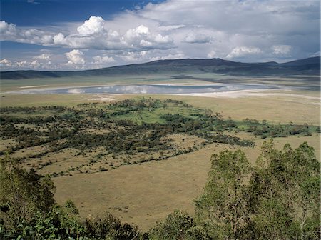
The world famous Ngorongoro Crater was declared a World Heritage Site in 1978. Its 102-square-mile crater floor is spectacular for wildlife. The crater is in fact a 'caldera' the largest unbroken,unflooded caldera in the world which was formed two and a half million years ago when a huge explosion destroyed the walls of a volcano standing about 15,000 feet high. .
Rights-Managed
-
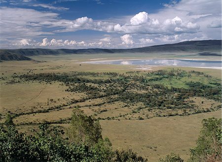
Mount Kulal is divided into two by an ancient volcano, which collapsed thousands of years ago, leaving an impressive gorge. This picture shows the remains of the steep sided volcanic crater. Mount Kulal rises to over 6,000 feet in Northern Kenya and is surrounded by a sea of lava and arid wastes.
Rights-Managed
-

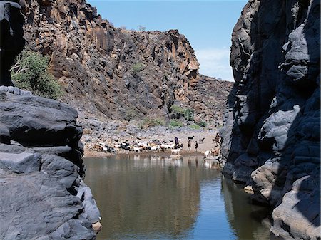
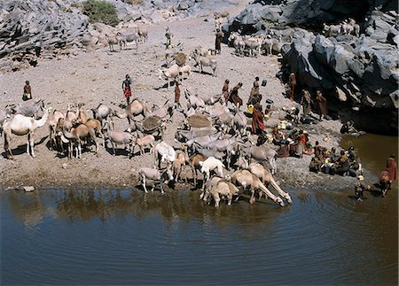
The natural rock pools along the Sirima lugga are important to the Turkana and their stock in an otherwise waterless, rocky region at the southern end of Lake Turkana. In a year of average rainfall, water in the deepest pools will last throughout the year.Lake Turkana is just visible in this picture.
Rights-Managed
-

South Island is Lake Turkanas largest island. Situated in the southern sector of the lake where the water reaches a depth of 374 feet, the island is a spine of volcanic cones and hills covering 15 square miles. The lava flows are remarkably well preserved.
Rights-Managed
-

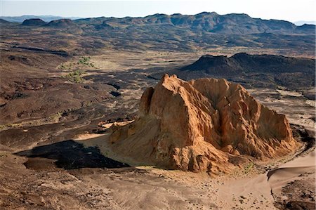
An extinct volcano with its outflow of lava rock in the Suguta Valley. Lake Turkana.
Rights-Managed
-
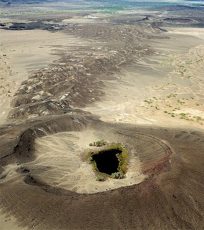
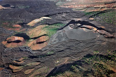
Some of the numerous volcanic craters dotting the northern end of the Suguta Valley.
Rights-Managed
-
A Samburu homeguard looks out over the steep-sided gorge of Mount Kulal,which divides the mountain into two. Volcanic in origin,Mount Kulal rises to over 6,000 feet in Northern Kenya and is surrounded by a sea of lava and arid wastes. The mountain is forested on top and is a vital water resource. It's open grasslands give pastoralists good grazing for their livestock.
Rights-Managed
-
Mount Longonot is unmistakably volcanic in origin because of its shape and rises to a height of 9,110 feet from the floor of the Great Rift Valley,just south of Lake Naivasha. Steam still issues from its large,circular inner crater wall
Rights-Managed
-

The natural rock pools along the Sirima lugga (seasonal watercourse) are important to the Turkana and their livestock in an otherwise waterless,rocky region at the southern end of Lake Turkana. In a year of average rainfall,water in the deepest pools will last throughout the year. If they dry up,the Turkana resort to using the alkaline water of Lake Turkana.
Rights-Managed
-
A view of the treeless,barren country along the southeast shores of Lake Turkana. Lava debris is omnipresent here,making walking a perfect misery. In dry weather,after the seasonal water pans and rock pools have dried up,the Turkana water their livestock at the lake.
Rights-Managed
-
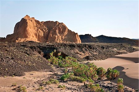
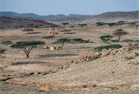
Semi-arid,thorn scrub country,littered with lava debris,near Parkati. Being extremely hot and dry,the area is only used by the nomadic Turkana for grazing goats and camels. No crops will grow there.
Rights-Managed
-
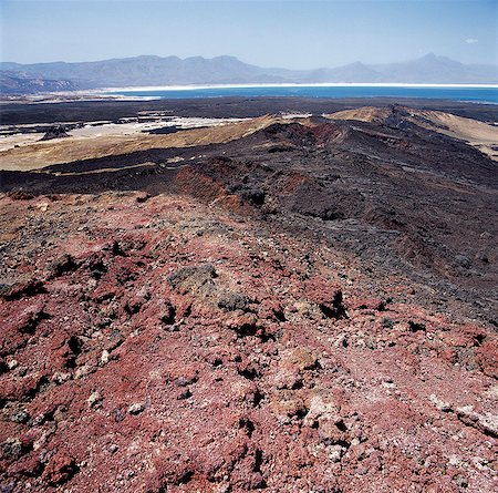
Red volcanic debris from the explosion crater of Garrayto lies on the surface of the hills that divide Lake Assal (in the distance) from the sea.
Rights-Managed
-

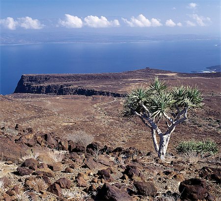
Forming a dramatic eastern boundary to Africa's Great Rift Valley,the Livingstone Mountains,a southern extension of the Kipengere Range,are situated in a remote part of Southern Tanzania. They drop almost perpendicularly more than 4,000 feet into the northeast corner of Lake Malawi. Trees grow sparsely on the rugged slopes but wild flowers are abundant.
Rights-Managed
-
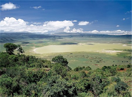
The world famous Ngorongoro Crater. Its 102-square-mile crater floor is the haunt of a wonderful wildlife spectacle. The crater is in fact a 'caldera' the largest unbroken,unflooded caldera in the world which was formed two and a half million years ago when a huge explosion destroyed a volcano standing about 15,000 feet high. Ngorongoro Crater was declared a World Heritage Site in 1978.
Rights-Managed
-

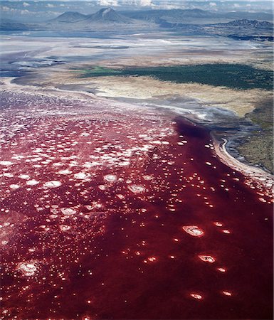
Lake Natron bathed in late afternoon sun with Shompole volcano (situated on the border of Kenya and Tanzania) in the distance at the northern end of the lake. Lake Natron is one of the most alkaline of the Rift system yet lesser flamingos breed there each year.
Rights-Managed
-

Evening light on the south shore of Lake Turkana with the volcanic cone of Nabuyatom on the lake edge
Rights-Managed
-
El Molo Bay,situated on the eastern side of Lake Turkana,is an inhospitable place where strong winds blow incessantly. The bay is named after the El Molo - a small tribe of fishermen and stock owners whose village can be seen in the middle distance across the bay. The mountain in the background is Mount Nyiru.
Rights-Managed
-

Andrews volcano is one of the numerous volcanic craters dotting the volcanic ridge, known as The Barrier, that separated the Suguta Valley from Lake Turkana several million years ago. The last eruption from a side vent took place just over 100 years ago.
Rights-Managed
-
Andrews volcano is one of the numerous volcanic craters dotting the volcanic ridge, known as The Barrier, that separated the Suguta Valley from Lake Turkana several million years ago. The last eruption took place just over 100 years ago.
Rights-Managed
-
The lava barrier that separates the southern end of Lake Turkana from the Suguta Valley. South Island is in the distance while the extinct volcanic crater, Abil Agituk, is close to the lakeshore. The region is pockmarked with volcanic cones.
Rights-Managed
-
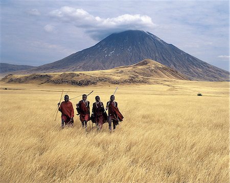
Maasai warriors stride across the golden grass plains at the foot of Ol doinyo Lengai, the Maasais Mountain of God. Ol doinyo Lengai is the only active volcano in the Gregory Rift, an important section of the eastern branch of Africas Great Rift Valley system that stretches from northern Kenya into Northern Tanzania.
Rights-Managed
-
The Gregory Rift appears at its most majestic a short distance northwest of Nairobi where the valley trough narrows to just fifteen miles across.From its eastern wall above the rock strewn Kedong Valley, the ancient volcanos of Suswa, left, and Longonot, far right, can be seen as reminders of a turbulent volcanic past that shaped the Rift Valley landscape over 25 million years.
Rights-Managed
-
A crumbling extinct volcano, known as Aruba Rock, is surrounded by outflows of black lava rock on the edge of the Suguta Valley.
Rights-Managed
-
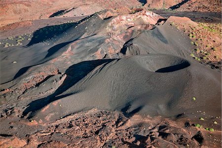
Some of the numerous volcanic craters dotting the volcanic ridge, known as The Barrier
Rights-Managed
-
Evening light on the south shore of Lake Turkana with the volcanic cone of Nabuyatom on the lake edge
Rights-Managed
-
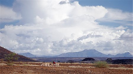
A Turkana man drives his donkeys through lava fields as clouds gather above Mount Nyiru.
Rights-Managed
-
South Island is Lake Turkana's largest island. Situated in the southern sector of the lake where the water reaches a depth of 374 feet,the island is a spine of volcanic cones and hills covering 15 square miles. The sparse vegetation struggles to grow in cinders and lava flows that are remarkably well preserved. In 1955,this island was the last part of the lake to be explored.
Rights-Managed
-

Ethiopia, Erta Ale, Afar Region. The lake of molten lava and the smoking fumarole of the two active pit craters of Erta Ale, a large shield volcano, (foreground) with Borale Ale Volcano in the far distance.
Rights-Managed
-
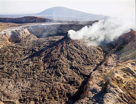
Ethiopia, Erta Ale, Afar Region. The smoking fumarole of one of the two active volcanic pit craters of Erta Ale (foreground) with Borale Ale Volcano in the distance.
Rights-Managed
-

Ethiopia, Erta Ale, Afar Region. The active volcanic pit craters of Erta Ale (foreground) looking north to Borale Ale and Dalafilla. This vast region has more volcanic activity than elsewhere in Africa.
Rights-Managed
-
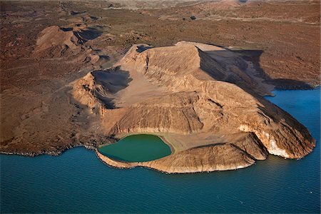
An extinct volcanic crater, Abil Agituk, at the southern end of Lake Turkana has a distinctively green crater lake which is fed by underground seepage from the main lake.
Rights-Managed
-
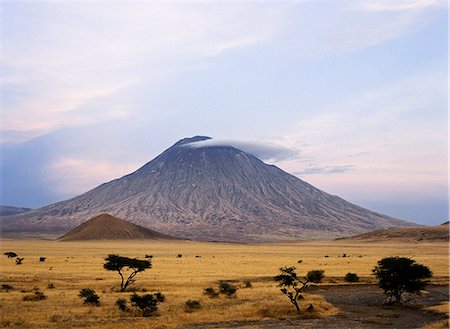
Ol doinyo Lengai, the Maasais Mountain of God, in early morning sunlight. It is the only active volcano in the Gregory Rift.An important section of the eastern branch of Africas Great Rift Valley.This 9,400 foot high volcano with deeply eroded sides stands 7,000 feet above the surrounding plains.
Rights-Managed
-

Ol doinyo Lengai, The Maasais Mountain of God, is the only active volcano in the Gregory Rift.An important section of the eastern branch of Africas Great Rift Valley.It still discharges rare carbonatite lavas, which turn white on exposure to air.
Rights-Managed
-
Ol doinyo Lengai, The Maasais Mountain of God, is the only active volcano in the Gregory Rift.An important section of the eastern branch of Africas Great Rift Valley.It still discharges rare carbonatite lavas, which turn white on exposure to air.
Rights-Managed
-
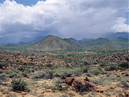
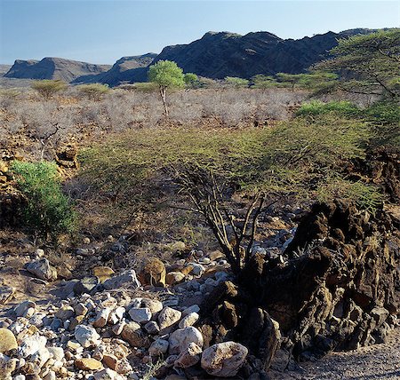
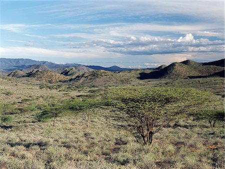
Semi arid thorn scrub best describes the vegetation of northern Samburuland where semi nomadic pastoralists eke out a living from an unforgiving land. The region is characterised by grand vistas, poor soil and an unreliable rainfall.
Rights-Managed
-

Semi arid thorn scrub best describes the vegetation of northern Samburuland where semi nomadic pastoralists eke out a living from an unforgiving land. The region is characterised by grand vistas, poor soil and an unreliable rainfall.
Rights-Managed
-
Semi arid thorn scrub best describes the vegetation of northern Samburuland where semi nomadic pastoralists make out a living from an unforgiving land. The region is characterised by grand vistas, poor soil and an unreliable rainfall.
Rights-Managed
-
Mount Longonot, 9,110 feet high, lies on the floor of the Great Rift Valley, thirty five miles northwest of Nairobi.Aptly called by the Maasai Ol doinyo Longonot, the mountain of many valleys and gullies, it is of volcanic origin.
Rights-Managed
-
A young Turkana man looks out over Lake Turkana, often referred to as the Jade Sea due to the colour of its alkaline water. The barren, windswept country at this southeast corner of the lake is strewn with basalt lava boulders.
Rights-Managed
-

A fine view from the western scarp of the Abyssinian Rift, just south of Debre Sina where the accumulated layers of basaltic lavas and tuffs lie 3,000 feet thick. The western scarp in this region rises to over 11,000 feet above sea level
Rights-Managed
-
A crumbling extinct volcano, known as Aruba Rock, is surrounded by outflows of black lava rock on the edge of the Suguta Valley.
Rights-Managed
-
Volcanic craters and lava dotting the volcanic ridge, known as The Barrier, that divided Lake Turkana and the Suguta Valley.
Rights-Managed
-
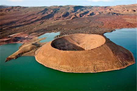
Nabuyatom crater juts into the jade waters at the southern end of Lake Turkana.
Rights-Managed
-
-

-

Panoramic view on La Graciosa island, Lanzarote, Spain
Budget Royalty-Free & Subscription
-

Kenya,Loiengalani,Sirima. A lava field near the southeast shore of Lake Turkana.
Rights-Managed
-

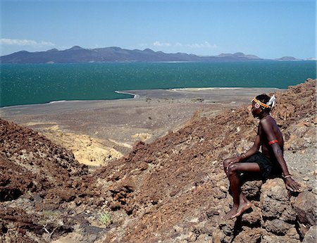
Kenya,Loiengalani,Lake turkana. A Turkana tribesman looks out over Lake Turkana from its barren southeastern shoreline.
Rights-Managed
-

From the air,a pink band of Lesser flamingos hugs the barren shoreline of this intensely alkaline Rift Valley lake. The colour of the water is the result of green algae with high chlorophyll concentrations developing in it.
Rights-Managed
-
The mud or soil flats of the Sugata Valley looking north towards 'The Barrier'.'The Barrier' a volcanic ridge with two dormant volcanoes,which erupted towards the end of the 19th century - divides the exceedingly hot,barren Suguta Valley from Lake Turkana to its north.
Rights-Managed
-

The alkaline waters of the seasonal Lake Logipi,situated at the northern end of the Suguta Valley,are a favourite haunt of lesser flamingos because the blue-green algae upon which they feed grows prolifically in the lake's shallow waters.
Rights-Managed
-
Semi-arid thorn scrub best describes the vegetation of northern Samburuland where semi-nomadic pastoralists eke out a living from an unforgiving land. The region is characterised by grand vistas,poor soil and an unreliable rainfall. The Ndoto Mountains can be seen in the far distance.
Rights-Managed
-
Flat-topped acacia trees and dome-shaped Turkana homesteads dot the landscape at Nachola - a semi-arid region with sparse vegetation. Large deposits of petrified wood nearby are evidence of a very different climate and vegetation millions of years ago.
Rights-Managed


