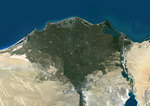
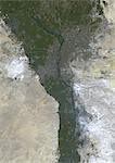
Nile Delta, Egypt, True Colour Satellite Image. True colour satellite image of the Nile Delta. It is formed in Northern Egypt where the Nile River spreads out and drains into the Mediterranean Sea. This swamp region has always been rich in fauna and flora, contrasting with the surrounding desert. Image taken on 23 August 2000 using LANDSAT data.

Offerta di lancio
Ottieni il 50% di sconto quando si uniscono alla nostra mailing list
-
Risoluzione Web
550×388px
19.4×13.7cm 28ppcm
-
Bassa risoluzione
1007×712px
35.6×25.2cm 28ppcm
-
Media risoluzione
2229×1576px
18.9×13.3cm 118ppcm
-
Alta risoluzione
4961×3508px
42.0×29.7cm 118ppcm
* Prezzo finale in base all'utilizzo, non alle dimensioni del file.
Parole chiave collegate
Immagini correlate
- Color satellite image of the Nile River, Egypt. The Nile Delta is formed in Northern Egypt where the Nile River spreads out and drains into the Mediterranean Sea. Images collected on October 1, 2017 by Landsat 8 satellite.
- Color satellite image of the Nile Delta. It is formed in Northern Egypt where the Nile River spreads out and drains into the Mediterranean Sea. Image collected on October 1, 2017 by Sentinel-2 satellites.
- Satellite View of Egypt
- Egypt, True Colour Satellite Image With Border. Egypt, true colour satellite image with border. North is at top. In the center of the image is the Nile Delta, its lush vegetation following the path of the river. To the east of the Nile is the Gulf of Suez, which runs down the western side of the Sinai Peninsula. This image was compiled from data acquired by LANDSAT 5 & 7 satellites.
- Satellite View of Red Sea, Middle East
- Assouan Dam And Lake Nasser, Egypt, True Colour Satellite Image. True colour satellite image of Assouan dam on the Nile river and the Lake Nasser in Egypt. Image taken on 15 November 1986 using LANDSAT data.
- Egypt, True Colour Satellite Image With Mask. Egypt, true colour satellite image with mask. North is at top. In the center of the image is the Nile Delta, its lush vegetation following the path of the river. To the east of the Nile is the Gulf of Suez, which runs down the western side of the Sinai Peninsula. This image was compiled from data acquired by LANDSAT 5 & 7 satellites.
- Cairo City, Egypt, In 2000, True Colour Satellite Image. True colour satellite image of Cairo City, the capital city of Egypt. Image taken on 11 November 2000 using LANDSAT data.
Più immagini correlate
- Cairo City, Egypt, In 1972, True Colour Satellite Image. True colour satellite image of Cairo City, the capital city of Egypt. Image taken on 31 August 1972 using LANDSAT data.
- Sahara Desert, Africa, True Colour Satellite Image. Sahara desert, true colour satellite image. The Sahara is the world's largest hot desert, made of sand and volcanic mountains. Composite image using data from LANDSAT 5 & 7 satellites.
- Cairo City, Egypt, True Colour Satellite Image. Cairo City, Egypt. True colour satellite image of Cairo City, the capital city of Egypt. Image taken on 11 September 2000 using LANDSAT 7 data.
- Satellite View of Deserts of Saudi Arabia and Surrounding Area
- Relief map of Egypt (with border and mask). This image was compiled from data acquired by landsat 5 & 7 satellites combined with elevation data.
- Egypt, True Colour Satellite Image With Border
- Egypt, True Colour Satellite Image With Border and Mask
- Egypt, Relief Map With Border

