-

-

-

-

-

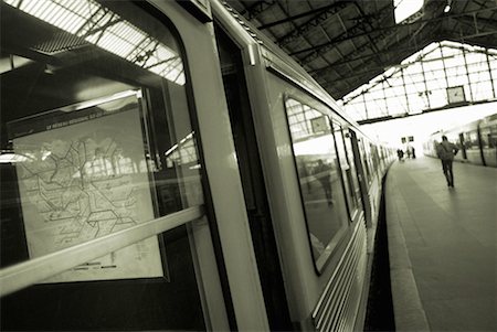
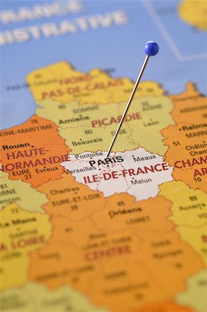
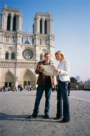
Man looking a map in a ticket machine, Paris, Ile-de-France, France
Premium Royalty-Free
-

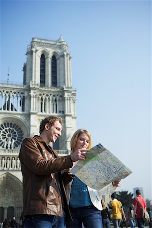
Man looking a map in a ticket machine, Paris, Ile-de-France, France
Premium Royalty-Free
-

Avignon, France, True Colour Satellite Image. Avignon, France. True colour satellite image of the city of Avignon. Composite of 2 images, taken on 21 July 2001 and 22 June 2002, by LANDSAT 7.
Rights-Managed
-

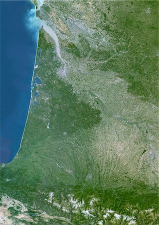
Basque Country, France-Spain, True Colour Satellite Image. Basque Country, France - Spain. True colour satellite image of the Basque Country, a region in the western Pyrenees mountains that goes across the border between France and Spain. This image was compiled from data acquired by LANDSAT 5 & 7 satellites.
Rights-Managed
-

Cherbourg, France, True Colour Satellite Image. Cherbourg, France. True colour satellite image of the city of Cherbourg, taken on 12 May 2002, using LANDSAT 7 data.
Rights-Managed
-
Massif Central Region, France, True Colour Satellite Image. Massif Central region, France, true colour satellite image. This image was compiled from data acquired by LANDSAT 5 & 7 satellites.
Rights-Managed
-

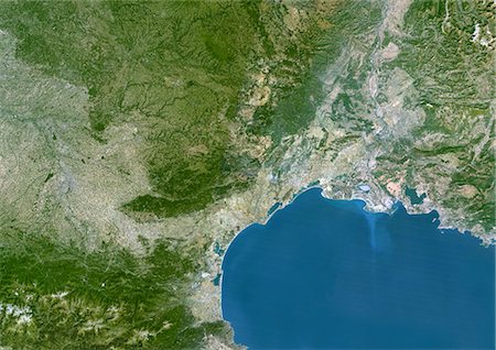
Marseille, France, True Colour Satellite Image. Marseille, France. True colour satellite image of the city of Marseille, taken on 21 July 2001, using LANDSAT 7 data.
Rights-Managed
-

Re And Oleron Islands, France, True Colour Satellite Image. Ré & Oleron Islands, France. True colour satellite image of Ré & Oléron islands, that are off the west coast of France near La Rochelle. This image was compiled from data acquired by LANDSAT 5 & 7 satellites.
Rights-Managed
-
Reims, France, True Colour Satellite Image. Reims, France. True colour satellite image of the city of Reims, taken on 2 July 2001, using LANDSAT 7 data.
Rights-Managed
-

Picardie Region, France, True Colour Satellite Image With Mask. Picardie region, France, true colour satellite image with mask. This image was compiled from data acquired by LANDSAT 5 & 7 satellites.
Rights-Managed
-

Lake Leman, Europe, True Colour Satellite Image. True colour satellite image of Lake Léman, the largest natural freshwater lake in western Europe. It is divided between two countries : France and Switzerland. Image taken on 21 July 2001, using LANDSAT 7 data.
Rights-Managed
-

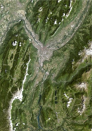
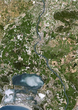
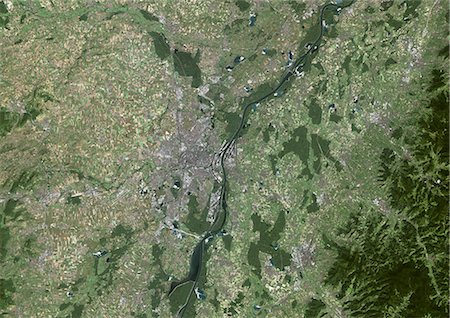
Lyon, France, True Colour Satellite Image. Lyon, France. True colour satellite image of the city of Lyon, taken on 21 July 2001, using LANDSAT 7 data.
Rights-Managed
-

Haute-Normandie Region, France, True Colour Satellite Image With Mask. Haute Normandie region, France, true colour satellite image with mask. This image was compiled from data acquired by LANDSAT 5 & 7 satellites.
Rights-Managed
-

Man looking a map in a ticket machine, Paris, Ile-de-France, France
Premium Royalty-Free
-

Man looking a map in a ticket machine, Paris, Ile-de-France, France
Premium Royalty-Free
-

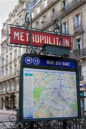
Bicycles parked near a ticket machine, Paris, Ile-de-France, France
Premium Royalty-Free
-

Rhône-Alpes Region, France, True Colour Satellite Image With Mask. Rhône Alpes region, France, true colour satellite image with mask. This image was compiled from data acquired by LANDSAT 5 & 7 satellites.
Rights-Managed
-
-
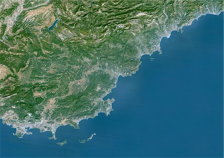
French Riviera, France, True Colour Satellite Image. French Riviera, France. True colour satellite image of the French Riviera, located on France's southeastern coast of the Mediterranean Sea, reaching from Toulon to Menton at the border with Italy. This image was compiled from data acquired by LANDSAT 5 & 7 satellites.
Rights-Managed
-

Nantes, France, True Colour Satellite Image. Nantes, France. True colour satellite image of the city of Nantes, taken on 21 May 2001, using LANDSAT 7 data.
Rights-Managed
-

Nice, France, True Colour Satellite Image. Nice, France. True colour satellite image of the city of Nice, taken on 2 November 2001, using LANDSAT 7 data.
Rights-Managed
-

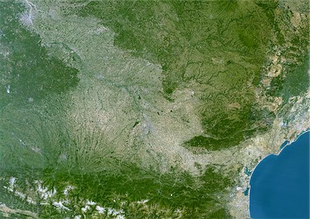
Rhône-Alpes Region, France, True Colour Satellite Image. Rhône-Alpes region, France, true colour satellite image. This image was compiled from data acquired by LANDSAT 5 & 7 satellites.
Rights-Managed
-
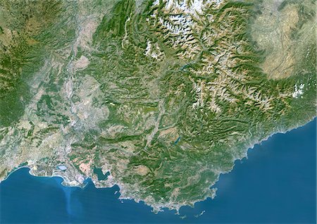
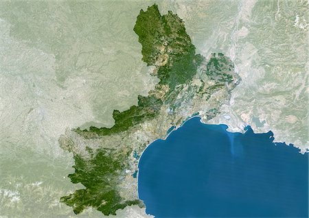
Provence-Alpes-Côte D'Azur Region, France, True Colour Satellite Image. Provence - Alpes - Côte d'Azur region, France, true colour satellite image. This image was compiled from data acquired by LANDSAT 5 & 7 satellites.
Rights-Managed
-
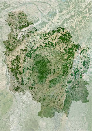
Lorraine Region, France, True Colour Satellite Image. Lorraine region, France, true colour satellite image. This image was compiled from data acquired by LANDSAT 5 & 7 satellites.
Rights-Managed
-
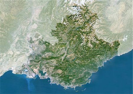
Provence-Alpes-Côte D'Azur Region, France, True Colour Satellite Image With Mask. Provence - Alpes - Côte d'Azur region, France, true colour satellite image with mask. This image was compiled from data acquired by LANDSAT 5 & 7 satellites.
Rights-Managed
-
-
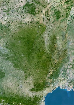
Midi-Pyrenees Region, France, True Colour Satellite Image. Midi Pyrénées region, France, true colour satellite image. This image was compiled from data acquired by LANDSAT 5 & 7 satellites.
Rights-Managed
-

Basse-Normandie Region, France, True Colour Satellite Image. Basse Normandie region, France, true colour satellite image. This image was compiled from data acquired by LANDSAT 5 & 7 satellites.
Rights-Managed
-

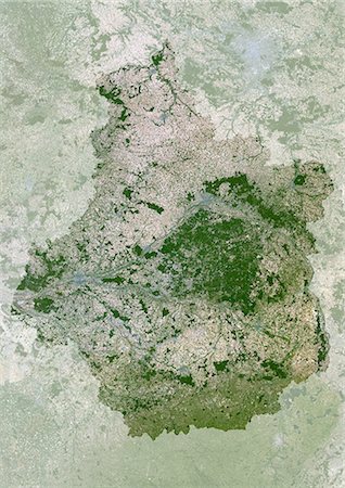
Ile-De-France Region, France, True Colour Satellite Image. Ile de France region, France, true colour satellite image. This image was compiled from data acquired by LANDSAT 5 & 7 satellites.
Rights-Managed
-

-
Highly detailed Earth, illuminated by moonlight. The glow of cities sheds light on the detailed exaggerated terrain. A piece of Europe - Italy and Greece. Elements of this image furnished by NASA
Budget Royalty-Free & Subscription
-

-
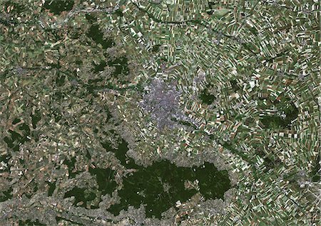
Grenoble, France, True Colour Satellite Image. Grenoble, France. True colour satellite image of the city of Grenoble, taken on 22 June 2002, using LANDSAT 7 data.
Rights-Managed
-
Arles, France, True Colour Satellite Image. Arles, France. True colour satellite image of the city of Arles, taken on 21 July 2001 by LANDSAT 7.
Rights-Managed
-

Man looking a map in a ticket machine, Paris, Ile-de-France, France
Premium Royalty-Free
-

Ile-De-France Region, France, True Colour Satellite Image With Mask. Ile de France region, France, true colour satellite image with mask. This image was compiled from data acquired by LANDSAT 5 & 7 satellites.
Rights-Managed
-

-

Alsace Region, France, True Colour Satellite Image With Mask. Alsace region, France, true colour satellite image with mask. This image was compiled from data acquired by LANDSAT 5 & 7 satellites.
Rights-Managed
-
Centre Region, France, True Colour Satellite Image With Mask. Centre region, France, true colour satellite image with mask. This image was compiled from data acquired by LANDSAT 5 & 7 satellites.
Rights-Managed
-
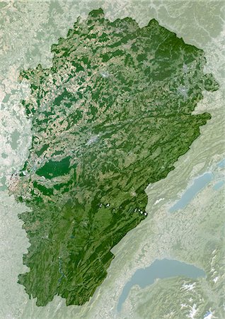
Franche-Comte Region, France, True Colour Satellite Image With Mask. Franche Comté region, France, true colour satellite image with mask. This image was compiled from data acquired by LANDSAT 5 & 7 satellites.
Rights-Managed
-
Languedoc-Roussillon Region, France, True Colour Satellite Image With Mask. Languedoc Roussillon region, France, true colour satellite image with mask. This image was compiled from data acquired by LANDSAT 5 & 7 satellites.
Rights-Managed
-
Strasbourg, France, True Colour Satellite Image. Strasbourg, France. True colour satellite image of the city of Strasbourg, taken on 11 September 1999 using LANDSAT 7 data.
Rights-Managed
-
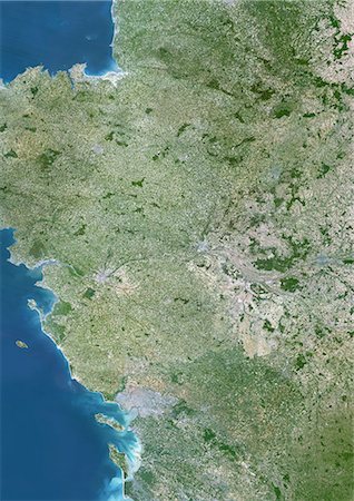
Aquitaine Region, France, True Colour Satellite Image. Aquitaine region, France, true colour satellite image. This image was compiled from data acquired by LANDSAT 5 & 7 satellites.
Rights-Managed
-
-
Bourgogne Region, France, True Colour Satellite Image With Mask. Bourgogne region, France, true colour satellite image with mask. This image was compiled from data acquired by LANDSAT 5 & 7 satellites.
Rights-Managed
-
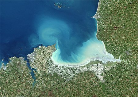
Mount Saint Michael Bay, France, True Colour Satellite Image. Mount Saint Michael (Mont Saint Michel) Bay, France. True colour satellite image of Mount Saint Michael, a small rocky tidal island in Normandy, France. This image was compiled from data acquired by LANDSAT 5 & 7 satellites.
Rights-Managed
-
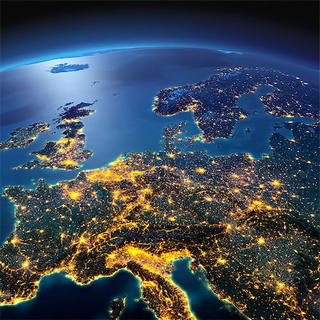
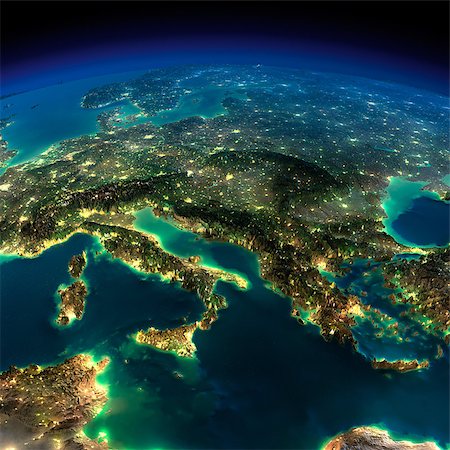
Night planet Earth with precise detailed relief and city lights illuminated by moonlight. Central Europe. Elements of this image furnished by NASA
Budget Royalty-Free & Subscription
-

Basse-Normandie Region, France, True Colour Satellite Image With Mask. Basse Normandie region, France, true colour satellite image with mask. This image was compiled from data acquired by LANDSAT 5 & 7 satellites.
Rights-Managed
-

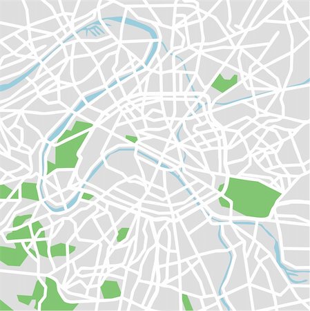
Paris Map in Retro Style. Hand Drawn. Vector Illustration.
Budget Royalty-Free & Subscription
-
Languedoc-Roussillon Region, France, True Colour Satellite Image. Languedoc Roussillon region, France, true colour satellite image. This image was compiled from data acquired by LANDSAT 5 & 7 satellites.
Rights-Managed
-
Pays De La Loire Region, France, True Colour Satellite Image. Pays de la Loire region, France, true colour satellite image. This image was compiled from data acquired by LANDSAT 5 & 7 satellites.
Rights-Managed
-

-
Symbols city to France. Vector illustration for you design
Budget Royalty-Free & Subscription
-

-
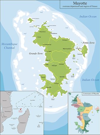
Mayotte is an overseas department and region of France officially named Department of Mayotte
Budget Royalty-Free & Subscription
-
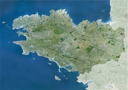
Brittany Region, France, True Colour Satellite Image With Mask. Brittany region, France, true colour satellite image with mask. This image was compiled from data acquired by LANDSAT 5 & 7 satellites.
Rights-Managed
-

-
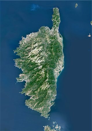
Corsica, France, True Colour Satellite Image. Corsica, France. True colour satellite image of the island of Corsica, the fourth largest island in the Mediterranean Sea. This image was compiled from data acquired by LANDSAT 5 & 7 satellites.
Rights-Managed
-
-

-
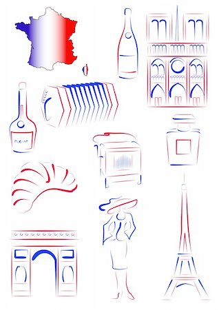
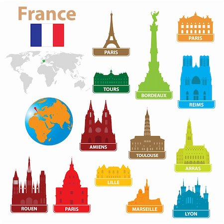
Set of vector drawn stylized sights and symbols of France
Budget Royalty-Free & Subscription
-

-

-
-

Young couple sitting on chairs, looking at map, in park, back view
Premium Royalty-Free
-

France, icons collection. Sketch for your design. Vector illustration
Budget Royalty-Free & Subscription
-
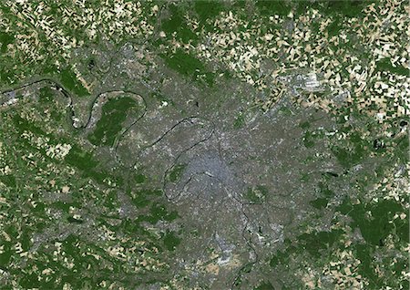
Paris, France, True Colour Satellite Image. Paris, France. True colour satellite image of Paris, capital city of France. Image taken on 23 May 2001, using LANDSAT 7 data.
Rights-Managed
-

France sketch, seamless pattern for your design. Vector illustration
Budget Royalty-Free & Subscription
-
-

-
-

-

-
-

-

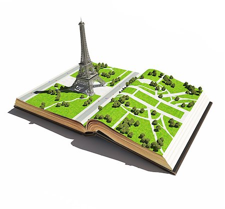
Simplified isometric map of the Field of Mars in Paris
Budget Royalty-Free & Subscription
-

-

Isometric low poly Map of La Defense business district in Paris, France
Budget Royalty-Free & Subscription
-

Simplified isometric map of the Field of Mars in Paris
Budget Royalty-Free & Subscription
-

-
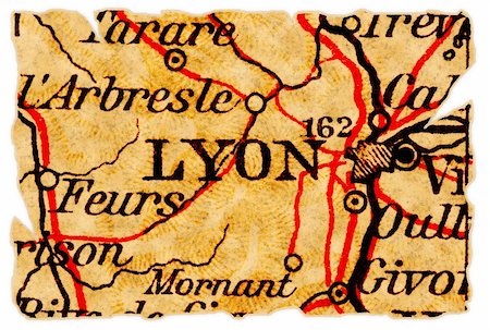
Lyon, France on an old torn map from 1949, isolated. Part of the old map series.
Budget Royalty-Free & Subscription
-
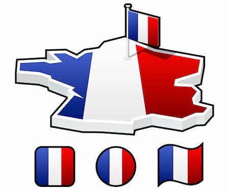
a set of icons - the map and flag of France. Flag stands on the site of the capital of France - Paris
Budget Royalty-Free & Subscription
-

Night planet Earth with precise detailed relief and city lights illuminated by moonlight. Italy, Greece and the Mediterranean Sea. Elements of this image furnished by NASA
Budget Royalty-Free & Subscription
-
-
-