-
Color satellite image of Shanghai, China. The city is located on the south edge of the estuary of the Yangtze River. Image collected on April 29, 2017 by Sentinel-2 satellites.
Rights-Managed
-

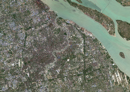
Color satellite image of Shanghai, China. The city is located in the Yangtze River Delta. Image collected on April 29, 2017 by Sentinel-2 satellites.
Rights-Managed
-

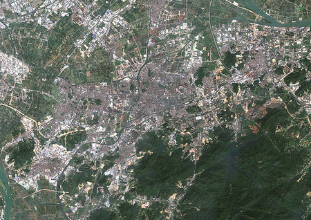
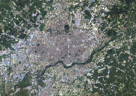
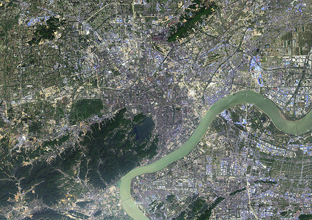
Color satellite image of Wuhan, China. The Yangtze river runs through the city. Image collected on April 15, 2017 by Sentinel-2 satellites.
Rights-Managed
-
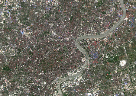
Color satellite image of Shanghai, China. Image collected on April 29, 2017 by Sentinel-2 satellites.
Rights-Managed
-
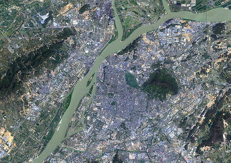
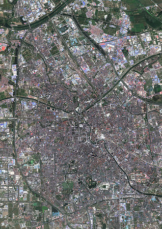
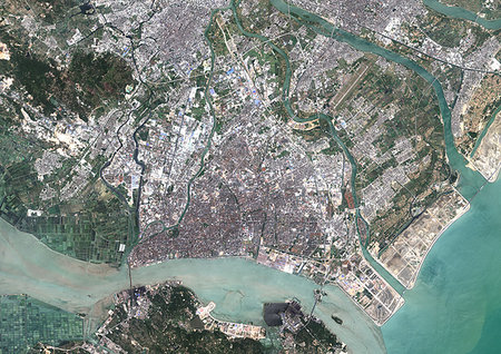
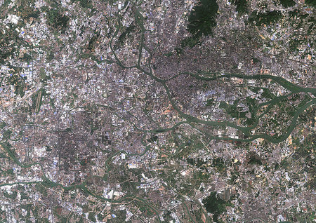
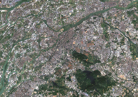
Color satellite image of Nanjing, China. The city is situated in the Yangtze River Delta region. Image collected on October 14, 2013 by Landsat 8 satellites.
Rights-Managed
-

Satellite view of Shanghai, China in 2001 and 2013. This before and after image shows urban expansion over the years.
Rights-Managed
-

Satellite view of Shanghai, China in 1979, 2001 and 2013. This before and after image shows urban expansion over the years.
Rights-Managed
-
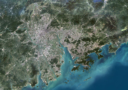
Color satellite image of Guangzhou to Hong Kong, China. This region is called the Pearl River Delta. Image collected on November 01, 2017 by Sentinel-2 satellites.
Rights-Managed
-
Color satellite image of Zhongshan, China. Image collected on November 01, 2017 by Sentinel-2 satellites.
Rights-Managed
-
Color satellite image of Tianjin, China. Image collected on September 22, 2017 by Sentinel-2 satellites.
Rights-Managed
-
Color satellite image of Tianjin and Binhai, China. Binhai is located on the west coast of the Bohai Sea and east of Tianjin. Image collected on September 22, 2017 by Sentinel-2 satellites.
Rights-Managed
-

Color satellite image of Tianjin, China. Image collected on September 22, 2017 by Sentinel-2 satellites.
Rights-Managed
-
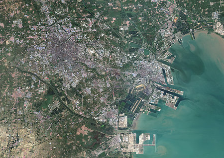
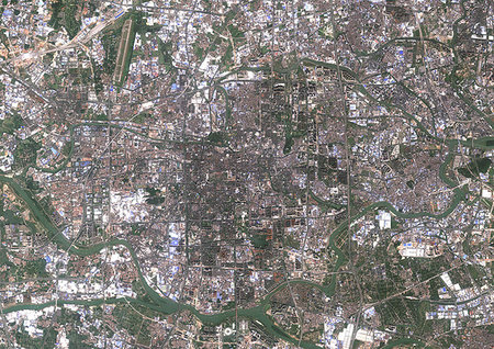
Color satellite image of Suzhou, China. Image collected on March 16, 2014 by Landsat 8 satellites.
Rights-Managed
-

Color satellite image of Shenzhen, China. It forms part of the Pearl River Delta megalopolis. Image collected on November 01, 2017 by Sentinel-2 satellites.
Rights-Managed
-

Color satellite image of Shenzhen, China. It forms part of the Pearl River Delta megalopolis. Image collected on November 01, 2017 by Sentinel-2 satellites.
Rights-Managed
-
Color satellite image of Shenyang, China. Image collected on August 28, 2016 by Landsat 8 satellites.
Rights-Managed
-
Color satellite image of Shantou, China. Image collected on April 02, 2017 by Sentinel-2 satellites.
Rights-Managed
-

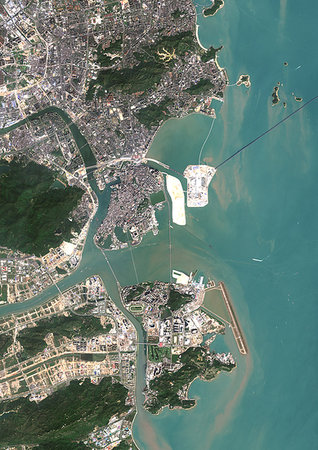
Color satellite image of Macau, China. The city is located on the western side of the Pearl River estuary. Image collected on November 01, 2017 by Sentinel-2 satellites.
Rights-Managed
-
Color satellite image of Macau, China. The city is located on the western side of the Pearl River estuary. Image collected on November 01, 2017 by Sentinel-2 satellites.
Rights-Managed
-
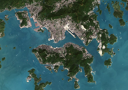
Color satellite image of Hong Kong, China. The city is located on the eastern side of the Pearl River estuary. Image collected on November 01, 2017 by Sentinel-2 satellites.
Rights-Managed
-
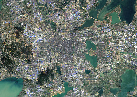
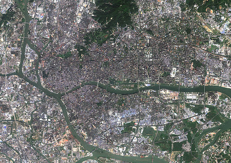
Color satellite image of Hangzhou, China. Image collected on October 13, 2015 by Landsat 8 satellites.
Rights-Managed
-
Color satellite image of Guangzhou and Foshan, China. Both cities are part of the Pearl River Delta Metropolitan Region. Image collected on November 01, 2017 by Sentinel-2 satellites.
Rights-Managed
-
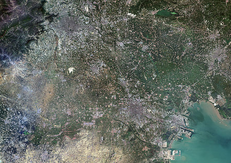
Color satellite image of Guangzhou, China. Image collected on November 01, 2017 by Sentinel-2 satellites.
Rights-Managed
-
Color satellite image of Foshan, China. Image collected on November 01, 2017 by Sentinel-2 satellites.
Rights-Managed
-
Color satellite image of Dongguan, China. Image collected on November 01, 2017 by Sentinel-2 satellites.
Rights-Managed
-

Color satellite image of Chongqing, China. Image collected on July 23, 2017 by Sentinel-2 satellites.
Rights-Managed
-
Color satellite image of Chengdu, China. Image collected on August 20, 2016 by Sentinel-2 satellites.
Rights-Managed
-
Color satellite image of Jingjinji Metropolitan Region, China. Also called Jing-Jin-Ji, this area encompasses Beijing, Tianjin and Hebei. Image collected on October 05, 2017 by Sentinel-2 satellites.
Rights-Managed
-
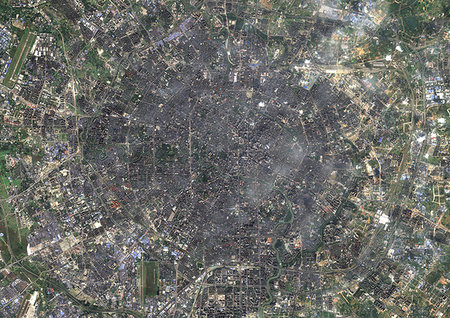
Color satellite image of Beijing, capital city of China. Image collected on October 05, 2017 by Sentinel-2 satellites.
Rights-Managed
-
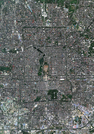
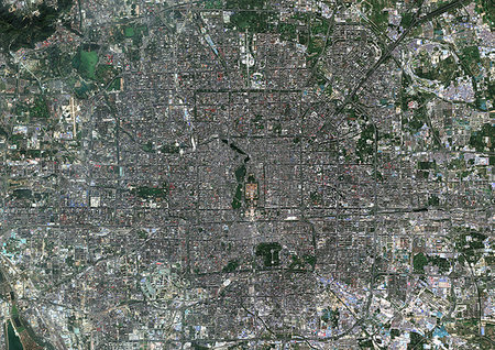
Color satellite image of Beijing, capital city of China. The Forbbiden City is at center. Image collected on October 05, 2017 by Sentinel-2 satellites.
Rights-Managed
-

Color satellite image of Beijing, capital city of China. Image collected on October 05, 2017 by Sentinel-2 satellites.
Rights-Managed
-

Colour satellite image of Tianjin and Binhai, China. Image taken on August 12, 2014 with Landsat 8 data.
Rights-Managed
-

Satellite view of Foshan and Guangzhou, China in 1990 and 2013. This before and after image shows urban expansion over the years.
Rights-Managed
-

Satellite view of Chengdu, China in 1992 and 2013. This before and after image shows urban expansion over the years.
Rights-Managed
-
Color satellite image of Ho Chi Minh City, Vietnam, with Tan Son Nhat International Airport. Image collected on March 04, 2016 by Sentinel-2 satellites.
Rights-Managed
-
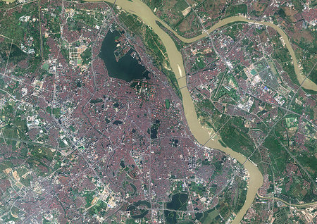
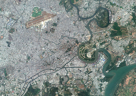
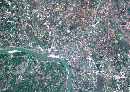
Color satellite image of Hanoi, capital city of Vietnam. It lies on the eastern bank of the Red River. Image collected on October 31, 2017 by Sentinel-2 satellites.
Rights-Managed
-
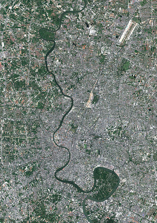
Color satellite image of Bangkok, capital city of Thailand. The Chao Phraya River flows through the city. Image collected on January 27, 2017 by Sentinel-2 satellites.
Rights-Managed
-
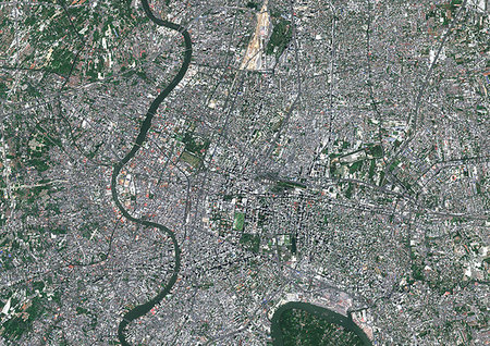
Color satellite image of Bangkok, capital city of Thailand. The Chao Phraya River flows through the city. Image collected on January 27, 2017 by Sentinel-2 satellites.
Rights-Managed
-
Color satellite image of Vientiane, capital city of Laos. It is located on the banks of the Mekong River. Image collected on February 12, 2016 by Sentinel-2 satellites.
Rights-Managed
-
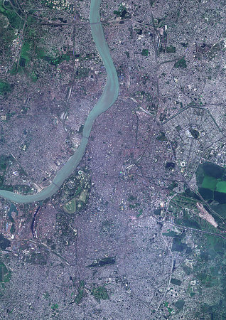
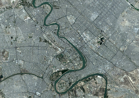
Color satellite image of Kolkata, India. The city is located on the east bank of the Hooghly River. Image collected on March 16, 2017 by Sentinel-2 satellites.
Rights-Managed
-

Color satellite image of Phnom Penh, capital city of Cambodia. Image collected on January 01, 2017 by Sentinel-2 satellites.
Rights-Managed
-

-
Colour satellite image of Tashkent, Uzbekistan. Image taken on August 28, 2014 with Landsat 8 data.
Rights-Managed
-

Satellite image of the Ganges River Delta, Bangladesh, India. Also known as the Brahmaputra Delta, it empties into the Bay of Bengal. Kolkata sits within the lower Ganges Delta along the Hooghly River (at west on the image). Image collected on March 16, 2017 by Sentinel-2 satellites.
Rights-Managed
-

Color satellite image of Montevideo, capital city of Uruguay. Image collected on December 12, 2016 by Sentinel-2 satellites.
Rights-Managed
-
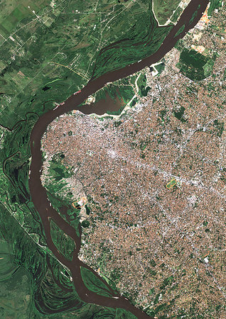
Color satellite image of Asuncion, capital city of Paraguay. Image collected on June 23, 2017 by Sentinel-2 satellites.
Rights-Managed
-

Color satellite image of Perth, Australia. Image collected on August 25, 2017 by Sentinel-2 satellites.
Rights-Managed
-

Color satellite image of Perth, Australia. Image collected on August 25, 2017 by Sentinel-2 satellites.
Rights-Managed
-
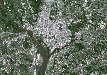
Color satellite image of Washington D.C., capital of the United States. The south bank of the Potomac River forms the District of Columbia's border with Virginia. Image collected on May 16, 2017 by Sentinel-2 satellites.
Rights-Managed
-

Color satellite image of Portland, Oregon, United States. The city lies at the confluence of the Willamette and Columbia Rivers. Image collected on August 31, 2017 by Sentinel-2 satellites.
Rights-Managed
-

Color satellite image of Portland, Oregon, United States. The city lies at the confluence of the Willamette and Columbia Rivers. Image collected on August 31, 2017 by Sentinel-2 satellites.
Rights-Managed
-
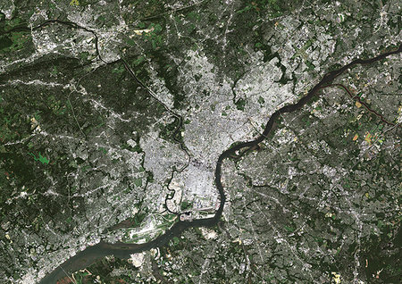
Color satellite image of Philadelphia, Pennsylvania, United States The city is located along the Delaware and Schuylkill Rivers. Image collected on September 23, 2017 by Sentinel-2 satellites.
Rights-Managed
-
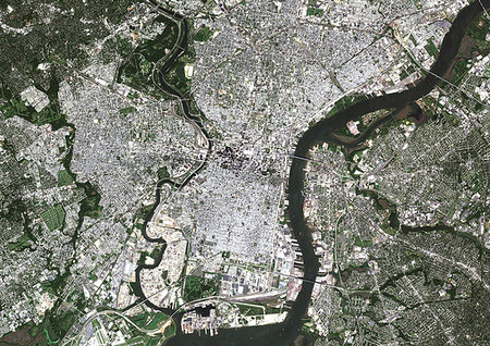
Color satellite image of Philadelphia, Pennsylvania, United States The city is located along the Delaware and Schuylkill Rivers. Image collected on September 23, 2017 by Sentinel-2 satellites.
Rights-Managed
-
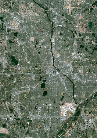
Color satellite image of Minneapolis, Minnesota, United States. The Mississippi River flows through the city. Minneapolis-Saint Paul International Airport is at south. Image collected on November 18, 2017 by Sentinel-2 satellites.
Rights-Managed
-

Color satellite image of Minneapolis, Minnesota, United States. The Mississippi River flows through the city. Image collected on November 18, 2017 by Sentinel-2 satellites.
Rights-Managed
-
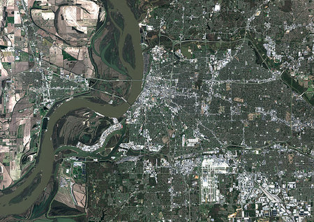
Color satellite image of Memphis, Tennessee, United States. Image collected on March 22, 2018 by Sentinel-2 satellites.
Rights-Managed
-
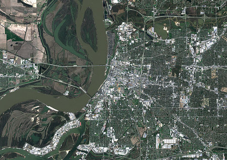
Color satellite image of Memphis, Tennessee, United States. Image collected on March 22, 2018 by Sentinel-2 satellites.
Rights-Managed
-

Color satellite image of Great Portland, Oregon, United States. Image collected on August 31, 2017 by Sentinel-2 satellites.
Rights-Managed
-
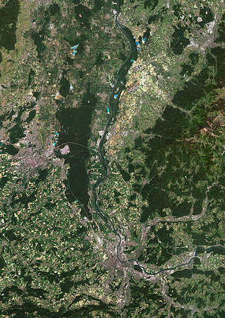
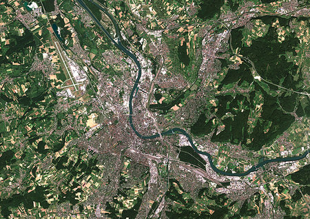
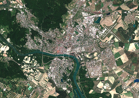
Color satellite image of Basel in Switzerland, Mulhouse in France and Freiburg in Germany. The Rhine flows through this area. Image collected on June 19, 2017 by Sentinel-2 satellites.
Rights-Managed
-
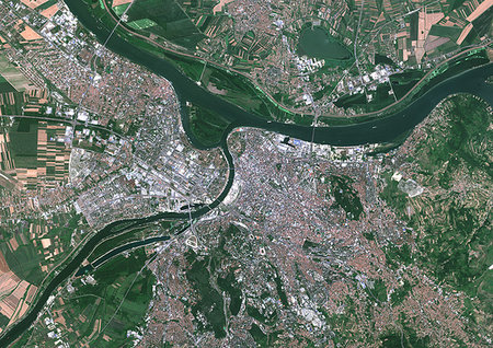
Color satellite image of Basel, Switzerland. The Rhine flows through the city. EuroAirport Basel Mulhouse Freiburg is at west. Image collected on June 19, 2017 by Sentinel-2 satellites.
Rights-Managed
-
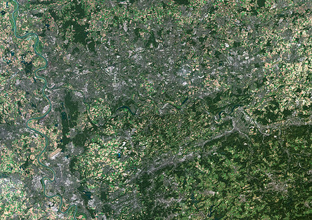
Color satellite image of Dusseldorf to Dortmund, Germany, showing the Ruhr region. The Rhine flows through the Rhineland at west. Image collected on September 25, 2016 by Sentinel-2 satellites.
Rights-Managed
-
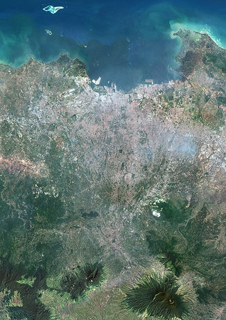
Color satellite image of Greater Jakarta, Indonesia. Mount Pangrango and Mount Salak, two volcanoes of West Java, are at south. Image collected on September 22, 2017 by Sentinel-2 satellites.
Rights-Managed
-
Color satellite image of the Bronx, New York City, New York State, United States. The Bronx is one borough of New York City. It lies north and east of Manhattan, across the Harlem River. Image collected on October 20, 2017 by Sentinel-2 satellites.
Rights-Managed
-
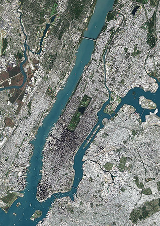
Color satellite image of Manhattan, New York City, New York State, United States. Manhattan is one borough of New York City. It is bound by Hudson River to the west, Harlem River to the north, and East River to the east. Central Park is in the center. Image collected on October 20, 2017 by Sentinel-2 satellites.
Rights-Managed
-

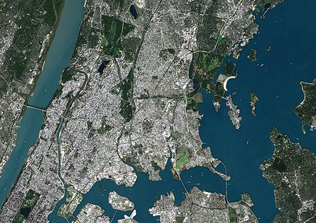
Color satellite image of New York City, New York State, United States. Image collected on October 20, 2017 by Sentinel-2 satellites.
Rights-Managed
-

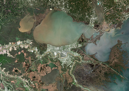
Color satellite image of New Orleans, Louisiana, United States. The city is located in the Mississippi River Delta, south of Lake Pontchartrain, on the banks of the Mississippi River. Image collected on February 10, 2017 by Sentinel-2 satellites.
Rights-Managed
-
Color satellite image of New Orleans, Louisiana, United States. The city is located in the Mississippi River Delta, south of Lake Pontchartrain, on the banks of the Mississippi River. Image collected on February 10, 2017 by Sentinel-2 satellites.
Rights-Managed
-

Color satellite image of Detroit, Michigan, United States. Image collected on May 15, 2017 by Sentinel-2 satellites.
Rights-Managed
-

Color satellite image of Detroit, Michigan, United States. Image collected on May 15, 2017 by Sentinel-2 satellites.
Rights-Managed
-
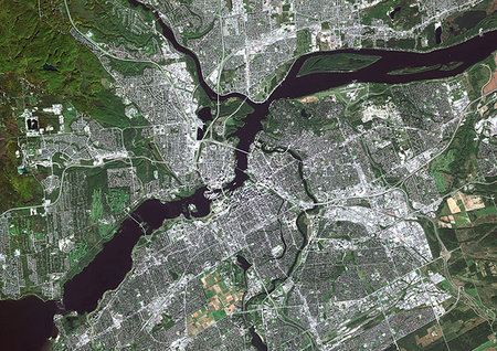
Color satellite image of Ottawa, capital city of Canada. It stands on the south bank of the Ottawa River. Image collected on October 03, 2017 by Sentinel-2 satellites.
Rights-Managed
-
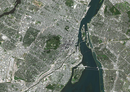
Color satellite image of Montreal, Quebec, Canada. The Saint Lawrence River flows through the city. Image collected on October 03, 2017 by Sentinel-2 satellites.
Rights-Managed
-
Color satellite image of Sana'a, capital city of Yemen. Image collected on April 16, 2017 by Sentinel-2 satellites.
Rights-Managed
-

Color satellite image of Abu Dhabi International Airport, United Arab Emirates. The amusement park Ferrari World Abu Dhabi is on Yas Island, at center left on the image. Image collected on September 21, 2017 by Sentinel-2 satellites.
Rights-Managed
-

Color satellite image of Abu Dhabi, capital city of United Arab Emirates. The city is on an island connected by bridges to the mainland and other islands. Image collected on September 21, 2017 by Sentinel-2 satellites.
Rights-Managed
-
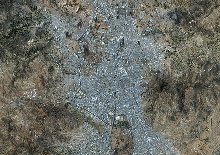
Color satellite image of Riyadh, capital city of Saudi Arabia. Image collected on October 23, 2017 by Sentinel-2 satellites.
Rights-Managed
-
Color satellite image of Riyadh, capital city of Saudi Arabia. Image collected on October 23, 2017 by Sentinel-2 satellites.
Rights-Managed
-

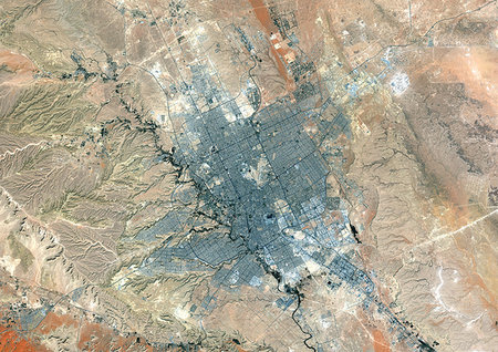
Color satellite image of Muscat, capital city of Oman. Image collected on October 18, 2017 by Sentinel-2 satellites.
Rights-Managed
-
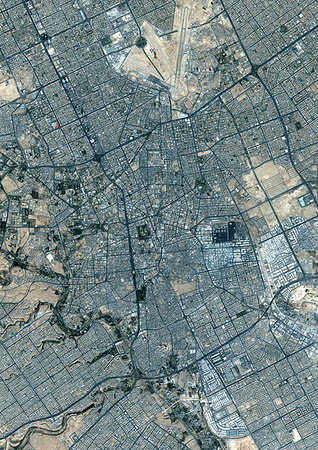
Color satellite image of Baghdad, capital city of Iraq, located along the Tigris River. Image collected on October 16, 2017 by Sentinel-2 satellites.
Rights-Managed
-

Color satellite image of Cairo, capital city of Egypt. Image collected on October 01, 2017 by Sentinel-2 satellites.
Rights-Managed
-

Color satellite image of Greater London, capital city of England and the United Kingdom. The River Thames flows through London. Image collected on April 09, 2017 by Sentinel-2 satellites.
Rights-Managed
-
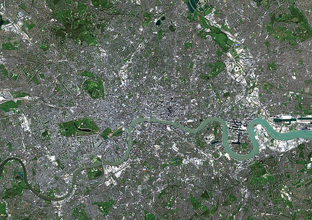
Color satellite image of London, capital city of England and the United Kingdom. The River Thames flows through London. Image collected on April 09, 2017 by Sentinel-2 satellites.
Rights-Managed
-

Color satellite image of Kiev, capital city of Ukraine. Kiev is located on both sides of the Dnieper River. Image collected on August 11, 2017 by Sentinel-2 satellites.
Rights-Managed
-
Color satellite image of Bratislava, capital city of Slovakia. The city is crossed by the Danube River. Image collected on June 20, 2017 by Sentinel-2 satellites.
Rights-Managed
-
Color satellite image of Belgrade, capital city of Serbia. It is located at the confluence of the Danube and Sava rivers. Image collected on October 02, 2017 by Sentinel-2 satellites.
Rights-Managed
-
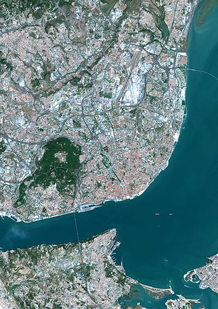
Color satellite image of Lisbon, capital city of Portugal. It is situated at the mouth of the Tagus River. Image collected on September 02, 2017 by Sentinel-2 satellites.
Rights-Managed
-

Color satellite image of Lisbon, capital city of Portugal. It is situated at the mouth of the Tagus River. Image collected on September 02, 2017 by Sentinel-2 satellites.
Rights-Managed
-
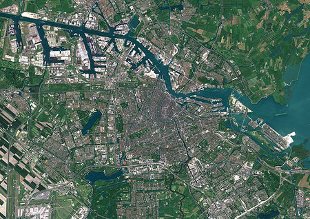
Color satellite image of Amsterdam, capital city of Netherlands. The River Amstel flows through the city. Image collected on May 26, 2017 by Sentinel-2 satellites.
Rights-Managed
-

Color satellite image of Riga, capital city of Latvia. Image collected on May 28, 2017 by Sentinel-2 satellites.
Rights-Managed
-
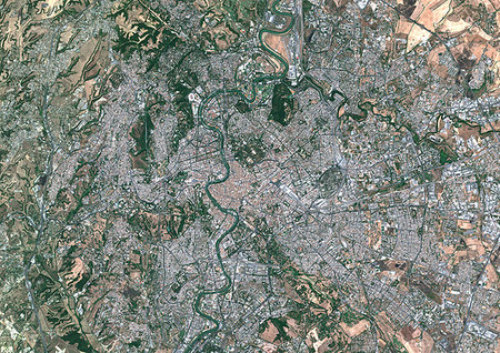
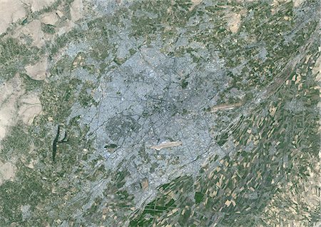
Color satellite image of Rome, capital city of Italy. The Tiber flows through the city. Image collected on July 30, 2017 by Sentinel-2 satellites.
Rights-Managed


