-
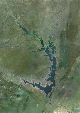
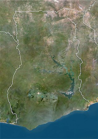
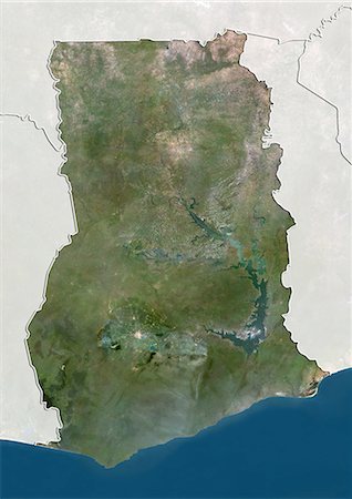
Satellite view of Lake Volta, in Ghana. It is the largest reservoir by surface area in the world, and the fourth largest by volume. This image was compiled from data acquired by Landsat satellites.
Rights-Managed
-

Satellite view of Tenerife, Canary Islands, Spain. It is the largest and most populous island of the seven Canary Islands. Volcano Mount Teide at center is the highest point of Spain, at 3718 m. This image was compiled from data acquired by Landsat 8 satellite in 2014.
Rights-Managed
-

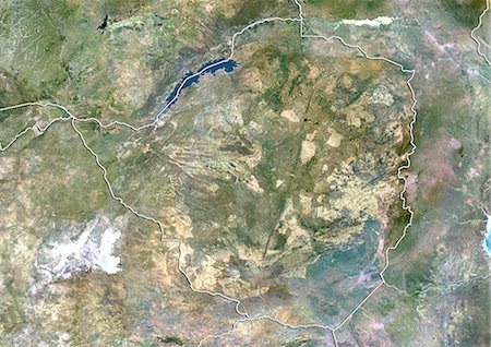
Satellite view of Southern Africa. It shows the African Great Lakes region. This image was compiled from data acquired by Landsat 7 & 8 satellites.
Rights-Managed
-

Satellite view of North Africa. This image was compiled from data acquired by Landsat 7 & 8 satellites.
Rights-Managed
-

Satellite view of Madagascar. Comoros and Mayotte islands are at North. This image was compiled from data acquired by Landsat satellites.
Rights-Managed
-

Satellite view of Cape Verde Southern Islands showing Fogo, Santiago and Miao islands. This image was compiled from data acquired by Landsat satellites.
Rights-Managed
-

Satellite view of Africa. This image was compiled from data acquired by Landsat 7 & 8 satellites.
Rights-Managed
-

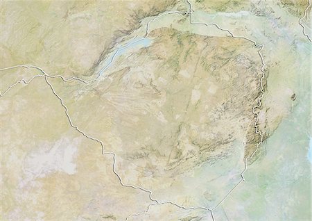
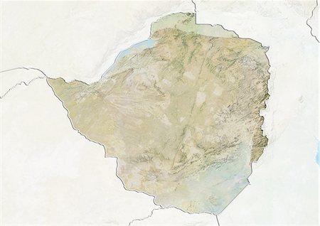
Plan-relief de Zimbabwe (avec bordure et masque). Cette image a été compilée à partir de données acquises par les satellites landsat 5 & 7 combinées avec les données d'élévation.
Rights-Managed
-
-
-
-
-
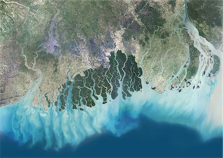
Satellite view of the Ganges River Delta, Bangladesh, India. Also known as the Brahmaputra Delta, it empties into the Bay of Bengal. Kolkata sits within the lower Ganges Delta along the Hooghly River (at west on the image). This image was compiled from data acquired in 2014 by Landsat 8 satellite.
Rights-Managed
-
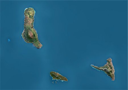
Satellite view of the Comoros Archipelago. This image was compiled from data acquired by Landsat satellites.
Rights-Managed
-
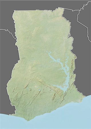
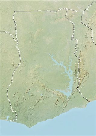
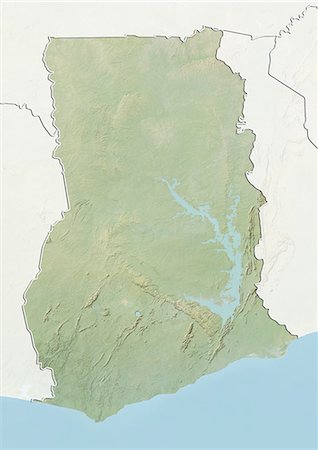
Plan-relief de Ghana (avec bordure et masque). Cette image a été compilée à partir de données acquises par les satellites landsat 5 & 7 combinées avec les données d'élévation.
Rights-Managed
-
-
-
-
-

Lac Volta, au Ghana, couleur vraie Image-Satellite. Image satellite de vraies couleurs du lac Volta, au Ghana. C'est le plus grand réservoir de surface dans le monde et au quatrième rang en volume. Image composite en utilisant les données de LANDSAT 7.
Rights-Managed
-

Colour satellite image of Lagos, Nigeria. Image taken on January 19, 2014 with Landsat 8 data.
Rights-Managed
-

Colour satellite image of Cairo, Egypt. Image taken on December 16, 2013 with Landsat 8 data.
Rights-Managed
-
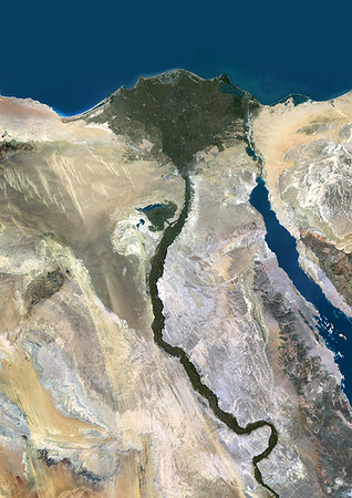
Color satellite image of the Nile River, Egypt. The Nile Delta is formed in Northern Egypt where the Nile River spreads out and drains into the Mediterranean Sea. Images collected on October 1, 2017 by Landsat 8 satellite.
Rights-Managed
-

Color satellite image of the Nile Delta. It is formed in Northern Egypt where the Nile River spreads out and drains into the Mediterranean Sea. Image collected on October 1, 2017 by Sentinel-2 satellites.
Rights-Managed
-

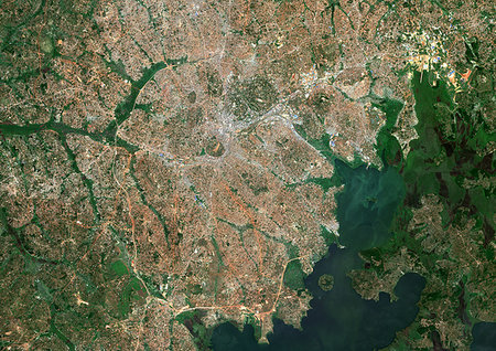
Color satellite image of Cairo, capital city of Egypt. Image collected on October 01, 2017 by Sentinel-2 satellites.
Rights-Managed
-

Color satellite image of Brazzaville, capital city of the Republic of the Congo, and Kinshasa, capital city of the Democratic Republic of the Congo. Brazzavile is located on the north shore of the Congo River, while Kinshasa lies on the south shore. Image collected on September 19, 2017 by Sentinel-2 satellites.
Rights-Managed
-
Color satellite image of Kampala, capital city of Uganda. It lies on the northern shore of Lake Victoria. Image collected on January 25, 2017 by Sentinel-2 satellites.
Rights-Managed
-

Color satellite image of Tunis, capital city of Tunisia. Image collected on August 19, 2017 by Sentinel-2 satellites.
Rights-Managed
-
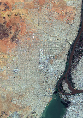
Color satellite image of Omdurman, Sudan. The city lies on the western banks of the River Nile, opposite the capital Khartoum. Image collected on October 25, 2017 by Sentinel-2 satellites.
Rights-Managed
-

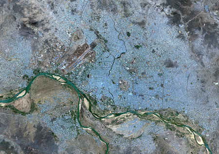
Color satellite image of Khartoum, capital city of Sudan. It is located at the confluence of the White Nile to the west and the Blue Nile to the east. Image collected on October 25, 2017 by Sentinel-2 satellites.
Rights-Managed
-

Color satellite image of Brazzaville, capital city of Republic of the Congo. The city is on the north side of the Congo River. Image collected on July 12, 2017 by Sentinel-2 satellites.
Rights-Managed
-

Color satellite image of Niamey, capital city of Niger. The Niger River flows through the city. Image collected on May 14, 2017 by Sentinel-2 satellites.
Rights-Managed
-

Color satellite image of Bamako, capital city of Mali. The city is situated on the Niger River floodplain. Image collected on April 19, 2017 by Sentinel-2 satellites.
Rights-Managed
-
Color satellite image of N'Djamena, capital city of Chad. The cities lies on the confluence of the Chari and Logone rivers. Image collected on April 29, 2017 by Sentinel-2 satellites.
Rights-Managed
-

Color satellite image of Bangui, capital city of Central African Republic. It lies on the northern shore of the Ubangi River. Image collected on May 13, 2017 by Sentinel-2 satellites.
Rights-Managed
-
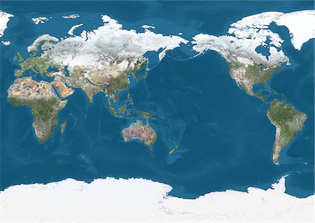
World Satellite Map (Pacific Centred) in winter, with partial snow cover. This image was compiled from data acquired by Landsat 7 & 8 satellites.
Rights-Managed
-
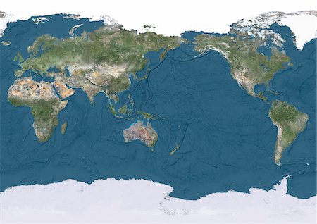
True natural colour satellite image of the Earth, centred on the Pacific ocean, with Arctic ice cap and showing ocean depths. This image was compiled from data acquired by Landsat satellites.
Rights-Managed
-

True natural colour satellite image of the Earth, centred on the Pacific ocean and with Arctic ice cap. This image was compiled from data acquired by Landsat satellites.
Rights-Managed
-
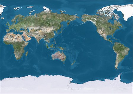
True natural colour satellite image of the Earth, centred on the Pacific ocean. This image was compiled from data acquired by Landsat satellites.
Rights-Managed
-
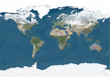
World Satellite Map in winter, with partial snow cover and showing ocean depths. This image was compiled from data acquired by Landsat 7 & 8 satellites.
Rights-Managed
-

World Satellite Map in winter, with partial snow cover. This image was compiled from data acquired by Landsat 7 & 8 satellites.
Rights-Managed
-

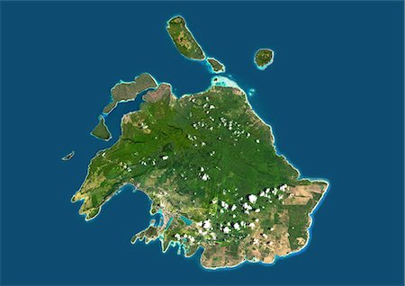
Satellite view of West Nusa Tenggara Province, Indonesia (with country boundaries and mask). The image shows the two largest islands in the province which are Lombok in the west and the larger Sumbawa island in the east. This image was compiled from data acquired by Landsat satellites.
Rights-Managed
-
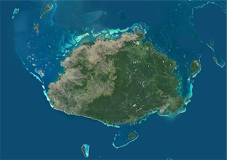
Satellite view of Viti Levu Island, Fiji. This is the largest island in the Republic of Fiji and the site of the nation's capital, Suva. This image was compiled from data acquired by Landsat 8 satellite in 2014.
Rights-Managed
-
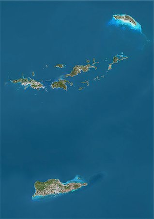
Satellite view of British and US Virgin Islands. This image was compiled from data acquired by Landsat satellites.
Rights-Managed
-

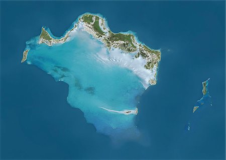
Satellite view of Vanua Balavu Island, Fiji. This image was compiled from data acquired by Landsat 8 satellite in 2014.
Rights-Managed
-
Satellite view of Turks and Caicos Islands. This image was compiled from data acquired by Landsat satellites.
Rights-Managed
-
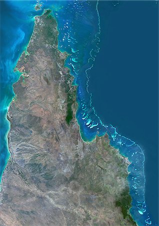
Satellite view of the Northern Great Barrier Reef along the east coast of Cape York Peninsula in north Australia. This image was compiled from data acquired in 2014 by Landsat 8 satellite.
Rights-Managed
-
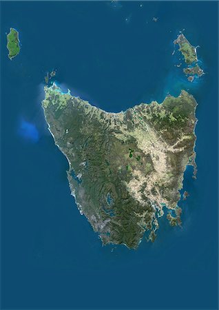
Satellite view of Tasmania, Australia. This image was compiled from data acquired by Landsat 8 satellite in 2014.
Rights-Managed
-

Satellite view of Taiwan. This image was compiled from data acquired by Landsat satellites.
Rights-Managed
-
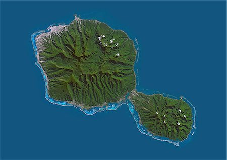
Satellite view of Tahiti, French Polynesia. This image was compiled from data acquired by Landsat 8 satellite in 2014.
Rights-Managed
-
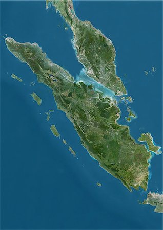
Satellite view of Sumatra, Malaysia and Singapore. This image was compiled from data acquired by Landsat satellites.
Rights-Managed
-
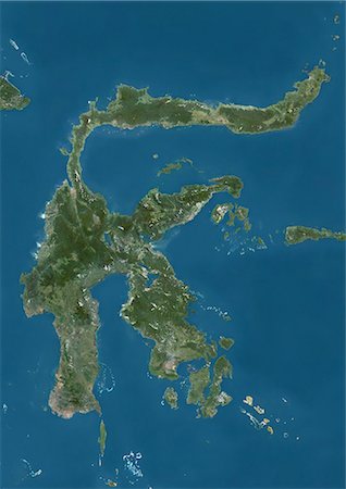
Satellite view of Sulawesi, Indonesia. This image was compiled from data acquired by Landsat satellites.
Rights-Managed
-
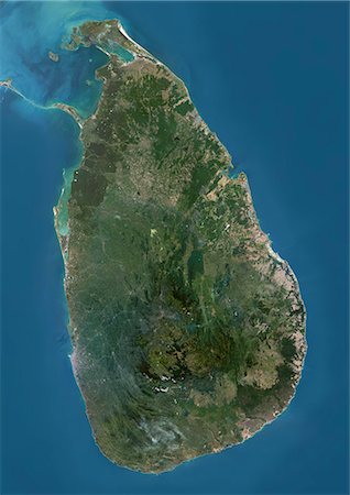
Satellite view of Sri Lanka. This image was compiled from data acquired by Landsat 8 satellite in 2014.
Rights-Managed
-

Satellite view of Southeast Asia. This image was compiled from data acquired by Landsat 7 & 8 satellites.
Rights-Managed
-
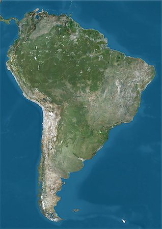
Satellite view of South America. This image was compiled from data acquired by Landsat 7 & 8 satellites.
Rights-Managed
-
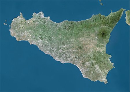
Satellite view of Sicily, Italy. Mount Etna, on the East coast of Sicily, is the largest active volcano in Europe. This image was compiled from data acquired by Landsat satellites.
Rights-Managed
-
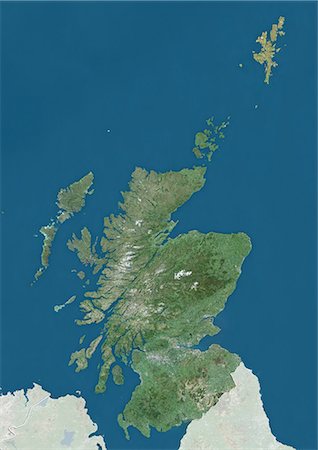
Satellite view of Scotland and the Northern Isles, UK (with country boundaries and mask). The image shows the mainland of Scotland, including the Northern Isles and the Hebrides. This image was compiled from data acquired by Landsat satellites.
Rights-Managed
-

Satellite view of Sardinia, Italy. It is the second-largest island in the Mediterranean Sea. This image was compiled from data acquired by Landsat satellites.
Rights-Managed
-
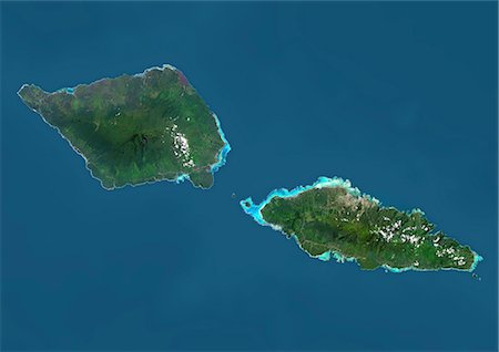
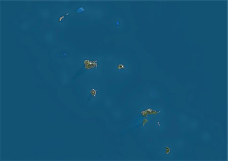
Satellite view of Samoa that consists of two large islands, Upolu and Savaii. This image was compiled from data acquired by Landsat 8 satellite in 2014.
Rights-Managed
-

Satellite view of Puerto Rico. This image was compiled from data acquired by Landsat satellites.
Rights-Managed
-
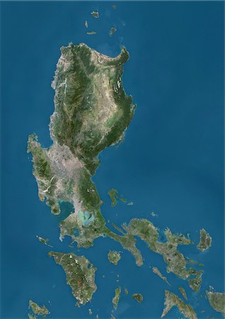
Satellite view of Luzon, Philippines. It is the largest and most populous island in the Philippines. This image was compiled from data acquired by Landsat satellites.
Rights-Managed
-

Satellite view of the Persian Gulf. This image was compiled from data acquired in 2014 by Landsat 8 satellite.
Rights-Managed
-

Satellite view of Oceania. This image was compiled from data acquired by Landsat 7 & 8 satellites.
Rights-Managed
-

Satellite view of New Zealand. This image was compiled from data acquired by Landsat 8 satellite in 2014.
Rights-Managed
-
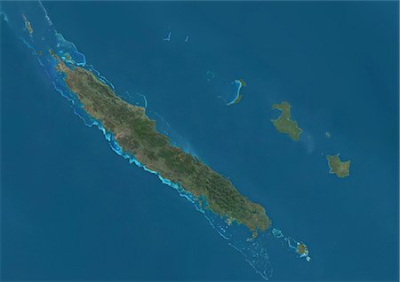
Satellite view of New Caledonia. This image was compiled from data acquired by Landsat satellites.
Rights-Managed
-
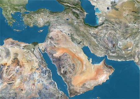
Satellite view of the Middle East. This image was compiled from data acquired in 2014 by Landsat 8 satellite.
Rights-Managed
-
Satellite view of the Marquesas Islands, French Polynesia. This image was compiled from data acquired by Landsat 8 satellite in 2014.
Rights-Managed
-

Satellite view of the Maluku Islands, Indonesia. This image was compiled from data acquired by Landsat satellites.
Rights-Managed
-

Satellite view of the Kerguelen Islands, a group of islands in the southern Indian Ocean that is part of the French Southern and Antarctic Lands. The main island is called Grande Terre. This image was compiled from data acquired by Landsat satellites.
Rights-Managed
-

Satellite view of Japan and Korean Peninsula. This image was compiled from data acquired by Landsat satellites.
Rights-Managed
-

Satellite view of Japan and Korean Peninsula. This image was compiled from data acquired by Landsat satellites.
Rights-Managed
-
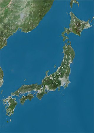
Satellite view of Japan. This image was compiled from data acquired by Landsat satellites.
Rights-Managed
-
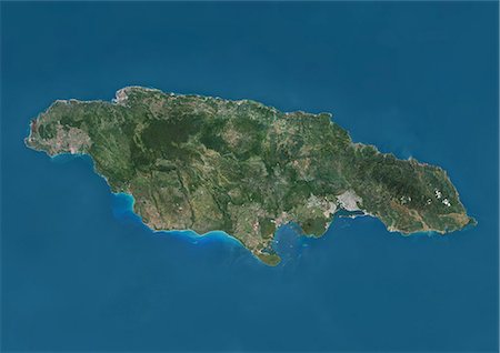
Satellite view of Jamaica. This image was compiled from data acquired by Landsat satellites.
Rights-Managed
-
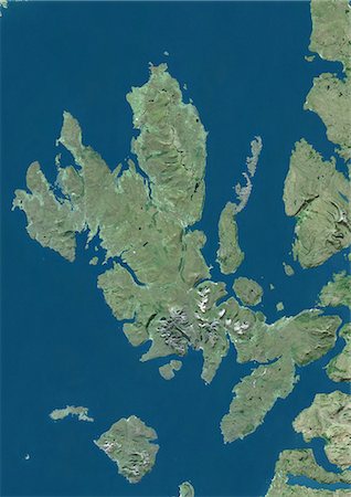
Satellite view of the Isle of Skye, Scotland. It is the largest island in the Inner Hebrides of Scotland. The Cuillin mountains dominate the Isle of Skye. This image was compiled from data acquired by Landsat satellites.
Rights-Managed
-
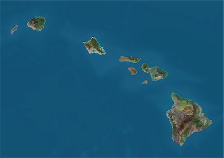
Satellite view of the State of Hawaii, USA. The main islands are Kauai, Oahu, Maui and the Island of Hawaii. This image was compiled from data acquired by Landsat 8 satellite in 2014.
Rights-Managed
-

Satellite view of the Island of Hawaii, USA. The island is formed of five volcanoes, Mauna Loa being the largest. This image was compiled from data acquired by Landsat 8 satellite in 2014.
Rights-Managed
-

Satellite view of Haiti and The Dominican Republic. This image was compiled from data acquired by Landsat satellites.
Rights-Managed
-
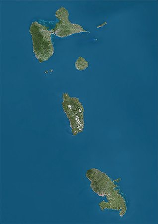
Satellite view of Guadeloupe, Dominica and Martinique. This image was compiled from data acquired by Landsat satellites.
Rights-Managed
-

Satellite view of Guadeloupe. This image was compiled from data acquired by Landsat satellites.
Rights-Managed
-

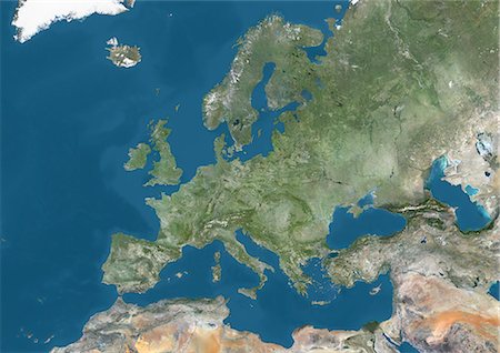
Satellite view of Europe in winter, with partial snow cover. This image was compiled from data acquired by Landsat 7 & 8 satellites.
Rights-Managed
-
Satellite view of Europe. This image was compiled from data acquired by Landsat 7 & 8 satellites.
Rights-Managed
-
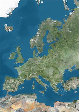
Satellite view of Europe. This image was compiled from data acquired by Landsat 7 & 8 satellites.
Rights-Managed
-
Satellite view of Efate, Vanuatu. It is the most populous island of Vanuatu archipelago. This image was compiled from data acquired by Landsat 8 satellite in 2014.
Rights-Managed
-
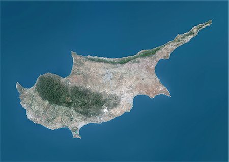
Satellite view of Cyprus. This image was compiled from data acquired by Landsat 8 satellite in 2014.
Rights-Managed
-
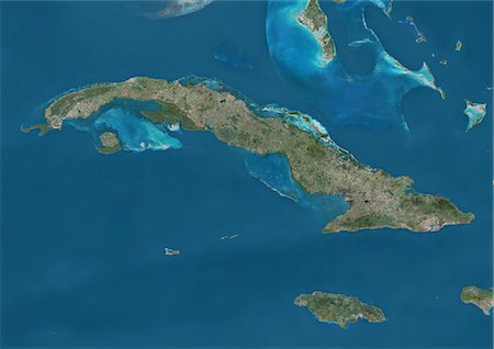
Satellite view of Cuba and Jamaica. This image was compiled from data acquired by Landsat satellites.
Rights-Managed
-
Satellite view of Central America and the Caribbean. This image was compiled from data acquired by Landsat 7 & 8 satellites.
Rights-Managed
-

Satellite view of the Caucasus. This image was compiled from data acquired in 2014 by Landsat 8 satellite.
Rights-Managed
-
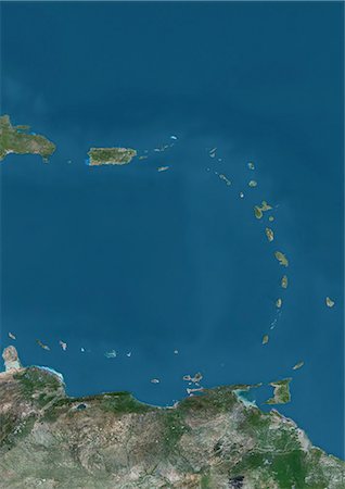
Satellite view of Islands of the Lesser Antilles and Puerto Rico and Puerto Rico in the Caribbean. This image was compiled from data acquired by Landsat satellites.
Rights-Managed
-
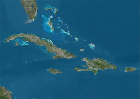
Satellite view of The Greater Antilles and Bahamas. This image was compiled from data acquired by Landsat satellites.
Rights-Managed
-

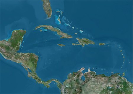
Satellite view of the Caribbean Sea. The entire area of the Caribbean Sea, including all islands of the West Indies is collectively known as the Caribbean. This image was compiled from data acquired by Landsat satellites.
Rights-Managed


