-

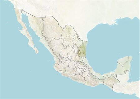
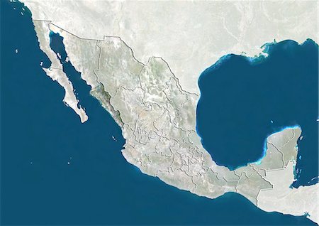
Mexico and the State of Tamaulipas, True Colour Satellite Image
Con derechos protegidos
-
-

Satellite view of Mexico City, Mexico. This image was compiled from data acquired by LANDSAT 5 & 7 satellites.
Con derechos protegidos
-

-

-
-
-
-

-
-
-
-

-
-
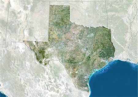
Satellite view of the State of Texas, United States. This image was compiled from data acquired by LANDSAT 5 & 7 satellites.
Con derechos protegidos
-
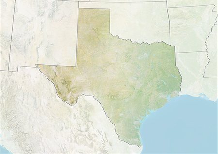
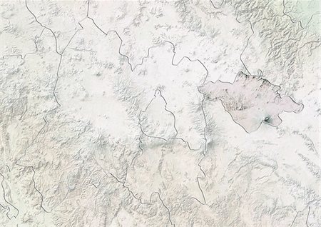
Relief map of the State of Texas, United States. This image was compiled from data acquired by LANDSAT 5 & 7 satellites combined with elevation data.
Con derechos protegidos
-
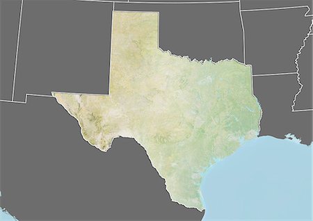
Relief map of the State of Texas, United States. This image was compiled from data acquired by LANDSAT 5 & 7 satellites combined with elevation data.
Con derechos protegidos
-
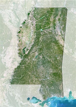
Satellite view of the State of Mississippi, United States. This image was compiled from data acquired by LANDSAT 5 & 7 satellites.
Con derechos protegidos
-

Relief map of the State of Mississippi, United States. This image was compiled from data acquired by LANDSAT 5 & 7 satellites combined with elevation data.
Con derechos protegidos
-

Relief map of the State of Mississippi, United States. This image was compiled from data acquired by LANDSAT 5 & 7 satellites combined with elevation data.
Con derechos protegidos
-

Satellite view of the State of Louisiana, United States. This image was taken in 2003 before Hurricane Katrina. It was compiled from data acquired by LANDSAT 7 satellite.
Con derechos protegidos
-

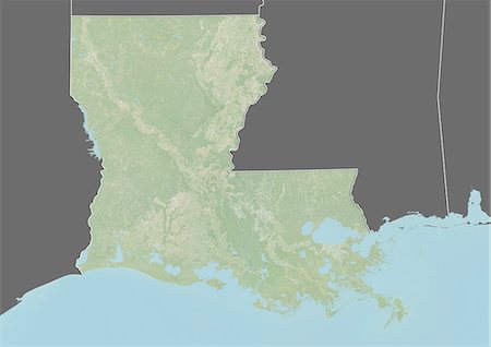
Relief map of the State of Louisiana, United States. This image was taken in 2003 before Hurricane Katrina. It was compiled from data acquired by LANDSAT 7 satellite combined with elevation data.
Con derechos protegidos
-
Relief map of the State of Louisiana, United States. This image was taken in 2003 before Hurricane Katrina. It was compiled from data acquired by LANDSAT 7 satellite combined with elevation data.
Con derechos protegidos
-

Satellite view of the State of Florida, United States. This image was compiled from data acquired by LANDSAT 5 & 7 satellites.
Con derechos protegidos
-
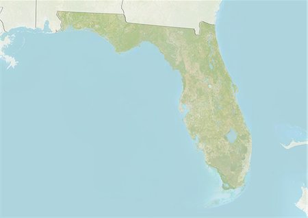
Relief map of the State of Florida, United States. This image was compiled from data acquired by LANDSAT 5 & 7 satellites combined with elevation data.
Con derechos protegidos
-

Relief map of the State of Florida, United States. This image was compiled from data acquired by LANDSAT 5 & 7 satellites combined with elevation data.
Con derechos protegidos
-
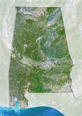
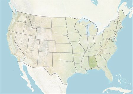
Satellite view of the State of Alabama, United States. This image was compiled from data acquired by LANDSAT 5 & 7 satellites.
Con derechos protegidos
-

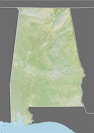
Relief map of the State of Alabama, United States. This image was compiled from data acquired by LANDSAT 5 & 7 satellites combined with elevation data.
Con derechos protegidos
-
Relief map of the State of Alabama, United States. This image was compiled from data acquired by LANDSAT 5 & 7 satellites combined with elevation data.
Con derechos protegidos
-
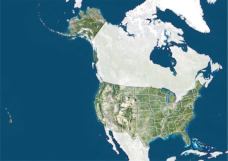
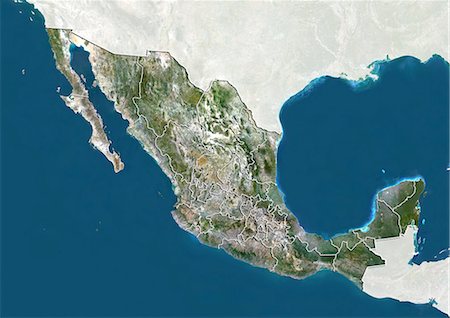
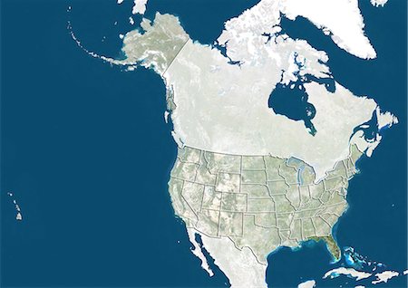
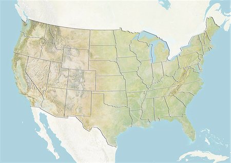
United States, True Colour Satellite Image With State Boundaries
Con derechos protegidos
-
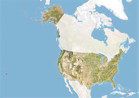
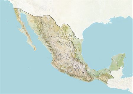
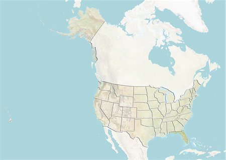
United States, Satellite Image With Bump Effect and State Boundaries
Con derechos protegidos
-
-

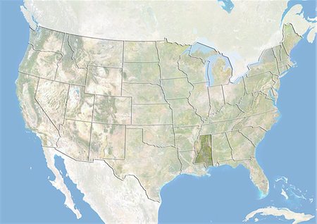
United States and the State of Mississippi, True Colour Satellite Image
Con derechos protegidos
-

United States and the State of Mississippi, Satellite Image With Bump Effect
Con derechos protegidos
-
-
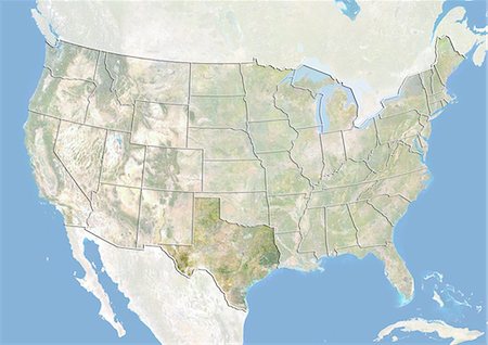
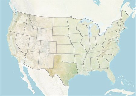
United States and the State of Texas, True Colour Satellite Image
Con derechos protegidos
-
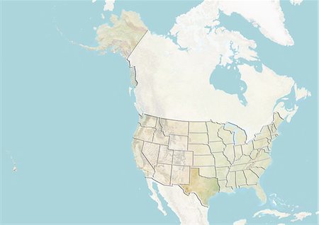
United States and the State of Texas, Satellite Image With Bump Effect
Con derechos protegidos
-
-

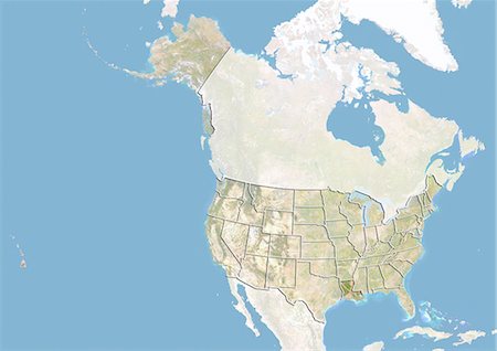
United States and the State of Louisiana, True Colour Satellite Image
Con derechos protegidos
-
United States and the State of Louisiana, Satellite Image With Bump Effect
Con derechos protegidos
-

-
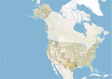
United States and the State of Florida, True Colour Satellite Image
Con derechos protegidos
-
United States and the State of Florida, Satellite Image With Bump Effect
Con derechos protegidos
-
-

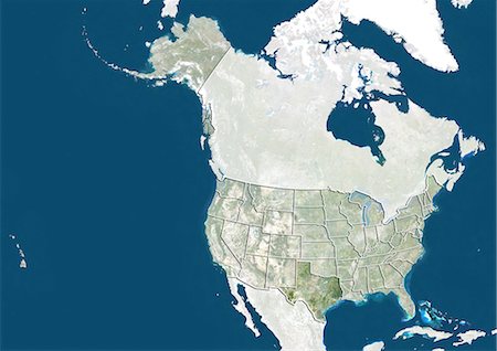
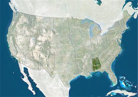
United States and the State of Alabama, True Colour Satellite Image
Con derechos protegidos
-

United States and the State of Alabama, Satellite Image With Bump Effect
Con derechos protegidos
-

-

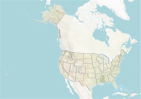
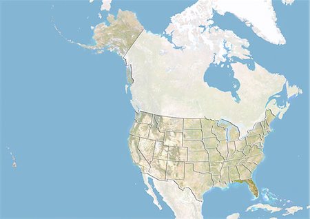
United States, True Colour Satellite Image With State Boundaries
Con derechos protegidos
-
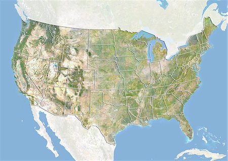
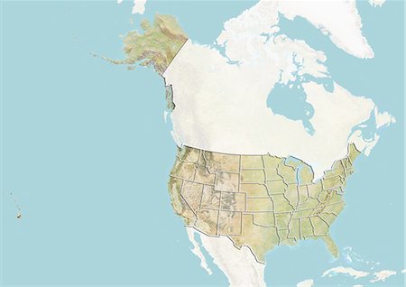
United States, Satellite Image With Bump Effect and State Boundaries
Con derechos protegidos
-
-

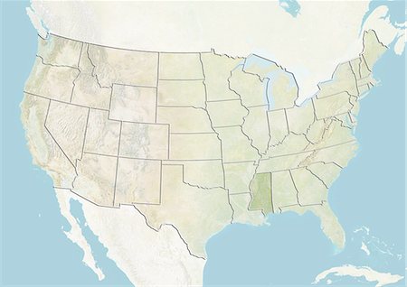
United States and the State of Mississippi, True Colour Satellite Image
Con derechos protegidos
-
United States and the State of Mississippi, Satellite Image With Bump Effect
Con derechos protegidos
-
-

United States and the State of Texas, True Colour Satellite Image
Con derechos protegidos
-
United States and the State of Texas, Satellite Image With Bump Effect
Con derechos protegidos
-
-

United States and the State of Louisiana, True Colour Satellite Image
Con derechos protegidos
-

United States and the State of Louisiana, Satellite Image With Bump Effect
Con derechos protegidos
-

-

United States and the State of Florida, True Colour Satellite Image
Con derechos protegidos
-

United States and the State of Florida, Satellite Image With Bump Effect
Con derechos protegidos
-

-
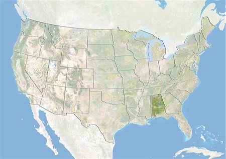
United States and the State of Alabama, True Colour Satellite Image
Con derechos protegidos
-
United States and the State of Alabama, Satellite Image With Bump Effect
Con derechos protegidos
-
-

-

-
-

-

-

-
-

-

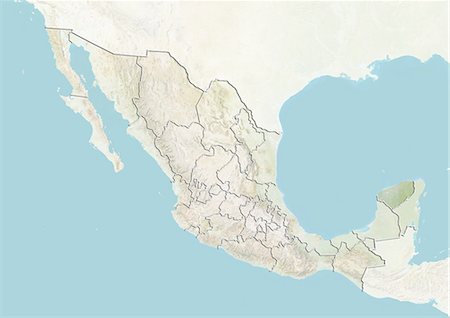
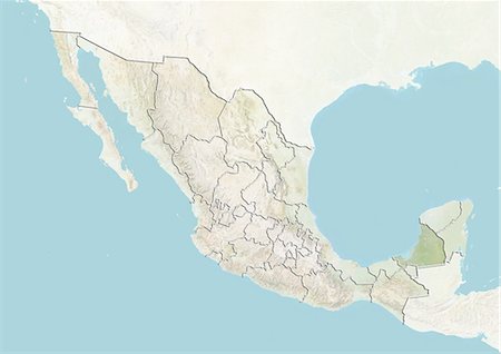
Mexico and the State of Quintana Roo, True Colour Satellite Image
Con derechos protegidos
-

-

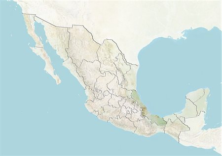
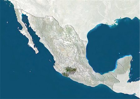
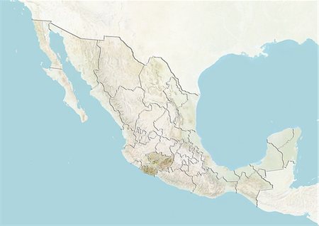
Mexico and the State of Nuevo Leon, True Colour Satellite Image
Con derechos protegidos
-

-
-
-
-

-

-

-

-

-

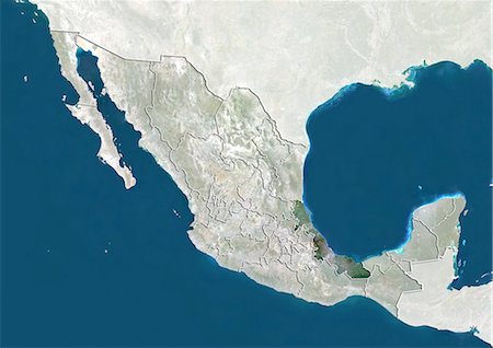
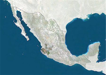
Mexico and the State of Baja California Sur, True Colour Satellite Image
Con derechos protegidos
-

-

Mexico and the State of Baja California, True Colour Satellite Image
Con derechos protegidos
-

-
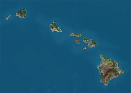
Satellite view of the State of Hawaii, USA. The main islands are Kauai, Oahu, Maui and the Island of Hawaii. This image was compiled from data acquired by Landsat 8 satellite in 2014.
Con derechos protegidos


