-
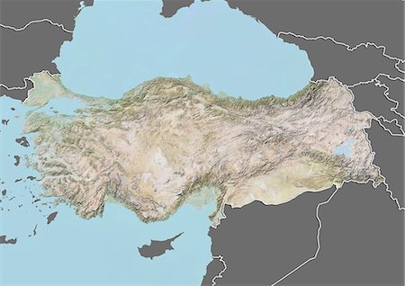
Relief map of Turkey (with border and mask). This image was compiled from data acquired by landsat 5 & 7 satellites combined with elevation data.
Con derechos protegidos
-
-
-
-

-

-

-

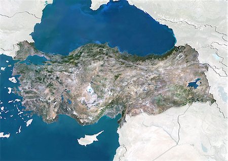
Turkey, Asia, True Colour Satellite Image With Mask. Satellite view of Turkey (with mask). This image was compiled from data acquired by LANDSAT 5 & 7 satellites.
Con derechos protegidos
-
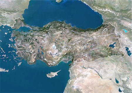
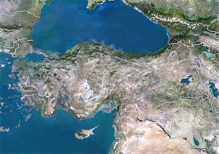
Turkey, Asia, True Colour Satellite Image With Border And Mask. Satellite view of Turkey (with border and mask). This image was compiled from data acquired by LANDSAT 5 & 7 satellites.
Con derechos protegidos
-
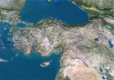
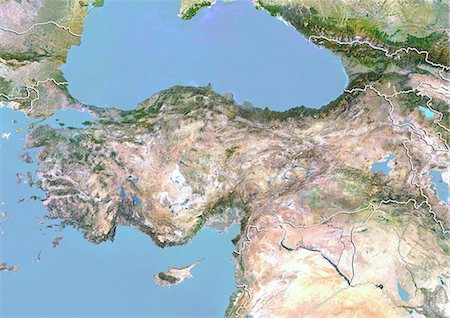
Turkey, Asia, True Colour Satellite Image With Border. Satellite view of Turkey (with border). This image was compiled from data acquired by LANDSAT 5 & 7 satellites.
Con derechos protegidos
-
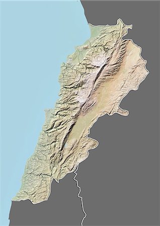
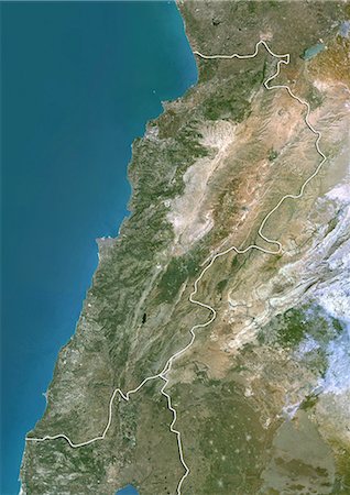
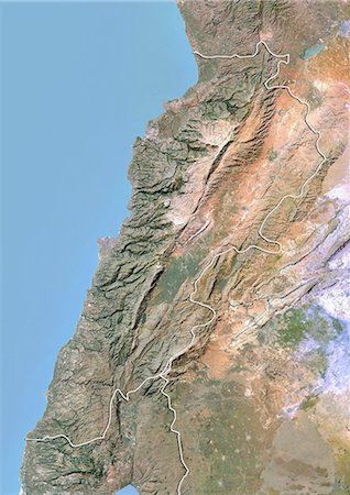
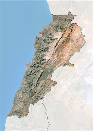
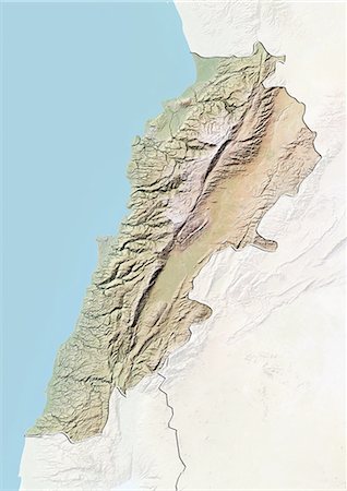
Relief map of Lebanon (with border and mask). This image was compiled from data acquired by landsat 5 & 7 satellites combined with elevation data.
Con derechos protegidos
-
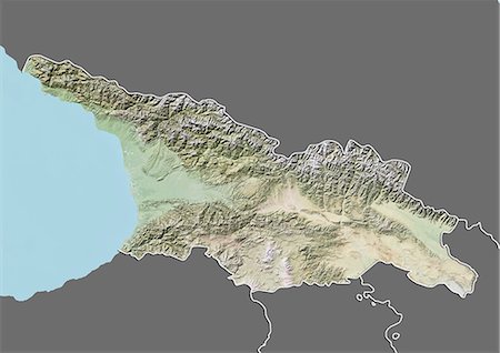
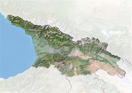
Relief map of Georgia (with border and mask). This image was compiled from data acquired by landsat 5 & 7 satellites combined with elevation data.
Con derechos protegidos
-
-

-
-
Lebanon, Satellite Image With Bump Effect, With Border and Mask
Con derechos protegidos
-

-
-

-

-

-
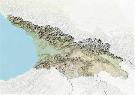
Georgia, Satellite Image With Bump Effect, With Border and Mask
Con derechos protegidos
-

-
-

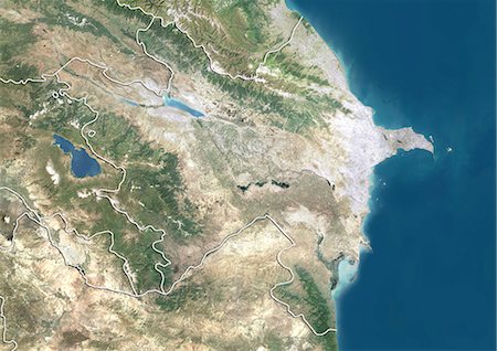
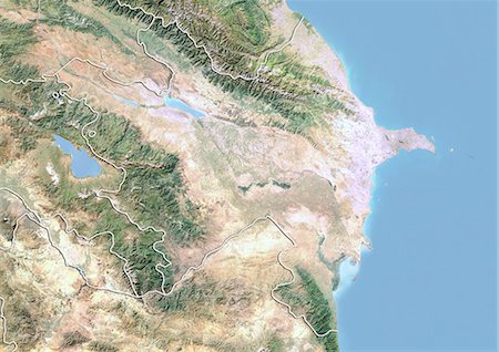
Relief map of Azerbaijan (with border and mask). This image was compiled from data acquired by landsat 5 & 7 satellites combined with elevation data.
Con derechos protegidos
-
-
-
-

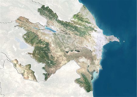
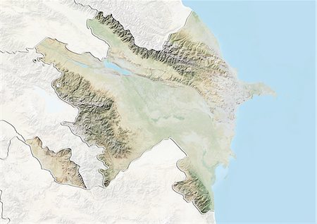
Azerbaijan, Satellite Image With Bump Effect, With Border and Mask
Con derechos protegidos
-
-
-

Sea Of Marmara, Turkey, True Colour Satellite Image. True colour satellite image of the Sea of Marmara, the inland sea that connects the Black Sea (at top) to the Aegean Sea (down left). The Bosphorus Strait connects it to the Black Sea and the Dardanelles Strait to the Aegean Sea. Istanbul is located on the Bosphorus Strait. Composite image using LANDSAT 5 data.
Con derechos protegidos
-
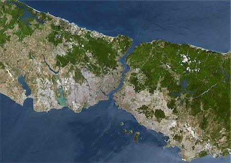
Istanbul, Turkey, True Colour Satellite Image. Istanbul, Turkey. True colour satellite image of Istanbul, capital city of Turkey. Image taken on 2 July 2000, using LANDSAT 7 data.
Con derechos protegidos
-

Satellite view of Europe in winter, with partial snow cover. This image was compiled from data acquired by Landsat 7 & 8 satellites.
Con derechos protegidos
-
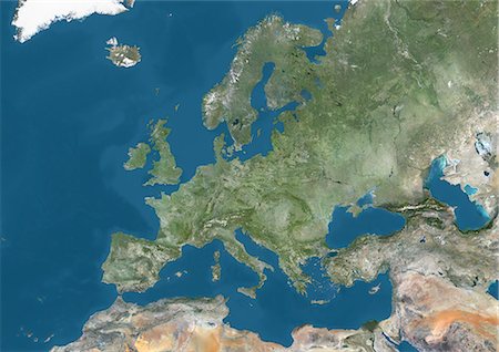
Satellite view of Europe. This image was compiled from data acquired by Landsat 7 & 8 satellites.
Con derechos protegidos
-

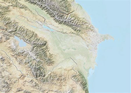
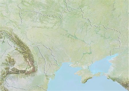
Satellite view of the Caucasus. This image was compiled from data acquired in 2014 by Landsat 8 satellite.
Con derechos protegidos
-

Relief map of Afghanistan (with border and mask). This image was compiled from data acquired by landsat 5 & 7 satellites combined with elevation data.
Con derechos protegidos
-

-

-

-

Afghanistan, Satellite Image With Bump Effect, With Border and Mask
Con derechos protegidos
-

-

-
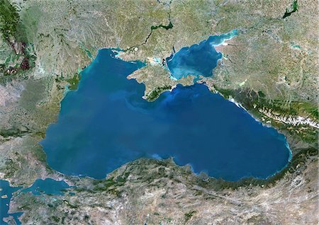
Black Sea, Europe, True Colour Satellite Image. True colour satellite image of the Black Sea, an inland sea bounded by Europe, Anatolia and the Caucasus. It lies between Bulgaria, Georgia, Romania, Russia, Turkey and Ukraine. The Black Sea connects to the Sea of Azov (at top). The Bosphorus strait connects it to the Sea of Marmara (down left). Composite image using LANDSAT 5 data.
Con derechos protegidos
-

Colour satellite image of Istanbul, Turkey. Image taken on July 30, 2013 with Landsat 8 data.
Con derechos protegidos
-
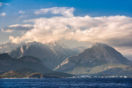
Tahtali, Taurus Mountains, Kemer, Antalya Province, Lycia, Anatolia, Mediterranean Sea, Turkey, Asia Minor, Eurasia
Sin royalties Premium
-

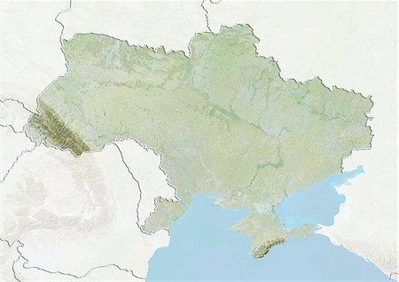
Relief map of Ukraine (with border and mask). This image was compiled from data acquired by landsat 5 & 7 satellites combined with elevation data.
Con derechos protegidos
-

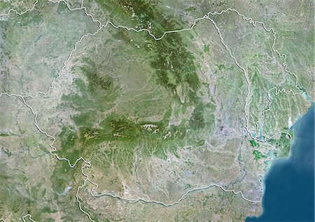
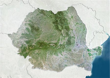
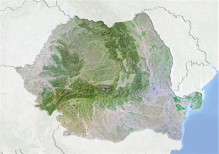
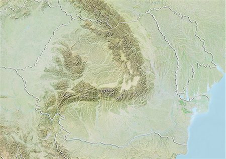
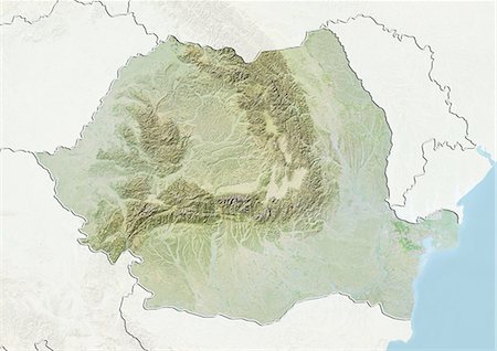
Relief map of Romania (with border and mask). This image was compiled from data acquired by landsat 5 & 7 satellites combined with elevation data.
Con derechos protegidos
-
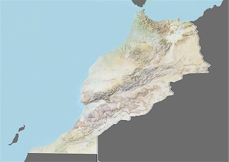
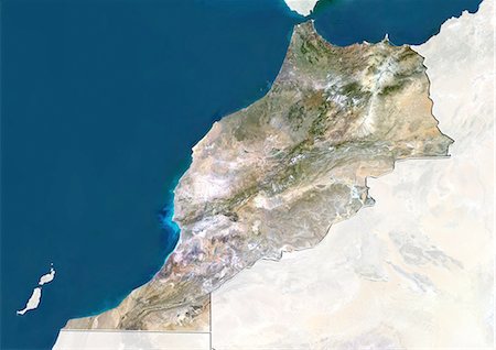
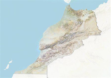
Relief map of Morocco (with border and mask). This image was compiled from data acquired by landsat 5 & 7 satellites combined with elevation data.
Con derechos protegidos
-
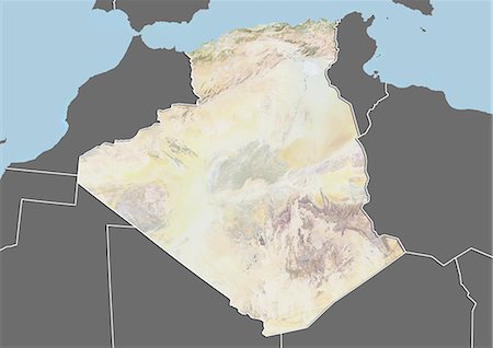
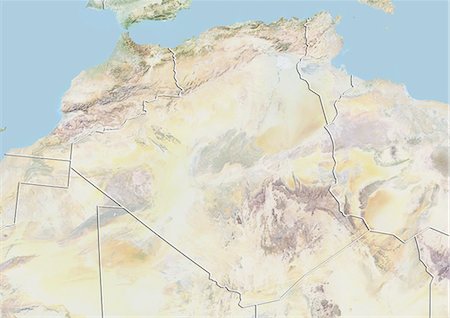
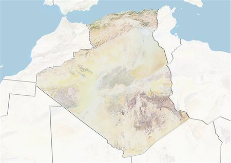
Relief map of Algeria (with border and mask). This image was compiled from data acquired by landsat 5 & 7 satellites combined with elevation data.
Con derechos protegidos
-

-

-
-
-
-
-
-
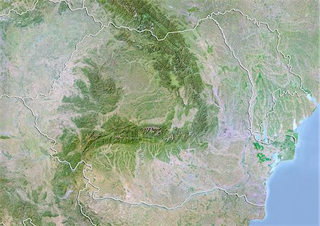
Romania, Satellite Image With Bump Effect, With Border and Mask
Con derechos protegidos
-
-
-

-
-
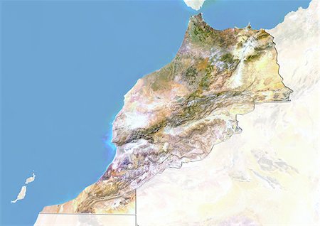
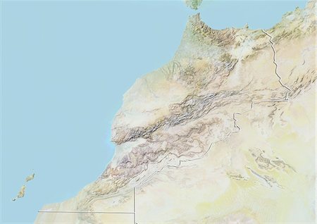
Morocco, Satellite Image With Bump Effect, With Border and Mask
Con derechos protegidos
-
-
-

-

-
-
-

Single hot air balloon over a misty dawn sky, Cappadocia, Anatolia, Turkey, Asia Minor, Eurasia
Con derechos protegidos
-

-

Satellite view of North Africa. This image was compiled from data acquired by Landsat 7 & 8 satellites.
Con derechos protegidos
-
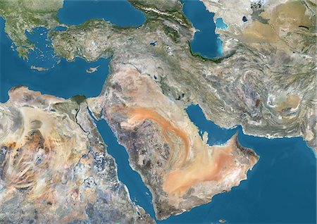
Satellite view of the Middle East. This image was compiled from data acquired in 2014 by Landsat 8 satellite.
Con derechos protegidos
-
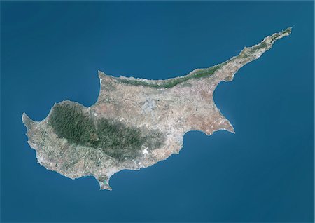
Satellite view of Cyprus. This image was compiled from data acquired by Landsat 8 satellite in 2014.
Con derechos protegidos
-
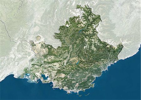
Satellite view of Provence-Alpes-Cote d'Azur, France. This image was compiled from data acquired by LANDSAT 5 & 7 satellites.
Con derechos protegidos
-
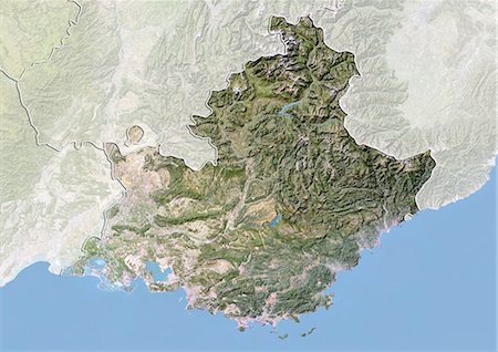
Satellite view with bump effect of Provence-Alpes-Cote d'Azur, France. This image was compiled from data acquired by LANDSAT 5 & 7 satellites.
Con derechos protegidos
-
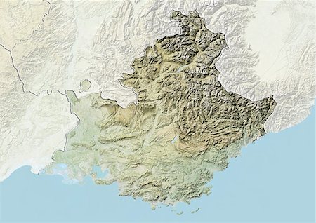
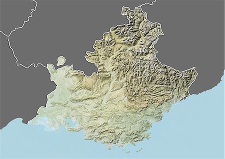
Relief map of Provence-Alpes-Cote d'Azur, France. This image was compiled from data acquired by LANDSAT 5 & 7 satellites combined with elevation data.
Con derechos protegidos
-
Relief map of Provence-Alpes-Cote d'Azur, France. This image was compiled from data acquired by LANDSAT 5 & 7 satellites combined with elevation data.
Con derechos protegidos
-

Satellite view of Languedoc-Roussillon, France. This image was compiled from data acquired by LANDSAT 5 & 7 satellites.
Con derechos protegidos
-

Relief map of Languedoc-Roussillon, France. This image was compiled from data acquired by LANDSAT 5 & 7 satellites combined with elevation data.
Con derechos protegidos
-

Relief map of Languedoc-Roussillon, France. This image was compiled from data acquired by LANDSAT 5 & 7 satellites combined with elevation data.
Con derechos protegidos
-

Relief map of Uzbekistan (with border and mask). This image was compiled from data acquired by landsat 5 & 7 satellites combined with elevation data.
Con derechos protegidos
-
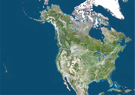
Satellite view of the United States and Canada (with border). This image was compiled from data acquired by LANDSAT 5 & 7 satellites.
Con derechos protegidos
-

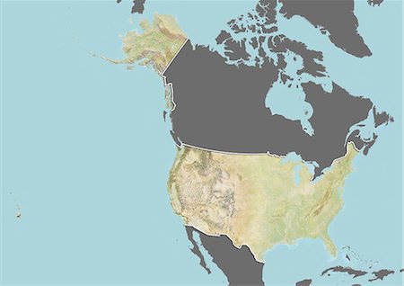
Satellite view of the United States (with border and mask). This image was compiled from data acquired by LANDSAT 5 & 7 satellites.
Con derechos protegidos
-

Relief map of the United States and Canada (with border). This image was compiled from data acquired by LANDSAT 5 & 7 satellites combined with elevation data.
Con derechos protegidos
-
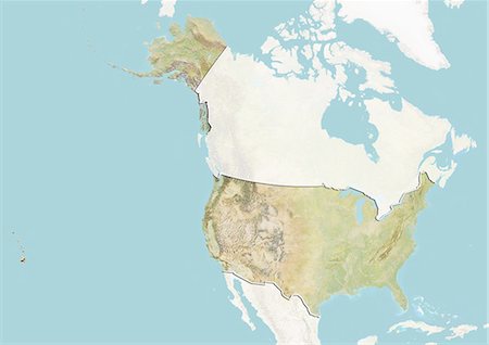
Relief map of the United States (with border and mask). This image was compiled from data acquired by landsat 5 & 7 satellites combined with elevation data.
Con derechos protegidos
-
Relief map of the United States (with border and mask). This image was compiled from data acquired by landsat 5 & 7 satellites combined with elevation data.
Con derechos protegidos
-
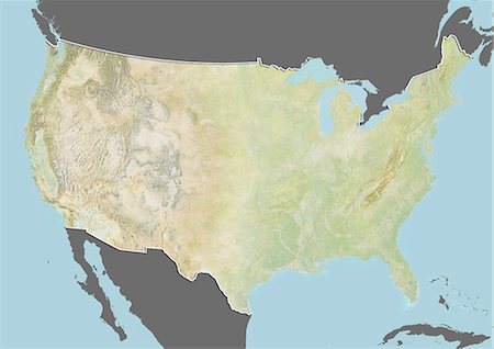
Relief map of the United States (with border and mask). This image was compiled from data acquired by landsat 5 & 7 satellites combined with elevation data.
Con derechos protegidos
-

Relief map of Peru (with border and mask). This image was compiled from data acquired by landsat 5 & 7 satellites combined with elevation data.
Con derechos protegidos
-
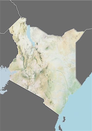
Relief map of Kenya (with border and mask). This image was compiled from data acquired by landsat 5 & 7 satellites combined with elevation data.
Con derechos protegidos


