-
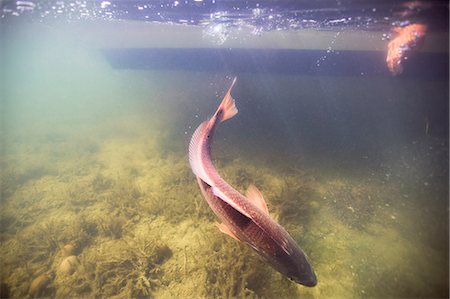
Man releasing small redfish in the Gulf of Mexico, Homosassa, Florida, US
Sin royalties Premium
-
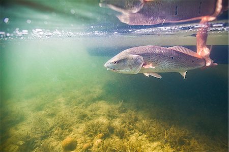
Man releasing small redfish in the Gulf of Mexico, Homosassa, Florida, US
Sin royalties Premium
-
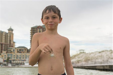
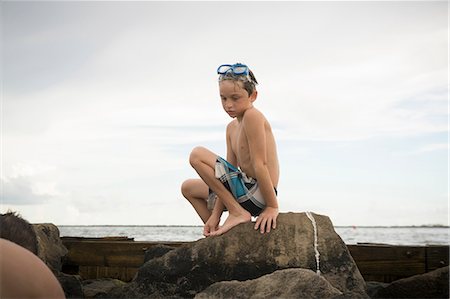
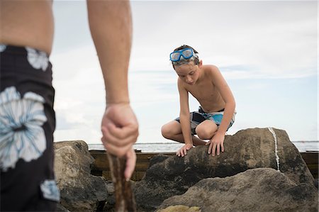
Boy holding blue crab, Gulf of Mexico, Emerald Coast, Florida, USA
Sin royalties Premium
-

-

-
-
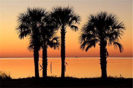
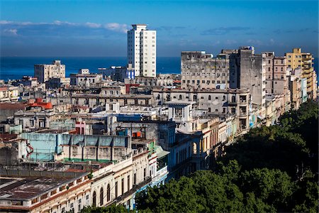
USA, Florida, Franklin County, Gulf of Mexico, Apalachicola, St. George Island , palm trees after sunset,
Con derechos protegidos
-

-

Toddler Girl Playing in Ocean with Shovel and Bucket at Beach, Destin, Florida, USA
Sin royalties Premium
-

Man filming redfish in the Gulf of Mexico, Homosassa, Florida, US
Sin royalties Premium
-

-
-

Toddler Girl Playing with Shovel and Bucket in Sand on Beach, Destin, Florida, USA
Sin royalties Premium
-
-
-

Toddler Girl Playing with Shovel and Bucket in Sand on Beach, Destin, Florida, USA
Sin royalties Premium
-
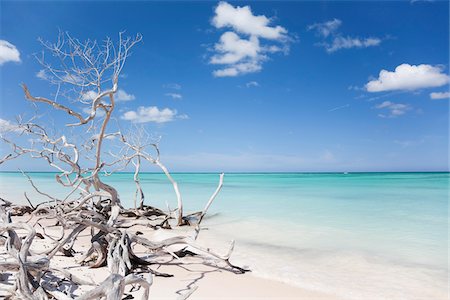
MANGROVE ON THE BEACH, CAYO JUTIAS, PINAR DEL RIO PROVINCE, CUBA
Con derechos protegidos
-
-

Back View of Toddler Girl wearing Sunhat on Beach looking out at Ocean, Destin, Florida, USA
Sin royalties Premium
-

Toddler Girl Playing with Shovel and Bucket in Sand on Beach, Destin, Florida, USA
Sin royalties Premium
-

Storm clouds forming on coast of Perez Island at sunset, Gulf of Mexico
Sin royalties Premium
-
-

-

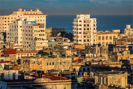
USA, Florida, Franklin County, Gulf of Mexico, Apalachicola, St. George Island
Con derechos protegidos
-
-

Satellite image of Hurricane Harvey in 2017 over Southeastern Texas, United States. Image taken on August 27, 2017.
Con derechos protegidos
-

USA, Florida, Franklin County, Gulf of Mexico, Apalachicola, St. George Island State Park, woman on nature boardwalk, MR 0009
Con derechos protegidos
-

USA, Florida, Franklin County, Gulf of Mexico, Apalachicola, St. George Island, sunset with palm trees looking west from causeway
Con derechos protegidos
-
-

-

Portrait of Toddler Girl wearing Sunhat on Beach and Looking out at Ocean, Destin, Florida, USA
Sin royalties Premium
-
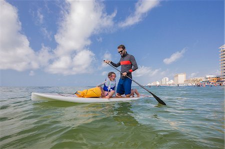
Father and daughter paddle boarding in the Gulf of Mexico, Florida, USA
Sin royalties Premium
-
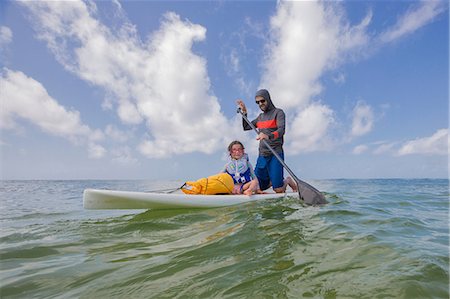
Father and daughter paddle boarding in the Gulf of Mexico, Destin, Florida, USA
Sin royalties Premium
-
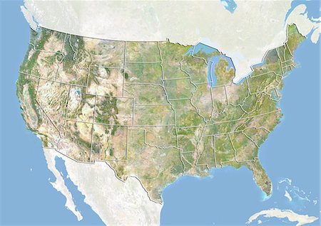
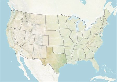
United States, Satellite Image With Bump Effect and State Boundaries
Con derechos protegidos
-

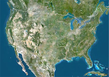
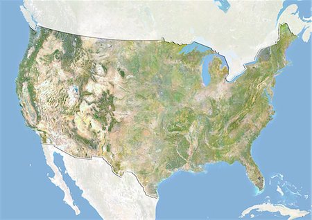
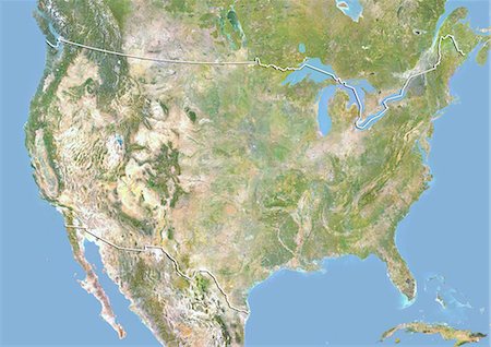
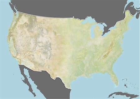
United States, True Colour Satellite Image With State Boundaries
Con derechos protegidos
-

Underwater view of group of sailfish corralling sardine shoal toward surface, Contoy Island, Quintana Roo, Mexico
Sin royalties Premium
-

Bull sharks (Carcharhinus leucas) migrate through the yucatan peninsula from central america in the winter months, Playa del Carmen, Quintana Roo, Mexico
Sin royalties Premium
-
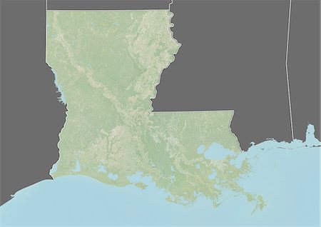
Relief map of the State of Louisiana, United States. This image was taken in 2003 before Hurricane Katrina. It was compiled from data acquired by LANDSAT 7 satellite combined with elevation data.
Con derechos protegidos
-

-

Satellite view of the State of Florida, United States. This image was compiled from data acquired by LANDSAT 5 & 7 satellites.
Con derechos protegidos
-

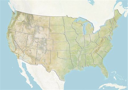
Relief map of the State of Florida, United States. This image was compiled from data acquired by LANDSAT 5 & 7 satellites combined with elevation data.
Con derechos protegidos
-
-
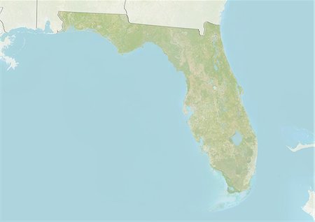
Relief map of the State of Florida, United States. This image was compiled from data acquired by LANDSAT 5 & 7 satellites combined with elevation data.
Con derechos protegidos
-
-

-

Underwater view of whale shark, Isla Mujeres, Quintana Roo, Mexico
Sin royalties Premium
-
United States, Satellite Image With Bump Effect and State Boundaries
Con derechos protegidos
-
United States, Satellite Image With Bump Effect, With Border and Mask
Con derechos protegidos
-
-

United States, True Colour Satellite Image With Border and Mask
Con derechos protegidos
-
-
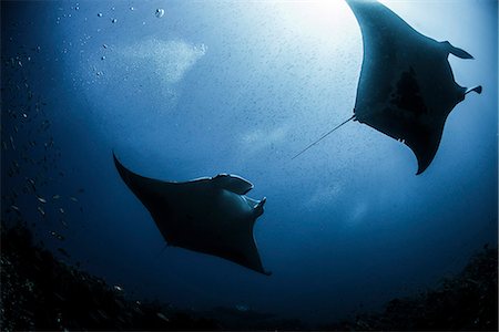
Silhouetted reef manta rays (Manta alfredi) swimming around an underwater pinnacle north of the Yucatan Peninsula, Cabo Catoche, Quintana Roo, Mexico
Sin royalties Premium
-

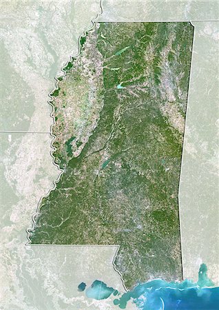
Relief map of the State of Mississippi, United States. This image was compiled from data acquired by LANDSAT 5 & 7 satellites combined with elevation data.
Con derechos protegidos
-

Relief map of the State of Mississippi, United States. This image was compiled from data acquired by LANDSAT 5 & 7 satellites combined with elevation data.
Con derechos protegidos
-

Relief map of the State of Louisiana, United States. This image was taken in 2003 before Hurricane Katrina. It was compiled from data acquired by LANDSAT 7 satellite combined with elevation data.
Con derechos protegidos
-
-
-

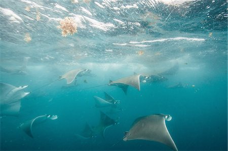
Underwater view of mobula rays gathering for migration around the Yucatan Peninsula, Contoy Island, Quintana Roo, Mexico
Sin royalties Premium
-
-

Hurricane Rita, Cuba, On 20/09/2005, True Colour Satellite Image. Hurricane Rita on 20 September 2005 nearing the Gulf of Mexico. The Bahamas are visible on the right of the image and Cuba down right. True-colour satellite image using MODIS data.
Con derechos protegidos
-
-
-
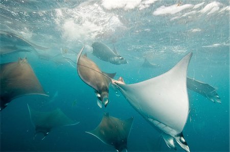
Underwater view of mobula rays gathering for migration around the Yucatan Peninsula, Contoy Island, Quintana Roo, Mexico
Sin royalties Premium
-
-
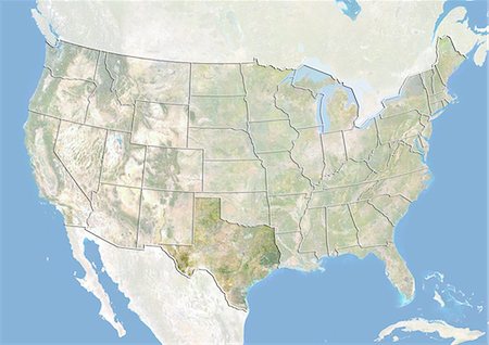
United States and the State of Texas, Satellite Image With Bump Effect
Con derechos protegidos
-
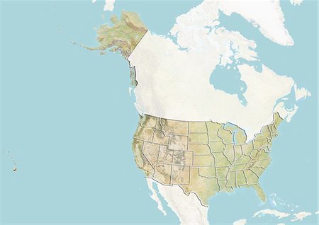
Relief map of the United States (with border and mask). This image was compiled from data acquired by landsat 5 & 7 satellites combined with elevation data.
Con derechos protegidos
-

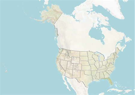
Relief map of the United States and Canada (with border). This image was compiled from data acquired by LANDSAT 5 & 7 satellites combined with elevation data.
Con derechos protegidos
-

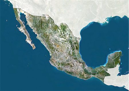
Satellite view of Mexico City, Mexico. This image was compiled from data acquired by LANDSAT 5 & 7 satellites.
Con derechos protegidos
-

United States and the State of Mississippi, Satellite Image With Bump Effect
Con derechos protegidos
-

Underwater view of group of sailfish corralling large sardine shoal, Contoy Island, Quintana Roo, Mexico
Sin royalties Premium
-
Satellite view of the State of Texas, United States. This image was compiled from data acquired by LANDSAT 5 & 7 satellites.
Con derechos protegidos
-
-
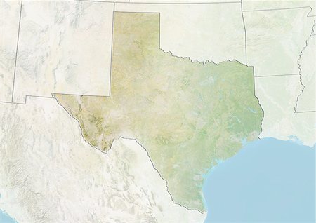
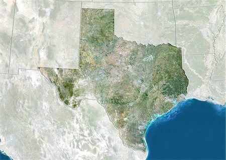
Relief map of the State of Texas, United States. This image was compiled from data acquired by LANDSAT 5 & 7 satellites combined with elevation data.
Con derechos protegidos
-
United States, True Colour Satellite Image With State Boundaries
Con derechos protegidos
-

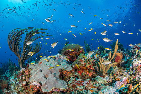
Underwater view of fish swimming near coral covered disposed oil rig in the Gulf of Mexico, Campeche, Mexico
Sin royalties Premium
-
Hurricane Rita, Gulf Of Mexico, On 23/09/2005, True Colour Satellite Image. Hurricane Rita on 23 September 2005 over the Gulf of Mexico. True-colour satellite image using MODIS data.
Con derechos protegidos
-
United States and the State of Texas, True Colour Satellite Image
Con derechos protegidos
-
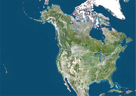
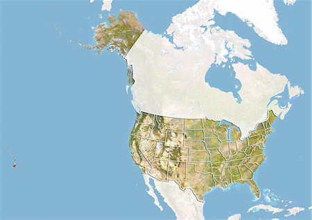
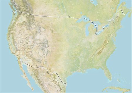
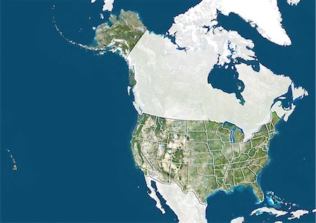
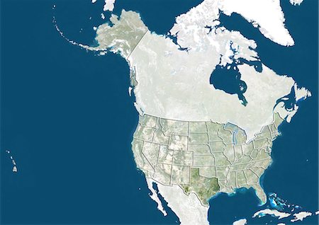
Satellite view of the United States and Canada (with border). This image was compiled from data acquired by LANDSAT 5 & 7 satellites.
Con derechos protegidos
-
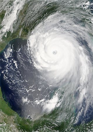
Hurricane Katrina, Louisiana, Us, On 28/08/2005, True Colour Satellite Image. Hurricane Katrina on 28 August 2005 near peak strength over the Gulf of Mexico. True-colour satellite image using MODIS data.
Con derechos protegidos
-
Satellite view of the State of Mississippi, United States. This image was compiled from data acquired by LANDSAT 5 & 7 satellites.
Con derechos protegidos
-

Satellite view of the United States (with border and mask). This image was compiled from data acquired by LANDSAT 5 & 7 satellites.
Con derechos protegidos
-

Hurricane Katrina, Louisiana, Us, On 29/08/2005, True Colour Satellite Image. Hurricane Katrina on 29 August 2005 over New-Orleans, Louisiana, US. True-colour satellite image using MODIS data.
Con derechos protegidos
-
Underwater view of mobula rays gathering for migration around the Yucatan Peninsula, Contoy Island, Quintana Roo, Mexico
Sin royalties Premium
-
-
-
-
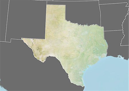
Relief map of the State of Texas, United States. This image was compiled from data acquired by LANDSAT 5 & 7 satellites combined with elevation data.
Con derechos protegidos
-

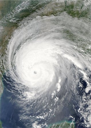
Hurricane Gustav, Louisiana, Us, In 2008, True Colour Satellite Image. Hurricane Gustav on 1st September 2008 over the coast of Louisiana, US. True-colour satellite image using MODIS data.
Con derechos protegidos
-
-

United States and the State of Louisiana, Satellite Image With Bump Effect
Con derechos protegidos


