-

Diverging plates in a volcanic fissure zone, Myvatn, Iceland, Polar Regions
Rights-Managed
-
An aerial view of the volcanic cones at the inlet of Ghoubbet el Kharäb (the Devil's Throat),a region of high seismic activity where deep fractures in the lava continue to widen year by year.
Rights-Managed
-
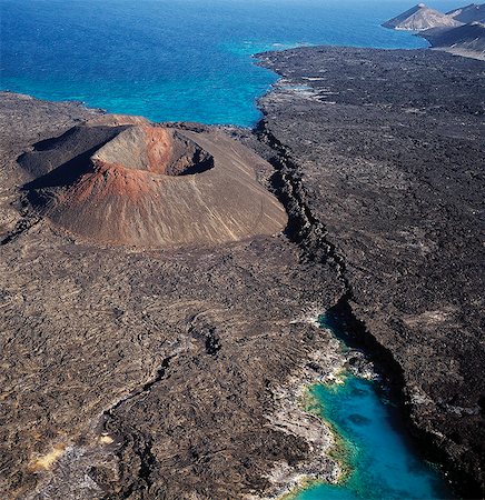
An aerial view of the caldera Sisale Koma,which is 3,937 feet in diameter and 300,000 years old. It is situated at the inlet of Ghoubbet el Kharäb (the Devil's Throat),a region of high seismic activity where deep fractures in the lava continue to widen year by year.
Rights-Managed
-
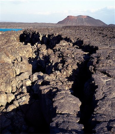
A little distance offshore from the coast of Djibouti, the northern extent of Africas Great Rift Valley abuts a triple junction where the oceanic rifts of the Red Sea and the Gulf of Aden converge.This photograph shows an obvious crack in a huge lava ridge.Other than Iceland, Djibouti is the only country where scientists can observe the sea floor spreading on dry land as two plates move apart.
Rights-Managed
-

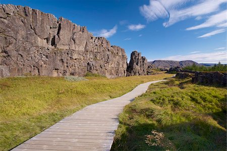
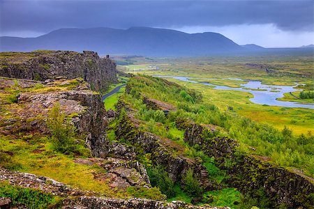
Fault in the landscape caused by continental drift between North American and Eurasian tectonic plates at Thingvellir National Park near Reykjavik, Iceland, Polar Regions
Rights-Managed
-
The Almannagja (All Man's Gorge) cliff face is the backdrop of the Althing, legislative assembly of the past, also the edge of the north American tectonic plate, Thingvellir National Park, UNESCO World Heritage Site, south-west Iceland (Sudurland), Iceland, Polar Regions
Rights-Managed
-

Flosagja (Flosi's Gorge), gorge filled with water in the lava fields between the European and American tectonic plates, Thingvellir National Park, UNESCO World Heritage Site, south-west Iceland (Sudurland), Iceland, Polar Regions
Rights-Managed
-
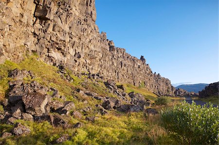
The Almannagja (All Man's Gorge) cliff face is the backdrop of the Althing, legislative assembly of the past, also the edge of the north American tectonic plate, Thingvellir National Park, UNESCO World Heritage Site, south-west Iceland (Sudurland), Iceland, Polar Regions
Rights-Managed
-
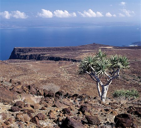
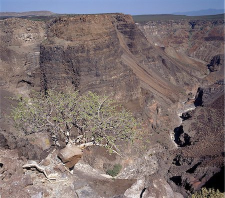
On the inhospitable lava-strewn hills surrounding the inlet of Ghoubbet el Kharäb (the Devil's Throat),a relative of the Dragon's Blood Tree (Dracaena orbet) struggles to survive in low rainfall and temperatures regularly exceeding 1000 F.
Rights-Managed
-
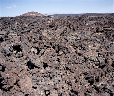
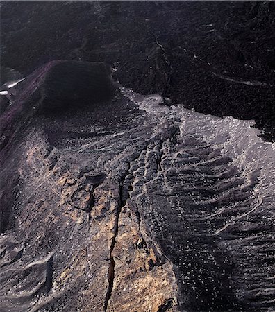
The region surrounding Ghoubbet el Kharäb (the Devil's Throat) is an inhospitable maze of lava rock,which makes walking virtually impossible.
Rights-Managed
-
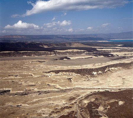
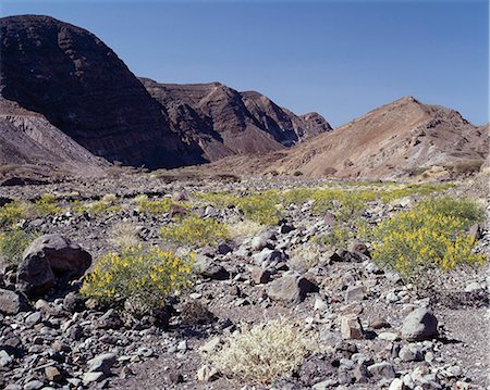
The inhospitable countryside between Garrayto and Lake Assal is strewn with lava and pale,friable material discharged from nearby volcanoes.
Rights-Managed
-
The impressive Canyon d'Adail_,known to the Afar people as Dimbia,is an intersection of rifts and land faulting,south of Ghoubbet el Kharäb.
Rights-Managed
-
A little distance offshore from the coast of Djibouti, the northern extent of Africas Great Rift Valley abuts a triple junction where the oceanic rifts of the Red Sea and the Gulf of Aden converge.This photograph shows an obvious crack in a huge lava ridge.Other than Iceland, Djibouti is the only country where scientists can observe the sea floor spreading on dry land as two plates move apart.
Rights-Managed
-
Thingvellir National Park rift valley in Iceland where North American and Eurasian tectonic plates separate
Budget Royalty-Free & Subscription
-

-

Oxara River tumbles down the Almannagja cliff face at Oxarafoss, Thingvellir National Park, UNESCO World Heritage Site, south-west Iceland (Sudurland), Iceland, Polar Regions
Rights-Managed
-
After a rain shower,shrubs of the Pea family (Papilionoideae) give a splash of colour to the forbidding landscape near Ghoubbet el Kharäb (the Devil's Throat),a region of high seismic activity where deep fractures in the lava continue to widen year by year.
Rights-Managed
-
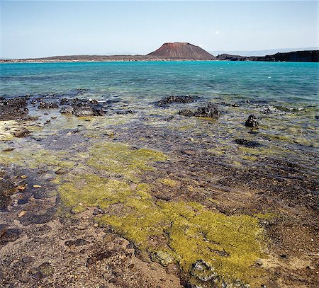
The volcanic island of Ounda Ginni Koma (the small Hill of Devils) situated near Ghoubbet el Kharäb (the Devil's Throat),a region of high seismic activity where deep fractures in the lava continue to widen year by year. The sand around the island is reddish due to the colour of some friable volcanic material.
Rights-Managed
-
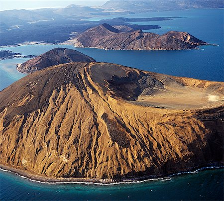
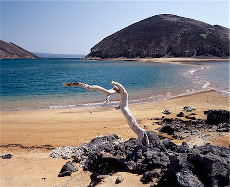
A perfect cone-shaped volcano juts into a beautiful turquoise sea at Ghoubbet el Kharäb (the Devil's Throat),a region of high seismic activity.
Rights-Managed
-
-

-

Earthquake Crack Destroying A House Natural Force Flat Vector Simplified Style Graphic Design Icon Isolated On White Background
Budget Royalty-Free & Subscription
-

-

Icon set showing a line measured by a seismograph with a target signaling the start of an earthquake
Budget Royalty-Free & Subscription
-

geology 3d inscription bright volume letter and textbooks and computer mouse on white background
Budget Royalty-Free & Subscription
-

-

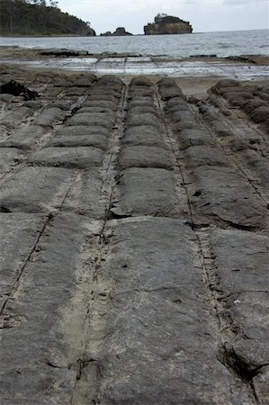
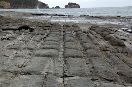
The natural phenomenon of tessellated pavement in Tasmania, caused by erosion of tectonic cracks in the rock
Budget Royalty-Free & Subscription
-

The natural phenomenon of tessellated pavement in Tasmania, caused by erosion of tectonic cracks in the rock
Budget Royalty-Free & Subscription
-
The natural phenomenon of tessellated pavement in Tasmania, caused by erosion of tectonic cracks in the rock
Budget Royalty-Free & Subscription
-
The natural phenomenon of tessellated pavement in Tasmania, caused by erosion of tectonic cracks in the rock
Budget Royalty-Free & Subscription
-

The natural phenomenon of tessellated pavement in Tasmania, caused by erosion of tectonic cracks in the rock
Budget Royalty-Free & Subscription
-

The natural phenomenon of tessellated pavement in Tasmania, caused by erosion of tectonic cracks in the rock
Budget Royalty-Free & Subscription
-

The natural phenomenon of tessellated pavement in Tasmania, caused by erosion of tectonic cracks in the rock
Budget Royalty-Free & Subscription


