-
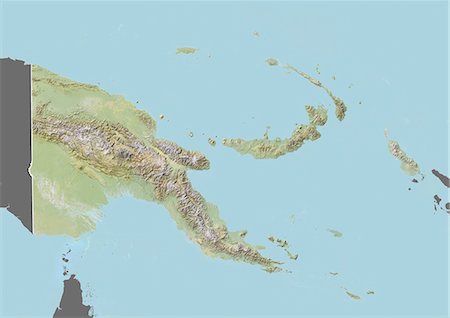
Relief map of Papua New Guinea (with border and mask). This image was compiled from data acquired by landsat 5 & 7 satellites combined with elevation data.
Rights-Managed
-

-

-
-
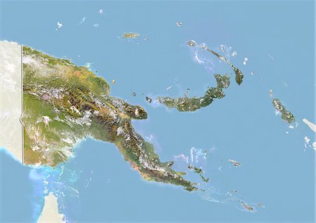
Papua New Guinea, Satellite Image With Bump Effect, With Border and Mask
Rights-Managed
-
-
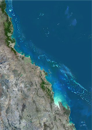
Satellite view of the Central Great Barrier Reef along Queensland's coastline in north-east Australia. The area covered goes from Cairns at north down to Townsville, Mackay and Rockhampton at south. This image was compiled from data acquired in 2014 by Landsat 8 satellite.
Rights-Managed
-
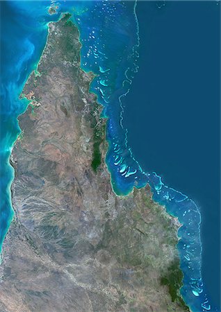
Satellite view of the Northern Great Barrier Reef along the east coast of Cape York Peninsula in north Australia. This image was compiled from data acquired in 2014 by Landsat 8 satellite.
Rights-Managed
-
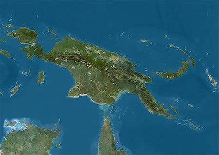
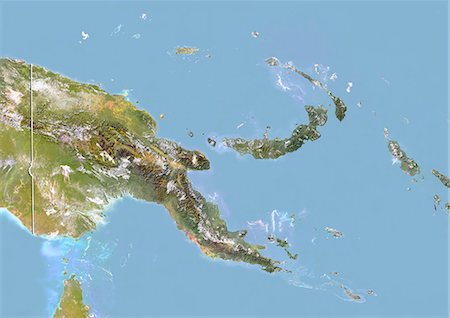
Satellite view of New Guinea. This image was compiled from data acquired by Landsat satellites.
Rights-Managed
-
-
-

-

-
-

-

-

-
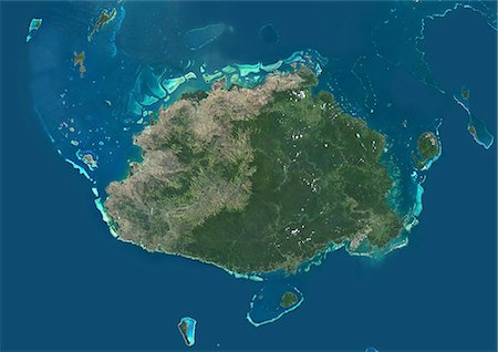
Satellite view of Viti Levu Island, Fiji. This is the largest island in the Republic of Fiji and the site of the nation's capital, Suva. This image was compiled from data acquired by Landsat 8 satellite in 2014.
Rights-Managed
-

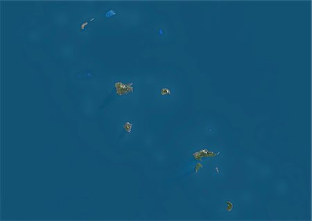
Satellite view of Vanua Balavu Island, Fiji. This image was compiled from data acquired by Landsat 8 satellite in 2014.
Rights-Managed
-
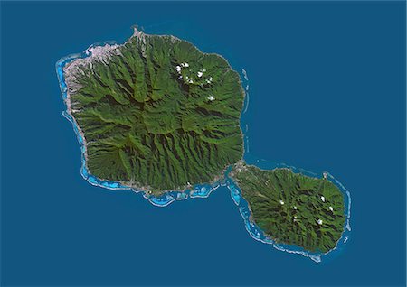
Satellite view of Tahiti, French Polynesia. This image was compiled from data acquired by Landsat 8 satellite in 2014.
Rights-Managed
-
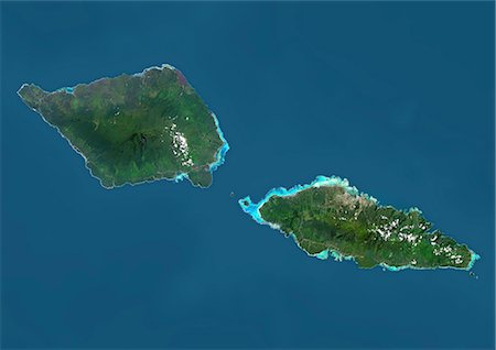
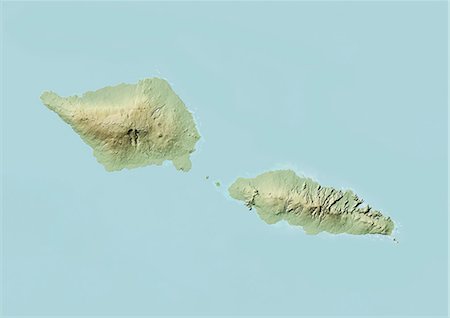
Satellite view of Samoa that consists of two large islands, Upolu and Savaii. This image was compiled from data acquired by Landsat 8 satellite in 2014.
Rights-Managed
-

Satellite view of New Zealand. This image was compiled from data acquired by Landsat 8 satellite in 2014.
Rights-Managed
-
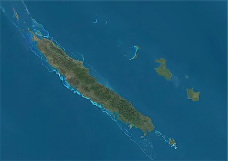
Satellite view of New Caledonia. This image was compiled from data acquired by Landsat satellites.
Rights-Managed
-
Satellite view of the Marquesas Islands, French Polynesia. This image was compiled from data acquired by Landsat 8 satellite in 2014.
Rights-Managed
-
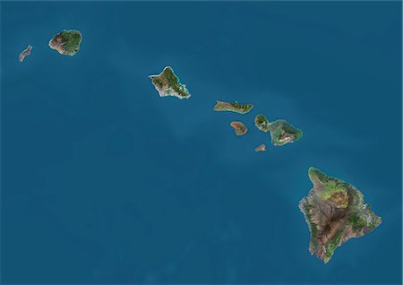
Satellite view of the State of Hawaii, USA. The main islands are Kauai, Oahu, Maui and the Island of Hawaii. This image was compiled from data acquired by Landsat 8 satellite in 2014.
Rights-Managed
-

Satellite view of the Island of Hawaii, USA. The island is formed of five volcanoes, Mauna Loa being the largest. This image was compiled from data acquired by Landsat 8 satellite in 2014.
Rights-Managed
-
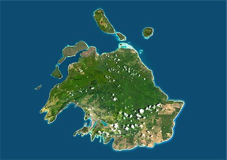
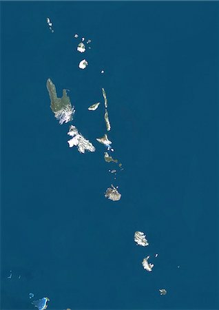
Satellite view of Efate, Vanuatu. It is the most populous island of Vanuatu archipelago. This image was compiled from data acquired by Landsat 8 satellite in 2014.
Rights-Managed
-
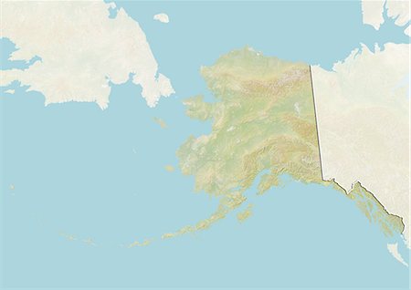
Relief map of the State of Alaska, United States. This image was compiled from data acquired by LANDSAT 5 & 7 satellites combined with elevation data.
Rights-Managed
-

Relief map of the State of Alaska, United States. This image was compiled from data acquired by LANDSAT 5 & 7 satellites combined with elevation data.
Rights-Managed
-
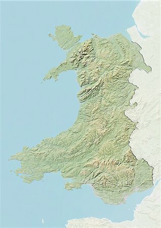
Relief map of Wales, United Kingdom. This image was compiled from data acquired by LANDSAT 5 & 7 satellites combined with elevation data.
Rights-Managed
-

Relief map of Scotland, United Kingdom. This image was compiled from data acquired by LANDSAT 5 & 7 satellites combined with elevation data.
Rights-Managed
-

Relief map of Scotland including Shetland, United Kingdom. This image was compiled from data acquired by LANDSAT 5 & 7 satellites combined with elevation data.
Rights-Managed
-
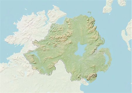
Relief map of Northern Ireland, United Kingdom. This image was compiled from data acquired by LANDSAT 5 & 7 satellites combined with elevation data.
Rights-Managed
-
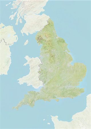
Relief map of England, United Kingdom. This image was compiled from data acquired by LANDSAT 5 & 7 satellites combined with elevation data.
Rights-Managed
-

Relief map of the region of Shikoku, Japan. This image was compiled from data acquired by LANDSAT 5 & 7 satellites combined with elevation data.
Rights-Managed
-

Relief map of the region of Shikoku, Japan. This image was compiled from data acquired by LANDSAT 5 & 7 satellites combined with elevation data.
Rights-Managed
-

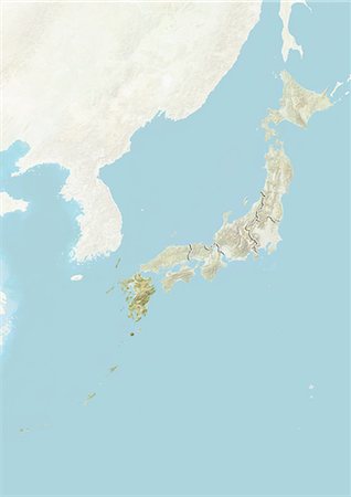
Relief map of the region of Kyushu, Japan. This image was compiled from data acquired by LANDSAT 5 & 7 satellites combined with elevation data.
Rights-Managed
-
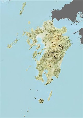
Relief map of the region of Kyushu, Japan. This image was compiled from data acquired by LANDSAT 5 & 7 satellites combined with elevation data.
Rights-Managed
-

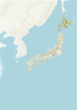
Relief map of the region of Hokkaido, Japan. This image was compiled from data acquired by LANDSAT 5 & 7 satellites combined with elevation data.
Rights-Managed
-
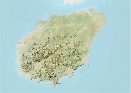
Relief map of the province of Hainan, China. This image was compiled from data acquired by LANDSAT 5 & 7 satellites combined with elevation data.
Rights-Managed
-
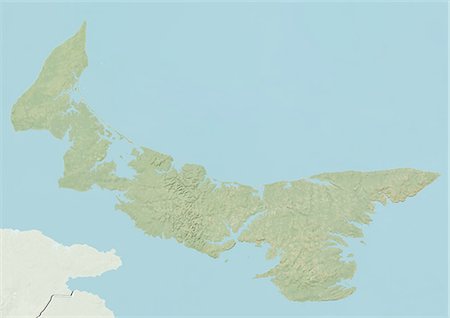
Relief map of Prince Edward Island, Canada. This image was compiled from data acquired by LANDSAT 5 & 7 satellites combined with elevation data.
Rights-Managed
-

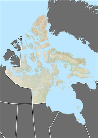
Relief map of Nunavut, Canada. This image was compiled from data acquired by LANDSAT 5 & 7 satellites combined with elevation data.
Rights-Managed
-
Relief map of Nunavut, Canada. This image was compiled from data acquired by LANDSAT 5 & 7 satellites combined with elevation data.
Rights-Managed
-
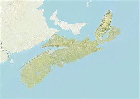
Relief map of Nova Scotia, Canada. This image was compiled from data acquired by LANDSAT 5 & 7 satellites combined with elevation data.
Rights-Managed
-
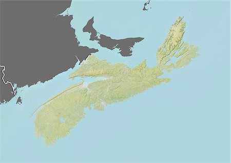
Relief map of Nova Scotia, Canada. This image was compiled from data acquired by LANDSAT 5 & 7 satellites combined with elevation data.
Rights-Managed
-

Relief map of the Northwest Territories, Canada. This image was compiled from data acquired by LANDSAT 5 & 7 satellites combined with elevation data.
Rights-Managed
-

Relief map of the Northwest Territories, Canada. This image was compiled from data acquired by LANDSAT 5 & 7 satellites combined with elevation data.
Rights-Managed
-

Relief map of Newfoundland and Labrador, Canada. This image was compiled from data acquired by LANDSAT 5 & 7 satellites combined with elevation data.
Rights-Managed
-

Relief map of Newfoundland and Labrador, Canada. This image was compiled from data acquired by LANDSAT 5 & 7 satellites combined with elevation data.
Rights-Managed
-

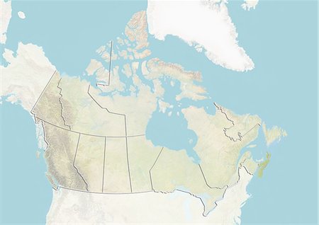
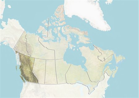
Relief map of British Columbia, Canada. This image was compiled from data acquired by LANDSAT 5 & 7 satellites combined with elevation data.
Rights-Managed
-
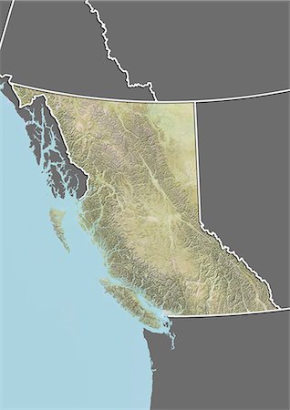
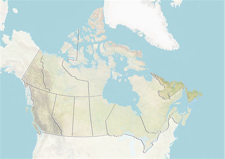
Relief map of British Columbia, Canada. This image was compiled from data acquired by LANDSAT 5 & 7 satellites combined with elevation data.
Rights-Managed
-

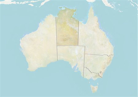
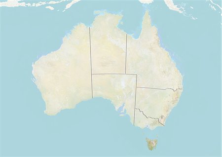
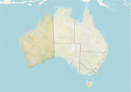
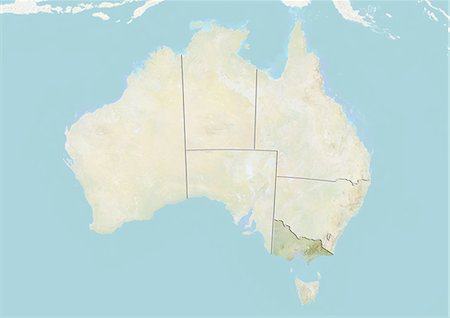
Relief map of the State of Western Australia, Australia. This image was compiled from data acquired by LANDSAT 5 & 7 satellites combined with elevation data.
Rights-Managed
-

Relief map of the State of Victoria, Australia. This image was compiled from data acquired by LANDSAT 5 & 7 satellites combined with elevation data.
Rights-Managed
-

Relief map of the State of South Australia, Australia. This image was compiled from data acquired by LANDSAT 5 & 7 satellites combined with elevation data.
Rights-Managed
-
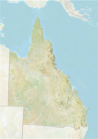
Relief map of the State of Queensland, Australia. This image was compiled from data acquired by LANDSAT 5 & 7 satellites combined with elevation data.
Rights-Managed
-

Relief map of the Northern Territory, Australia. This image was compiled from data acquired by LANDSAT 5 & 7 satellites combined with elevation data.
Rights-Managed
-
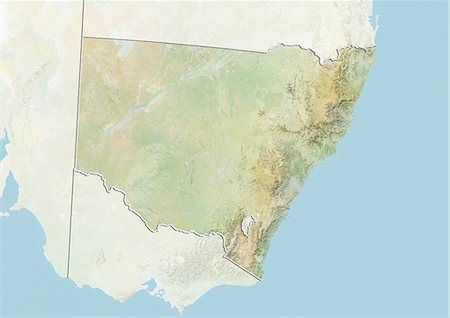
Relief map of the State of New South Wales, Australia. This image was compiled from data acquired by LANDSAT 5 & 7 satellites combined with elevation data.
Rights-Managed
-
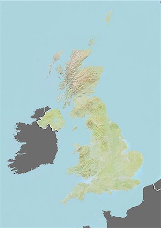
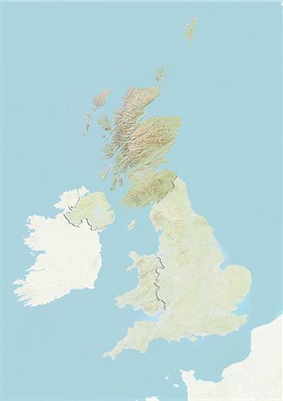
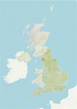
Relief map of the United Kingdom (with border and mask). This image was compiled from data acquired by landsat 5 & 7 satellites combined with elevation data.
Rights-Managed
-
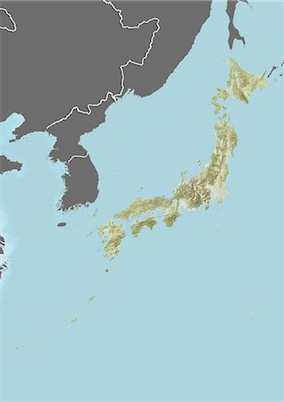
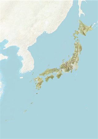
Relief map of Japan (with border and mask). This image was compiled from data acquired by landsat 5 & 7 satellites combined with elevation data.
Rights-Managed
-
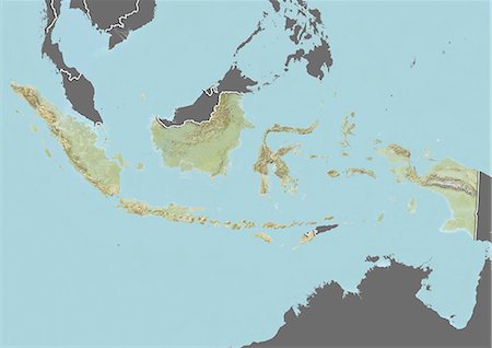
Relief map of Indonesia (with border and mask). This image was compiled from data acquired by landsat 5 & 7 satellites combined with elevation data.
Rights-Managed
-
Relief map of Haiti (with border and mask). This image was compiled from data acquired by landsat 5 & 7 satellites combined with elevation data.
Rights-Managed
-

Relief map of Haiti (with border and mask). This image was compiled from data acquired by landsat 5 & 7 satellites combined with elevation data.
Rights-Managed
-

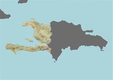
Relief map of the Dominican Republic (with border and mask). This image was compiled from data acquired by landsat 5 & 7 satellites combined with elevation data.
Rights-Managed
-

Relief map of the Dominican Republic (with border and mask). This image was compiled from data acquired by landsat 5 & 7 satellites combined with elevation data.
Rights-Managed
-

-

-
-

-

-

-

-
-
-

-
-
-

-

-

-
-

-
-
-

-
-
-

-

-

-