-
-
-
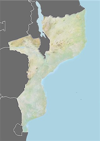
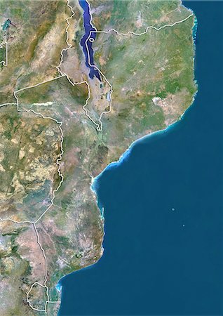
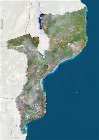
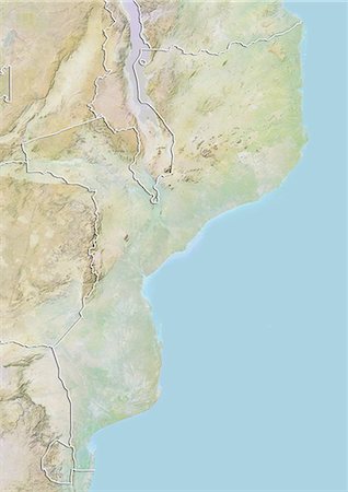
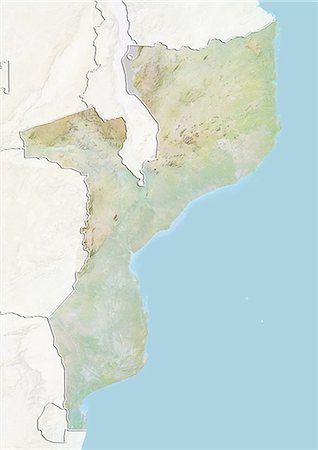
Relief map of Mozambique (with border and mask). This image was compiled from data acquired by landsat 5 & 7 satellites combined with elevation data.
Rights-Managed
-
-
-
-
-

Satellite view of Tenerife, Canary Islands, Spain. It is the largest and most populous island of the seven Canary Islands. Volcano Mount Teide at center is the highest point of Spain, at 3718 m. This image was compiled from data acquired by Landsat 8 satellite in 2014.
Rights-Managed
-

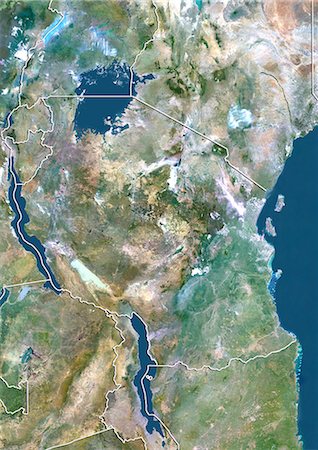
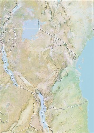
Satellite view of Southern Africa. It shows the African Great Lakes region. This image was compiled from data acquired by Landsat 7 & 8 satellites.
Rights-Managed
-

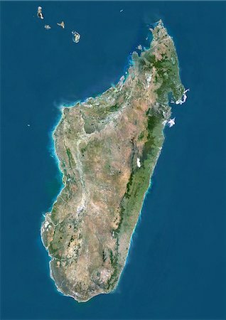
Satellite view of Madagascar. Comoros and Mayotte islands are at North. This image was compiled from data acquired by Landsat satellites.
Rights-Managed
-
-
-
-
-

-

-

-

-
-

-
-
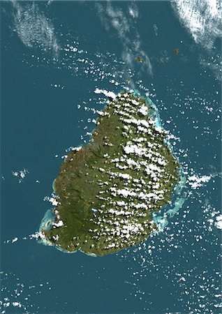
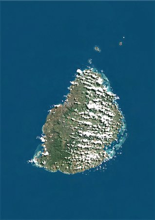
Mauritius, True Colour Satellite Image. Mauritius, true colour satellite image, taken on 19 August 1999, by the LANDSAT 7 satellite.
Rights-Managed
-
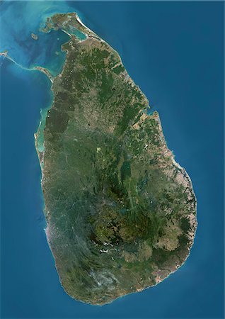
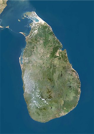
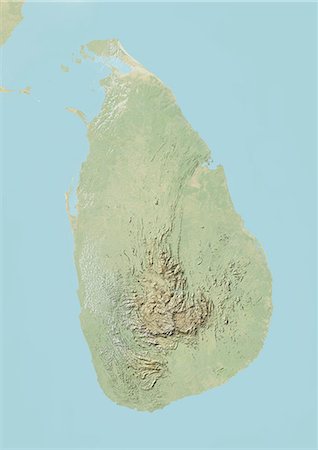
Satellite view of Sri Lanka. This image was compiled from data acquired by Landsat 8 satellite in 2014.
Rights-Managed
-

Satellite view of North Africa. This image was compiled from data acquired by Landsat 7 & 8 satellites.
Rights-Managed
-
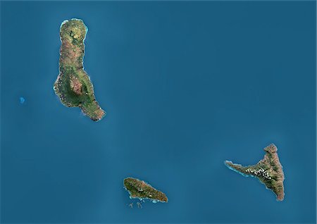
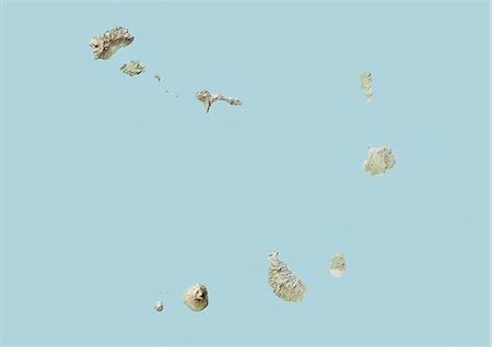
Satellite view of the Comoros Archipelago. This image was compiled from data acquired by Landsat satellites.
Rights-Managed
-

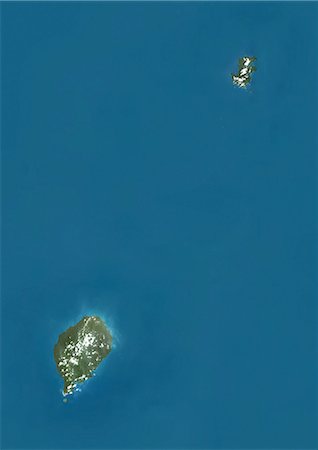
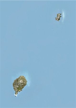
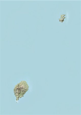
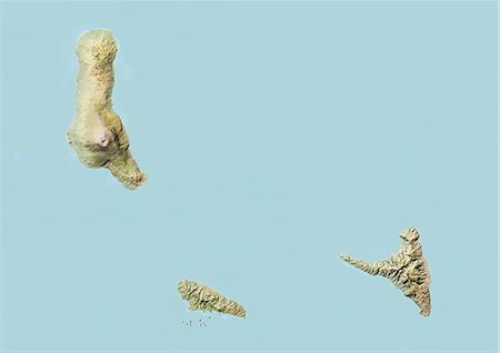
Satellite view of Cape Verde Southern Islands showing Fogo, Santiago and Miao islands. This image was compiled from data acquired by Landsat satellites.
Rights-Managed
-
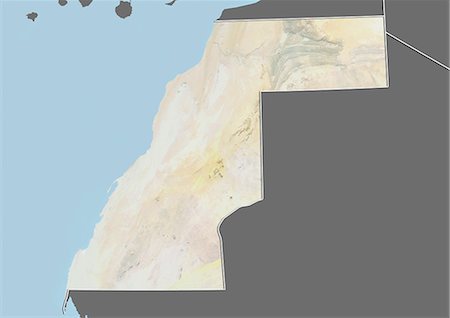
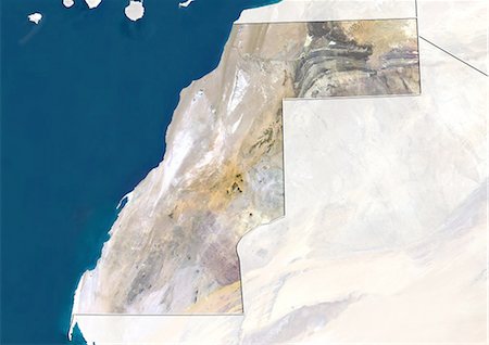
Relief map of Western Sahara (with border and mask). This image was compiled from data acquired by landsat 5 & 7 satellites combined with elevation data.
Rights-Managed
-
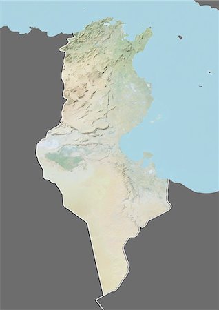
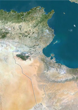
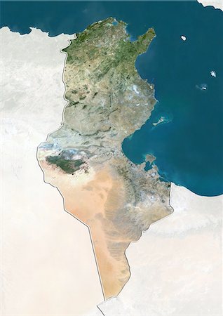
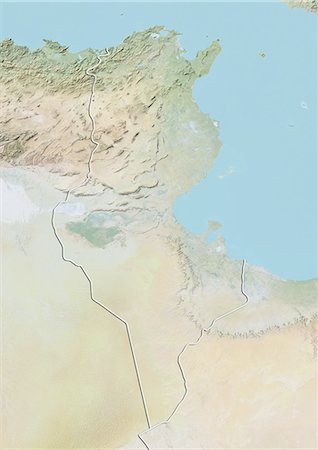
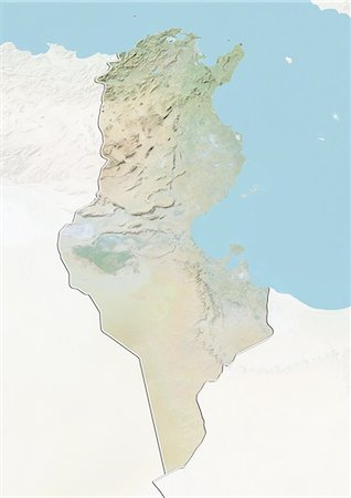
Relief map of Tunisia (with border and mask). This image was compiled from data acquired by landsat 5 & 7 satellites combined with elevation data.
Rights-Managed
-
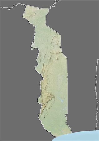
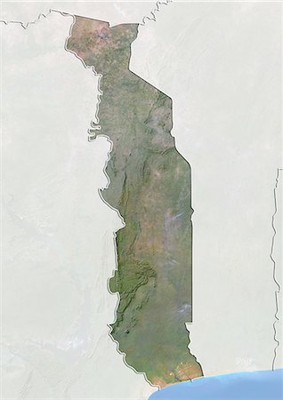
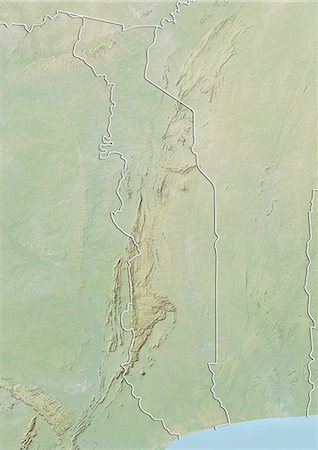
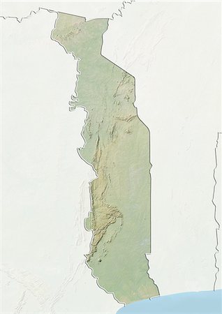
Relief map of Togo (with border and mask). This image was compiled from data acquired by landsat 5 & 7 satellites combined with elevation data.
Rights-Managed
-
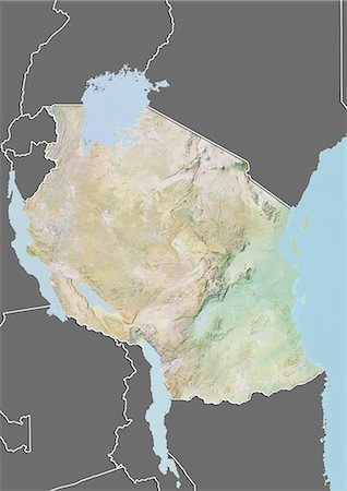
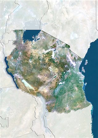
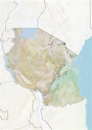
Relief map of Tanzania (with border and mask). This image was compiled from data acquired by landsat 5 & 7 satellites combined with elevation data.
Rights-Managed
-
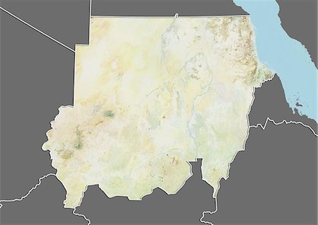
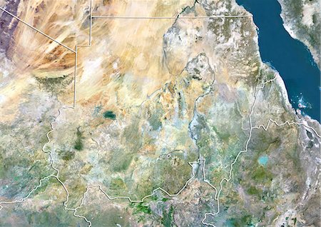
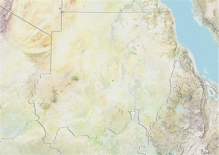
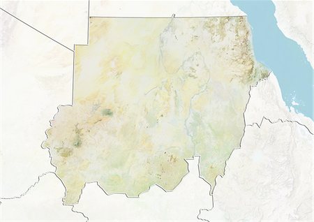
Relief map of Sudan (with border and mask). This image was compiled from data acquired by landsat 5 & 7 satellites combined with elevation data.
Rights-Managed
-
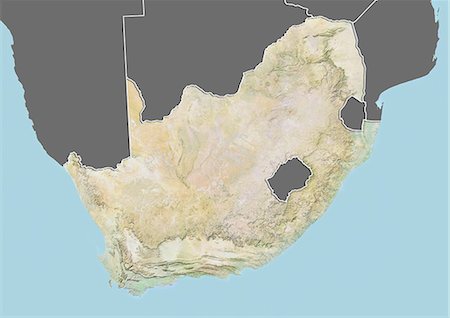
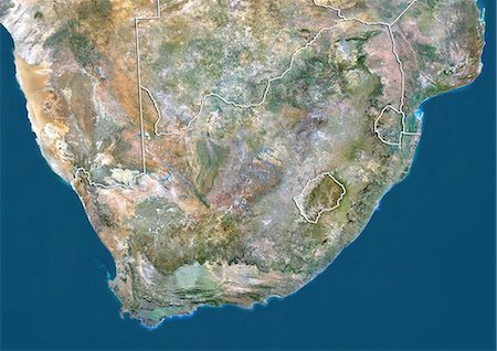
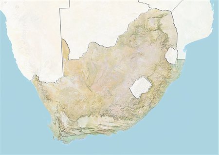
Relief map of South Africa (with border and mask). This image was compiled from data acquired by landsat 5 & 7 satellites combined with elevation data.
Rights-Managed
-
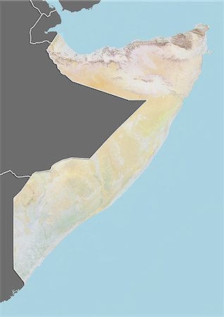
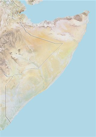
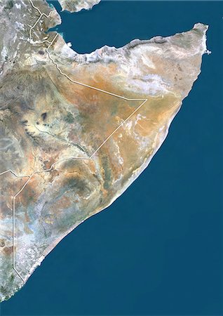
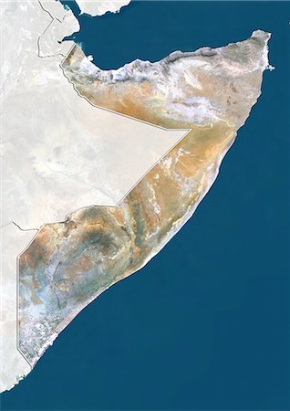
Relief map of Somalia (with border and mask). This image was compiled from data acquired by landsat 5 & 7 satellites combined with elevation data.
Rights-Managed
-
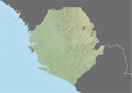
Relief map of Sierra Leone (with border and mask). This image was compiled from data acquired by landsat 5 & 7 satellites combined with elevation data.
Rights-Managed
-

Relief map of Senegal (with border and mask). This image was compiled from data acquired by landsat 5 & 7 satellites combined with elevation data.
Rights-Managed
-
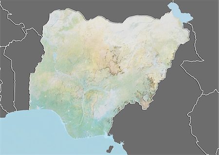
Relief map of Nigeria (with border and mask). This image was compiled from data acquired by landsat 5 & 7 satellites combined with elevation data.
Rights-Managed
-

Relief map of Namibia (with border and mask). This image was compiled from data acquired by landsat 5 & 7 satellites combined with elevation data.
Rights-Managed
-
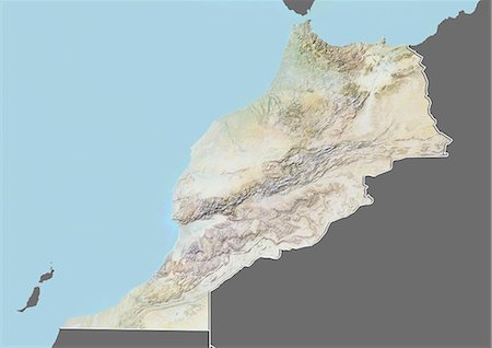
Relief map of Morocco (with border and mask). This image was compiled from data acquired by landsat 5 & 7 satellites combined with elevation data.
Rights-Managed
-
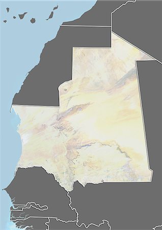
Relief map of Mauritania (with border and mask). This image was compiled from data acquired by landsat 5 & 7 satellites combined with elevation data.
Rights-Managed
-
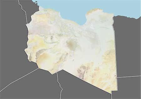
Relief map of Libya (with border and mask). This image was compiled from data acquired by landsat 5 & 7 satellites combined with elevation data.
Rights-Managed
-
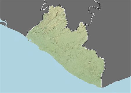
Relief map of Liberia (with border and mask). This image was compiled from data acquired by landsat 5 & 7 satellites combined with elevation data.
Rights-Managed
-
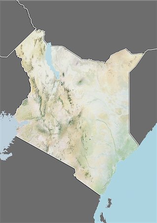
Relief map of Kenya (with border and mask). This image was compiled from data acquired by landsat 5 & 7 satellites combined with elevation data.
Rights-Managed
-
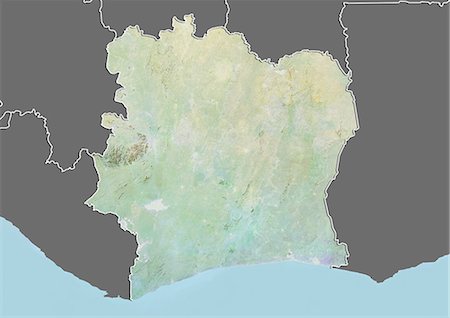
Relief map of Ivory Coast (with border and mask). This image was compiled from data acquired by landsat 5 & 7 satellites combined with elevation data.
Rights-Managed
-
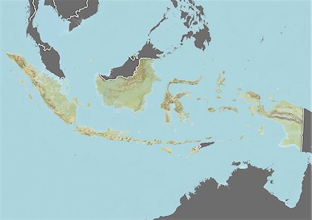
Relief map of Indonesia (with border and mask). This image was compiled from data acquired by landsat 5 & 7 satellites combined with elevation data.
Rights-Managed
-
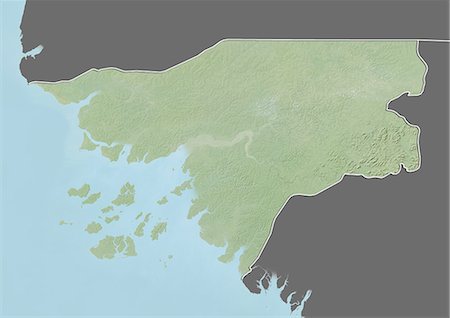
Relief map of Guinea-Bissau (with border and mask). This image was compiled from data acquired by landsat 5 & 7 satellites combined with elevation data.
Rights-Managed
-
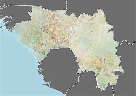
Relief map of Guinea (with border and mask). This image was compiled from data acquired by landsat 5 & 7 satellites combined with elevation data.
Rights-Managed
-
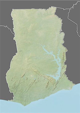
Relief map of Ghana (with border and mask). This image was compiled from data acquired by landsat 5 & 7 satellites combined with elevation data.
Rights-Managed
-
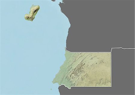
Relief map of Gambia (with border and mask). This image was compiled from data acquired by landsat 5 & 7 satellites combined with elevation data.
Rights-Managed
-
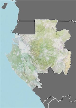
Relief map of Gabon (with border and mask). This image was compiled from data acquired by landsat 5 & 7 satellites combined with elevation data.
Rights-Managed
-
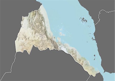
Relief map of Eritrea (with border and mask). This image was compiled from data acquired by landsat 5 & 7 satellites combined with elevation data.
Rights-Managed
-
Relief map of Equatorial Guinea (with border and mask). This image was compiled from data acquired by landsat 5 & 7 satellites combined with elevation data.
Rights-Managed
-
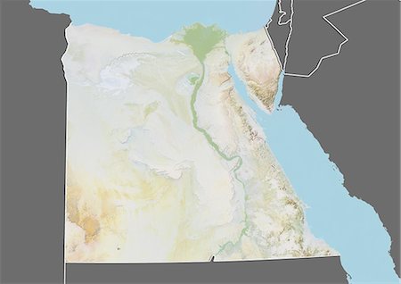
Relief map of Egypt (with border and mask). This image was compiled from data acquired by landsat 5 & 7 satellites combined with elevation data.
Rights-Managed
-
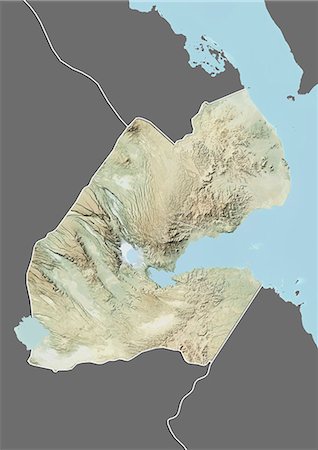
Relief map of Djibouti (with border and mask). This image was compiled from data acquired by landsat 5 & 7 satellites combined with elevation data.
Rights-Managed
-

Relief map of Democratic Republic of Congo (with border and mask). This image was compiled from data acquired by landsat 5 & 7 satellites combined with elevation data.
Rights-Managed
-
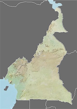
Relief map of Cameroon (with border and mask). This image was compiled from data acquired by landsat 5 & 7 satellites combined with elevation data.
Rights-Managed
-
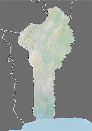
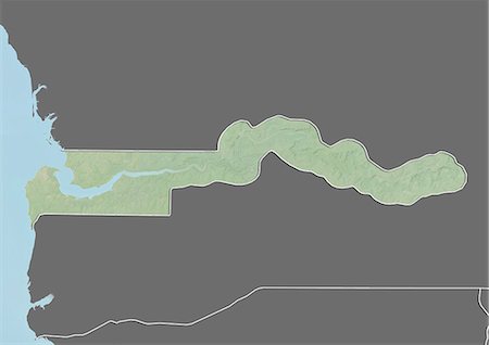
Relief map of Benin (with border and mask). This image was compiled from data acquired by landsat 5 & 7 satellites combined with elevation data.
Rights-Managed
-

Relief map of Angola (with border and mask). This image was compiled from data acquired by landsat 5 & 7 satellites combined with elevation data.
Rights-Managed
-
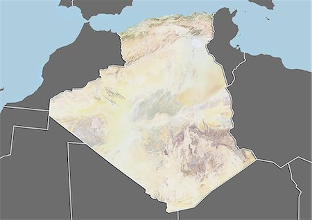
Relief map of Algeria (with border and mask). This image was compiled from data acquired by landsat 5 & 7 satellites combined with elevation data.
Rights-Managed
-

-
-
-
-
-
-
-
-

-

-

-
-
-
-
-
-
-
-
-

-
-
-
-

-
-
-

-

-
-
-
-