-

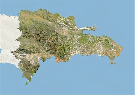
Relief map of the Dominican Republic (with border and mask). This image was compiled from data acquired by landsat 5 & 7 satellites combined with elevation data.
Rights-Managed
-

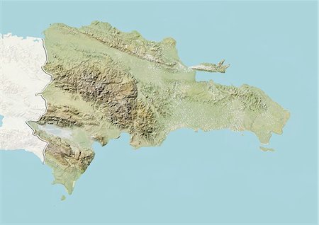
Relief map of the Dominican Republic (with border and mask). This image was compiled from data acquired by landsat 5 & 7 satellites combined with elevation data.
Rights-Managed
-
-
-

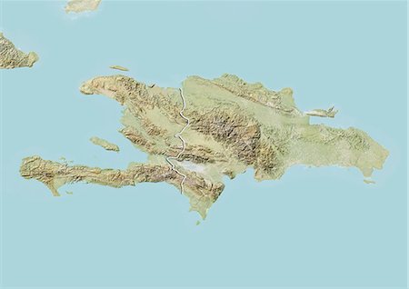
Dominican Republic and Haiti, Satellite Image With Bump Effect, With Border
Rights-Managed
-
Dominican Republic, Satellite Image With Bump Effect, With Border and Mask
Rights-Managed
-
-

-
-
-
-
Dominican Republic, Satellite Image With Bump Effect, With Border and Mask
Rights-Managed
-

-
-

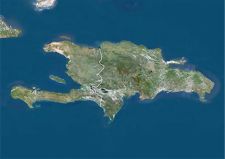
Satellite view of Haiti and The Dominican Republic. This image was compiled from data acquired by Landsat satellites.
Rights-Managed
-
Satellite view of The Greater Antilles and Bahamas. This image was compiled from data acquired by Landsat satellites.
Rights-Managed
-

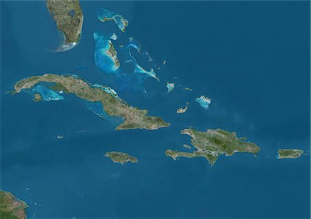
Satellite view of the Caribbean Sea. The entire area of the Caribbean Sea, including all islands of the West Indies is collectively known as the Caribbean. This image was compiled from data acquired by Landsat satellites.
Rights-Managed
-
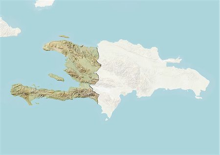
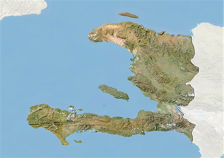
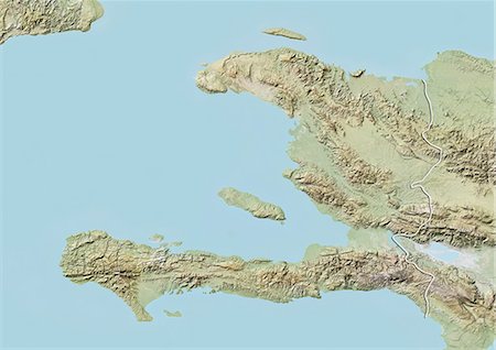
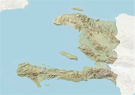
Relief map of Haiti (with border and mask). This image was compiled from data acquired by landsat 5 & 7 satellites combined with elevation data.
Rights-Managed
-

Relief map of Haiti (with border and mask). This image was compiled from data acquired by landsat 5 & 7 satellites combined with elevation data.
Rights-Managed
-
-

-
-
-

-
-
-

-

-
-
-
-

-
-
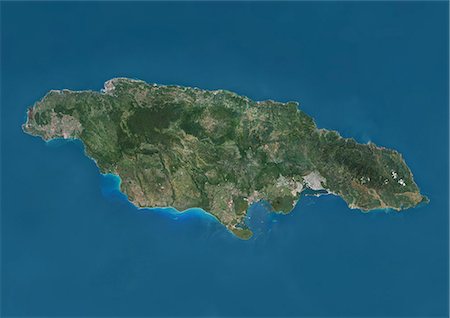
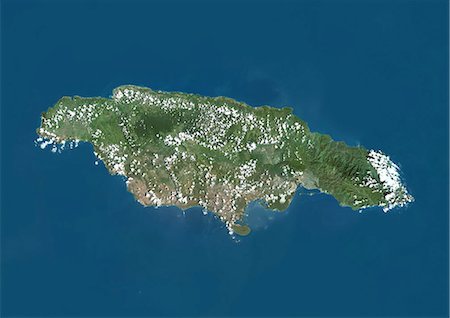
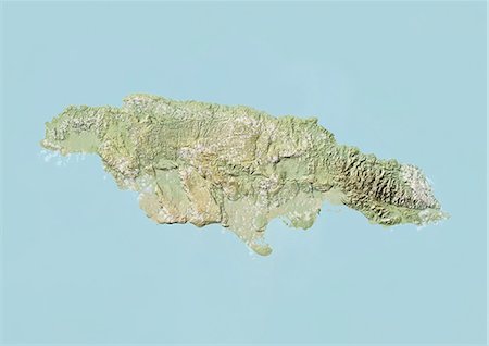
Satellite view of Jamaica. This image was compiled from data acquired by Landsat satellites.
Rights-Managed
-
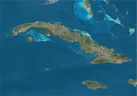
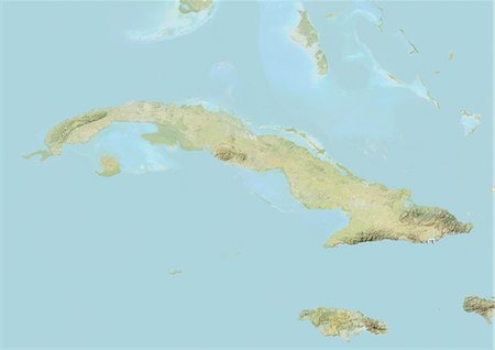
Satellite view of Cuba and Jamaica. This image was compiled from data acquired by Landsat satellites.
Rights-Managed
-
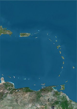
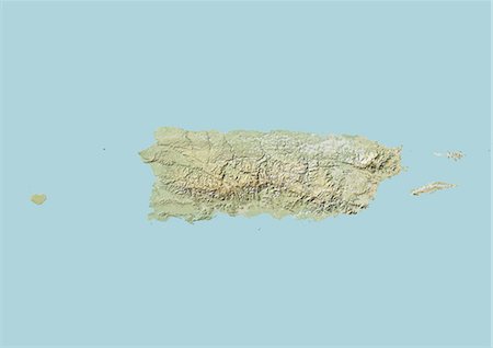
Satellite view of Islands of the Lesser Antilles and Puerto Rico and Puerto Rico in the Caribbean. This image was compiled from data acquired by Landsat satellites.
Rights-Managed
-
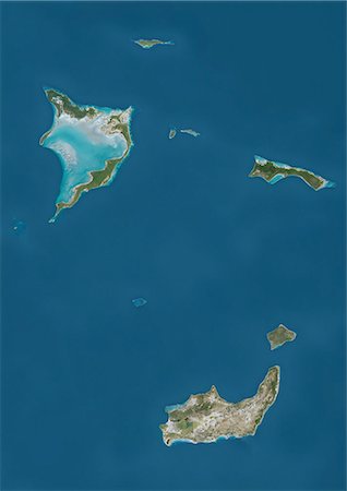
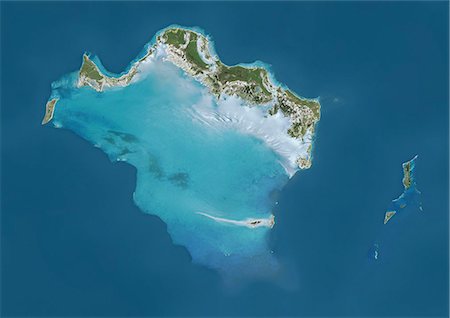
Satellite view of Bahamas Southern Islands comprising Acklins and Crooked Island, Inagua and Mayaguana. This image was compiled from data acquired by Landsat satellites.
Rights-Managed
-

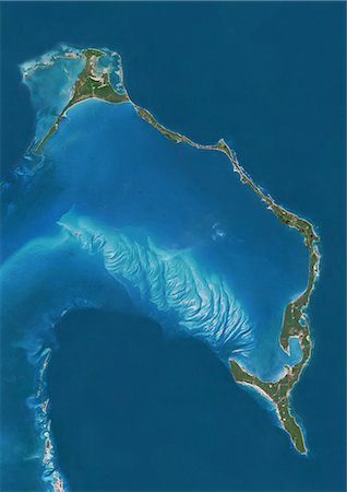
Satellite view of New Providence and Eleuthera Island, Bahamas. New Providence is the most populous island in the Bahamas and it houses the capital city of Nassau. This image was compiled from data acquired by Landsat satellites.
Rights-Managed
-

Satellite view of Andros Islands and New Providence, Bahamas. New Providence is the most populous island in the Bahamas and it houses the capital city of Nassau. This image was compiled from data acquired by Landsat satellites.
Rights-Managed
-

Satellite view of Grand Bahama and Abaco Islands, Bahamas. This image was compiled from data acquired by Landsat satellites.
Rights-Managed
-
Satellite view of Eleuthera Island, Bahamas. This image was compiled from data acquired by Landsat satellites.
Rights-Managed
-
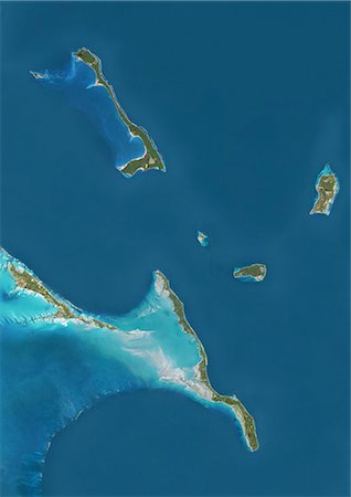
Satellite view of Cat Island, Great Exuma and Long Island, Bahamas. San Salvador Island and Rum Cay are also to be seen on the image. This image was compiled from data acquired by Landsat satellites.
Rights-Managed
-
Satellite view of Andros, New Providence and Eleuthera Islands, Bahamas. New Providence is the most populous island in the Bahamas and it houses the capital city of Nassau. This image was compiled from data acquired by Landsat satellites.
Rights-Managed
-

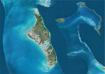
Satellite view of the Abaco Islands that lie in the northern Bahamas. They comprise the main islands of Great Abaco and Little Abaco, along with smaller barrier cays. This image was compiled from data acquired by Landsat satellites.
Rights-Managed
-
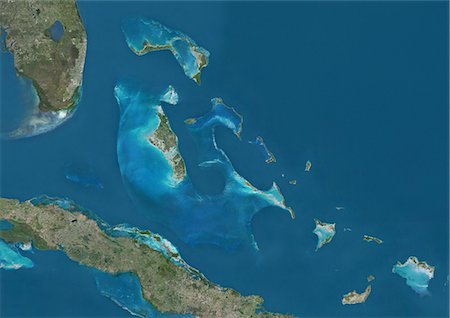
Satellite view of The Bahamas. It consists of more than 700 islands, cays and islets in the Atlantic Ocean, north of Cuba and southeast of the US state of Florida. The capital is Nassau on the island of New Providence. This image was compiled from data acquired by Landsat satellites.
Rights-Managed
-

-
-
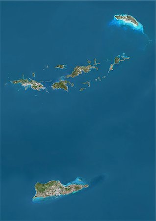
Satellite view of British and US Virgin Islands. This image was compiled from data acquired by Landsat satellites.
Rights-Managed
-

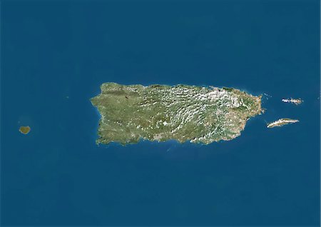
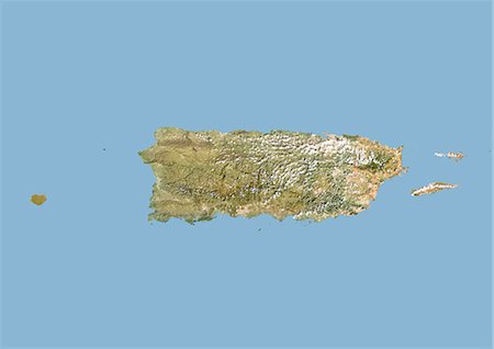
Satellite view of Puerto Rico. This image was compiled from data acquired by Landsat satellites.
Rights-Managed
-
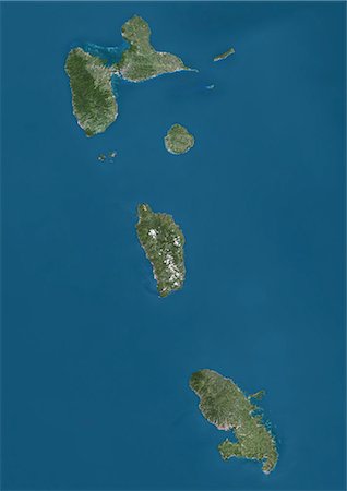
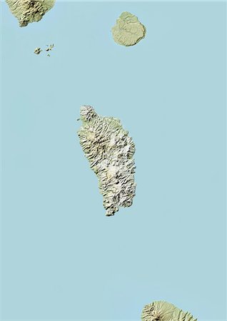
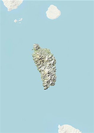
Satellite view of Guadeloupe, Dominica and Martinique. This image was compiled from data acquired by Landsat satellites.
Rights-Managed
-

Satellite view of Guadeloupe. This image was compiled from data acquired by Landsat satellites.
Rights-Managed
-
-
-
-
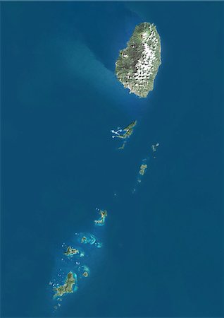
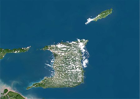
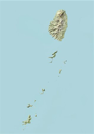
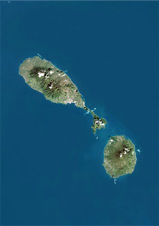
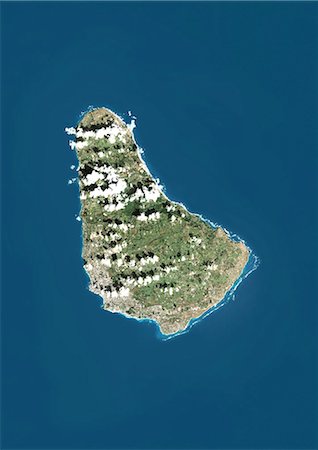
Saint Vincent and the Grenadines, True Colour Satellite Image With Border
Rights-Managed
-

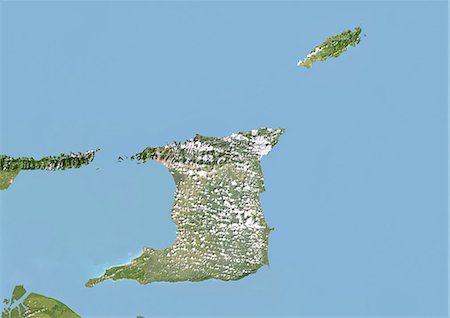
Saint Vincent and the Grenadines, Satellite Image With Bump Effect, With Border
Rights-Managed
-
-

-
-

-
-
-
-
-
-
-
-

-

-
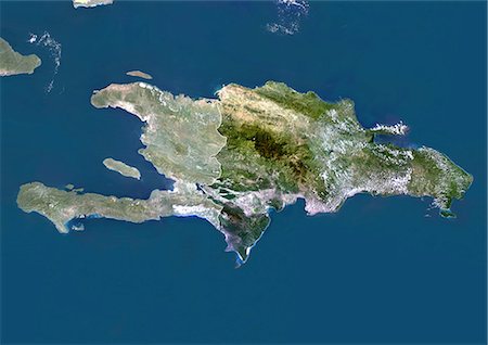
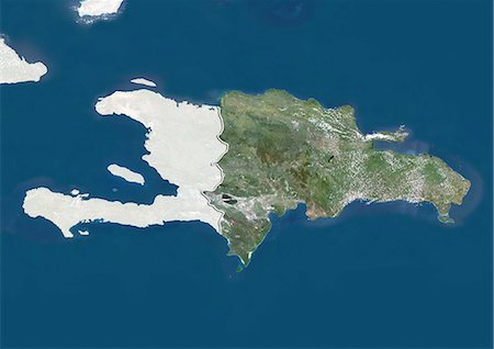
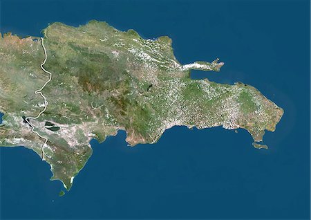
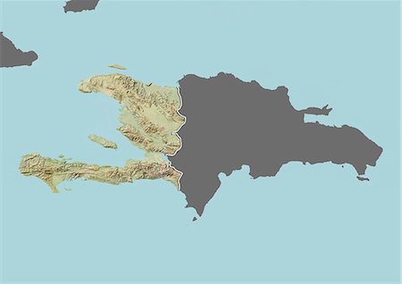
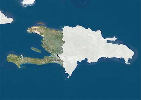
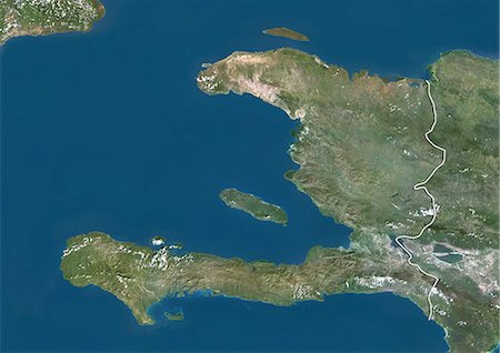
Haiti (With Mask And Border) And Dominican Republic, True Colour Satellite Image. Haiti (with mask and border) and Dominican Republic, true colour satellite image. This image was compiled from data acquired by LANDSAT 5 & 7 satellites.
Rights-Managed
-
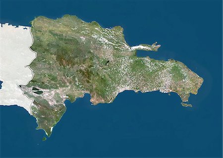
Haiti And Dominican Republic (With Mask And Border), True Colour Satellite Image. Haiti and Dominican Republic (with mask and border), true colour satellite image. This image was compiled from data acquired by LANDSAT 5 & 7 satellites.
Rights-Managed
-

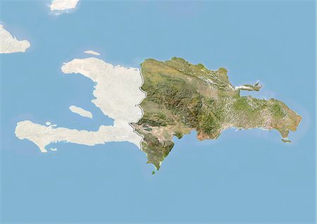
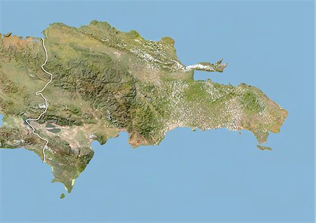
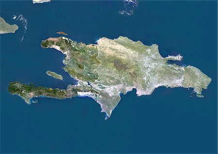
Haiti And Dominican Republic, True Colour Satellite Image With Border. Haiti and Dominican Republic, true colour satellite image with border. This image was compiled from data acquired by LANDSAT 5 & 7 satellites.
Rights-Managed
-

Haiti (With Mask) And Dominican Republic, True Colour Satellite Image With Mask. Haiti (with mask) and Dominican Republic, true colour satellite image. This image was compiled from data acquired by LANDSAT 5 & 7 satellites.
Rights-Managed
-

Haiti And Dominican Republic (With Mask), True Colour Satellite Image. Haiti and Dominican Republic (with mask), true colour satellite image. This image was compiled from data acquired by LANDSAT 5 & 7 satellites.
Rights-Managed
-
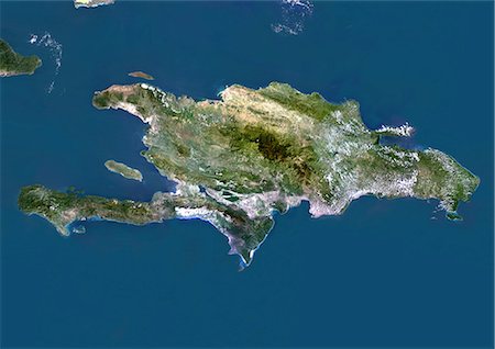
Haiti And Dominican Republic, True Colour Satellite Image. Haiti and Dominican Republic, true colour satellite image. This image was compiled from data acquired by LANDSAT 5 & 7 satellites.
Rights-Managed
-

Caribbean Islands, True Colour Satellite Image. Caribbean Islands, true colour satellite image. This image was compiled from data acquired by LANDSAT 5 & 7 satellites.
Rights-Managed
-
Satellite view of Turks and Caicos Islands. This image was compiled from data acquired by Landsat satellites.
Rights-Managed
-
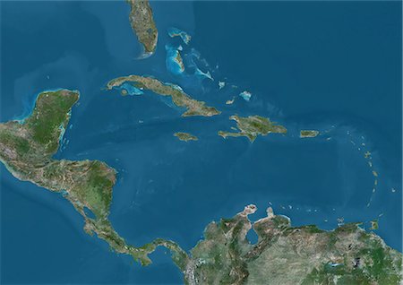
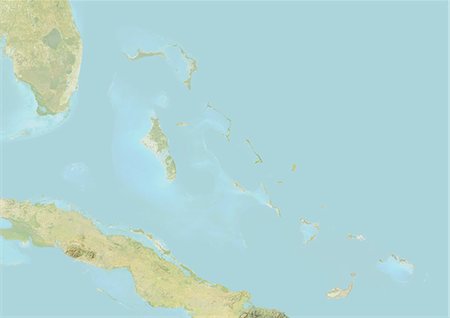
Satellite view of Central America and the Caribbean. This image was compiled from data acquired by Landsat 7 & 8 satellites.
Rights-Managed
-
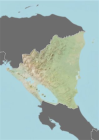
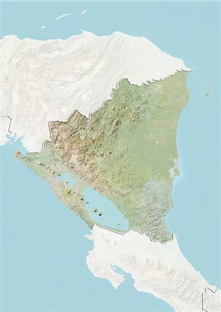
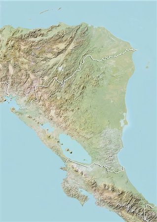
Relief map of Nicaragua (with border and mask). This image was compiled from data acquired by landsat 5 & 7 satellites combined with elevation data.
Rights-Managed
-

Relief map of Honduras (with border and mask). This image was compiled from data acquired by landsat 5 & 7 satellites combined with elevation data.
Rights-Managed
-
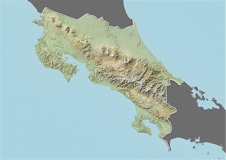
Relief map of Costa Rica (with border and mask). This image was compiled from data acquired by landsat 5 & 7 satellites combined with elevation data.
Rights-Managed
-
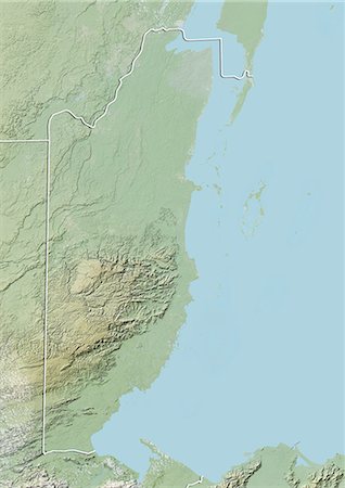
Relief map of Belize (with border). This image was compiled from data acquired by LANDSAT 5 & 7 satellites combined with elevation data.
Rights-Managed
-
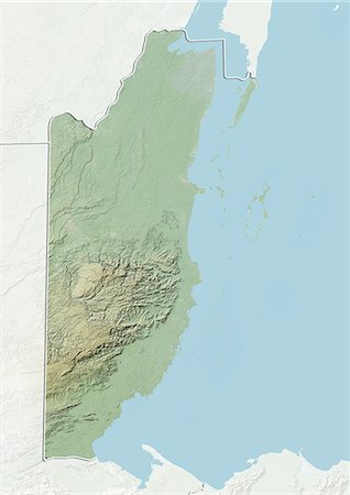
Relief map of Belize (with border and mask). This image was compiled from data acquired by landsat 5 & 7 satellites combined with elevation data.
Rights-Managed
-

Relief map of Belize (with border and mask). This image was compiled from data acquired by landsat 5 & 7 satellites combined with elevation data.
Rights-Managed
-

-

-

-

-
-