-
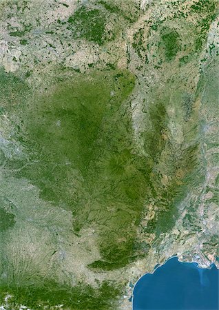
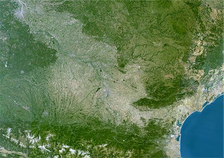
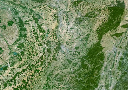
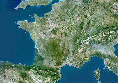
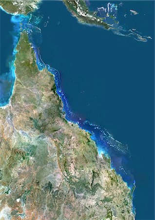
Massif Central Region, France, True Colour Satellite Image. Massif Central region, France, true colour satellite image. This image was compiled from data acquired by LANDSAT 5 & 7 satellites.
Rights-Managed
-
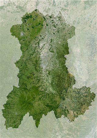
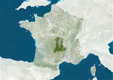
Auvergne Region, France, True Colour Satellite Image With Mask. Auvergne region, France, true colour satellite image with mask. This image was compiled from data acquired by LANDSAT 5 & 7 satellites.
Rights-Managed
-
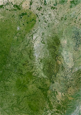
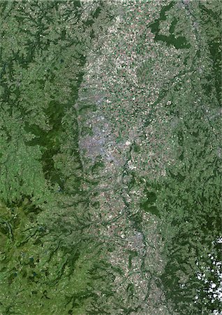
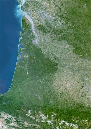
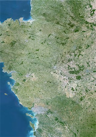
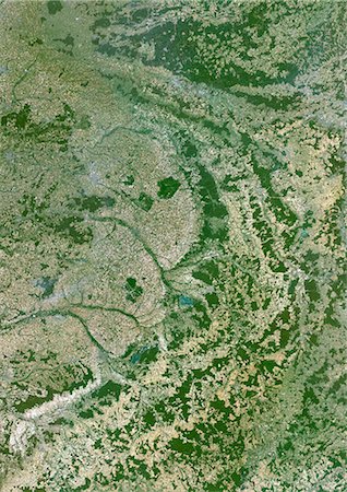
Auvergne Region, France, True Colour Satellite Image. Auvergne region, France, true colour satellite image. This image was compiled from data acquired by LANDSAT 5 & 7 satellites.
Rights-Managed
-
Satellite view of Auvergne, France. This image was compiled from data acquired by LANDSAT 5 & 7 satellites.
Rights-Managed
-

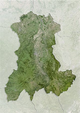
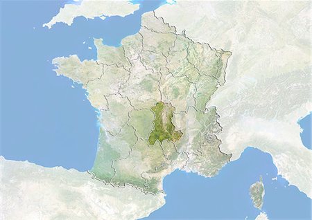
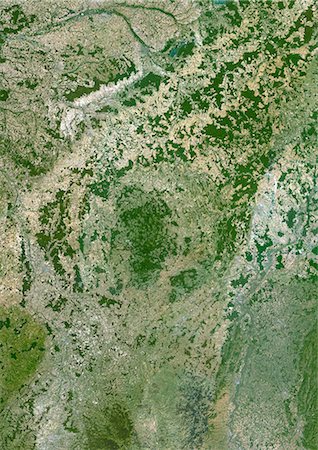
Relief map of Auvergne, France. This image was compiled from data acquired by LANDSAT 5 & 7 satellites combined with elevation data.
Rights-Managed
-

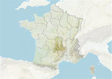
Relief map of Auvergne, France. This image was compiled from data acquired by LANDSAT 5 & 7 satellites combined with elevation data.
Rights-Managed
-
-
-
-
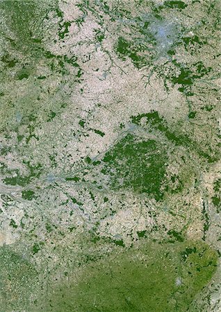
Clermont-Ferrand, France, True Colour Satellite Image. Clermont-Ferrand, France. True colour satellite image of the city of Clermont-Ferrand, taken on 22 July 2002, using LANDSAT 7 data.
Rights-Managed
-

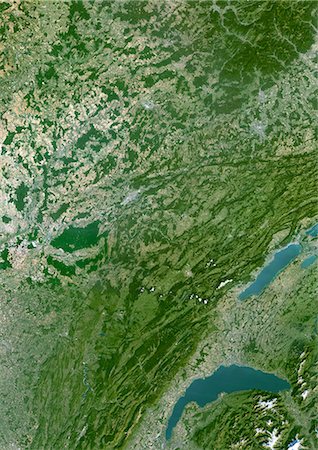
Lake Leman, Europe, True Colour Satellite Image. True colour satellite image of Lake Léman, the largest natural freshwater lake in western Europe. It is divided between two countries : France and Switzerland. Image taken on 21 July 2001, using LANDSAT 7 data.
Rights-Managed
-
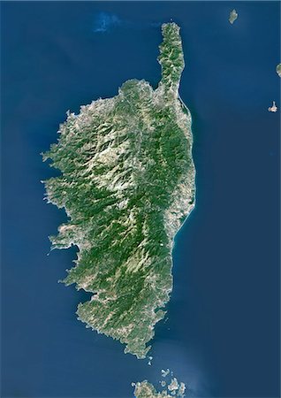
Corsica, France, True Colour Satellite Image. Corsica, France. True colour satellite image of the island of Corsica, the fourth largest island in the Mediterranean Sea. This image was compiled from data acquired by LANDSAT 5 & 7 satellites.
Rights-Managed
-
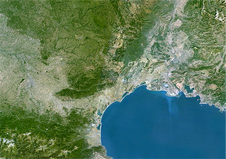
French Riviera, France, True Colour Satellite Image. French Riviera, France. True colour satellite image of the French Riviera, located on France's southeastern coast of the Mediterranean Sea, reaching from Toulon to Menton at the border with Italy. This image was compiled from data acquired by LANDSAT 5 & 7 satellites.
Rights-Managed
-

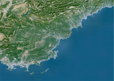
Basque Country, France-Spain, True Colour Satellite Image. Basque Country, France - Spain. True colour satellite image of the Basque Country, a region in the western Pyrenees mountains that goes across the border between France and Spain. This image was compiled from data acquired by LANDSAT 5 & 7 satellites.
Rights-Managed
-

Re And Oleron Islands, France, True Colour Satellite Image. Ré & Oleron Islands, France. True colour satellite image of Ré & Oléron islands, that are off the west coast of France near La Rochelle. This image was compiled from data acquired by LANDSAT 5 & 7 satellites.
Rights-Managed
-
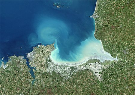
Mount Saint Michael Bay, France, True Colour Satellite Image. Mount Saint Michael (Mont Saint Michel) Bay, France. True colour satellite image of Mount Saint Michael, a small rocky tidal island in Normandy, France. This image was compiled from data acquired by LANDSAT 5 & 7 satellites.
Rights-Managed
-
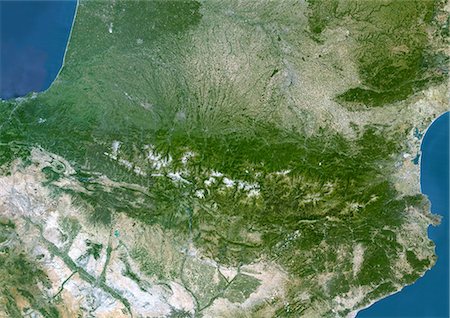
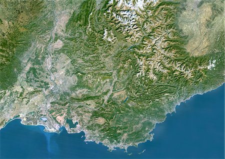
Pyrenees, France, Spain, True Colour Satellite Image. Pyrenees, France - Spain. True colour satellite image of the Pyrenees, a range of mountains in southwest Europe that form a natural border between France and Spain. This image was compiled from data acquired by LANDSAT 5 & 7 satellites.
Rights-Managed
-

Chamonix-Mont Blanc, France, True Colour Satellite Image. Chamonix & Mont Blanc, France. True colour satellite image of the Mont Blanc, in the Alps, that is the highest mountain in Western Europe. Its height is about 4,808 m (15,774 feet), This image was compiled from data acquired by LANDSAT 5 & 7 satellites.
Rights-Managed
-
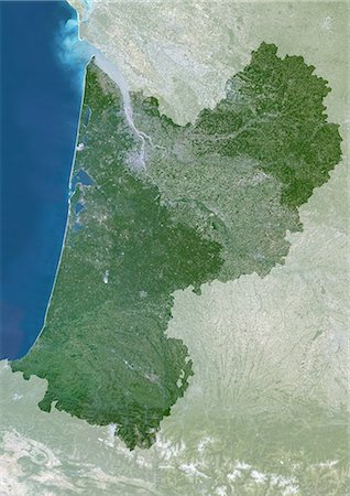
Aquitaine Region, France, True Colour Satellite Image With Mask. Aquitaine region, France, true colour satellite image with mask. This image was compiled from data acquired by LANDSAT 5 & 7 satellites.
Rights-Managed
-

Midi-Pyrenees Region, France, True Colour Satellite Image With Mask. Midi-Pyrénées region, France, true colour satellite image with mask. This image was compiled from data acquired by LANDSAT 5 & 7 satellites.
Rights-Managed
-
Languedoc-Roussillon Region, France, True Colour Satellite Image With Mask. Languedoc Roussillon region, France, true colour satellite image with mask. This image was compiled from data acquired by LANDSAT 5 & 7 satellites.
Rights-Managed
-
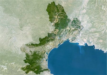
Provence-Alpes-Côte D'Azur Region, France, True Colour Satellite Image With Mask. Provence - Alpes - Côte d'Azur region, France, true colour satellite image with mask. This image was compiled from data acquired by LANDSAT 5 & 7 satellites.
Rights-Managed
-

Rhône-Alpes Region, France, True Colour Satellite Image With Mask. Rhône Alpes region, France, true colour satellite image with mask. This image was compiled from data acquired by LANDSAT 5 & 7 satellites.
Rights-Managed
-

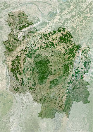
Limousin Region, France, True Colour Satellite Image With Mask. Limousin region, France, true colour satellite image with mask. This image was compiled from data acquired by LANDSAT 5 & 7 satellites.
Rights-Managed
-

Poitou-Charentes Region, France, True Colour Satellite Image With Mask. Poitou Charentes region, France, true colour satellite image with mask. This image was compiled from data acquired by LANDSAT 5 & 7 satellites.
Rights-Managed
-
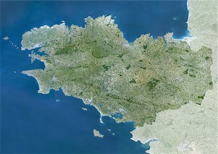
Brittany Region, France, True Colour Satellite Image With Mask. Brittany region, France, true colour satellite image with mask. This image was compiled from data acquired by LANDSAT 5 & 7 satellites.
Rights-Managed
-

Pays De La Loire Region, France, True Colour Satellite Image With Mask. Pays de la Loire region, France, true colour satellite image with mask. This image was compiled from data acquired by LANDSAT 5 & 7 satellites.
Rights-Managed
-
Centre Region, France, True Colour Satellite Image With Mask. Centre region, France, true colour satellite image with mask. This image was compiled from data acquired by LANDSAT 5 & 7 satellites.
Rights-Managed
-
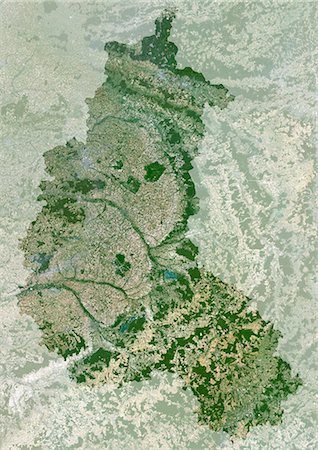
Bourgogne Region, France, True Colour Satellite Image With Mask. Bourgogne region, France, true colour satellite image with mask. This image was compiled from data acquired by LANDSAT 5 & 7 satellites.
Rights-Managed
-
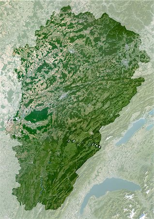
Franche-Comte Region, France, True Colour Satellite Image With Mask. Franche Comté region, France, true colour satellite image with mask. This image was compiled from data acquired by LANDSAT 5 & 7 satellites.
Rights-Managed
-

Alsace Region, France, True Colour Satellite Image With Mask. Alsace region, France, true colour satellite image with mask. This image was compiled from data acquired by LANDSAT 5 & 7 satellites.
Rights-Managed
-

Lorraine Region, France, True Colour Satellite Image With Mask. Lorraine region, France, true colour satellite image with mask. This image was compiled from data acquired by LANDSAT 5 & 7 satellites.
Rights-Managed
-
Champagne-Ardenne Region, France, True Colour Satellite Image With Mask. Champagne-Ardenne region, France, true colour satellite image with mask. This image was compiled from data acquired by LANDSAT 5 & 7 satellites.
Rights-Managed
-

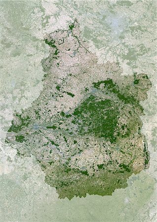
Ile-De-France Region, France, True Colour Satellite Image With Mask. Ile de France region, France, true colour satellite image with mask. This image was compiled from data acquired by LANDSAT 5 & 7 satellites.
Rights-Managed
-

Basse-Normandie Region, France, True Colour Satellite Image With Mask. Basse Normandie region, France, true colour satellite image with mask. This image was compiled from data acquired by LANDSAT 5 & 7 satellites.
Rights-Managed
-

Haute-Normandie Region, France, True Colour Satellite Image With Mask. Haute Normandie region, France, true colour satellite image with mask. This image was compiled from data acquired by LANDSAT 5 & 7 satellites.
Rights-Managed
-

Picardie Region, France, True Colour Satellite Image With Mask. Picardie region, France, true colour satellite image with mask. This image was compiled from data acquired by LANDSAT 5 & 7 satellites.
Rights-Managed
-

Nord - Pas-De-Calais Region, France, True Colour Satellite Image With Mask. Nord Pas de Calais region, France, true colour satellite image with mask. This image was compiled from data acquired by LANDSAT 5 & 7 satellites.
Rights-Managed
-
Aquitaine Region, France, True Colour Satellite Image. Aquitaine region, France, true colour satellite image. This image was compiled from data acquired by LANDSAT 5 & 7 satellites.
Rights-Managed
-
Midi-Pyrenees Region, France, True Colour Satellite Image. Midi Pyrénées region, France, true colour satellite image. This image was compiled from data acquired by LANDSAT 5 & 7 satellites.
Rights-Managed
-
Languedoc-Roussillon Region, France, True Colour Satellite Image. Languedoc Roussillon region, France, true colour satellite image. This image was compiled from data acquired by LANDSAT 5 & 7 satellites.
Rights-Managed
-
Provence-Alpes-Côte D'Azur Region, France, True Colour Satellite Image. Provence - Alpes - Côte d'Azur region, France, true colour satellite image. This image was compiled from data acquired by LANDSAT 5 & 7 satellites.
Rights-Managed
-

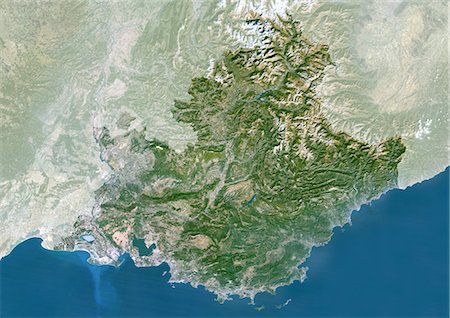
Rhône-Alpes Region, France, True Colour Satellite Image. Rhône-Alpes region, France, true colour satellite image. This image was compiled from data acquired by LANDSAT 5 & 7 satellites.
Rights-Managed
-

Limousin Region, France, True Colour Satellite Image. Limousin region, France, true colour satellite image. This image was compiled from data acquired by LANDSAT 5 & 7 satellites.
Rights-Managed
-

Poitou-Charentes Region, France, True Colour Satellite Image. Poitou-Charentes region, France, true colour satellite image. This image was compiled from data acquired by LANDSAT 5 & 7 satellites.
Rights-Managed
-

Brittany Region, France, True Colour Satellite Image. Brittany region, France, true colour satellite image. This image was compiled from data acquired by LANDSAT 5 & 7 satellites.
Rights-Managed
-
Pays De La Loire Region, France, True Colour Satellite Image. Pays de la Loire region, France, true colour satellite image. This image was compiled from data acquired by LANDSAT 5 & 7 satellites.
Rights-Managed
-
Centre Region, France, True Colour Satellite Image. Centre region, France, true colour satellite image. This image was compiled from data acquired by LANDSAT 5 & 7 satellites.
Rights-Managed
-
Bourgogne Region, France, True Colour Satellite Image. Bourgogne region, France, true colour satellite image. This image was compiled from data acquired by LANDSAT 5 & 7 satellites.
Rights-Managed
-
Franche-Comte Region, France, True Colour Satellite Image. Franche Comté region, France, true colour satellite image. This image was compiled from data acquired by LANDSAT 5 & 7 satellites.
Rights-Managed
-

Alsace Region, France, True Colour Satellite Image. Alsace region, France, true colour satellite image. This image was compiled from data acquired by LANDSAT 5 & 7 satellites.
Rights-Managed
-
Lorraine Region, France, True Colour Satellite Image. Lorraine region, France, true colour satellite image. This image was compiled from data acquired by LANDSAT 5 & 7 satellites.
Rights-Managed
-
Champagne-Ardenne Region, France, True Colour Satellite Image. Champagne-Ardenne region, France, true colour satellite image. This image was compiled from data acquired by LANDSAT 5 & 7 satellites.
Rights-Managed
-

Ile-De-France Region, France, True Colour Satellite Image. Ile de France region, France, true colour satellite image. This image was compiled from data acquired by LANDSAT 5 & 7 satellites.
Rights-Managed
-

Basse-Normandie Region, France, True Colour Satellite Image. Basse Normandie region, France, true colour satellite image. This image was compiled from data acquired by LANDSAT 5 & 7 satellites.
Rights-Managed
-

Haute-Normandie Region, France, True Colour Satellite Image. Haute Normandie region, France, true colour satellite image. This image was compiled from data acquired by LANDSAT 5 & 7 satellites.
Rights-Managed
-

Picardie Region, France, True Colour Satellite Image. Picardie region, France, true colour satellite image. This image was compiled from data acquired by LANDSAT 5 & 7 satellites.
Rights-Managed
-

Nord - Pas-De-Calais Region, France, True Colour Satellite Image. Nord-Pas de Calais region, France, true colour satellite image. This image was compiled from data acquired by LANDSAT 5 & 7 satellites.
Rights-Managed
-

-
-

Marrakech, Morocco, True Colour Satellite Image. True colour satellite image of Marrakech, Morocco. Composite image using LANDSAT 7 data.
Rights-Managed
-
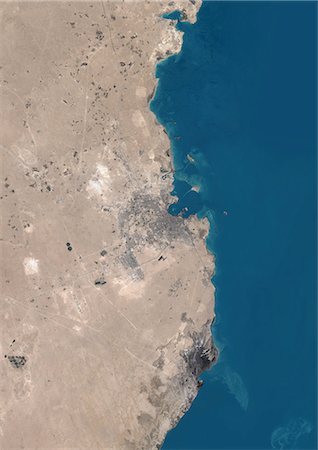
Doha, Qatar, True Colour Satellite Image. True colour satellite image of Doha, the capital city of Qatar, located on the Persian Gulf. Image taken in August 2001, using LANDSAT 7 data.
Rights-Managed
-

Athens, Greece, True Colour Satellite Image. True colour satellite image of Athens, the capital and largest city of Greece. Composite image using LANDSAT 7 data.
Rights-Managed
-

Phuket, Thailand, True Colour Satellite Image. True colour satellite image of Phuket, Thailand. It is the biggest island in Thailand, located in the Andaman Sea in southern Thailand. Composite image using LANDSAT 7 data.
Rights-Managed
-

Agra, India, True Colour Satellite Image. True colour satellite image of the city of Agra and surroundings in India. It is a city located on the banks of the Yamuna River in the northern state of Uttar Pradesh, India. The city is famous for its UNESCO World Heritage Sites : the Taj Mahal, the Agra Fort and Fatehpur Sikri. Image taken on 22 October 1999, using LANDSAT 7 data.
Rights-Managed
-

Pisa And Livorno, Italy, True Colour Satellite Image. True colour satellite image of the cities of Pisa and Livorno, Tuscany, Italy. Pisa is located on the right bank of the mouth of the Arno River and Livorno is a port city on the Ligurian Sea. Image taken on 20 June 2000, using LANDSAT 7 data.
Rights-Managed
-

Cozumel Island, Mexico, True Colour Satellite Image. True colour satellite image of Cozumel, an island in the Caribbean Sea off the eastern coast of Mexico's Yucatan Peninsula (left). Image taken on 17 April 2001, using LANDSAT 7 data.
Rights-Managed
-

Niagara Falls, North America, True Colour Satellite Image. True colour satellite image of Niagara Falls. The Niagara River flows from Lake Erie (bottom) into Lake Ontario (top) and forms the border between Canada (left) and the USA (right). Image taken on 12 September 1999, using LANDSAT 7 data.
Rights-Managed
-

Chicago, United States, True Colour Satellite Image. True colour satellite image of the city of Chicago, Illinois, USA. The city is located on the southwestern shores of Lake Michigan. Composite image from 2001, using LANDSAT 7 data.
Rights-Managed
-

Cancun, Mexico, True Colour Satellite Image. True colour satellite image of Cancun in Mexico. It is a coastal city on the Yucatan Peninsula. Image taken on 17 April 2001, using LANDSAT 7 data.
Rights-Managed
-
-
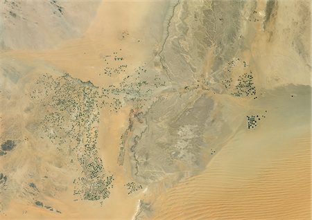
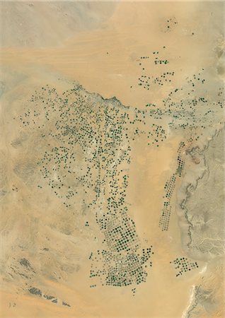
Agriculture In The Murzuq Desert In 2005, Libya, True Colour Satellite Image. True colour satellite image of agriculture in the northern Murzuq Desert in Libya. The Murzuq Desert is an erg desert, part of the Sahara desert, in southwestern Libya. Circular agricultural plots are visible on the image. Image taken on 11 March 2005, using LANDSAT 7 data.
Rights-Managed
-

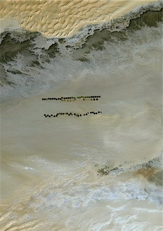
Agriculture In The Murzuq Desert In 2000, Libya, True Colour Satellite Image. True colour satellite image of agriculture in the northern Murzuq Desert in Libya. The Murzuq Desert is an erg desert, part of the Sahara desert, in southwestern Libya. Circular agricultural plots are visible on the image. Image taken on 8 November 2000, using LANDSAT 7 data.
Rights-Managed
-
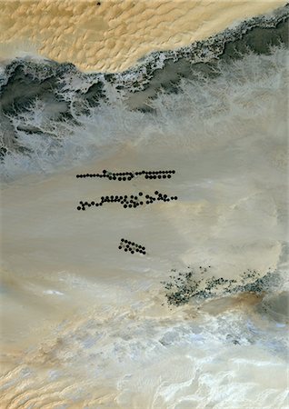
Agriculture In The Murzuq Desert In 1987, Libya, True Colour Satellite Image. True colour satellite image of agriculture in the northern Murzuq Desert in Libya. The Murzuq Desert is an erg desert, part of the Sahara desert, in southwestern Libya. Circular agricultural plots are visible on the image. Image taken on 13 January 1987, using LANDSAT 5 data.
Rights-Managed
-

Agriculture In The Libyan Desert, Libya, True Colour Satellite Image. True colour satellite image of agriculture in the Libyan desert in 2001, in the eastern part of Libya. Circular agricultural plots are visible on the image. Composite image using LANDSAT 7 data.
Rights-Managed
-

Agriculture In The Desert, City Of Tabuk In 2001, Saudi Arabia, True Colour Satellite Image. True colour satellite image of the city of Tabuk in 2001, in north western Saudi Arabia. Circular agricultural plots are visible on the image. Composite image using LANDSAT 7 data.
Rights-Managed
-

Agriculture In The Desert, City Of Tabuk In 1990, Saudi Arabia, True Colour Satellite Image. True colour satellite image of the city of Tabuk in 1990, in north western Saudi Arabia. Circular agricultural plots are visible on the image. Composite image using LANDSAT 5 data.
Rights-Managed
-
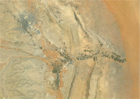
Agriculture In The Desert, South Part Of The Riyadh Province, Saudi Arabia, True Colour Satellite Image. True colour satellite image of agriculture in the desert in Saudi Arabia. The image shows the south part of the Riyadh Province, about 500 km south of Riyadh. Circular agricultural plots are visible on the image. Composite image from 2001, using LANDSAT 7 data.
Rights-Managed
-

Topographic Map of Al Sulail, South Part Of The Riyadh Province, Saudi Arabia
Rights-Managed
-
Agriculture In The Desert, South Part Of The Riyadh Province, Saudi Arabia, True Colour Satellite Image. True colour satellite image of agriculture in the desert in Saudi Arabia. The image shows the south part of the Riyadh Province, about 500 km south of Riyadh. Circular agricultural plots are visible on the image. Composite image from 2001, using LANDSAT 7 data.
Rights-Managed
-

Agriculture In The Desert In 2006, Saudi Arabia, True Colour Satellite Image. True colour satellite image of agriculture in the desert, about 250 km west of the Saudi capital, Riyadh. Circular agricultural plots are visible on the image. Composite image taken in 2006, using LANDSAT 5 data.
Rights-Managed
-
Agriculture In The Desert In 2001, Saudi Arabia, True Colour Satellite Image. True colour satellite image of agriculture in the desert, about 250 km west of the Saudi capital, Riyadh. Circular agricultural plots are visible on the image. Composite image taken in 2001, using LANDSAT 5 data.
Rights-Managed
-

Agriculture In The Desert In 1998, Saudi Arabia, True Colour Satellite Image. True colour satellite image of agriculture in the desert, about 250 km west of the Saudi capital, Riyadh. Circular agricultural plots are visible on the image. Composite image taken in 1998, using LANDSAT 5 data.
Rights-Managed
-

Agriculture In The Desert, Al-Qassim Province, Saudi Arabia, True Colour Satellite Image. True colour satellite image of agriculture in the desert, north of the Saudi cities of Buraydah and Unaizah (bottom right), in the Al-Qassim Province, Saudi Arabia. Circular agricultural plots are visible on the image. Composite image using LANDSAT 7 data.
Rights-Managed
-
Riyadh, Saudi Arabia , True Colour Satellite Image. True colour satellite image of Riyadh, the capital and largest city of Saudi Arabia. Circular agricultural plots are visible southeast of Riyadh. Composite image using LANDSAT 7 data.
Rights-Managed
-

Agriculture In The Desert, Riyadh Province, Saudi Arabia, True Colour Satellite Image. True colour satellite image of agriculture in the desert in the Riyadh Province, Saudi Arabia, about 250 km west of the Saudi capital, Riyadh. Circular agricultural plots are visible on the image. Composite image using LANDSAT 7 data.
Rights-Managed
-

-
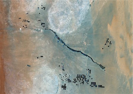
Indus Delta, Pakistan, True Colour Satellite Image. True colour satellite image of the Indus Delta in Pakistan. The Indus River flows into the Arabian Sea near Pakistan's port city of Karachi (top left on the image). The city of Hyderabad, located on the east bank of the Indus River, is on the top centre of the image. India is southeast of the Indus delta. Composite image using LANDSAT 7 data.
Rights-Managed
-

Chao Phraya Delta, Thailand, True Colour Satellite Image. True colour satellite image of Chao Phraya Delta in Thailand. The Chao Phraya is a major river in Thailand which runs through Bangkok (center of the image), the capital of Thailand, to the Gulf of Thailand. Composite image using LANDSAT 7 data.
Rights-Managed
-
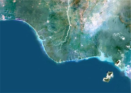
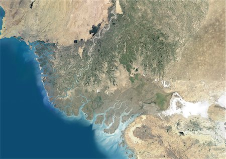
Niger River Delta, Nigeria, True Colour Satellite Image. True colour satellite image of the Niger River Delta in Nigeria, Africa. The city of Lagos, the second most populous city in Africa, is to be seen west of the Niger River Delta on the Atlantic coast in the Gulf of Guinea.Composite image using LANDSAT 5 data.
Rights-Managed


