-

Satellite view of deforestation in East Rondonia, Brazil in 1986 and 2001. This before and after image shows deforestation impact over the years.
Rights-Managed
-
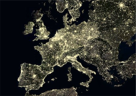
Western Europe at night in 2012, from Portugal to Moscow, Russia. This satellite image shows urban and industrial lights.
Rights-Managed
-

Color satellite image of Los Angeles International Airport, California, United States. Image collected on June 13, 2017 by Sentinel-2 satellites.
Rights-Managed
-

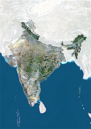
Satellite view of Asia. This image was compiled from data acquired by Landsat 7 & 8 satellites.
Rights-Managed
-

Color satellite image of Mumbai and Navi Mumbai, India. Navi Mumbai is a planned township located East of Mumbai. Both cities are connected by the Vashi bridge, also called Thane Creek Bridge. Image collected on May 03, 2017 by Sentinel-2 satellites.
Rights-Managed
-

Satellite view of the State of West Bengal, India. This image was compiled from data acquired by LANDSAT 5 & 7 satellites.
Rights-Managed
-

-
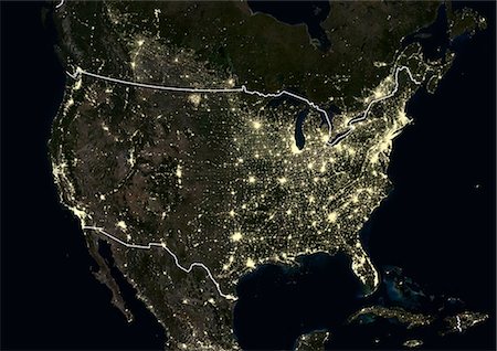
United States at night in 2012. This satellite image with country borders shows urban and industrial lights.
Rights-Managed
-

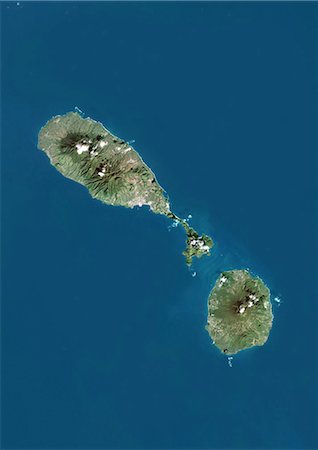
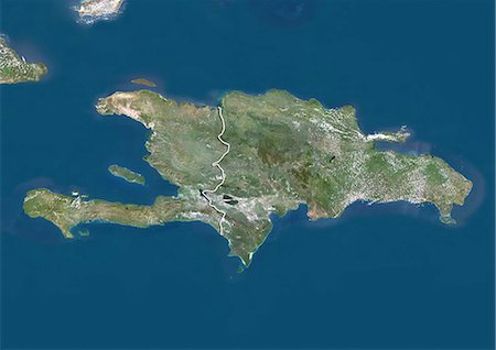
Satellite view of the Caribbean Sea. The entire area of the Caribbean Sea, including all islands of the West Indies is collectively known as the Caribbean. This image was compiled from data acquired by Landsat satellites.
Rights-Managed
-

-

Satellite view of the province of Shandong, China. This image was compiled from data acquired by LANDSAT 5 & 7 satellites.
Rights-Managed
-
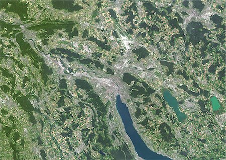
Colour satellite image of Zurich, Switzerland. Image taken on July 19, 2014 with Landsat 8 data.
Rights-Managed
-
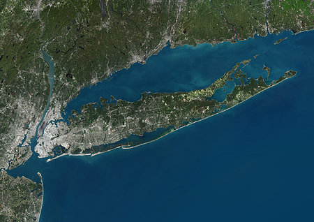
Color satellite image of Long Island, New York State, United States. Image collected on October 20, 2017 by Sentinel-2 satellites.
Rights-Managed
-
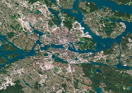
Color satellite image of Stockholm, capital city of Sweden. Image collected on July 06, 2017 by Sentinel-2 satellites.
Rights-Managed
-
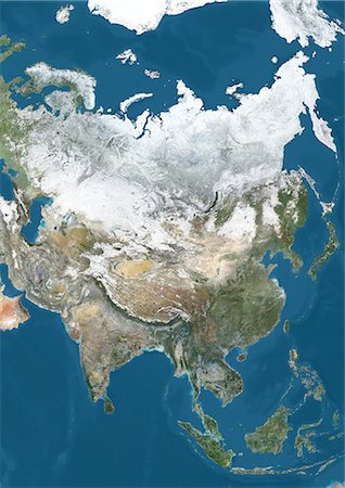
Satellite view of Asia in winter, with partial snow cover. This image was compiled from data acquired by Landsat 7 & 8 satellites.
Rights-Managed
-

Satellite view of the province of Guangdong, China. This image was compiled from data acquired by LANDSAT 5 & 7 satellites.
Rights-Managed
-
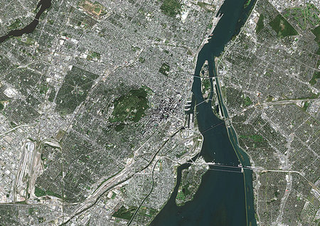
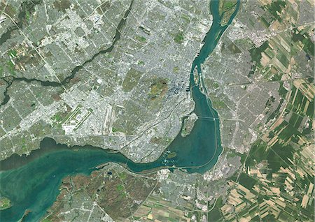
Color satellite image of Montreal, Quebec, Canada. The Saint Lawrence River flows through the city. Image collected on October 03, 2017 by Sentinel-2 satellites.
Rights-Managed
-
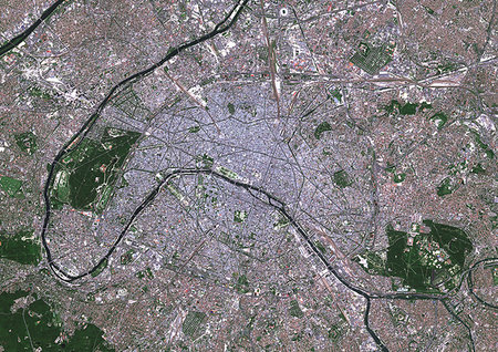
Color satellite image of Paris, capital city of France. The Seine River flows through the city. Image collected on May 26, 2017 by Sentinel-2 satellites.
Rights-Managed
-
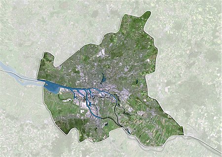
Satellite view of the State of Hamburg, Germany. This image was compiled from data acquired by LANDSAT 5 & 7 satellites.
Rights-Managed
-

Satellite view of Puerto Rico. This image was compiled from data acquired by Landsat satellites.
Rights-Managed
-
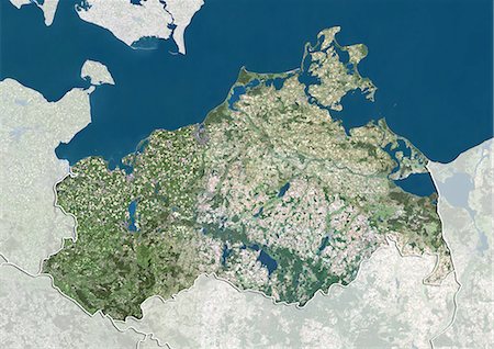
Satellite view of the State of Mecklenburg-Vorpommern, Germany. This image was compiled from data acquired by LANDSAT 5 & 7 satellites.
Rights-Managed
-
-
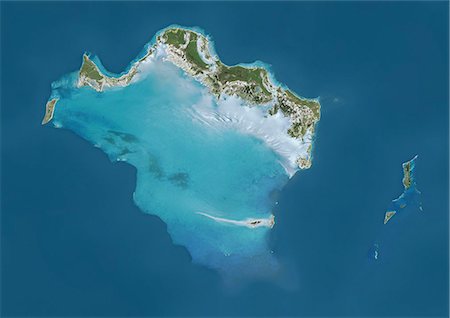
Satellite view of Turks and Caicos Islands. This image was compiled from data acquired by Landsat satellites.
Rights-Managed
-

Relief map of the State of Baden-Wurttemberg, Germany. This image was compiled from data acquired by LANDSAT 5 & 7 satellites combined with elevation data.
Rights-Managed
-
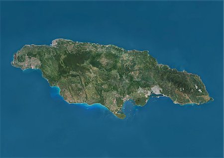
Satellite view of Jamaica. This image was compiled from data acquired by Landsat satellites.
Rights-Managed
-
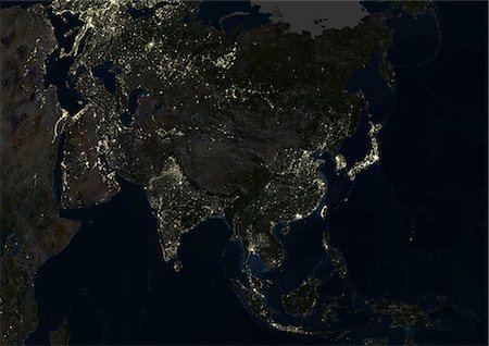
Asia At Night, True Colour Satellite Image. True colour satellite image of Asia at night. This image in Lambert Azimuthal Equal Area projection was compiled from data acquired by LANDSAT 5 & 7 satellites.
Rights-Managed
-
-
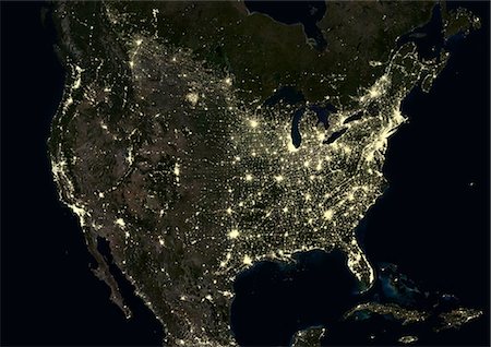
United States at night in 2012. This satellite image shows urban and industrial lights.
Rights-Managed
-
-
-

Great Lakes, North America, True Colour Satellite Image. True colour satellite image of the Great Lakes region which includes the Canadian Province of Ontario and eight US states. Lakes are from west to east : Lake Superior, Lake Michigan, Lake Huron, Lake Erie and Lake Ontario. Composite image using LANDSAT 5 data.
Rights-Managed
-

Colour satellite image of Amsterdam, Netherlands. Image taken on September 17, 2014 with Landsat 8 data.
Rights-Managed
-
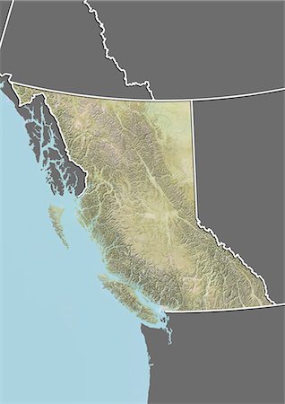
Relief map of British Columbia, Canada. This image was compiled from data acquired by LANDSAT 5 & 7 satellites combined with elevation data.
Rights-Managed
-
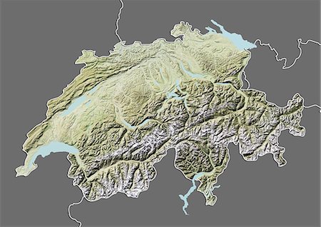
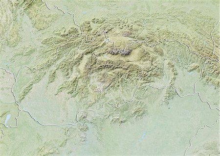
Relief map of Switzerland (with border and mask). This image was compiled from data acquired by landsat 5 & 7 satellites combined with elevation data.
Rights-Managed
-

Globe Europe, True Colour Satellite Image. True colour satellite image of the whole earth, showing Europe at centre. The picture is a composite created from thousands of separate images recorded by LANDSAT 5 & 7 satellites. Print size 42x42cm.
Rights-Managed
-
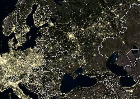
Eastern Europe at night in 2012, with Moscow, Russia at center. This satellite image with country borders shows urban and industrial lights.
Rights-Managed
-
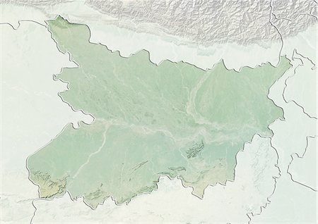
Relief map of the State of Bihar, India. This image was compiled from data acquired by LANDSAT 5 & 7 satellites combined with elevation data.
Rights-Managed
-
-
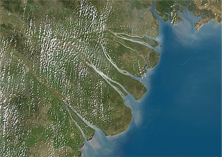
Mekong Delta, Vietnam, True Colour Satellite Image. True colour satellite image of the Mekong Delta in Vietnam. The Mekong delta region encompasses a large portion of southeastern Vietnam. The Mekong River empties into the South China Sea. Composite image using LANDSAT 7 data.
Rights-Managed
-
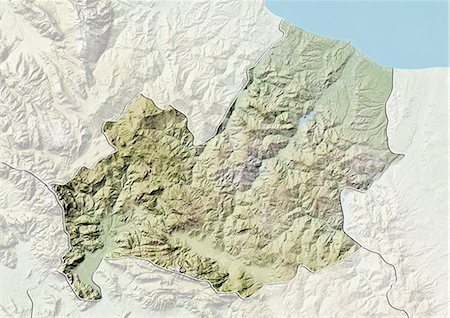
Relief map of the region of Molise, Italy. This image was compiled from data acquired by LANDSAT 5 & 7 satellites combined with elevation data.
Rights-Managed
-

Relief map of the State of California, United States. This image was compiled from data acquired by LANDSAT 5 & 7 satellites combined with elevation data.
Rights-Managed
-
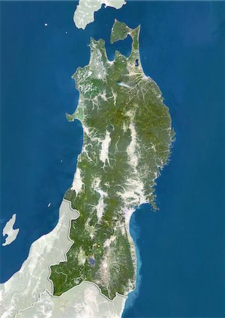
Satellite view of the region of Tohoku, Japan. This image was compiled from data acquired by LANDSAT 5 & 7 satellites.
Rights-Managed
-
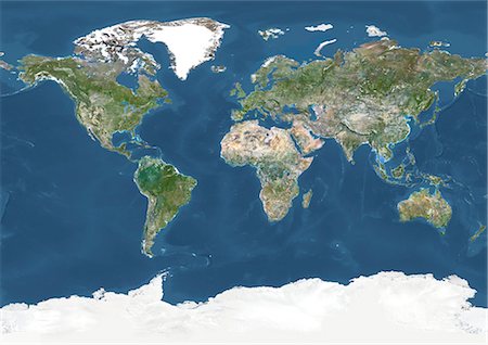
World In Geographic Projection, True Colour Satellite Image. True colour cloudless satellite image of the whole Earth, shown in geographic projection. This image was compiled from data acquired by LANDSAT 5 & 7 satellites.
Rights-Managed
-
-
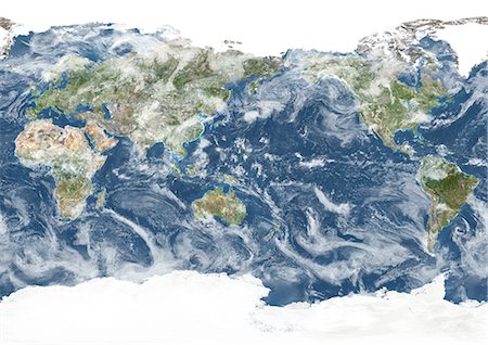
Whole Earth Centred On Pacific Ocean, True Colour Satellite Image. True colour satellite image of the whole Earth centred on the Pacific Ocean, with country borders and cloud coverage. This image in Miller projection was compiled from data acquired by LANDSAT 5 & 7 satellites.
Rights-Managed
-
-

-
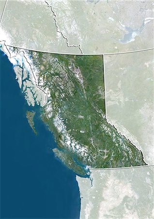
Satellite view of British Columbia, Canada. This image was compiled from data acquired by LANDSAT 5 & 7 satellites.
Rights-Managed
-
-

Satellite view of Nova Scotia, Canada. This image was compiled from data acquired by LANDSAT 5 & 7 satellites.
Rights-Managed
-
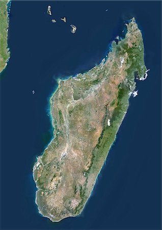
Madagascar, True Colour Satellite Image. Madagascar, true colour satellite image. This image was compiled from data acquired by LANDSAT 5 & 7 satellites.
Rights-Managed
-

North America At Night, True Colour Satellite Image. True colour satellite image of North America at night. This image in Lambert Conformal Conic projection was compiled from data acquired by LANDSAT 5 & 7 satellites.
Rights-Managed
-
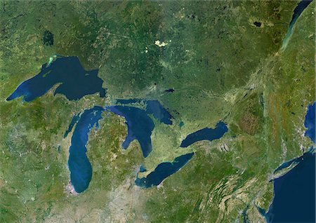
Great Lakes, Usa & Canada, True Colour Satellite Image. Satellite image of the American Great Lakes : lake Superior, Michigan, Huron, Erie and Ontario. This image was compiled from data acquired by LANDSAT 5 & 7 satellites.
Rights-Managed
-
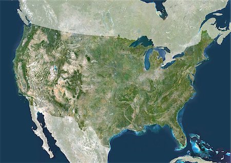
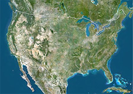
United States, True Colour Satellite Image With Mask. USA, true colour satellite image with mask. This image was compiled from data acquired by LANDSAT 5 & 7 satellites.
Rights-Managed
-

Globe Centred On The Americas, True Colour Satellite Image. True colour satellite image of the Earth centred on the Americas with cloud coverage, during summer solstice at 6 a.m GMT. This image in orthographic projection was compiled from data acquired by LANDSAT 5 & 7 satellites.
Rights-Managed
-
-
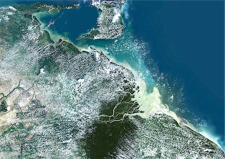
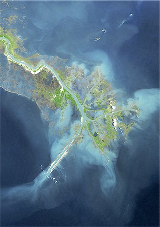
Orinoco Delta, Venezuela, True Colour Satellite Image. True colour satellite image of the Orinoco Delta in eastern Venezuela, The Orinoco river flows into the Atlantic ocean. At top is the island of Trinidad in the Caribbean sea. Composite image using LANDSAT 5 data.
Rights-Managed
-

Manicouagan Crater, Quebec, Canada, True Colour Satellite Image. True colour satellite image of Manicouagan Reservoir (also Lake Manicouagan), an annular lake in northern Quebec, Canada, the remnant of an impact crater made approximately 212 million years ago, of 100 km diameter. Image taken on 1 June 2001 using LANDSAT data.
Rights-Managed
-

Caribbean Islands, True Colour Satellite Image. Caribbean Islands, true colour satellite image. This image was compiled from data acquired by LANDSAT 5 & 7 satellites.
Rights-Managed
-
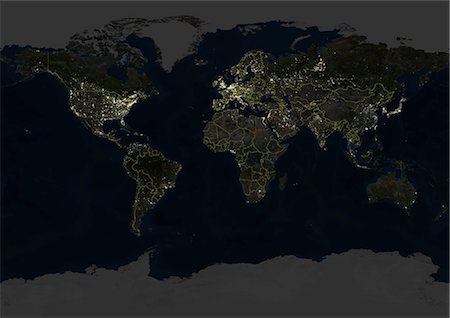
Whole Earth At Night With Country Borders, True Colour Satellite Image. True colour satellite image of the whole Earth at night with country borders. This image in Miller projection was compiled from data acquired by LANDSAT 5 & 7 satellites.
Rights-Managed
-

-
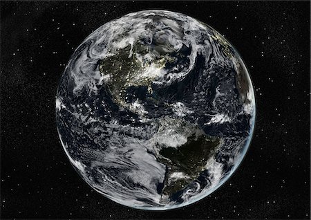
Globe Centred On The Americas, True Colour Satellite Image. True colour satellite image of the Earth centred on the Americas with cloud coverage, during winter solstice at 6 a.m GMT. This image in orthographic projection was compiled from data acquired by LANDSAT 5 & 7 satellites.
Rights-Managed
-
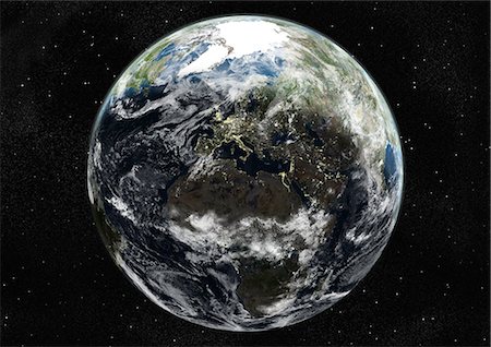
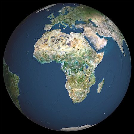
Globe Centred On Europe And Africa, True Colour Satellite Image. True colour satellite image of the Earth centred on Europe and Africa with cloud coverage, during summer solstice at 12 p.m GMT. This image in orthographic projection was compiled from data acquired by LANDSAT 5 & 7 satellites.
Rights-Managed
-
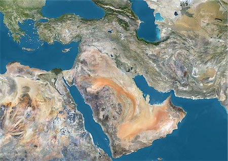
Satellite view of the Middle East. This image was compiled from data acquired in 2014 by Landsat 8 satellite.
Rights-Managed
-
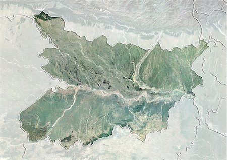
Satellite view of the State of Bihar, India. This image was compiled from data acquired by LANDSAT 5 & 7 satellites.
Rights-Managed
-
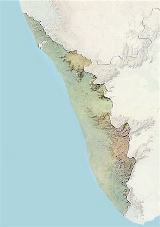
Relief map of the State of Kerala, India. This image was compiled from data acquired by LANDSAT 5 & 7 satellites combined with elevation data.
Rights-Managed
-
-

-
-
-
-

-
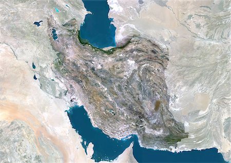
Iran, Middle East, Asia, True Colour Satellite Image With Mask. Satellite view of Iran (with mask). This image was compiled from data acquired by LANDSAT 5 & 7 satellites.
Rights-Managed
-
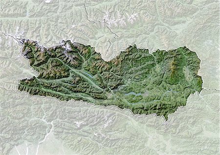
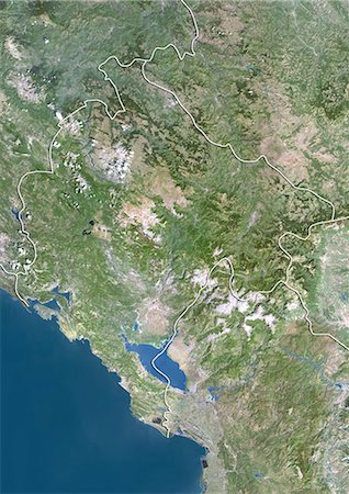
Satellite view with bump effect of the State of Carinthia, Austria. This image was compiled from data acquired by LANDSAT 5 & 7 satellites.
Rights-Managed
-

-

Satellite view of Bahrain in 2002 and 2014. This before and after image shows urban expansion over the years.
Rights-Managed
-

North America At Night With Country Borders, True Colour Satellite Image. True colour satellite image of North America at night with country borders. This image in Lambert Conformal Conic projection was compiled from data acquired by LANDSAT 5 & 7 satellites.
Rights-Managed
-
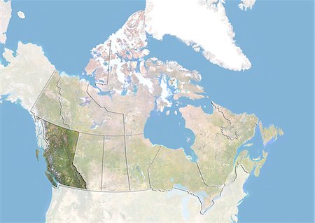
Canada and the Province of British Columbia, Satellite Image With Bump Effect
Rights-Managed
-

-

Europe At Night With Country Borders, True Colour Satellite Image. True colour satellite image of Europe at night with country borders. This image in Lambert Conformal Conic projection was compiled from data acquired by LANDSAT 5 & 7 satellites.
Rights-Managed
-
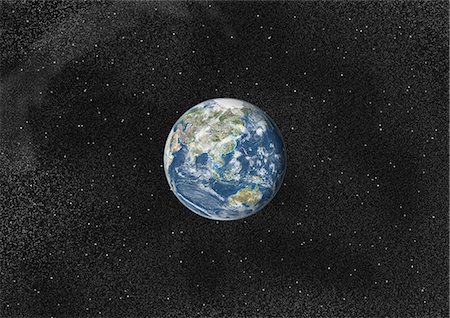
Globe Centred On Asia And Oceania, True Colour Satellite Image. True colour satellite image of the Earth centred on Asia and Oceania with cloud coverage. This image in orthographic projection was compiled from data acquired by LANDSAT 5 & 7 satellites.
Rights-Managed
-
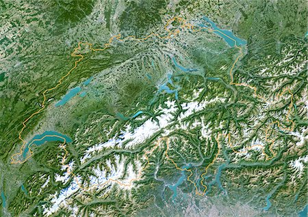
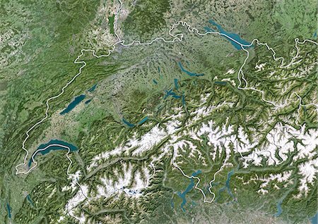
Switzerland, True Colour Satellite Image With Border. Switzerland. Satellite image of the European country of Switzerland, with border. North is at top. This small landlocked country is dominated by the Alps mountains in the south and lakes in the north. Lake Constance is at upper right, Lake Geneva is at lower left. The image used data from LANDSAT 5 & 7 satellites.
Rights-Managed
-

United States (Alaska Incl.), True Colour Satellite Image With Border. USA (Alaska incl.) and Canada, true colour satellite image. This image was compiled from data acquired by LANDSAT 5 & 7 satellites.
Rights-Managed
-
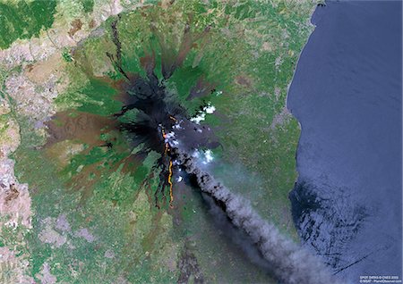
Mount Etna, Sicily, True Colour Satellite Image. Satellite image of Mount Etna, the highest active volcano in Europe, situated North-East of Sicily, 3350m high. Image taken on 23 July 2001 using LANDSAT data.
Rights-Managed
-
-
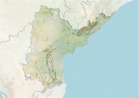
Relief map of the State of Andhra Pradesh, India. This image was compiled from data acquired by LANDSAT 5 & 7 satellites combined with elevation data.
Rights-Managed
-
-

Delhi, India, True Colour Satellite Image. Delhi, India. True colour satellite image of Delhi, taken on 22 October 1999, using LANDSAT 7 data.
Rights-Managed
-
Colour satellite image of Montreal, Quebec, Canada. Image taken on November 11, 2014 with Landsat 8 data.
Rights-Managed
-

Agriculture In The Desert, City Of Tabuk In 1990, Saudi Arabia, True Colour Satellite Image. True colour satellite image of the city of Tabuk in 1990, in north western Saudi Arabia. Circular agricultural plots are visible on the image. Composite image using LANDSAT 5 data.
Rights-Managed


