-

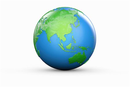
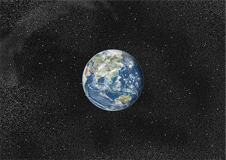
Glass sphere representing Europe, Russia, Middle East, China and India
Premium Royalty-Free
-
-
-

-

-

Satellite view of Taiwan. This image was compiled from data acquired by Landsat satellites.
Rights-Managed
-

-
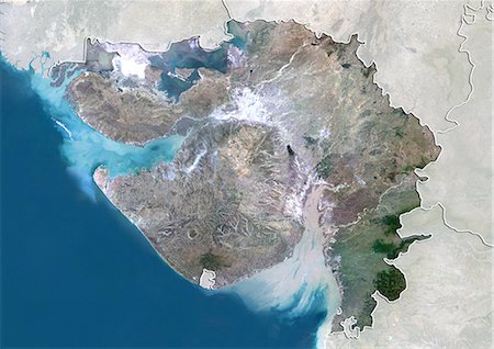
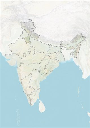
Satellite view of the State of Gujarat, India. This image was compiled from data acquired by LANDSAT 5 & 7 satellites.
Rights-Managed
-

-
-

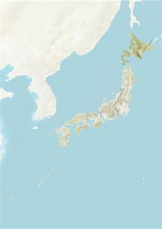
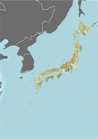
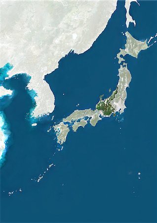
Satellite view of the region of Hokkaido, Japan. This image was compiled from data acquired by LANDSAT 5 & 7 satellites.
Rights-Managed
-

-

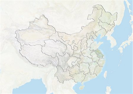
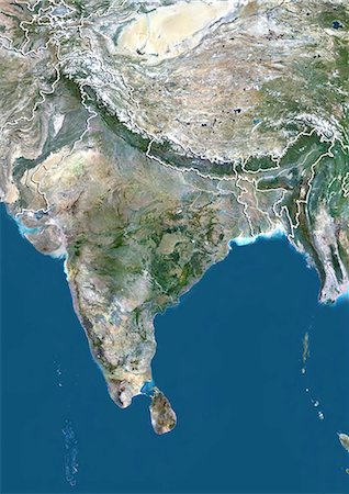
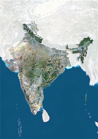
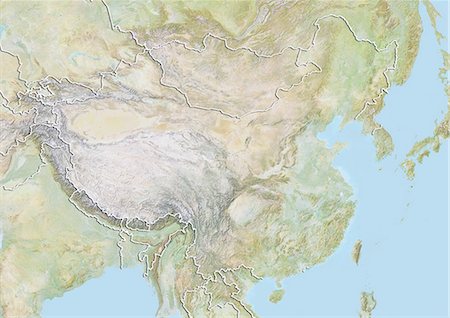
Satellite view of Asia. This image was compiled from data acquired by Landsat 7 & 8 satellites.
Rights-Managed
-
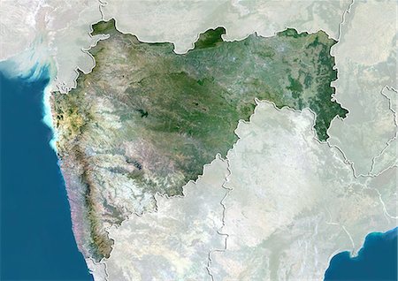
Satellite view of the State of Maharashtra, India. This image was compiled from data acquired by LANDSAT 5 & 7 satellites.
Rights-Managed
-

Illustration of metal globe on wooden stand, showing Africa, Europe and Asia, studio shot on grey, wooden background
Premium Royalty-Free
-

-
-

-

-

Satellite view of the State of West Bengal, India. This image was compiled from data acquired by LANDSAT 5 & 7 satellites.
Rights-Managed
-

-

-

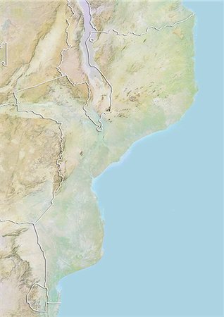
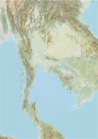
Relief map of Kyrgyzstan (with border and mask). This image was compiled from data acquired by landsat 5 & 7 satellites combined with elevation data.
Rights-Managed
-

Globe Showing Asia, True Colour Satellite Image. True colour satellite image of the Earth showing Asia and the North Pole. This image in orthographic projection was compiled from data acquired by LANDSAT 5 & 7 satellites.
Rights-Managed
-

-

-
-

Glass globe representing Europe, Russia, Middle East, China and India
Premium Royalty-Free
-
-

-

-
-
Satellite view of the State of Sikkim, India. This image was compiled from data acquired by LANDSAT 5 & 7 satellites.
Rights-Managed
-

-
-

Glass Globe illustrating Asia, India, China, Russia, Africa, Saudi Arabia, Middle East
Premium Royalty-Free
-

-
-
-

-
Satellite view of the State of Haryana, India. This image was compiled from data acquired by LANDSAT 5 & 7 satellites.
Rights-Managed
-
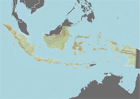
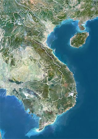
Relief map of Indonesia (with border and mask). This image was compiled from data acquired by landsat 5 & 7 satellites combined with elevation data.
Rights-Managed
-
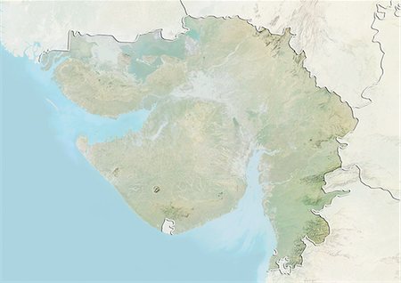
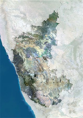
Relief map of the State of Gujarat, India. This image was compiled from data acquired by LANDSAT 5 & 7 satellites combined with elevation data.
Rights-Managed
-

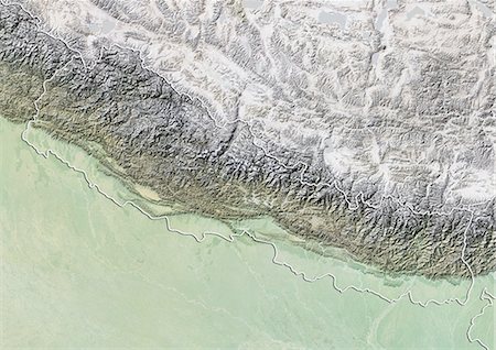
Relief map of the region of Hokkaido, Japan. This image was compiled from data acquired by LANDSAT 5 & 7 satellites combined with elevation data.
Rights-Managed
-
-

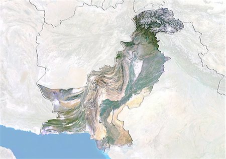
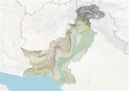
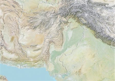
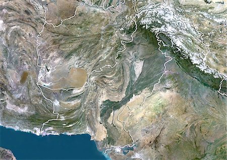
Relief map of Pakistan (with border and mask). This image was compiled from data acquired by landsat 5 & 7 satellites combined with elevation data.
Rights-Managed
-
-
Relief map of Japan (with border and mask). This image was compiled from data acquired by landsat 5 & 7 satellites combined with elevation data.
Rights-Managed
-
-

-
-

Inle Lake, Myanmar, True Colour Satellite Image. True colour satellite image of Inle Lake, a freshwater lake located in Myanmar. Image taken on 24 January 2000, using LANDSAT 7 data.
Rights-Managed
-

-
-
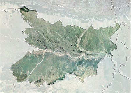
Satellite view of the State of Bihar, India. This image was compiled from data acquired by LANDSAT 5 & 7 satellites.
Rights-Managed
-

-
-

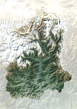
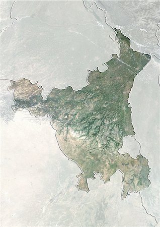
Relief map of the province of Yunnan, China. This image was compiled from data acquired by LANDSAT 5 & 7 satellites combined with elevation data.
Rights-Managed
-

-
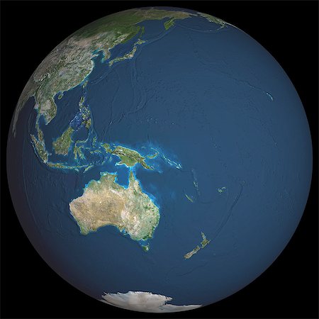
Globe Centred On Asia And Oceania, True Colour Satellite Image. True colour satellite image of the Earth centred on Asia and Oceania with cloud coverage. This image in orthographic projection was compiled from data acquired by LANDSAT 5 & 7 satellites.
Rights-Managed
-

Satellite view of the State of Uttarakhand, India. This image was compiled from data acquired by LANDSAT 5 & 7 satellites.
Rights-Managed
-
-
-
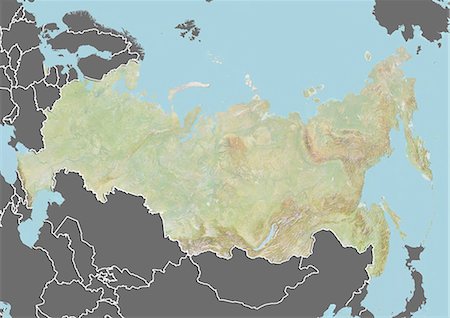
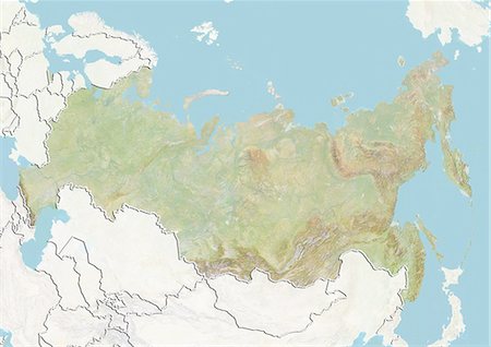
Relief map of Russia (with border and mask). This image was compiled from data acquired by landsat 5 & 7 satellites combined with elevation data.
Rights-Managed
-
-

-
-
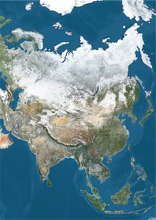
Satellite view of Asia in winter, with partial snow cover. This image was compiled from data acquired by Landsat 7 & 8 satellites.
Rights-Managed
-
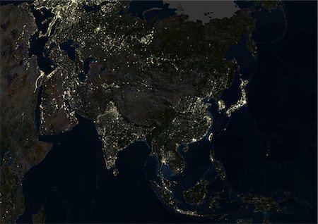
Asia At Night, True Colour Satellite Image. True colour satellite image of Asia at night. This image in Lambert Azimuthal Equal Area projection was compiled from data acquired by LANDSAT 5 & 7 satellites.
Rights-Managed
-
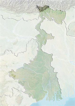
Relief map of the State of West Bengal, India. This image was compiled from data acquired by LANDSAT 5 & 7 satellites combined with elevation data.
Rights-Managed
-

Satellite view of the province of Guangdong, China. This image was compiled from data acquired by LANDSAT 5 & 7 satellites.
Rights-Managed
-
-
-
-
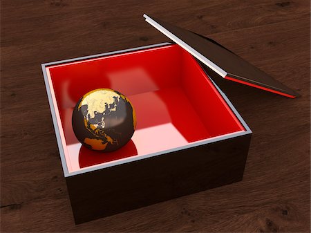
Illustration of close-up of black, lacquer case with red interior, displaying a marble covered with map of Asia, studio shot
Premium Royalty-Free
-
-
Satellite view of the State of Karnataka, India. This image was compiled from data acquired by LANDSAT 5 & 7 satellites.
Rights-Managed
-

Globe Showing Asia, True Colour Satellite Image. True colour satellite image of the Earth showing Asia, half in shadow, and the sun. This image in orthographic projection was compiled from data acquired by LANDSAT 5 & 7 satellites.
Rights-Managed
-
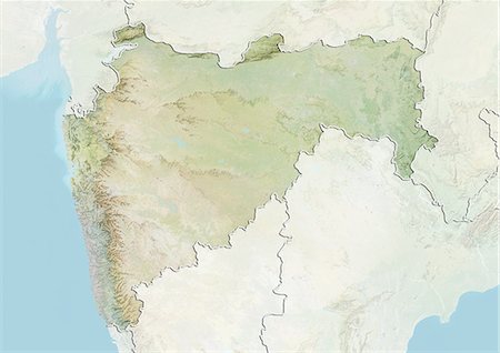
Relief map of the State of Maharashtra, India. This image was compiled from data acquired by LANDSAT 5 & 7 satellites combined with elevation data.
Rights-Managed
-
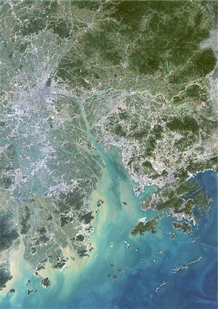
Canton And Shenzen, China, In 2000, True Colour Satellite Image. True colour satellite image of the cities of Guangzhou (Canton) and Shenzen, China. Image in portrait format, taken on 14 September 2000, using LANDSAT data.
Rights-Managed
-
-

Long Island Volcano In 3D, Papua New Guinea, True Colour Satellite Image. Long Island, Papua New Guinea, true colour satellite image. 3D satellite view of Long Island volcano in the Bismark Sea, Papua New Guinea. This volcano contains a large caldera filled by Lake Wisdom. Image using LANDSAT data.
Rights-Managed
-

-

Iran, Middle East, Asia, True Colour Satellite Image With Border. Satellite view of Iran (with border). This image was compiled from data acquired by LANDSAT 5 & 7 satellites.
Rights-Managed
-
-
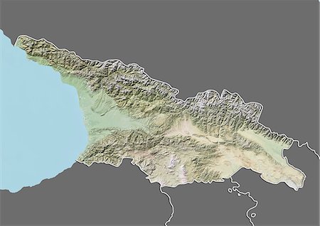
Relief map of Georgia (with border and mask). This image was compiled from data acquired by landsat 5 & 7 satellites combined with elevation data.
Rights-Managed
-
-

-

Satellite view of the province of Shandong, China. This image was compiled from data acquired by LANDSAT 5 & 7 satellites.
Rights-Managed
-

Mahanadi River Delta, India, True Colour Satellite Image. True colour satellite image of the Mahanadi River Delta in India. The Mahanadi River flows into the Gulf of Bengal. Composite image using LANDSAT 7 data.
Rights-Managed


