-

Relief map of Zambia (with border and mask). This image was compiled from data acquired by landsat 5 & 7 satellites combined with elevation data.
Rights-Managed
-
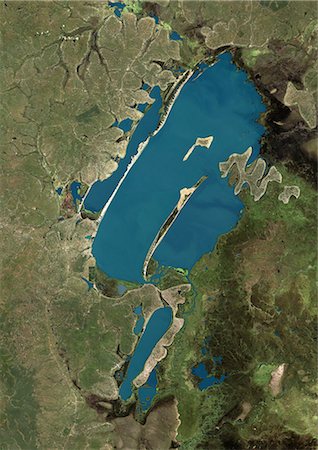
Lake Bangweulu, Zambia, True Colour Satellite Image. True colour satellite image of Lake Bangweulu situated in the upper Congo River basin in Zambia, Africa. Part of the Bangweulu Swamps are at the bottom right corner of the image. Composite image from May 2002 using LANDSAT 7 data.
Rights-Managed
-

Lake Tanganyika, Africa, True Colour Satellite Image. True colour satellite image of Lake Tanganyika, an African Great Lake divided between four countries : Burundi, Democratic Republic of the Congo (DRC), Tanzania and Zambia. Composite image using LANDSAT 5 data.
Rights-Managed
-

Zambia, Africa, True Colour Satellite Image With Mask. Satellite view of Zambia (with mask). This image was compiled from data acquired by LANDSAT 5 & 7 satellites.
Rights-Managed
-
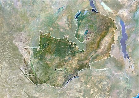
Zambia, Africa, True Colour Satellite Image With Border And Mask. Satellite view of Zambia (with border and mask). This image was compiled from data acquired by LANDSAT 5 & 7 satellites.
Rights-Managed
-
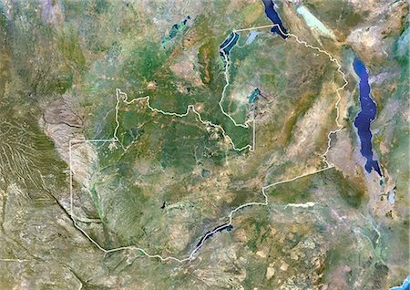
Zambia, Africa, True Colour Satellite Image With Border. Satellite view of Zambia (with border). This image was compiled from data acquired by LANDSAT 5 & 7 satellites.
Rights-Managed


