-
-
-
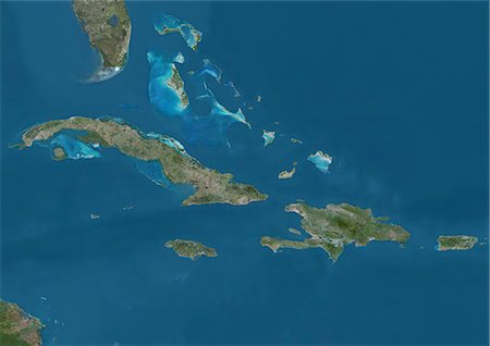
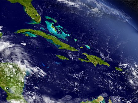
Satellite view of The Greater Antilles and Bahamas. This image was compiled from data acquired by Landsat satellites.
Rights-Managed
-
-

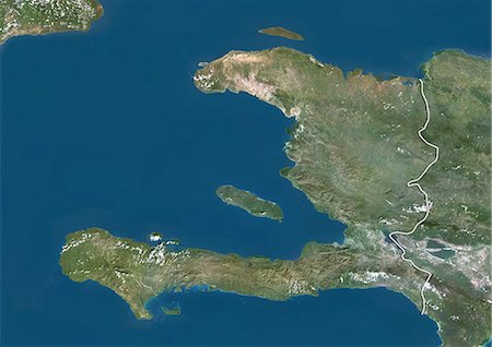
Haiti And Dominican Republic, True Colour Satellite Image With Border. Haiti and Dominican Republic, true colour satellite image with border. This image was compiled from data acquired by LANDSAT 5 & 7 satellites.
Rights-Managed
-

Caribbean Sea, Central America, True Colour Satellite Image. True colour satellite image of the Caribbean Sea. It is bounded to the south and west by Central and South America, with the North Atlantic Ocean to the northeast and the Gulf of Mexico to the northwest. Composite image using LANDSAT 5 data.
Rights-Managed
-
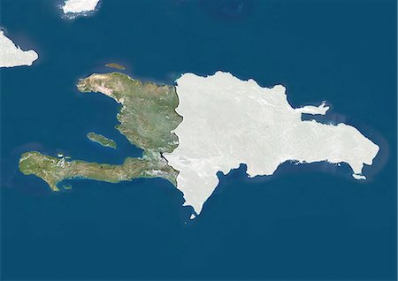
Haiti (With Mask And Border) And Dominican Republic, True Colour Satellite Image. Haiti (with mask and border) and Dominican Republic, true colour satellite image. This image was compiled from data acquired by LANDSAT 5 & 7 satellites.
Rights-Managed
-
-

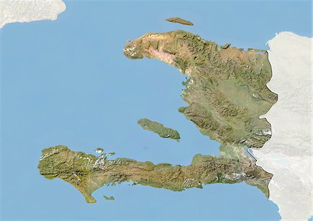
Satellite view of Haiti and The Dominican Republic. This image was compiled from data acquired by Landsat satellites.
Rights-Managed
-

Satellite view of the Caribbean Sea. The entire area of the Caribbean Sea, including all islands of the West Indies is collectively known as the Caribbean. This image was compiled from data acquired by Landsat satellites.
Rights-Managed
-
-
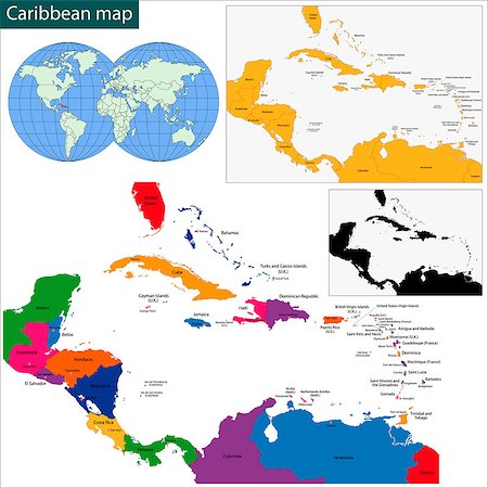
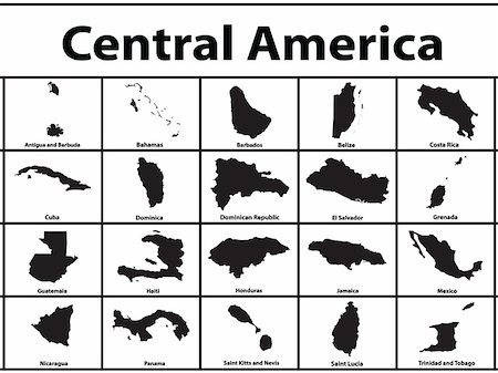
Colorful Caribbean map with countries and capital cities
Budget Royalty-Free & Subscription
-
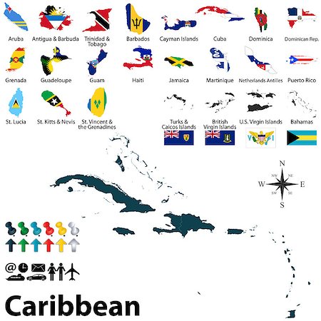
Vector political maps with flags of Caribbean on white background
Budget Royalty-Free & Subscription
-
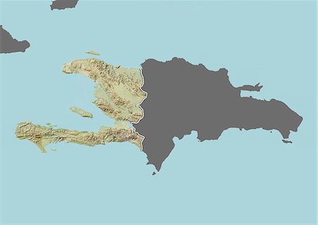
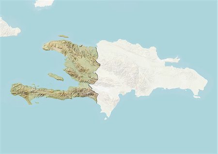
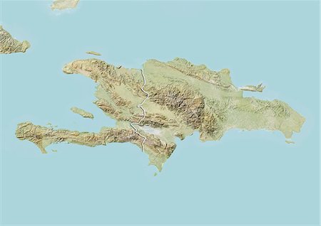
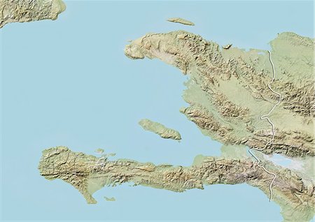
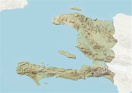
Relief map of Haiti (with border and mask). This image was compiled from data acquired by landsat 5 & 7 satellites combined with elevation data.
Rights-Managed
-

Relief map of Haiti (with border and mask). This image was compiled from data acquired by landsat 5 & 7 satellites combined with elevation data.
Rights-Managed
-
-

Hispaniola Political Map with Haiti and Dominican Republic, located in the Caribbean island group, the Greater Antilles. With capitals, national borders, important cities, rivers and lakes. English labeling and scaling. Illustration.
Budget Royalty-Free & Subscription
-
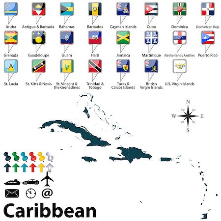
Vector of political map of Caribbean set with buttons flags on white background
Budget Royalty-Free & Subscription
-
Cuba, Jamaica, Haiti and Dominican Republic with surrounding region as seen from Earth's orbit in space. 3D illustration with detailed planet surface. Elements of this image furnished by NASA.
Budget Royalty-Free & Subscription
-

Haiti (With Mask) And Dominican Republic, True Colour Satellite Image With Mask. Haiti (with mask) and Dominican Republic, true colour satellite image. This image was compiled from data acquired by LANDSAT 5 & 7 satellites.
Rights-Managed
-
-

-

-

fully editable vector flag of haiti in map and web buttons shapes
Budget Royalty-Free & Subscription
-

-
-
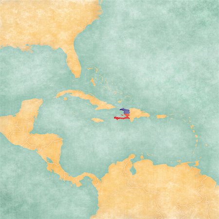
Haiti (Haitian flag) on the map of Caribbean and Central America. The Map is in vintage summer style and sunny mood. The map has a soft grunge and vintage atmosphere, which acts as a watercolor painting.
Budget Royalty-Free & Subscription
-
-
-
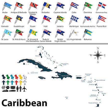
Vector political maps with flags of Caribbean on white background
Budget Royalty-Free & Subscription
-
-
-
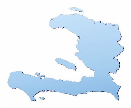
Haiti map filled with light blue gradient. High resolution. Mercator projection.
Budget Royalty-Free & Subscription
-

-
-
-

-

Dominican Republic Political Map with capital Santo Domingo, with national borders, important cities, rivers and lakes. English labeling and scaling. Illustration.
Budget Royalty-Free & Subscription
-

Haiti, True Colour Satellite Image With Border. Haiti, true colour satellite image with border. This image was compiled from data acquired by LANDSAT 5 & 7 satellites.
Rights-Managed
-

Dominican Republic and Haiti, Satellite Image With Bump Effect, With Border
Rights-Managed
-
-
-
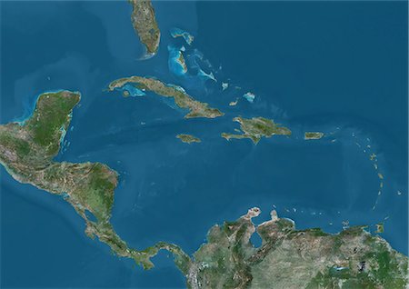
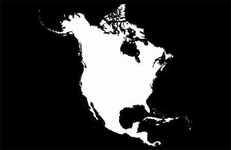
Satellite view of Central America and the Caribbean. This image was compiled from data acquired by Landsat 7 & 8 satellites.
Rights-Managed
-
-

-

Haiti, True Colour Satellite Image With Mask And Border. Haiti, true colour satellite image with mask and border. This image was compiled from data acquired by LANDSAT 5 & 7 satellites.
Rights-Managed
-

Haiti, True Colour Satellite Image With Mask. Haiti, true colour satellite image with mask. This image was compiled from data acquired by LANDSAT 5 & 7 satellites.
Rights-Managed
-
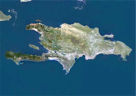
Haiti And Dominican Republic (With Mask And Border), True Colour Satellite Image. Haiti and Dominican Republic (with mask and border), true colour satellite image. This image was compiled from data acquired by LANDSAT 5 & 7 satellites.
Rights-Managed
-

Haiti And Dominican Republic (With Mask), True Colour Satellite Image. Haiti and Dominican Republic (with mask), true colour satellite image. This image was compiled from data acquired by LANDSAT 5 & 7 satellites.
Rights-Managed
-
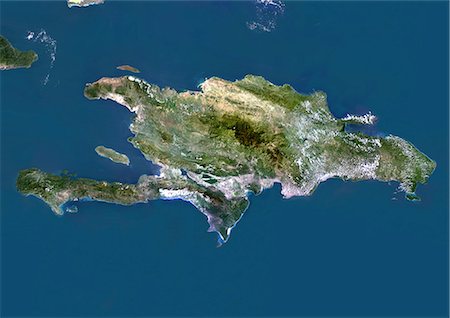
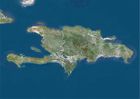
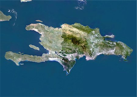
Haiti And Dominican Republic, True Colour Satellite Image. Haiti and Dominican Republic, true colour satellite image. This image was compiled from data acquired by LANDSAT 5 & 7 satellites.
Rights-Managed
-

Map of Haiti with embedded national flag. 3D illustration
Budget Royalty-Free & Subscription
-

Haiti Political Map with capital Port-au-Prince, with national borders, important cities, rivers and lakes. English labeling and scaling. Illustration.
Budget Royalty-Free & Subscription
-
button as a symbol GUINEA flag and map on a white background
Budget Royalty-Free & Subscription
-
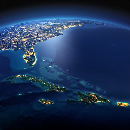
Night planet Earth with precise detailed relief and city lights illuminated by moonlight. South America. Caribbean islands. Cuba, Haiti, Jamaica. Elements of this image furnished by NASA
Budget Royalty-Free & Subscription
-

map of Haiti and the different types of characters on a white background
Budget Royalty-Free & Subscription
-

Vector map of Haiti with regions, coat of arms and location on world map
Budget Royalty-Free & Subscription
-

Haiti flag map, three dimensional render, isolated on white
Budget Royalty-Free & Subscription
-
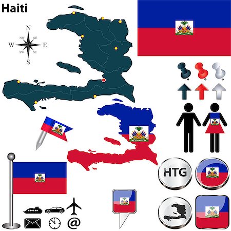
Vector of Haiti set with detailed country shape with region borders, flags and icons
Budget Royalty-Free & Subscription
-

Map of the Republic of Haiti with the departments and cities
Budget Royalty-Free & Subscription
-

-

-

-

-

-

-

-


