-

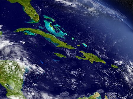
Satellite view of the Caribbean Sea. The entire area of the Caribbean Sea, including all islands of the West Indies is collectively known as the Caribbean. This image was compiled from data acquired by Landsat satellites.
Rights-Managed
-
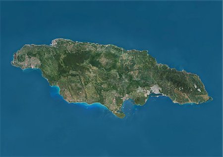
Satellite view of Jamaica. This image was compiled from data acquired by Landsat satellites.
Rights-Managed
-

Satellite view of Puerto Rico. This image was compiled from data acquired by Landsat satellites.
Rights-Managed
-

Caribbean Sea, Central America, True Colour Satellite Image. True colour satellite image of the Caribbean Sea. It is bounded to the south and west by Central and South America, with the North Atlantic Ocean to the northeast and the Gulf of Mexico to the northwest. Composite image using LANDSAT 5 data.
Rights-Managed
-
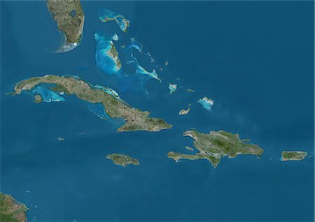
Satellite view of The Greater Antilles and Bahamas. This image was compiled from data acquired by Landsat satellites.
Rights-Managed
-
Haiti (With Mask And Border) And Dominican Republic, True Colour Satellite Image. Haiti (with mask and border) and Dominican Republic, true colour satellite image. This image was compiled from data acquired by LANDSAT 5 & 7 satellites.
Rights-Managed
-

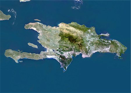
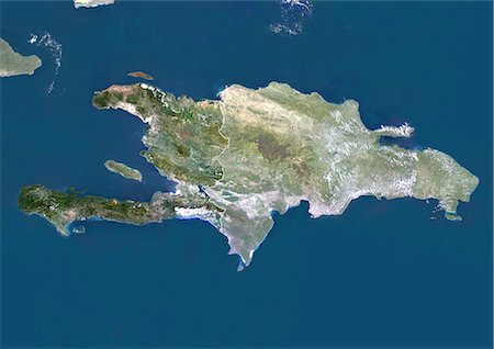
Satellite view of Haiti and The Dominican Republic. This image was compiled from data acquired by Landsat satellites.
Rights-Managed
-

Haiti (With Mask) And Dominican Republic, True Colour Satellite Image With Mask. Haiti (with mask) and Dominican Republic, true colour satellite image. This image was compiled from data acquired by LANDSAT 5 & 7 satellites.
Rights-Managed
-
Cuba, True Colour Satellite Image. True colour satellite image of Cuba, the largest island in the Carribean. The image used data from LANDSAT 5 & 7 satellites.
Rights-Managed
-
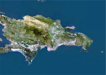
Dominican Republic, True Colour Satellite Image With Border. Dominican Republic, true colour satellite image with border. This image was compiled from data acquired by LANDSAT 5 & 7 satellites.
Rights-Managed
-

Haiti And Dominican Republic, True Colour Satellite Image With Border. Haiti and Dominican Republic, true colour satellite image with border. This image was compiled from data acquired by LANDSAT 5 & 7 satellites.
Rights-Managed
-
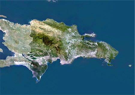
Dominican Republic, True Colour Satellite Image With Mask And Border. Dominican Republic, true colour satellite image with mask and border. This image was compiled from data acquired by LANDSAT 5 & 7 satellites.
Rights-Managed
-
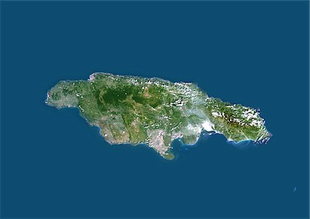
Jamaica, Caribbean, True Colour Satellite Image. Satellite view of Jamaica, Caribbean. This image was compiled from data acquired by LANDSAT 5 & 7 satellites.
Rights-Managed
-
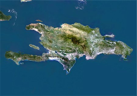
Haiti And Dominican Republic, True Colour Satellite Image. Haiti and Dominican Republic, true colour satellite image. This image was compiled from data acquired by LANDSAT 5 & 7 satellites.
Rights-Managed
-
Cuba, Jamaica, Haiti and Dominican Republic with surrounding region as seen from Earth's orbit in space. 3D illustration with detailed planet surface. Elements of this image furnished by NASA.
Budget Royalty-Free & Subscription
-

Haiti, True Colour Satellite Image With Border. Haiti, true colour satellite image with border. This image was compiled from data acquired by LANDSAT 5 & 7 satellites.
Rights-Managed
-
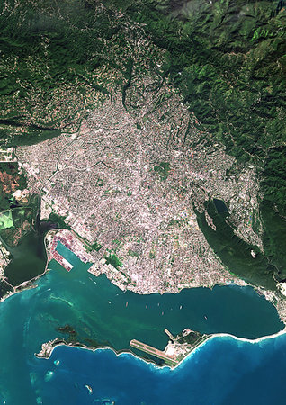
Color satellite image of Kingston, capital city of JaMayca. Image collected on December 16, 2017 by Sentinel-2 satellites.
Rights-Managed
-
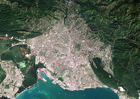
Color satellite image of Kingston, capital city of JaMayca. Image collected on December 16, 2017 by Sentinel-2 satellites.
Rights-Managed
-

Color satellite image of Port-au-Prince, capital city of Haiti. Image collected on March 25, 2017 by Sentinel-2 satellites.
Rights-Managed
-
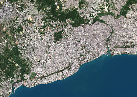
Color satellite image of Santo Domingo, capital city of Dominican Republic. Image collected on February 20, 2017 by Sentinel-2 satellites.
Rights-Managed
-
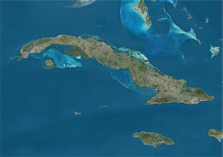
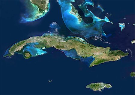
Satellite view of Cuba and Jamaica. This image was compiled from data acquired by Landsat satellites.
Rights-Managed
-

Caribbean at night in 2012. This satellite image shows urban and industrial lights.
Rights-Managed
-

Dominican Republic, True Colour Satellite Image With Mask. Dominican Republic, true colour satellite image with mask. This image was compiled from data acquired by LANDSAT 5 & 7 satellites.
Rights-Managed
-

Haiti, True Colour Satellite Image With Mask And Border. Haiti, true colour satellite image with mask and border. This image was compiled from data acquired by LANDSAT 5 & 7 satellites.
Rights-Managed
-

Haiti, True Colour Satellite Image With Mask. Haiti, true colour satellite image with mask. This image was compiled from data acquired by LANDSAT 5 & 7 satellites.
Rights-Managed
-
Haiti And Dominican Republic (With Mask And Border), True Colour Satellite Image. Haiti and Dominican Republic (with mask and border), true colour satellite image. This image was compiled from data acquired by LANDSAT 5 & 7 satellites.
Rights-Managed
-

Haiti And Dominican Republic (With Mask), True Colour Satellite Image. Haiti and Dominican Republic (with mask), true colour satellite image. This image was compiled from data acquired by LANDSAT 5 & 7 satellites.
Rights-Managed


