-

Satellite view of deforestation in East Rondonia, Brazil in 1986 and 2001. This before and after image shows deforestation impact over the years.
Rights-Managed
-

-

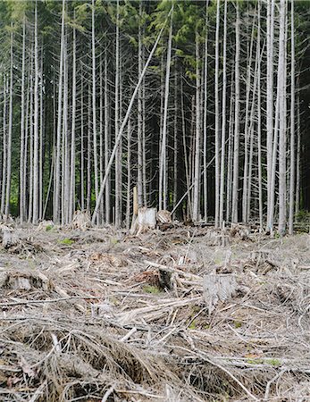
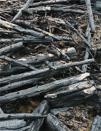
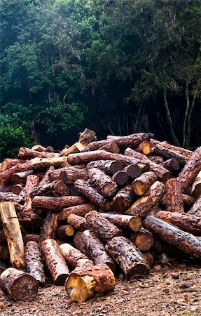
Recently cut logs of Sitka Spruce and Western Hemlock in lush temperate rainforest, Hoh Rainforest, Olympic NF
Premium Royalty-Free
-

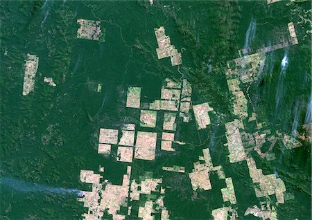
Deforestation, East Rondonia, Brazil, In 2000, True Colour Satellite Image. True colour satellite image showing deforestation in Amazonia in the Eastern part of the State of Rondonia, Brazil. Image in landscape format taken in 2000, using LANDSAT data.
Rights-Managed
-
-

Logging and deforistation of primary rainforest in the Crocker Range,Sabah,Borneo
Rights-Managed
-
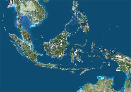
Indonesia, Asia, True Colour Satellite Image With Border. Satellite view of Indonesia (with border). This image was compiled from data acquired by LANDSAT 5 & 7 satellites.
Rights-Managed
-
-
Deforestation, Para, Brazil, In 2000, True Colour Satellite Image. True colour satellite image showing deforestation in Amazonia in the State of Para, Brazil. Image taken in 2000, using LANDSAT data.
Rights-Managed
-
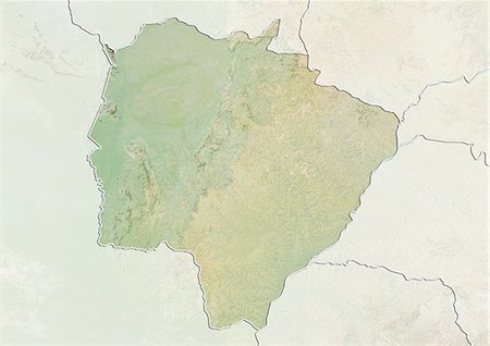
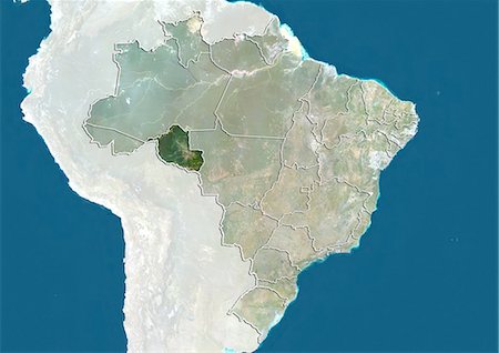
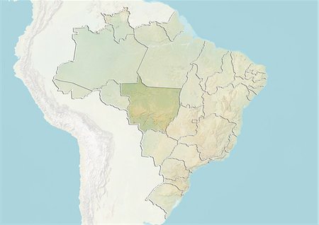
Relief map of the State of Mato Grosso do Sul, Brazil. This image was compiled from data acquired by LANDSAT 5 & 7 satellites combined with elevation data.
Rights-Managed
-
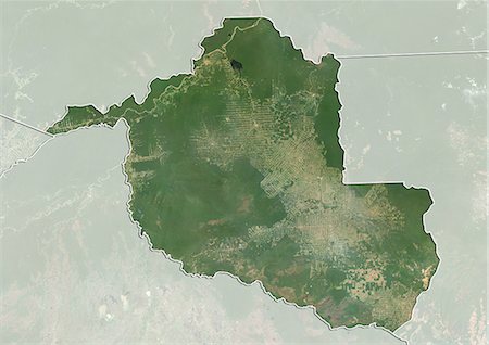
Satellite view of the State of Rondonia, Brazil. This image is from 2003 and compiled from data acquired by LANDSAT 7 satellite.
Rights-Managed
-

-

Logging and deforistation of primary rainforest in the Crocker Range,Sabah,Borneo
Rights-Managed
-

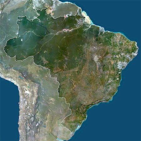
Brazil, South America, True Colour Satellite Image With Mask. Satellite view of Brazil (with mask), print size 42x42cm. This image was compiled from data acquired by LANDSAT 5 & 7 satellites.
Rights-Managed
-
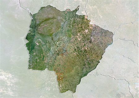
Satellite view of the State of Mato Grosso do Sul, Brazil. This image was compiled from data acquired by LANDSAT 5 & 7 satellites.
Rights-Managed
-

Deforestation, West Rondonia, Brazil, In 1986, True Colour Satellite Image. True colour satellite image showing deforestation in Amazonia in the Western part of the State of Rondonia, Brazil. Image taken on 07 July 1986, using LANDSAT data.
Rights-Managed
-
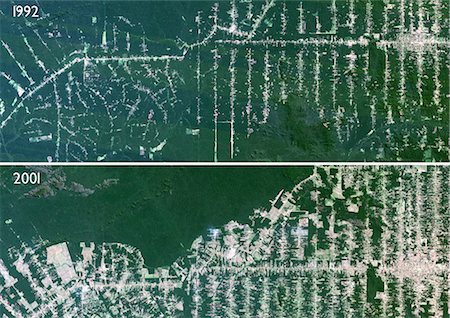
Deforestation, Mato Grosso, Brazil, True Colour Satellite Image. True colour satellite image showing deforestation in progress between 1992 and 2001 in Amazonia in the State of Mato Grosso, using LANDSAT data.
Rights-Managed
-
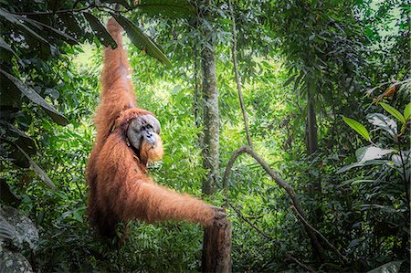
Sumatran orangutan, Pongo Abelii, Gunung Leuser National Park, Sumatra, Indonesia
Rights-Managed
-

Deforestation, West Rondonia, Brazil, In 2000, True Colour Satellite Image. True colour satellite image showing deforestation in Amazonia in the Western part of the State of Rondonia, Brazil. Image taken on 22 August 2000, using LANDSAT data.
Rights-Managed
-
Brazil, South America, True Colour Satellite Image With Border And Mask. Satellite view of Brazil (with border and mask), print size 42x42cm. This image was compiled from data acquired by LANDSAT 5 & 7 satellites.
Rights-Managed
-
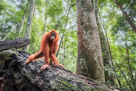
Sumatran orangutan, Pongo Abelii, Gunung Leuser National Park, Sumatra, Indonesia
Rights-Managed
-

Recently cut logs of Sitka Spruce and Western Hemlock in lush temperate rainforest, Hoh Rainforest, Olympic NF
Premium Royalty-Free
-
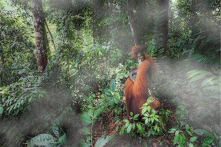
Sumatran orangutan, Pongo Abelii, Gunung Leuser National Park, Sumatra, Indonesia
Rights-Managed
-
-

-
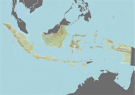
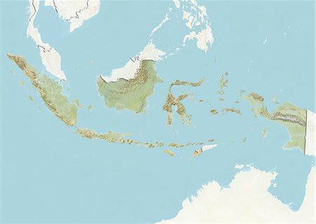
Relief map of Indonesia (with border and mask). This image was compiled from data acquired by landsat 5 & 7 satellites combined with elevation data.
Rights-Managed
-

Rivers Barito& Kahayan, Borneo, Indonesia, True Colour Satellite Image. South coast of Borneo, true colour satellite image. The rivers Barito and Kahayan, red coloured by laterite, flow into the Java sea. The rainforest (dark green), a rich biodiversified ecosystem, is shrinking rapidly due to heavy logging (areas in light green, with many paths). Image taken on 16 July 2000 using LANDSAT data.
Rights-Managed
-
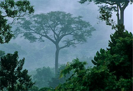
Ghana,Eastern region,Atewa. A large forest tree stands out at dawn. Atewa is one of the reserves protecting trees from being used as firewood.
Rights-Managed
-

-

-
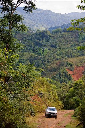
Logging roads and cross country driving in the Crocker Range,Sabah,Borneo
Rights-Managed
-
-

Satellite view of the State of Rondonia, Brazil. This image is from 1990 and compiled from data acquired by LANDSAT 5 satellite.
Rights-Managed
-
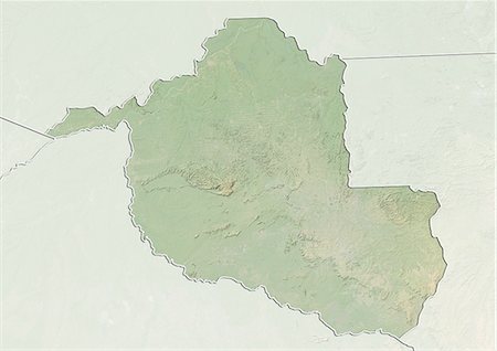
Relief map of the State of Rondonia, Brazil. This image is from 2003 and compiled from data acquired by LANDSAT 7 satellite combined with elevation data.
Rights-Managed
-

Relief map of the State of Rondonia, Brazil. This image is from 1990 and compiled from data acquired by LANDSAT 5 satellite combined with elevation data.
Rights-Managed
-

-
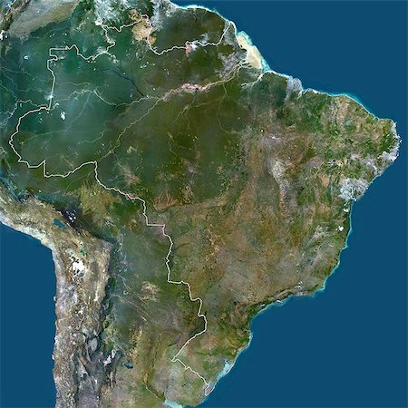
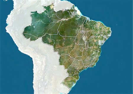
Brazil, South America, True Colour Satellite Image With Border. Satellite view of Brazil (with border), print size 42x42cm. This image was compiled from data acquired by LANDSAT 5 & 7 satellites.
Rights-Managed
-

-
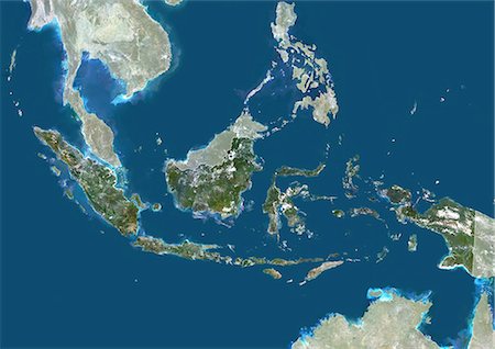
Indonesia, Asia, True Colour Satellite Image With Border And Mask. Satellite view of Indonesia (with border and mask). This image was compiled from data acquired by LANDSAT 5 & 7 satellites.
Rights-Managed
-

Indonesia, Asia, True Colour Satellite Image With Mask. Satellite view of Indonesia (with mask). This image was compiled from data acquired by LANDSAT 5 & 7 satellites.
Rights-Managed
-

-

Clearing forest for building of the Forest Edge highway in high jungle region of Tarapoto, Peru, South america
Rights-Managed
-

Replacing the original vegetation of the rainforest by loblolly pine commercial forests in southern Brazil.
Budget Royalty-Free & Subscription
-

Satellite view of deforestation in Matto Grosso, Brazil in 1985 and 2000. This before and after image shows deforestation impact over the years.
Rights-Managed
-

Deforestation, East Rondonia, Brazil, In 1986, True Colour Satellite Image. True colour satellite image showing deforestation in Amazonia in the Eastern part of the State of Rondonia, Brazil. Image in portrait format taken in 1986, using LANDSAT data.
Rights-Managed
-

Deforestation, Para, Brazil, In 1992, True Colour Satellite Image. True colour satellite image showing deforestation in Amazonia in the State of Para, Brazil. Image taken in 1992, using LANDSAT data.
Rights-Managed
-

-

Deforestation, East Rondonia, Brazil, In 2001, True Colour Satellite Image. True colour satellite image showing deforestation in Amazonia in the Eastern part of the State of Rondonia, Brazil. Image in portrait format taken in 2001, using LANDSAT data.
Rights-Managed
-

Araucaria forest is a associated ecosystem to Atlantic rainforest, endangered by deforestation. Currently remains less than 1% of this ecosystem.
Budget Royalty-Free & Subscription
-

Deforestation, East Rondonia, Brazil, In 1990, True Colour Satellite Image. True colour satellite image showing deforestation in Amazonia in the Eastern part of the State of Rondonia, Brazil. Image in landscape format taken in 1990, using LANDSAT data.
Rights-Managed
-

Deforestation, Mato Grosso, Brazil, In 2000, True Colour Satellite Image. True colour satellite image showing deforestation in Amazonia in the State of Mato Grosso, Brazil. Image taken on 18 June 2000, using LANDSAT data.
Rights-Managed
-

-
-

plant, ecology, pollution, environment, nature, radiation, protection, mountains, poles
Budget Royalty-Free & Subscription
-
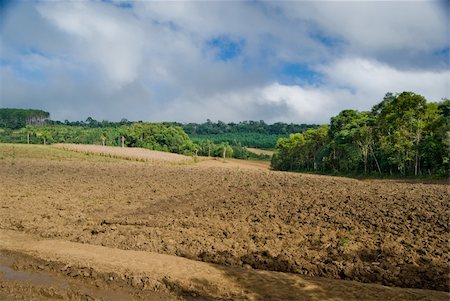
Exposed soil on forest converted to agricultural production area in southern Brazil.
Budget Royalty-Free & Subscription
-

-

A grove of brazilian pine trees (Araucaria angustifolia - Araucariaceae), typical of Southern Brazil.
Budget Royalty-Free & Subscription
-

Conversion of native atlantic rainforest for pasture in northwestern Parana, Brazil.
Budget Royalty-Free & Subscription
-
-

Replacement of native forest for sugarcane and eucalyptus in the south of Brazil. Today there are less than 1% of the Brazilian Atlantic forest, deforestation is the main cause of emissions of greenhouse gases in Brazil.
Budget Royalty-Free & Subscription
-

-

-
-
-

Deforestation, Mato Grosso, Brazil, In 1985, True Colour Satellite Image. True colour satellite image showing deforestation in Amazonia in the State of Mato Grosso, Brazil. Image taken on 17 June 1985, using LANDSAT data.
Rights-Managed
-

Wild monkey face jungle wildlife green background in Tailand
Budget Royalty-Free & Subscription
-

A grove of brazilian pine trees (Araucaria angustifolia - Araucariaceae), typical of Southern Brazil.
Budget Royalty-Free & Subscription
-

A grove of brazilian pine trees (Araucaria angustifolia - Araucariaceae), typical of Southern Brazil.
Budget Royalty-Free & Subscription
-

Conversion of areas of rainforest for cattle ranching and agriculture in the northwest of Paraná, southern Brazil.
Budget Royalty-Free & Subscription
-


