-

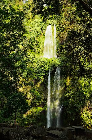
Pearl Shoal Waterfall, Unesco World Heritage Site, Jiuzhaigou National Park, Sichuan Province, China, East Asia
Rights-Managed
-
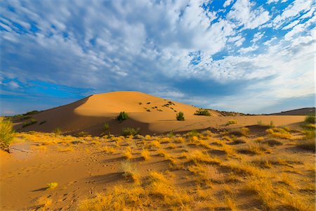
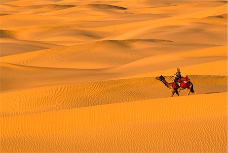
Singing Dunes, Altyn-Emel National Park, Almaty region, Kazakhstan, Central Asia, Asia
Rights-Managed
-
-
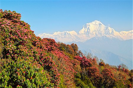
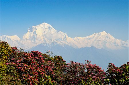
Rhododendron and Dhaulagiri Himal seen from Poon Hill, Annapurna Conservation Area, Dhawalagiri (Dhaulagiri), Western Region (Pashchimanchal), Nepal, Himalayas, Asia
Rights-Managed
-
-
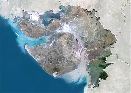
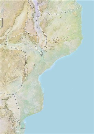
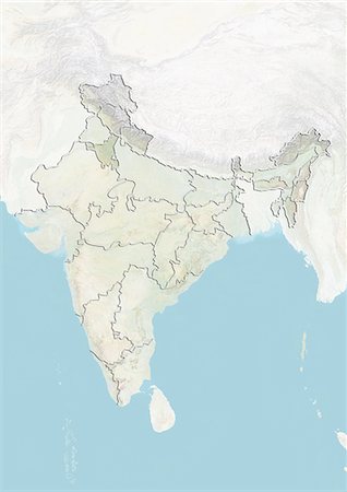
Satellite view of the State of Gujarat, India. This image was compiled from data acquired by LANDSAT 5 & 7 satellites.
Rights-Managed
-

Khao Sok National Park, Surat Thani Province, Thailand, Southeast Asia, Asia
Rights-Managed
-

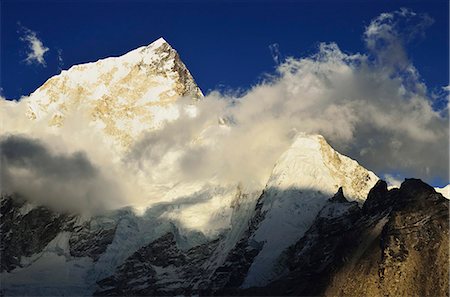
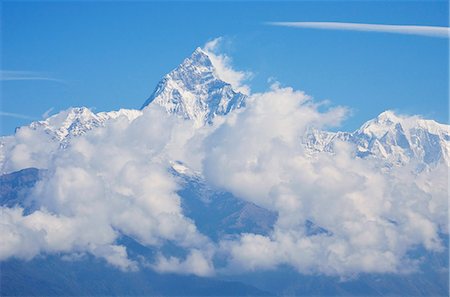
Mount Everest, 8850m, and glacial lake, Solu Khumbu Everest Region, Sagarmatha National Park, UNESCO World Heritage Site, Nepal, Himalayas, Asia
Rights-Managed
-
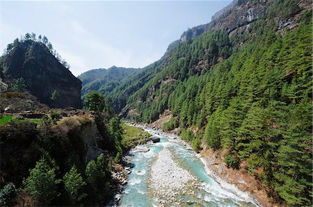
Bhote Kosi River, Solu Khumbu Everest Region, Sagarmatha National Park, UNESCO World Heritage Site, Nepal, Himalayas, Asia
Rights-Managed
-
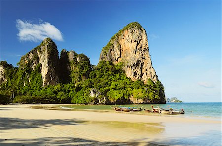
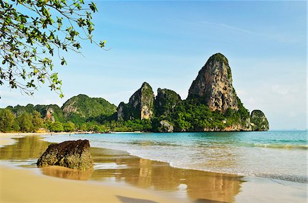
Rai Leh West Beach, Rai Leh (Railay), Andaman Coast, Krabi Province, Thailand, Southeast Asia, Asia
Rights-Managed
-
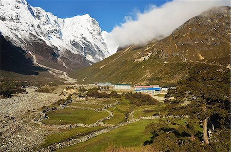
Thame village, Sagarmatha National Park, UNESCO World Heritage Site, Solukhumbu District, Sagarmatha, Eastern Region (Purwanchal), Nepal, Himalayas, Asia
Rights-Managed
-
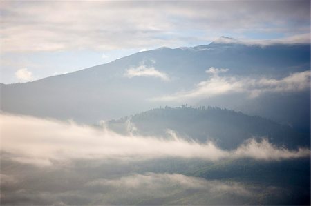
Early morning mist hanging over mountains outside Thimpu, Bhutan, Himalayas, Asia
Rights-Managed
-

Ice pinnacles near Everest Base Camp, Solu Khumbu Everest Region, Sagarmatha National Park, UNESCO World Heritage Site, Nepal, Himalayas, Asia
Rights-Managed
-

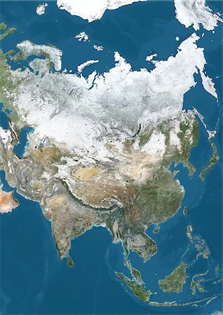
Satellite view of Asia. This image was compiled from data acquired by Landsat 7 & 8 satellites.
Rights-Managed
-

Aktau Mountains, Altyn-Emel National Park, Almaty region, Kazakhstan, Central Asia, Asia
Rights-Managed
-

Ile-Alatau National Park, Assy Plateau, Almaty, Kazakhstan, Central Asia, Asia
Rights-Managed
-
-
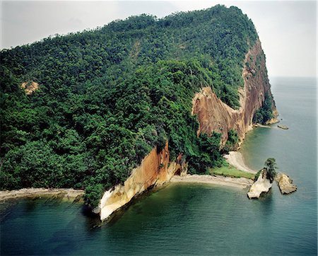
Sandekan, Semporne Bay, Sabah, island of Borneo, Malaysia, Southeast Asia, Asia
Rights-Managed
-
-

Palm tree landscape near Iboih, Pulau Weh Island, Aceh Province, Sumatra, Indonesia, Southeast Asia, Asia
Rights-Managed
-

-
Satellite view of the province of Gansu, China. This image was compiled from data acquired by LANDSAT 5 & 7 satellites.
Rights-Managed
-
-
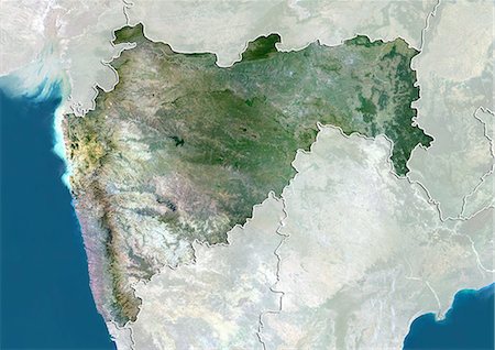
Satellite view of the State of Maharashtra, India. This image was compiled from data acquired by LANDSAT 5 & 7 satellites.
Rights-Managed
-
Nuptse seen from Kala Patthar, Sagarmatha National Park, UNESCO World Heritage Site, Solukhumbu District, Sagarmatha, Eastern Region (Purwanchal), Nepal, Himalayas, Asia
Rights-Managed
-

-
-

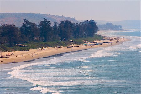
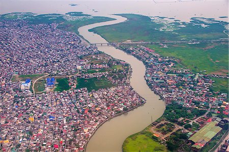
Fishing boats and ferry on the River Ganges in the early morning, Sonepur, Bihar, India, Asia
Rights-Managed
-

Satellite view of the province of Shandong, China. This image was compiled from data acquired by LANDSAT 5 & 7 satellites.
Rights-Managed
-
Machapuchare seen from Sarangkot, Gandaki Zone, Western Region, Nepal, Himalayas, Asia
Rights-Managed
-
Air Terjun Sendang Gila waterfall, Senaru, Lombok, Indonesia, Southeast Asia, Asia
Rights-Managed
-
-
-

Happy Island, Hat Phra Nang Beach, Railay, Krabi Province, Thailand, Southeast Asia, Asia
Rights-Managed
-
Rai Leh West Beach, Rai Leh (Railay), Andaman Coast, Krabi Province, Thailand, Southeast Asia, Asia
Rights-Managed
-
Rhododendron and Dhaulagiri Himal seen from Poon Hill, Annapurna Conservation Area, Dhawalagiri (Dhaulagiri), Western Region (Pashchimanchal), Nepal, Himalayas, Asia
Rights-Managed
-
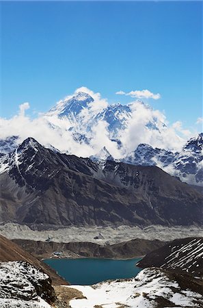
View from Renjo Pass of Mount Everest, Everest Himalayan Range and Gokyo Lake, Sagarmatha National Park, UNESCO World Heritage Site, Solukhumbu District, Sagarmatha, Eastern Region (Purwanchal), Nepal, Himalayas, Asia
Rights-Managed
-

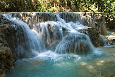
Kouang Si Waterfall and Pools, near Luang Prabang, Laos, Indochina, Southeast Asia, Asia
Rights-Managed
-
Satellite view of Asia in winter, with partial snow cover. This image was compiled from data acquired by Landsat 7 & 8 satellites.
Rights-Managed
-
-
-

Satellite view of the province of Guangdong, China. This image was compiled from data acquired by LANDSAT 5 & 7 satellites.
Rights-Managed
-
Relief map of the province of Gansu, China. This image was compiled from data acquired by LANDSAT 5 & 7 satellites combined with elevation data.
Rights-Managed
-

The Great Wall of China, UNESCO World Heritage Site, Mutianyu, Beijing District, China, Asia
Rights-Managed
-
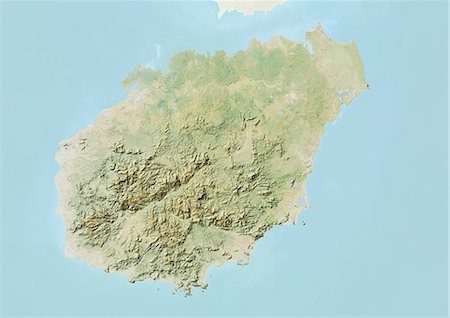
Relief map of the province of Hainan, China. This image was compiled from data acquired by LANDSAT 5 & 7 satellites combined with elevation data.
Rights-Managed
-
-

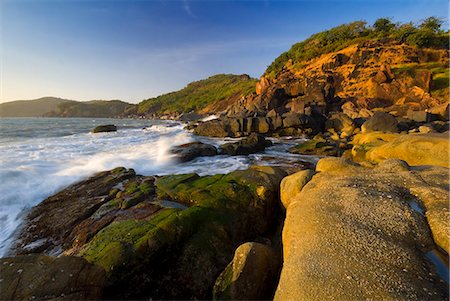
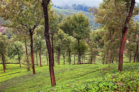
Village amidst tea plantations in the hill country between Hatton and Nuwara Eliya, Central Highlands, Sri Lanka, Asia
Rights-Managed
-
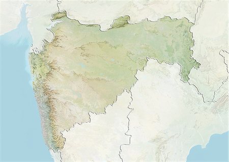
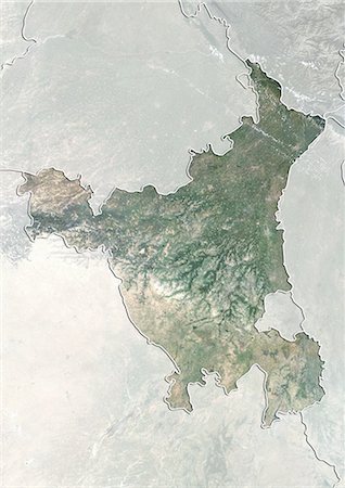
Relief map of the State of Maharashtra, India. This image was compiled from data acquired by LANDSAT 5 & 7 satellites combined with elevation data.
Rights-Managed
-

Sandekan, Semporne Bay, Sabah, island of Borneo, Malaysia, Southeast Asia, Asia
Rights-Managed
-
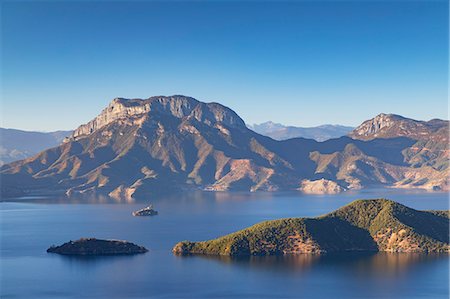
Jiuzhaigou on the edge of the Tibetan Plateau, known for its waterfalls and colourful lakes, located in the north of Sichuan Province, China, Asia
Premium Royalty-Free
-

Tourist watching sunrise at Angkor Wat Temple, Angkor Temples, UNESCO World Heritage Site, Siem Reap Province, Cambodia, Indochina, Southeast Asia, Asia
Rights-Managed
-
Kouang Si Waterfall and Pools, near Luang Prabang, Laos, Indochina, Southeast Asia, Asia
Rights-Managed
-
-

View of Gunung Agung from the rice fields of Karangasem, Bali, Indonesia, Southeast Asia, Asia
Rights-Managed
-

Relief map of the region of Hokkaido, Japan. This image was compiled from data acquired by LANDSAT 5 & 7 satellites combined with elevation data.
Rights-Managed
-
-

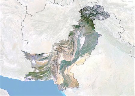
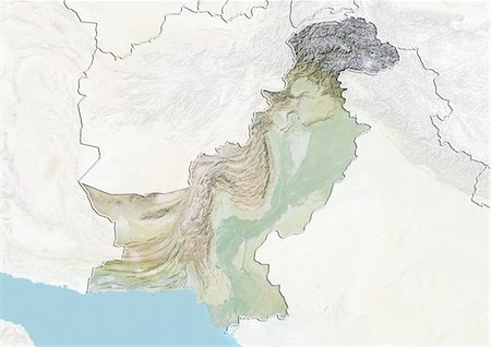
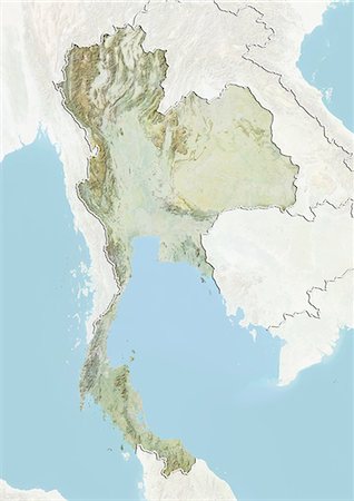
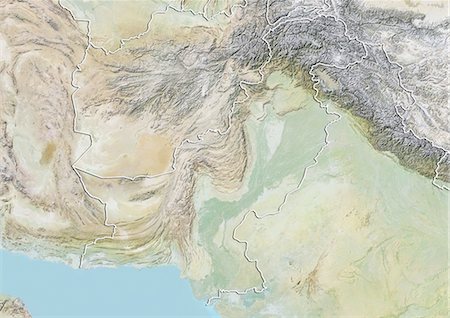
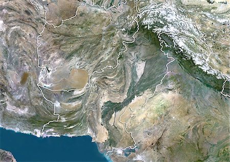
Relief map of Pakistan (with border and mask). This image was compiled from data acquired by landsat 5 & 7 satellites combined with elevation data.
Rights-Managed
-
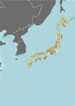
Relief map of Japan (with border and mask). This image was compiled from data acquired by landsat 5 & 7 satellites combined with elevation data.
Rights-Managed
-

View of the coast of Bali near Candi Dasa, Bali, Indonesia, Southeast Asia, Asia
Rights-Managed
-
-
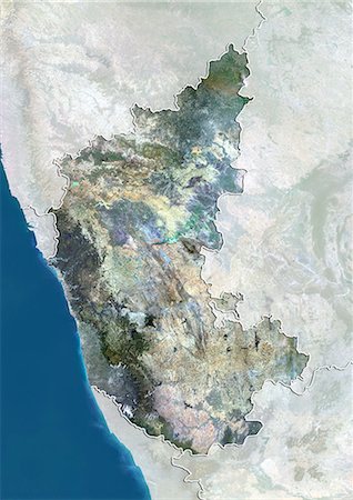
Satellite view of the State of Karnataka, India. This image was compiled from data acquired by LANDSAT 5 & 7 satellites.
Rights-Managed
-

Rhododendron forest, near Titi, Annapurna Conservation Area, Dhawalagiri (Dhaulagiri), Western Region (Pashchimanchal), Nepal, Asia
Rights-Managed
-
Rainforest, Tiger Cave Temple (Wat Tham Suea), Krabi Province, Thailand, Southeast Asia, Asia
Rights-Managed
-
Satellite view of the State of Haryana, India. This image was compiled from data acquired by LANDSAT 5 & 7 satellites.
Rights-Managed
-
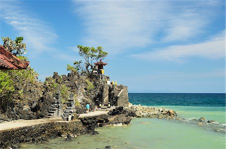
Pura Batu Bolong Temple, south of Senggigi, Lombok, Indonesia, Southeast Asia, Asia
Rights-Managed
-

Vegetable cultivation, an important alternative to the normal tea crop in the Hill Country near Nuwara Eliya, Sri Lanka, Asia
Rights-Managed
-
-

Ruins of King Kassapa's Palace at the top of Sigiriya Rock Fortress (Lion Rock), UNESCO World Heritage Site, Sigiriya, Sri Lanka, Asia
Rights-Managed
-
-
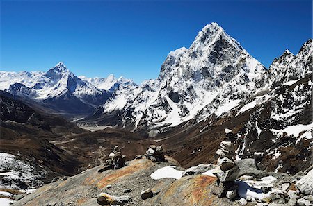
View of Ama Dablam and Chola Khola from Cho La Pass, Sagarmatha National Park, UNESCO World Heritage Site, Solukhumbu District, Sagarmatha, Eastern Region (Purwanchal), Nepal, Himalayas, Asia
Rights-Managed
-

-

Fertile carefully tended smallholdings full of vegetables covering the sloping hills in central Java, Surakarta district, Java, Indonesia, Southeast Asia, Asia
Rights-Managed
-
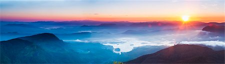
Adams Peak (Sri Pada) view at sunrise, mountains and the Maussakele Reservoir, Central Highlands, Sri Lanka, Asia
Premium Royalty-Free
-

-
-

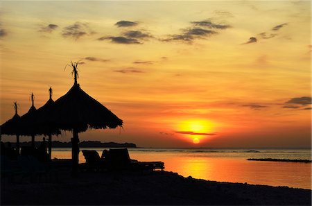
Two deck chairs under palm trees and tropical beach, The Maldives, Indian Ocean, Asia
Premium Royalty-Free
-
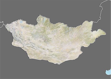
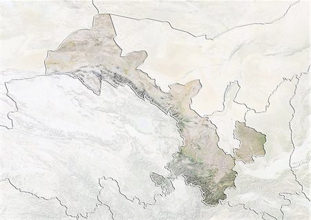
Relief map of Mongolia (with border and mask). This image was compiled from data acquired by landsat 5 & 7 satellites combined with elevation data.
Rights-Managed
-
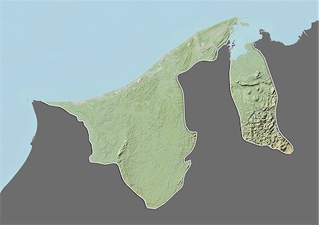
Relief map of Brunei (with border and mask). This image was compiled from data acquired by landsat 5 & 7 satellites combined with elevation data.
Rights-Managed
-
-

-
-

-
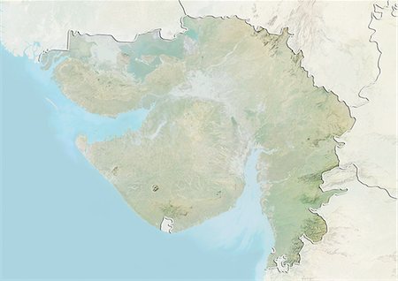
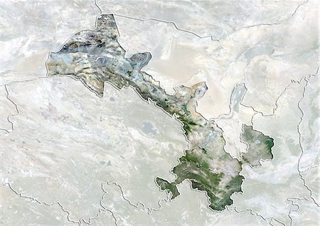
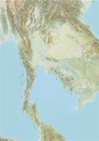
Relief map of the State of Gujarat, India. This image was compiled from data acquired by LANDSAT 5 & 7 satellites combined with elevation data.
Rights-Managed
-
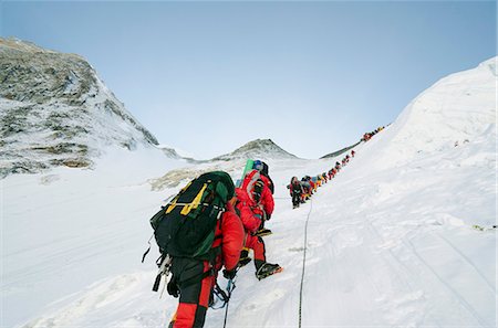
A line of climbers on the Lhotse Face, Mount Everest, Solu Khumbu Everest Region, Sagarmatha National Park, UNESCO World Heritage Site, Nepal, Himalayas, Asia
Rights-Managed
-

Temples at Doi Inthanon, the highest peak in Thailand, Chiang Mai Province, Thailand, Southeast Asia, Asia
Premium Royalty-Free
-

Climbers on the Geneva Spur, Solu Khumbu Everest Region, Sagarmatha National Park, UNESCO World Heritage Site, Nepal, Himalayas, Asia
Rights-Managed
-

The tropical island of Gili Air, with Gili Meno beach in the foreground, Gili Isles, Indonesia, Southeast Asia, Asia
Rights-Managed
-
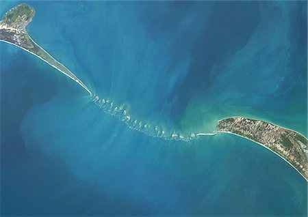
Satellite view of Adam's Bridge. This chain of limestone shoals connects Sri Lanka to India. This image was taken in 2014 by Landsat 8 satellite.
Rights-Managed
-
-
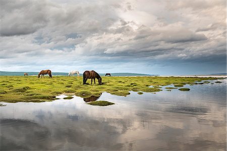
Horses grazing on the shores of Hovsgol Lake, Hovsgol province, Mongolia, Central Asia, Asia
Premium Royalty-Free


