-

-

-

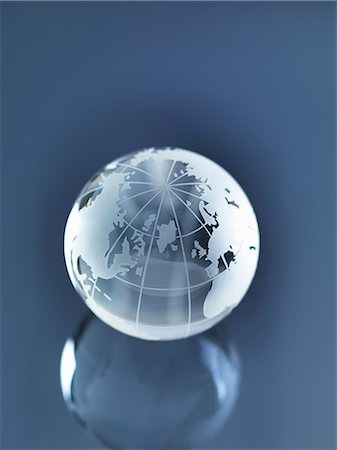
Glass Globe illustrating North and South America, Europe, Russia and Africa
Premium Royalty-Free
-

-

Glass Globe illustrating North and South America, Europe, Russia and Africa
Premium Royalty-Free
-
-
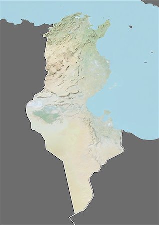
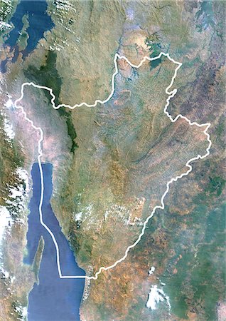
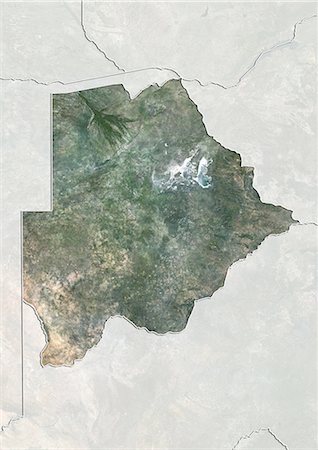
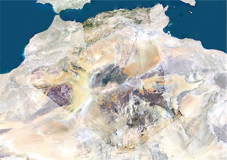
Relief map of Tunisia (with border and mask). This image was compiled from data acquired by landsat 5 & 7 satellites combined with elevation data.
Rights-Managed
-

-

-
-

-

-
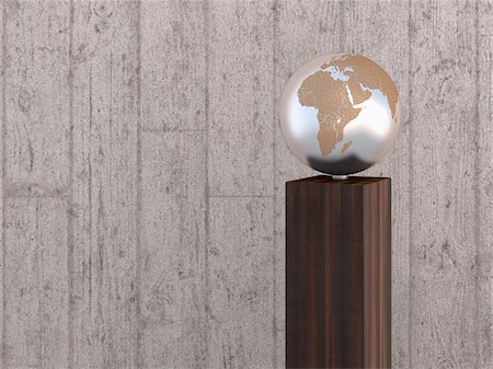
Illustration of metal globe on wooden stand, showing Africa, Europe and Asia, studio shot on grey, wooden background
Premium Royalty-Free
-

-
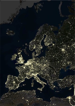
Europe At Night, True Colour Satellite Image. True colour satellite image of Europe at night. This image in Lambert Conformal Conic projection was compiled from data acquired by LANDSAT 5 & 7 satellites.
Rights-Managed
-

-

-

Democratic Republic Of The Congo, Africa, True Colour Satellite Image With Border. Satellite view of the Democratic Republic of the Congo - Kinshasa (with border). This image was compiled from data acquired by LANDSAT 5 & 7 satellites.
Rights-Managed
-
-

-
-

Glass Globe illustrating Asia, India, China, Russia, Africa, Saudi Arabia, Middle East
Premium Royalty-Free
-

-
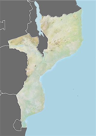
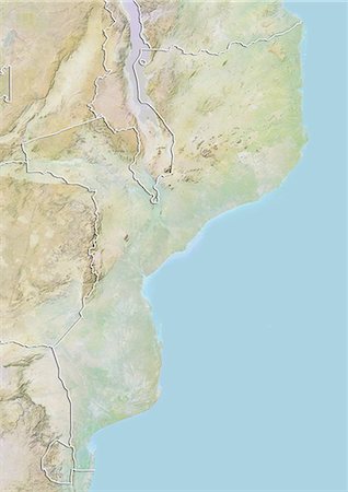
Relief map of Mozambique (with border and mask). This image was compiled from data acquired by landsat 5 & 7 satellites combined with elevation data.
Rights-Managed
-

-
-

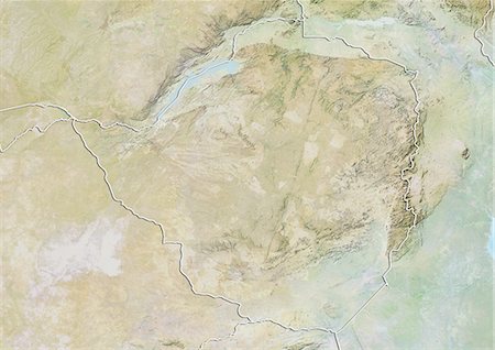
Relief map of Democratic Republic of Congo (with border and mask). This image was compiled from data acquired by landsat 5 & 7 satellites combined with elevation data.
Rights-Managed
-
-
-

-

-

-

Europe At Night With Country Borders, True Colour Satellite Image. True colour satellite image of Europe at night with country borders. This image in Lambert Conformal Conic projection was compiled from data acquired by LANDSAT 5 & 7 satellites.
Rights-Managed
-

Satellite view of Southern Africa. It shows the African Great Lakes region. This image was compiled from data acquired by Landsat 7 & 8 satellites.
Rights-Managed
-

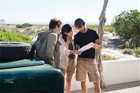
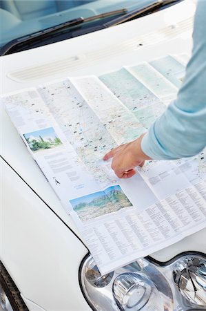
Rear view of a man looking at map on car with young woman sitting in the background
Premium Royalty-Free
-
-

-
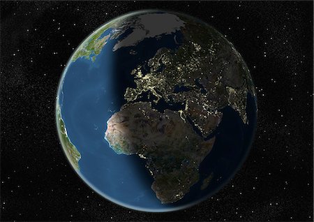
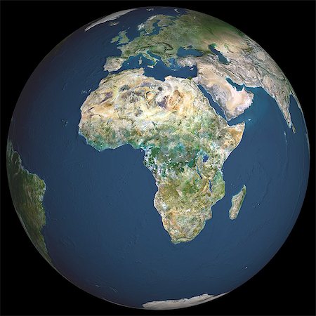
Globe Centred On Europe And Africa, True Colour Satellite Image. True colour satellite image of the Earth centred on Europe and Africa, during winter solstice at 6 p.m GMT. This image in orthographic projection was compiled from data acquired by LANDSAT 5 & 7 satellites.
Rights-Managed
-

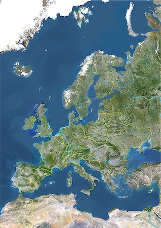
Europe, True Colour Satellite Image. True colour satellite image of Europe. This image in Lambert Conformal Conic projection was compiled from data acquired by LANDSAT 5 & 7 satellites.
Rights-Managed
-

Mediterranean Area, True Colour Satellite Image. Mediterranean Sea. True colour satellite images showing the Mediterranean Sea. Points of interest include the Alps (just above centre, white), the Blakek Sea (centre right), and the Nile Delta (green, lower right). This image was compiled from data acquired by LANDSAT 5 & 7 satellites.
Rights-Managed
-
Casablanc, Morocco, True Colour Satellite Image. Casablanca, Morocco. True colour satellite image of the city of Casablanca, located on the Atlantic Ocean. Image taken on 20 January 2001, using LANDSAT 7 data.
Rights-Managed
-
-

-

-

-

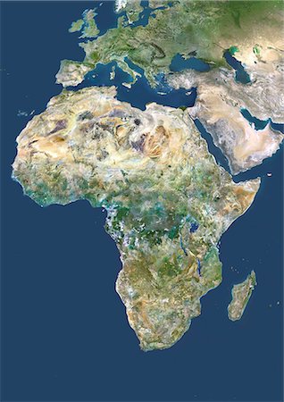
Africa, True Colour Satellite Image. True colour satellite image of Africa. This image in Lambert Azimuthal Equal Area projection was compiled from data acquired by LANDSAT 5 & 7 satellites.
Rights-Managed
-

-
Burundi, Africa, True Colour Satellite Image With Border. Satellite view of Burundi (with border). This image was compiled from data acquired by LANDSAT 5 & 7 satellites.
Rights-Managed
-
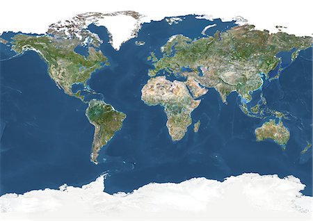
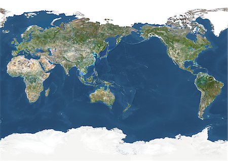
Whole Earth With Country Borders And Major Rivers, True Colour Satellite Image. True colour satellite image of the whole Earth with country borders and major rivers. This image in Miller projection was compiled from data acquired by LANDSAT 5 & 7 satellites.
Rights-Managed
-
-

-

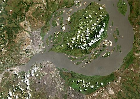
Ogooue River Delta, Gabon, True Colour Satellite Image. True colour satellite image of the Ogooué river delta, the principal river of Gabon in west central Africa. Composite image using LANDSAT 5 data.
Rights-Managed
-
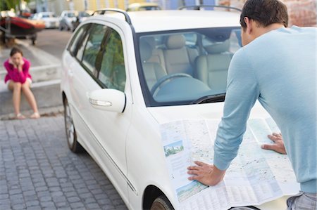
Rear view of a man looking at map on car with young woman sitting in the background
Premium Royalty-Free
-

Piton De La Fournaise Volcano, Reunion Island, French Overseas, True Colour Satellite Image. Piton de la Fournaise, Reunion island, French overseas, true colour satellite image. Piton de la Fournaise (2631m), one of the world's most active volcanoes, is located on the South East part of Reunion Island, in the Indian Ocean. Image taken on 19 June 2000 using LANDSAT data. Print size 30 x 30 cm.
Rights-Managed
-
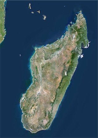
Madagascar, True Colour Satellite Image. Madagascar, true colour satellite image. This image was compiled from data acquired by LANDSAT 5 & 7 satellites.
Rights-Managed
-
Whole Earth Centred On Pacific Ocean, True Colour Satellite Image. True colour satellite image of the whole Earth centred on the Pacific Ocean, with country borders and cloud coverage. This image in Miller projection was compiled from data acquired by LANDSAT 5 & 7 satellites.
Rights-Managed
-
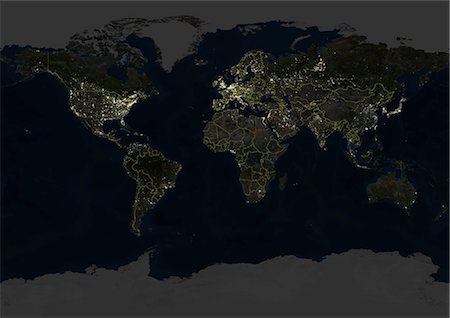
Whole Earth At Night With Country Borders, True Colour Satellite Image. True colour satellite image of the whole Earth at night with country borders. This image in Miller projection was compiled from data acquired by LANDSAT 5 & 7 satellites.
Rights-Managed
-

Burkina Faso, Africa, True Colour Satellite Image With Border. Satellite view of Burkina Faso (with border). This image was compiled from data acquired by LANDSAT 5 & 7 satellites.
Rights-Managed
-

Rub Al Khali Desert, Saudi Arabia, True Colour Satellite Image. Rub Al Khali, a sand desert South East of Saudi Arabia ; sand dunes are sculptured and moved by the winds, in blue the argillakeeous subsoil, and in white the salt crusts left out by the oueds in the rainy season.
Rights-Managed
-
-
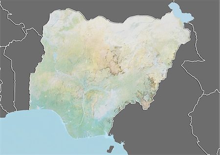
Relief map of Nigeria (with border and mask). This image was compiled from data acquired by landsat 5 & 7 satellites combined with elevation data.
Rights-Managed
-
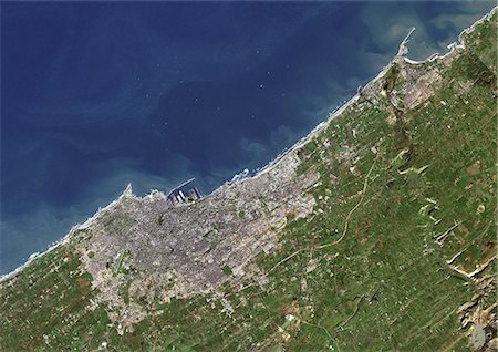
Tangier, Morocco, True Colour Satellite Image. Tangier, Morocco. True colour satellite image of Tangier, a city of northern Morocco that lies on the North African coast. Image taken on 20 August 1999 using LANDSAT 7 data.
Rights-Managed
-

Piton De La Fournaise Volcano In 3D, Reunion Island, French Overseas, True Colour Satellite Image. Piton de la Fournaise, Reunion, true colour satellite image. 3D satellite view of the Piton de la Fournaise (2631m), one of the world's most active volcanoes, located on the South East part of Reunion Island, in the Indian Ocean. Image using LANDSAT data.
Rights-Managed
-
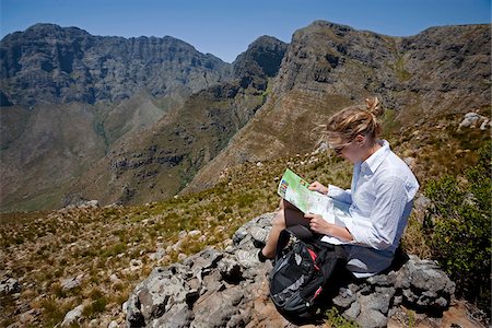
South Africa, Franschhoek. A tourist checks her map on a hike in the Mont Rochelle Nature Reserve near Franschhoek.
Rights-Managed
-

Globe Centred On Europe And Africa, True Colour Satellite Image. True colour satellite image of the Earth centred on Europe and Africa, during winter solstice at 12 p.m GMT. This image in orthographic projection was compiled from data acquired by LANDSAT 5 & 7 satellites.
Rights-Managed
-
Whole Earth Centred On Pacific Ocean, True Colour Satellite Image. True colour satellite image of the whole Earth centred on the Pacific Ocean, with country borders and major rivers. This image in Miller projection was compiled from data acquired by LANDSAT 5 & 7 satellites.
Rights-Managed
-
Globe Showing Europe, True Colour Satellite Image. True colour satellite image of the Earth showing Greenland, the North Pole and Europe, with cloud coverage. This image in orthographic projection was compiled from data acquired by LANDSAT 5 & 7 satellites.
Rights-Managed
-
-
-

Agriculture In The Libyan Desert, Libya, True Colour Satellite Image. True colour satellite image of agriculture in the Libyan desert in 2001, in the eastern part of Libya. Circular agricultural plots are visible on the image. Composite image using LANDSAT 7 data.
Rights-Managed
-

Europe With Cloud Coverage, True Colour Satellite Image. True colour satellite image of Europe with cloud coverage. This image in Lambert Conformal Conic projection was compiled from data acquired by LANDSAT 5 & 7 satellites.
Rights-Managed
-
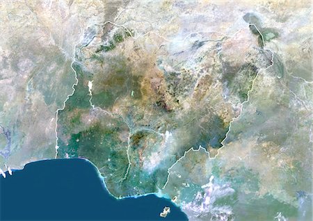
Nigeria, Africa, True Colour Satellite Image With Border And Mask. Satellite view of Nigeria (with border and mask). This image was compiled from data acquired by LANDSAT 5 & 7 satellites.
Rights-Managed
-

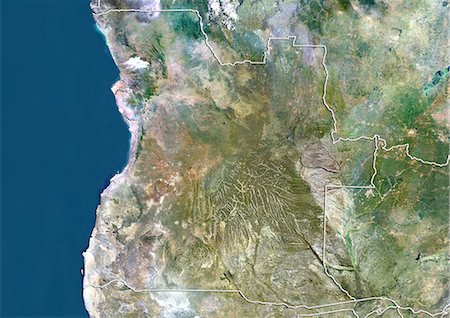
Angola, Africa, True Colour Satellite Image With Border. Satellite view of Angola (with border). This image was compiled from data acquired by LANDSAT 5 & 7 satellites.
Rights-Managed
-
-

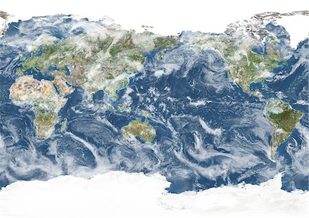
Whole Earth With Cloud Coverage, True Colour Satellite Image. True colour satellite image of the whole Earth with cloud coverage. This image in Miller projection was compiled from data acquired by LANDSAT 5 & 7 satellites.
Rights-Managed
-
-
Kinshasa, Congo, True Colour Satellite Image. Kinshasa, Democratic Republic of Congo. True colour satellite image of Kinshasa, capital city of the Democratic Republic of Congo. Image taken on 30 April 2001, using LANDSAT 7 data.
Rights-Managed
-

-

-
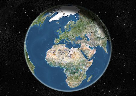
Globe Centred On Europe And Africa, True Colour Satellite Image. True colour satellite image of the Earth centred on Europe and Africa, at the equinox at 12 a.m GMT. This image in orthographic projection was compiled from data acquired by LANDSAT 5 & 7 satellites.
Rights-Managed
-

-

Africa With Country Borders And Cloud Coverage, True Colour Satellite Image. True colour satellite image of Africa with country borders and cloud coverage. This image in Lambert Azimuthal Equal Area projection was compiled from data acquired by LANDSAT 5 & 7 satellites.
Rights-Managed
-
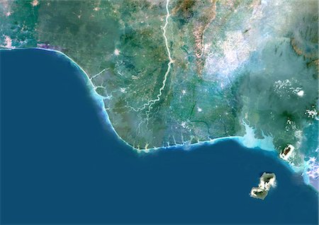
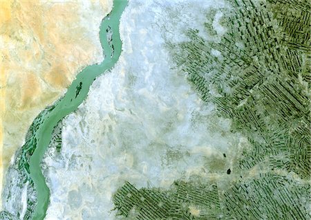
Niger River Delta, Nigeria, True Colour Satellite Image. True colour satellite image of the Niger River Delta in Nigeria, Africa. The city of Lagos, the second most populous city in Africa, is to be seen west of the Niger River Delta on the Atlantic coast in the Gulf of Guinea.Composite image using LANDSAT 5 data.
Rights-Managed
-

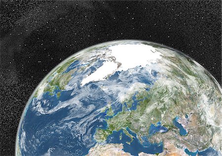
Globe Centred On Europe And Africa, True Colour Satellite Image. True colour satellite image of the Earth centred on Europe and Africa with cloud coverage. This image in orthographic projection was compiled from data acquired by LANDSAT 5 & 7 satellites.
Rights-Managed
-
Europe With Country Borders And Major Rivers, True Colour Satellite Image. True colour satellite image of Europe with country borders and major rivers. This image in Lambert Conformal Conic projection was compiled from data acquired by LANDSAT 5 & 7 satellites.
Rights-Managed
-
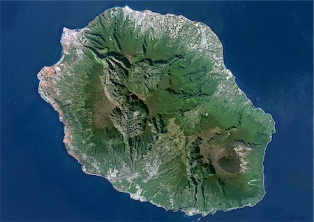
Piton De La Fournaise, Reunion Island, French Overseas, True Colour Satellite Image. Reunion Island, French overseas, true colour satellite image. Reunion island is made of two volcanos, Piton des Neiges volcano, the highest point on the island at 3069m, and Piton de la Fournaise (2632m), an active shield volcano on the Eastern end of Reunion Island. Image taken on 19 June 2000 using LANDSAT data.
Rights-Managed
-

Democratic Republic Of The Congo, Africa, True Colour Satellite Image With Border And Mask. Satellite view of the Democratic Republic of the Congo - Kinshasa (with border and mask). This image was compiled from data acquired by LANDSAT 5 & 7 satellites.
Rights-Managed
-

-
-