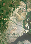
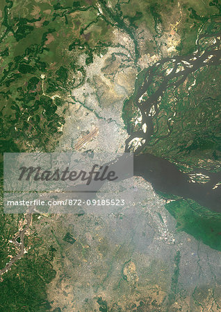
Color satellite image of Brazzaville, capital city of the Republic of the Congo, and Kinshasa, capital city of the Democratic Republic of the Congo. Brazzavile is located on the north shore of the Congo River, while Kinshasa lies on the south shore. Image collected on September 19, 2017 by Sentinel-2 satellites.
Offre de lancement
Economisez 50% lorsque vous rejoignez notre bulletin
-
Résolution Web
389×550px
13.8×19.4cm 28ppcm
-
Basse Résolution
712×1007px
25.2×35.6cm 28ppcm
-
Résolution Moyenne
1576×2229px
13.3×18.9cm 118ppcm
-
Haute Résolution
3508×4961px
29.7×42.0cm 118ppcm
* Prix final selon l'usage, non pas la taille du fichier.
Images apparentées
- Color satellite image of Brazzaville, capital city of Republic of the Congo. The city is on the north side of the Congo River. Image collected on July 12, 2017 by Sentinel-2 satellites.
- Color satellite image of Cairo, capital city of Egypt. Image collected on October 01, 2017 by Sentinel-2 satellites.
- Color satellite image of Omdurman, Sudan. The city lies on the western banks of the River Nile, opposite the capital Khartoum. Image collected on October 25, 2017 by Sentinel-2 satellites.
- Color satellite image of Khartoum, capital city of Sudan. It is located at the confluence of the White Nile to the west and the Blue Nile to the east. Image collected on October 25, 2017 by Sentinel-2 satellites.
- Color satellite image of Niamey, capital city of Niger. The Niger River flows through the city. Image collected on May 14, 2017 by Sentinel-2 satellites.
- Color satellite image of Bamako, capital city of Mali. The city is situated on the Niger River floodplain. Image collected on April 19, 2017 by Sentinel-2 satellites.
- Color satellite image of N'Djamena, capital city of Chad. The cities lies on the confluence of the Chari and Logone rivers. Image collected on April 29, 2017 by Sentinel-2 satellites.
- Color satellite image of Bangui, capital city of Central African Republic. It lies on the northern shore of the Ubangi River. Image collected on May 13, 2017 by Sentinel-2 satellites.
Plus d’images apparentées
- Colour satellite image of Cairo, Egypt. Image taken on December 16, 2013 with Landsat 8 data.
- Color satellite image of the Nile River, Egypt. The Nile Delta is formed in Northern Egypt where the Nile River spreads out and drains into the Mediterranean Sea. Images collected on October 1, 2017 by Landsat 8 satellite.
- Color satellite image of the Nile Delta. It is formed in Northern Egypt where the Nile River spreads out and drains into the Mediterranean Sea. Image collected on October 1, 2017 by Sentinel-2 satellites.
- Color satellite image of Alexandria, Egypt. Image collected on July 26, 2017 by Sentinel-2 satellites.
- Color satellite image of Harare, capital city of Zimbabwe. Image collected on September 19, 2017 by Sentinel-2 satellites.
- Color satellite image of Lusaka, capital city of Zambia. Image collected on October 02, 2017 by Sentinel-2 satellites.
- Color satellite image of Kampala, capital city of Uganda. It lies on the northern shore of Lake Victoria. Image collected on January 25, 2017 by Sentinel-2 satellites.
- Color satellite image of Tunis, capital city of Tunisia. Image collected on August 19, 2017 by Sentinel-2 satellites.
