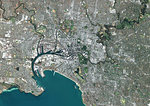
Colour satellite image of Melbourne, Australia. Image taken on January 30, 2014 with Landsat 8 data.

Oferta introductoria
Obtener 50% de descuento cuando se une a nuestra lista de correo electrónico
-
Resolución de Internet
550×388px
19.4×13.7cm 28ppcm
-
Baja resolución
1007×712px
35.6×25.2cm 28ppcm
-
Mediana resolución
2229×1576px
18.9×13.3cm 118ppcm
-
Alta resolución
4961×3508px
42.0×29.7cm 118ppcm
* Precio final basado en el uso, no en el tamaño del archivo.
Palabras clave relacionadas
- 872-
- aire libre
- al aire libre
- Australia
- cartográfico
- ciudad
- escena costera
- escenas de costa
- fotógrafia
- fotografía (arte)
- fotógrafias
- imagen a color
- litoral
- Melbourne
- nadie
- Oceanía
- Oceania
- océano
- región costanera
- sacar fotos
- Universal Images Group
- Victoria
- Victoria, Australia
- vista aérea
- vista de satélite
Imágenes relacionadas
- Color satellite image of Melbourne, Australia. Image collected on March 9, 2017 by Sentinel-2 satellites.
- Colour satellite image of Sydney, Australia. Image taken on August 4, 2014 with Landsat 8 data.
- Colour satellite image of Brisbane, Australia. Image taken on October 7, 2014 with Landsat 8 data.
- Colour satellite image of Adelaide, Australia. Image taken on August 29, 2014 with Landsat 8 data.
- Colour satellite image of Lisbon, Portugal. Image taken on July 9, 2014 with Landsat 8 data.
- Colour satellite image of Lagos, Nigeria. Image taken on January 19, 2014 with Landsat 8 data.
- Colour satellite image of Auckland, New Zealand. Image taken on February 9, 2014 with Landsat 8 data.
- Colour satellite image of Rotterdam, The Hague and Dordrecht, Netherlands. Image taken on September 17, 2014 with Landsat 8 data.
Más imágenes relacionadas
- Colour satellite image of Tallinn, Estonia. Image taken on July 25, 2014 with Landsat 8 data.
- Colour satellite image of Copenhagen, Denmark, and Malmo, Sweden. Image taken on September 5, 2014 with Landsat 8 data.
- Colour satellite image of Tianjin and Binhai, China. Image taken on August 12, 2014 with Landsat 8 data.
- Satellite view of Shanghai, China in 2001 and 2013. This before and after image shows urban expansion over the years.
- Satellite view of Shanghai, China in 1979, 2001 and 2013. This before and after image shows urban expansion over the years.
- Colour satellite image of Greater Vancouver, British Colombia, Canada. Image taken on September 15, 2014 with Landsat 8 data.
- Colour satellite image of Toronto, Ontario, Canada. Image taken on August 19, 2014 with Landsat 8 data.
- Colour satellite image of Rio de Janeiro, Brazil. Image taken on October 24, 2014 with Landsat 8 data.


