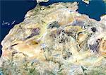
Satellite view of North Africa. This image was compiled from data acquired by Landsat 7 & 8 satellites.

Introductory Offer
Save 50% when you join our email list
-
Web Resolution
550×388px
7.6×5.4in 72ppi
-
Low Resolution
1007×712px
14.0×9.9in 72ppi
-
Medium Resolution
2230×1576px
7.4×5.3in 300ppi
-
High Resolution
4961×3507px
16.5×11.7in 300ppi
* Final price based on usage, not file size.
Related Keywords
- 872-
- Africa
- African
- African (places and things)
- Algeria
- cartographic
- color image
- color photography
- color picture
- desert
- Egypt
- ethnic
- image
- Libya
- Mali
- map
- Mauritania
- Mediterranean Sea
- Middle East
- Middle Eastern
- Middle Eastern (places and things)
- Morocco
- Niger
- Nigeria
- Nile River
- no people
- North Africa
- ocean
- outdoors
- photograph
- photographic (pertaining to the discipline of photography)
- photography
- physical geography
- picture
- Red Sea
- Sahara Desert
- satellite view
- shoreline
- stock photograph
- stock picture
- Sudan
- Sudanese ethnicity
- topography
- Universal Images Group
Related Images
- Satellite view of Africa. This image was compiled from data acquired by Landsat 7 & 8 satellites.
- Sahara Desert, Africa, True Colour Satellite Image. Sahara desert, true colour satellite image. The Sahara is the world's largest hot desert, made of sand and volcanic mountains. Composite image using data from LANDSAT 5 & 7 satellites.
- Satellite view of Southern Africa. It shows the African Great Lakes region. This image was compiled from data acquired by Landsat 7 & 8 satellites.
- Relief map of Egypt (with border and mask). This image was compiled from data acquired by landsat 5 & 7 satellites combined with elevation data.
- Egypt, True Colour Satellite Image With Border
- Egypt, True Colour Satellite Image With Border and Mask
- Egypt, Relief Map With Border
- Egypt, Relief Map With Border and Mask
More Related Images
- Satellite view of the Arabian Peninsula. This image was compiled from data acquired in 2014 by Landsat 8 satellite.
- Satellite View of Red Sea, Middle East
- Mediterranean Area, True Colour Satellite Image. Mediterranean Sea. True colour satellite images showing the Mediterranean Sea. Points of interest include the Alps (just above centre, white), the Blakek Sea (centre right), and the Nile Delta (green, lower right). This image was compiled from data acquired by LANDSAT 5 & 7 satellites.
- Color satellite image of the Nile River, Egypt. The Nile Delta is formed in Northern Egypt where the Nile River spreads out and drains into the Mediterranean Sea. Images collected on October 1, 2017 by Landsat 8 satellite.
- Color satellite image of the Nile Delta. It is formed in Northern Egypt where the Nile River spreads out and drains into the Mediterranean Sea. Image collected on October 1, 2017 by Sentinel-2 satellites.
- Satellite view of the Persian Gulf. This image was compiled from data acquired in 2014 by Landsat 8 satellite.
- Satellite view of the Middle East. This image was compiled from data acquired in 2014 by Landsat 8 satellite.
- Satellite view of Cyprus. This image was compiled from data acquired by Landsat 8 satellite in 2014.


