Satellite view of the Maluku Islands, Indonesia. This image was compiled from data acquired by Landsat satellites.

Introductory Offer
Save 50% when you join our email list
-
Web Resolution
388×550px
5.4×7.6in 72ppi
-
Low Resolution
712×1007px
9.9×14.0in 72ppi
-
Medium Resolution
1576×2230px
5.3×7.4in 300ppi
-
High Resolution
3507×4961px
11.7×16.5in 300ppi
* Final price based on usage, not file size.
Related Keywords
- 872-
- Asia
- Asian (places and things)
- cartographic
- color image
- color photography
- color picture
- image
- Indonesia
- island
- map
- no people
- ocean
- outdoors
- photograph
- photographic (pertaining to the discipline of photography)
- photography
- physical geography
- picture
- satellite view
- shoreline
- Southeast Asia
- stock photograph
- stock picture
- topography
- tourism
- Universal Images Group
Related Images
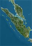
- Satellite view of Sumatra, Malaysia and Singapore. This image was compiled from data acquired by Landsat satellites.
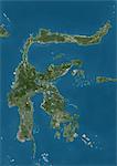
- Satellite view of Sulawesi, Indonesia. This image was compiled from data acquired by Landsat satellites.
- Satellite view of West Nusa Tenggara Province, Indonesia (with country boundaries and mask). The image shows the two largest islands in the province which are Lombok in the west and the larger Sumbawa island in the east. This image was compiled from data acquired by Landsat satellites.
- Satellite view of Southeast Asia. This image was compiled from data acquired by Landsat 7 & 8 satellites.
- Satellite view of Luzon, Philippines. It is the largest and most populous island in the Philippines. This image was compiled from data acquired by Landsat satellites.
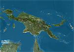
- Satellite view of New Guinea. This image was compiled from data acquired by Landsat satellites.
- Satellite view of Japan and Korean Peninsula. This image was compiled from data acquired by Landsat satellites.
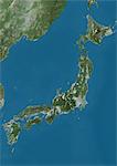
- Satellite view of Japan. This image was compiled from data acquired by Landsat satellites.
More Related Images
- Satellite view of Viti Levu Island, Fiji. This is the largest island in the Republic of Fiji and the site of the nation's capital, Suva. This image was compiled from data acquired by Landsat 8 satellite in 2014.
- Satellite view of British and US Virgin Islands. This image was compiled from data acquired by Landsat satellites.
- Satellite view of Vanua Balavu Island, Fiji. This image was compiled from data acquired by Landsat 8 satellite in 2014.
- Satellite view of Turks and Caicos Islands. This image was compiled from data acquired by Landsat satellites.
- Satellite view of the Northern Great Barrier Reef along the east coast of Cape York Peninsula in north Australia. This image was compiled from data acquired in 2014 by Landsat 8 satellite.
- Satellite view of Tenerife, Canary Islands, Spain. It is the largest and most populous island of the seven Canary Islands. Volcano Mount Teide at center is the highest point of Spain, at 3718 m. This image was compiled from data acquired by Landsat 8 satellite in 2014.
- Satellite view of Taiwan. This image was compiled from data acquired by Landsat satellites.
- Satellite view of Tahiti, French Polynesia. This image was compiled from data acquired by Landsat 8 satellite in 2014.


