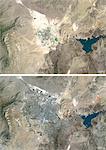
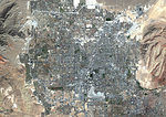
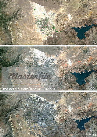
Satellite view of Las Vegas, Nevada, USA in 1975, 2000 and 2013. This before and after image shows urban expansion over the years.
Introductory Offer
Save 50% when you join our email list
-
Web Resolution
388×550px
5.4×7.6in 72ppi
-
Low Resolution
712×1007px
9.9×14.0in 72ppi
-
Medium Resolution
1576×2229px
5.3×7.4in 300ppi
-
High Resolution
3508×4961px
11.7×16.5in 300ppi
* Final price based on usage, not file size.
Related Keywords
- 21st century
- 872-
- aerial view
- Americas
- cartographic
- city
- Colorado River
- color image
- color photography
- color picture
- desert
- image
- lake
- Lake Mead
- Las Vegas
- Mojave Desert
- Nevada
- no people
- North America
- outdoors
- photograph
- photographic (pertaining to the discipline of photography)
- photography
- picture
- river
- satellite view
- stock photograph
- stock picture
- Universal Images Group
- USA
Related Images
- Colour satellite image of Las Vegas, Nevada, USA. Image taken on September 23, 2014 with Landsat 8 data.
- Satellite view of Las Vegas, Nevada, USA in 1975 and 2013. This before and after image shows urban expansion over the years.
- Colour satellite image of New Orleans, Louisiana, USA. Image taken on November 3, 2014 with Landsat 8 data.
- Color satellite image of Las Vegas, Nevada, United States, with McCarran International Airport. Image collected on October 08, 2017 by Sentinel-2 satellites.
- Color satellite image of Las Vegas, Nevada, United States. Image collected on October 08, 2017 by Sentinel-2 satellites.
- Colour satellite image of New York City, New York State, USA. Image taken on July 31, 2014 with Landsat 8 data.
- Colour satellite image of Los Angeles, California, USA. Image taken on October 23, 2014 with Landsat 8 data.
- Colour satellite image of Detroit, Michigan, USA. Image taken on June 14, 2014 with Landsat 8 data.
More Related Images
- Colour satellite image of Chicago, Illinois, USA. Image taken on August 15, 2014 with Landsat 8 data.
- Colour satellite image of Asuncion, Paraguay. Image taken on September 21, 2014 with Landsat 8 data.
- Colour satellite image of Pyongyang, North Korea. Image taken on June 6, 2014 with Landsat 8 data.
- Colour satellite image of Paris, France. Image taken on May 19, 2014 with Landsat 8 data.
- Colour satellite image of Cairo, Egypt. Image taken on December 16, 2013 with Landsat 8 data.
- Colour satellite image of Toronto, Ontario, Canada. Image taken on August 19, 2014 with Landsat 8 data.
- Colour satellite image of Montreal, Quebec, Canada. Image taken on November 11, 2014 with Landsat 8 data.
- Colour satellite image of Tashkent, Uzbekistan. Image taken on August 28, 2014 with Landsat 8 data.

