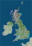
Shetland, Scotland, Uk, True Colour Satellite Image. True colour satellite image of the Shetland, an archipelago in Scotland (UK), off the northeast coast. The islands lie between the Atlantic ocean and the Norwegian sea to the West and the North Sea to the East. The main island of the group is known as Mainland. Image taken on 14 May 2000 using LANDSAT 7 data.

Introductory Offer
Save 50% when you join our email list
-
Web Resolution
388×550px
5.4×7.6in 72ppi
-
Low Resolution
712×1007px
9.9×14.0in 72ppi
-
Medium Resolution
1576×2229px
5.3×7.4in 300ppi
-
High Resolution
3508×4961px
11.7×16.5in 300ppi
* Final price based on usage, not file size.
Related Keywords
- 872-
- archipelago
- Atlantic Ocean
- color image
- color photography
- color picture
- environment
- Europe
- European
- European (places and things)
- image
- island
- map
- North Sea
- Norwegian Sea
- ocean
- photograph
- photography
- picture
- satellite view
- Scotland
- Shetland Islands
- stock photograph
- stock picture
- tourism
- United Kingdom
- Universal Images Group
Related Images
- United Kingdom, Europe, True Colour Satellite Image With Mask. Satellite view of the United Kingdom (with mask). This image was compiled from data acquired by LANDSAT 5 & 7 satellites.
- United Kingdom, Europe, True Colour Satellite Image With Border And Mask. Satellite view of the United Kingdom (with border and mask). This image was compiled from data acquired by LANDSAT 5 & 7 satellites.
- United Kingdom, Europe, True Colour Satellite Image With Border. Satellite view of Bulgaria (with border). This image was compiled from data acquired by LANDSAT 5 & 7 satellites.
- Azores Islands, Portugal, True Colour Satellite Image. True colour satellite image of the Azores, a Portuguese archipelago in the Atlantic ocean. The islands are, from west to east, Corvo, Flores, Faial, Pico, Sao Jorge,Graciosa, Terceira, Sao Miguel and Santa Maria. Image using LANDSAT 7 data.
- Satellite view of Scotland including Shetland, United Kingdom. This image was compiled from data acquired by LANDSAT 5 & 7 satellites.
- Relief map of Scotland including Shetland, United Kingdom. This image was compiled from data acquired by LANDSAT 5 & 7 satellites combined with elevation data.
- United Kingdom and Scotland, True Colour Satellite Image
- United Kingdom and Scotland, Satellite Image With Bump Effect
More Related Images
- United Kingdom and Scotland, Relief Map
- Pechora River Delta, Russia, True Colour Satellite Image. True colour satellite image of the Pechora River Delta in Russia. The Pechora River flows into the Pechora Sea at Nosovaya. The sea at top is the Barents Sea. At the top of the image is part of Novaya Zemlya, an archipelago in the Arctic Ocean. Composite image using LANDSAT 5 data.
- Balearic Islands, Spain, True Colour Satellite Image. True colour satellite image of the Balearic Islands, a Spanish archipelago in the western Mediterranean Sea. The four largest islands are (from west to east) Ibiza, Formentera, Majorca, Minorca. Image using LANDSAT 7 data.
- Aeolian Islands, Italy, True Colour Satellite Image. True colour satellite image of the Aeolian Islands or Lipari Islands, a volcanic archipelago in the Tyrrhenian Sea north of Sicily, Italy. The largest island is Lipari. The other islands include Vulcano, Salina, Stromboli, Filicudi, Alicudi, Panarea and Basiluzzo. Image using LANDSAT 7 data.
- Norway, Europe, True Colour Satellite Image With Mask. Satellite view of Norway (with mask). This image was compiled from data acquired by LANDSAT 5 & 7 satellites.
- French Polynesia, Oceania, True Colour Satellite Image. Satellite view of French Polynesia. The island groups are Austral Islands, Gambier Islands, Marquesas Islands, Society Islands (including Tahiti), Tuamotu Archipelago. This image was compiled from data acquired by LANDSAT 5 & 7 satellites.
- Society Islands, French Polynesia, French Overseas, Oceania, True Colour Satellite Image. Satellite view of Society Islands, a group of islands part of French Polynesia, an overseas collectivity of France in the South Pacific. This image was compiled from data acquired by LANDSAT 5 & 7 satellites.
- Tuamotu Archipelago And Gambier Islands, French Polynesia, French Overseas, Oceania, True Colour Satellite Image. Satellite view of the Tuamotu Archipelago, a chain of atolls in French Polynesia, and of the Gambier Islands, located at the southeast terminus of the Tuamotu archipelago. This image was compiled from data acquired by LANDSAT 5 & 7 satellites.


