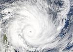
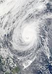
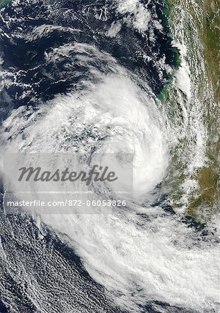
Cyclone Izilda, Madagascar, Africa, In 2009, True Colour Satellite Image. Cyclone Izilda in the Mozambique Channel off the coast of Southern Magadascar on 25 March 2009. True-colour satellite image using MODIS data.
Introductory Offer
Save 50% when you join our email list
-
Web Resolution
388×550px
5.4×7.6in 72ppi
-
Low Resolution
712×1007px
9.9×14.0in 72ppi
-
Medium Resolution
1576×2230px
5.3×7.4in 300ppi
-
High Resolution
3507×4961px
11.7×16.5in 300ppi
* Final price based on usage, not file size.
Related Keywords
- 872-
- Africa
- African
- African (places and things)
- alert
- blowing
- climatological
- climatology
- cloud
- color image
- color photography
- color picture
- destructing
- destruction
- Destructive
- devastation
- Earth observation
- extreme
- extreme sport
- extremism
- eye
- forecasting
- from space
- hurricane
- image
- land
- Madagascar
- meteorology
- MOZAMBIQUE CHANNEL
- natural disaster
- photograph
- photography
- picture
- power
- powerful (things in nature excluding animals)
- satellite view
- severe
- spiral
- stock photograph
- stock picture
- storm
- strong (things in nature excluding animals)
- TYPHOON
- Universal Images Group
- warning
- weather
- wind
- windy
Related Images
- Cyclone Gafilo, Indian Ocean, In 2004, True Colour Satellite Image. Tropical Cyclone Gafilo over the Indian Ocean, Northwest of Madagascar, on 6 March 2004. True-colour satellite image using MODIS data.
- Typhoon Nuri, Western Pacific, Asia, On 21/08/2008, True Colour Satellite Image. Typhoon Nuri on 21 August 2008 nearing Hong-Kong in the Western Pacific ocean. True-colour satellite image using MODIS data.
- Typhoon Nuri, Western Pacific, Asia, On 19/08/2008, True Colour Satellite Image. Typhoon Nuri on 19 August 2008 nearing the Philippines in the Western Pacific ocean. True-colour satellite image using MODIS data.
- Typhoon Nari, Taiwan, China, Asia, In 2001, True Colour Satellite Image. Typhoon Nari in September 2001 northeast of Taiwan and west of Shanghai, China. True-colour satellite image using MODIS data.
- Typhoon Mitag, Philippine Sea, Asia, In 2002, True Colour Satellite Image. Typhoon Mitag on 6 March 2002 in the Philippine Sea, north of the Philippines (lower left-hand corner of the image). True-colour satellite image using MODIS data.
- Typhoon Mawar And Tropical Cyclone Guchol, Western Pacific, In 2005, True Colour Satellite Image. Typhon Mawar (left) and Tropical Cyclone Guchol (right) on 22 August 2005, far out in the northwestern Pacific Ocean, some 900 kilometers from Tokyo. True-colour satellite image using MODIS data.
- Typhoon Man-Yi, Western Pacific, In 2007, True Colour Satellite Image. Typhoon Man-yi in July 2007 over the Western Pacific nearing Japan. True-colour satellite image using MODIS data.
- Typhoon Haiyan, Western Pacific, In 2001, True Colour Satellite Image. Typhoon Haiyan on 16 October 2001 over the Western Pacific, covering the Ryukyu Islands between Taiwan and Japan. True-colour satellite image using MODIS data.
More Related Images
- Hurricane Felix, West Caribbean, In 2007, True Colour Satellite Image. Hurricane Felix on 3 September 2007 in the western Caribbean, nearing Central America and the coast of Nicaragua. True-colour satellite image using MODIS data.
- Typhoon Ewiniar, Pacific Ocean, In 2006, True Colour Satellite Image. Typhoon Ewiniar on 7 July 2006 over the Pacific ocean. True-colour satellite image using MODIS data.
- Tropical Storm Edouard, Gulf Of Mexico, In 2008, True Colour Satellite Image. Tropical storm Edouard on 4 August 2008 in the Gulf of Mexico off Louisana, US. True-colour satellite image using MODIS data.
- Tropical Storms Boris And Cristina, Pacific Ocean, In 2008, True Colour Satellite Image. Tropical storms Boris and Cristina on 28 June 2008 over the Pacific ocean. True-colour satellite image using MODIS data.
- Hurricane Bertha, Atlantic Ocean, In 2008, True Colour Satellite Image. Hurricane Bertha on 9 July 2008 over the Atlantic ocean. True-colour satellite image using MODIS data.
- Hurricane Wilma, Atlantic Ocean, On 24/10/2005, True Colour Satellite Image. Hurricane Wilma on 24 October 2005 over Florida, US. True-colour satellite image using MODIS data.
- Hurricane Wilma, Atlantic Ocean, On 21/10/2005, True Colour Satellite Image. Hurricane Wilma on 21 October 2005 nearing the Yucatan Peninsula coast, Mexico.True-colour satellite image using MODIS data.
- Hurricane Rita, Gulf Of Mexico, On 23/09/2005, True Colour Satellite Image. Hurricane Rita on 23 September 2005 over the Gulf of Mexico. True-colour satellite image using MODIS data.
