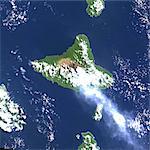
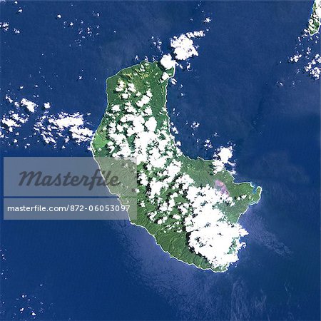
Yasur Volcano, Vanuatu, Pacific, True Colour Satellite Image. Yasur volcano, Vanuatu, true colour satellite image. Yasur (365m) is a small active volcano on Tanna island, in Vanuatu. Composite image dated 1999-2000 using LANDSAT data. Print size 30 x 30 cm.
Introductory Offer
Save 50% when you join our email list
-
Web Resolution
550×550px
7.6×7.6in 72ppi
-
Low Resolution
847×847px
11.8×11.8in 72ppi
-
Medium Resolution
1875×1875px
6.3×6.3in 300ppi
-
High Resolution
3543×3543px
11.8×11.8in 300ppi
* Final price based on usage, not file size.
Related Keywords
Related Images
- Ambrym Volcano, Vanuatu, Pacific, True Colour Satellite Image. Ambrym Island, Vanuatu, true colour satellite image. Ambrym volcano is a large shield volcano with a 12km-wide caldera, with two active cones, Mont Benbow and Mont Maroum. Image taken on 12 September 1999 using LANDSAT data. Print size 30 x 30 cm.
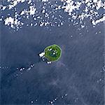
- Niuafo'Ou Volcano, Tonga Islands, True Colour Satellite Image. Niuafo'ou volcano, Tonga, true colour satellite image. Niuafo'ou (250m) is an active volcano located in the Tonga archipelago. Image taken on 28 January 2000 using LANDSAT data. Print size 30 x 30 cm.
- White Island Volcano'S Smoke Plume, New Zealand, True Colour Satellite Image. White Island volcano, New Zealand, true colour satellite image. White Island (312m) is an uninhabited volcanic island, 2 km wide, located 50 km off the coast of North Island in New Zealand. The plume contains smoke and ash. Image taken on 14 August 2000 using LANDSAT data. Print size 30 x 30 cm.
- Mauna Loa Volcano, Hawai, Usa, True Colour Satellite Image. Mauna Loa, Hawai, true colour satellite image. Mauna Loa (4170m), one of the tallest mountains in the world, is located on the Big Island of Hawai. Composite image dated 2000-2001 using LANDSAT data. Print size 30 x 30 cm.
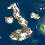
- Satellite View of Galapagos Volcanoes, Galapagos Archipelago
- Piton De La Fournaise Volcano In 3D, Reunion Island, French Overseas, True Colour Satellite Image. Piton de la Fournaise, Reunion, true colour satellite image. 3D satellite view of the Piton de la Fournaise (2631m), one of the world's most active volcanoes, located on the South East part of Reunion Island, in the Indian Ocean. Image using LANDSAT data.
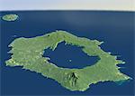
- Long Island Volcano In 3D, Papua New Guinea, True Colour Satellite Image. Long Island, Papua New Guinea, true colour satellite image. 3D satellite view of Long Island volcano in the Bismark Sea, Papua New Guinea. This volcano contains a large caldera filled by Lake Wisdom. Image using LANDSAT data.
- Unzen Volcano In 3D, Japan, True Colour Satellite Image. Unzen, Japan, true colour satellite image. 3D satellite view of Unzen volcano, located on the Island of Kyushu, East of Nagasaki. Image taken on 15 May 1993 using LANDSAT data.
More Related Images
- Hekla Volcano, Iceland, True Colour Satellite Image. Hekla, Iceland, true colour satellite image. Hekla (1491m), in South Iceland, is the most famous volcano of the island. Image taken on 20 August 2000 using LANDSAT data. Print size 30 x 30 cm.
- Galunggung Volcano, Java, Indonesia, True Colour Satellite Image. Galunggung, Java, Indonesia, true colour satellite image. Galunggung volcano (2168m) is located in West Java, Indonesia, near the city of Tasikmalaya. Image taken on 22 June 2001 using LANDSAT data. Print size 30 x 30 cm.
- Piton De La Fournaise Volcano, Reunion Island, French Overseas, True Colour Satellite Image. Piton de la Fournaise, Reunion island, French overseas, true colour satellite image. Piton de la Fournaise (2631m), one of the world's most active volcanoes, is located on the South East part of Reunion Island, in the Indian Ocean. Image taken on 19 June 2000 using LANDSAT data. Print size 30 x 30 cm.
- Pinatubo Volcano, Philippines, True Colour Satellite Image. Mount Pinatubo, Philippines, true colour satellite image. Mount Pinatubo (1486m) is in the Philippines. The 2,5km-wide caldera formed after the 1991 eruption is today filled with a lake. Composite image dated 01/11/2001 and 26/11/2001 using LANDSAT data. Print size 30 x 30 cm.
- Mayon Volcano, Philippines, True Colour Satellite Image. Mayon volcano, Philippines, true colour satellite image. Mayon (2462m), on Luzon island, is the most active volcano in the Philippines. Image taken on 23 November 1999 using LANDSAT data. Print size 30 x 30 cm.
- Long Island Volcano, Papua New Guinea, True Colour Satellite Image. Long Island volcano, Papua New Guinea, true colour satellite image. Long Island volcano is in the Bismark Sea, in Papua New Guinea. This volcano contains a large caldera filled by Lake Wisdom. Image taken on 31 March 1991 using LANDSAT data. Print size 30 x 30 cm.
- Karkar Volcano, Papua New Guinea, True Colour Satellite Image. Karkar volcano, Papua New Guinea, true colour satellite image. Karkar is a volcanic island of Papua New Guinea, North West of Long Island. Image taken on 14 August 2000 using LANDSAT data. Image taken on 20 February 2000 using LANDSAT data. Print size 30 x 30 cm.
- Usu Volcano, Japan, True Colour Satellite Image. Usu Volcano, Japan, true colour satellite image. Usu is a volcano (737m) located on the Southern rim of Lake Toya on Hokkaido island. Image taken on 9 August 1999 using LANDSAT data. Print size 30 x 30 cm.
